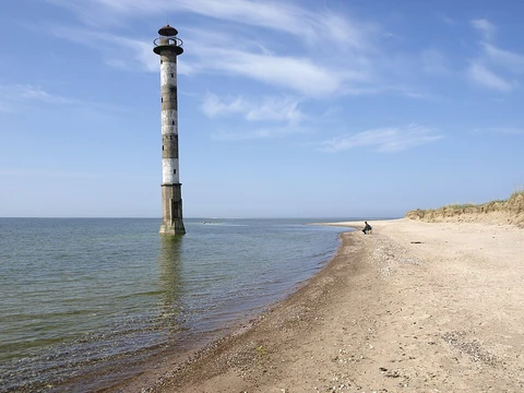
Scandinavian Peninsula
Largest European peninsula, spanning Sweden, Norway, and northwestern Finland.

The Scandinavian Peninsula, the largest in Europe, sits in Northern Europe and covers most of Sweden, Norway, and the northwestern part of Finland. Its name comes from Scandinavia, a cultural region that includes Denmark, Norway, and Sweden. That name traces back to Scania, a southern tip of the peninsula that belonged to Denmark for centuries and is now part of Sweden. During the Ice Ages, the Atlantic Ocean’s sea level fell so low that the Baltic Sea, the Gulf of Bothnia, and the Gulf of Finland vanished, linking the surrounding countries—including Germany, Poland, the Baltic states, and Scandinavia—by land. Today, the peninsula’s only land connection to the rest of Europe lies as far north as the Arctic Circle, keeping it somewhat isolated. People in the region, along with historical Germanic philology, consider it separate from mainland Europe, which they call “the Continent.”
The peninsula stretches about 1,850 kilometers (1,150 miles) long and varies in width from roughly 370 to 805 kilometers (230 to 500 miles). The Scandinavian mountain range mostly marks the border between Norway and Sweden. Its highest point was once Glittertinden in Norway at 2,470 meters (8,104 feet), but after its summit glacier partly melted, the highest elevation shifted to Galdhøpiggen, also in Norway, at 2,469 meters (8,100 feet). These mountains also hold Jostedalsbreen, the largest glacier on mainland Europe. About a quarter of the peninsula lies north of the Arctic Circle, with its northernmost point at Cape Nordkinn, Norway. The climate ranges from tundra and subarctic in the north, to cool marine west coast in northwestern coastal areas just north of Lofoten, to humid continental in the center, and marine west coast in the south and southwest. The region is rich in timber, iron, and copper, with the best farmland in southern Sweden. Large petroleum and natural-gas deposits have been found off Norway’s coast in the North Sea and Atlantic Ocean. Most of the population lives in the southern, agricultural part. The largest cities are Stockholm, Sweden; Oslo, Norway; Gothenburg, Sweden; Malmö, Sweden; and Bergen, Norway, in that order. Geologically, the peninsula sits on the Baltic Shield, a stable, ancient crust segment made of crystalline metamorphic rocks. Glaciers during the Ice Ages scraped away much of the soil covering this bedrock, especially in northern Scandinavia, where the shield is closest to the surface. Because of this scouring, the land’s elevation, and the cool-to-cold climate, only a small percentage of the land is arable. The same glaciation deepened many river valleys, which the sea later flooded as ice melted, creating Norway’s famous fjords. In the south, glaciers left vast terminal moraines, shaping a chaotic landscape that now covers all of Denmark. Although the Baltic Shield is generally stable, the weight of nearly four kilometers of ice during the Ice Ages caused the entire Scandinavian terrain to sink. When the ice melted, the shield began rising again, a process that continues at about one meter per century. Meanwhile, the southern part has tended to sink, leading to flooding in the Low Countries and Denmark. The crystalline bedrock and lack of soil have exposed mineral deposits of iron, copper, nickel, zinc, silver, and gold. The most valuable have been iron ore deposits in northwestern Sweden. In the 19th century, these deposits spurred construction of a railway from northwestern Sweden to the Norwegian port of Narvik, allowing export of ore by ship to places like southern Sweden, Germany, Great Britain, and Belgium for smelting. This railway runs through a region of Norway and Sweden that otherwise has no railways due to the rugged terrain, mountains, and fjords. The first recorded human presence in the southern peninsula and Denmark dates back 12,000 years. As ice sheets retreated, a tundra biome attracted reindeer hunters. The climate gradually warmed, first supporting evergreen trees, then deciduous forests that brought animals like aurochs. Hunter-fisher-gatherer groups began inhabiting the area from the Mesolithic (8200 BC) until agriculture arrived in the Neolithic (3200 BC). The northern and central parts are partially inhabited by the Sámi, who arrived several thousand years after the south was already settled. In earliest records, they occupied arctic and subarctic regions as well as central areas as far south as Dalarna, Sweden. They speak Sámi languages, a non-Indo-European group from the Uralic family, related to Estonian and Finnish.
- area
- Largest peninsula in Europe, greater than the Balkan, Iberian, and Italian penin
- length
- Approximately 1,850 km (1,150 mi)
- width
- Varies from approximately 370 to 805 km (230 to 500 mi)
- highest_point
- Galdhøpiggen, Norway, at 2,469 m (8,100 ft) above sea level
- largest_glacier
- Jostedalsbreen, the largest glacier on mainland Europe
- northernmost_point
- Cape Nordkinn, Norway
- largest_cities
- Stockholm, Sweden; Oslo, Norway; Gothenburg, Sweden; Malmö, Sweden; Bergen, Norw
Verified Timeline
Quick Facts
- Location
- Northern Europe
- Waterbody
- Arctic Sea, Atlantic Ocean
- Area Km2
- 750,000
- Elevation M
- 2,469
- Highest Mount
- Galdhøpiggen
- Country1
- Norway
- Country1 Admin Divisions
- Mainland
- Country2
- Sweden
- Country3
- Finland
- Country3 Admin Divisions
- Parts of Lapland
Facts from the source article.
Lore & Background
The Scandinavian Peninsula occupies part of the Baltic Shield, a stable and large crust segment formed of very old, crystalline metamorphic rocks. Most of the soil covering this substrate was scraped by glaciers during the Ice Ages of antiquity, especially in northern Scandinavia, where the Baltic Shield is closest to the surface of the land. As a consequence of this scouring, the elevation of the land, and the cool-to-cold climate, a relatively small percentage of its land is arable. The glaciation during the Ice Ages also deepened many of the river valleys, which were invaded by the sea when the ice melted, creating the noteworthy fjords of Norway. In the southern part of the peninsula, the glaciers deposited vast numbers of terminal moraines, configuring a very chaotic landscape. These terminal moraines covered all of what is now Denmark. Although the Baltic Shield is mostly geologically stable, the weight of nearly four kilometres of ice during the Ice Ages caused all of the Scandinavian terrain to sink. When the ice sheet disappeared, the shield rose again, a tendency that continues to this day at a rate of about one metre per century. Conversely, the southern part has tended to sink to compensate, causing flooding of the Low Countries and Denmark. The first recorded human presence in the southern area of the peninsula and Denmark dates from 12,000 years ago. As the ice sheets from the glaciation retreated, the climate allowed a tundra biome that attracted reindeer hunters. The climate warmed up gradually, favouring the growth of evergreen trees first and then deciduous forest which brought animals like aurochs. Groups of hunter-fisher-gatherers started to inhabit the area from the Mesolithic (8200 BC), up to the advent of agriculture in the Neolithic (3200 BC). The northern and central part of the peninsula is partially inhabited by the Sámi, who began to arrive several thousand years after the Scandinavian Peninsula had already been inhabited in the south. In the earliest recorded periods they occupied the arctic and subarctic regions as well as the central part of the peninsula as far south as Dalarna, Sweden. They speak the Sámi languages, a group of non-Indo-European languages of the Uralic family which is related to Estonian and Finnish. The first inhabitants of the peninsula were the Norwegians on the west coast of Norway, the Danes in what is now southern and western Sweden and southeastern Norway, the Svear in the region around Mälaren as well as a large portion of the present day eastern seacoast of Sweden and the Geats in Västergötland and Östergötland. These peoples spoke closely related dialects of an Indo-European language, Old Norse. Political boundaries emerged gradually. The Swedish and Norwegian boundaries were agreed and marked out in 1751. The Finnish-Norwegian border on the peninsula was established after extensive negotiation in 1809, and the common Norwegian-Russian districts were not partitioned until 1826. Denmark, Sweden and the Russian Empire dominated the political relationships on the Scandinavian Peninsula for centuries, with Iceland, Finland and Norway only gaining their full independence during the 20th century. The Kingdom of Norway – long held in personal union by Denmark – fell to Sweden after the Napoleonic Wars and only attained full independence in 1905. Having been an autonomous grand duchy within the Russian Empire since 1809, Finland declared independence during the Soviet revolution of Russia in 1917. Iceland declared its independence from Denmark in 1944, while Denmark was under the occupation of Nazi Germany. The Wehrmacht invaded Norway in 1940 and the German Army occupied all of Norway until May 1945. With the acquiescence of the Kingdom of Sweden, German troops moved from northern Norway, across northern Sweden, into Finland, which had become an ally of Nazi Germany. In the spring of 1941, the German Army and the Finnish Army invaded the Soviet Union together. Sweden remained a neutral country during the First World War, the Korean War and the Cold War. In 1945, Norway, Denmark and Iceland were founding members of the United Nations. Sweden joined the U.N. soon after. Finland joined during the 1950s. The first Secretary-General of the United Nations, Trygve Lie, was a Norwegian citizen. The second Secretary General of the United Nations, Dag Hammarskjöld, was a Swedish citizen. In 1949, Norway, Denmark and Iceland became founding members of NATO. Finland later joined NATO in 2023, and Sweden in 2024, in response to the 2022 Russian invasion of Ukraine. Sweden and Finland joined the European Union in 1995. Norway remains outside the Union.
Reader's Guide
The Scandinavian Peninsula's significance lies in its unique geography, geology, and historical role as a distinct region in Northern Europe. As the largest European peninsula, it has shaped the cultural and political identities of Sweden, Norway, and Finland. Its geological foundation on the Baltic Shield, with ancient crystalline rocks and glacial scouring, has exposed rich mineral deposits, particularly iron ore in northwestern Sweden, which drove railway construction to the Norwegian port of Narvik for export. The peninsula's climate varies from tundra (Köppen: ET) and subarctic (Dfc) in the north, with cool marine west coast climate (Cfc) in northwestern coastal areas reaching just north of Lofoten, to humid continental (Dfb) in the central portion and marine west coast (Cfb) in the south and southwest. The region is rich in timber, iron and copper with the best farmland in southern Sweden. Large petroleum and natural-gas deposits have been found off Norway's coast in the North Sea and the Atlantic Ocean. Much of the population of the Scandinavian Peninsula is naturally concentrated in its southern part, which is also its agricultural region. The largest cities of the peninsula are Stockholm, Sweden; Oslo, Norway; Gothenburg, Sweden; Malmö, Sweden and Bergen, Norway, in that order. Historically, the peninsula's peoples—Norwegians, Danes, Svear, and Geats—spoke Old Norse and their descendants remain dominant. The Sámi, speaking Uralic languages, inhabit northern and central areas. Political development saw late boundary agreements and shifting control among Denmark, Sweden, and Russia, with Norway, Finland, and Iceland gaining independence in the 20th century. The peninsula's influence extended internationally through figures like Trygve Lie and Dag Hammarskjöld, who served as UN Secretaries-General.
Did You Know?
- The Scandinavian Peninsula is the largest of the peninsulas of Europe, with a greater area than the Balkan, Iberian and Italian peninsulas.
- The highest elevation on the peninsula is Galdhøpiggen in Norway at 2,469 m (8,100 ft) above sea level.
- Jostedalsbreen, located in Norway, is the largest glacier on the mainland of Europe.
- The first recorded human presence in the southern area of the peninsula dates from 12,000 years ago.
- The first Secretary-General of the United Nations, Trygve Lie, was a Norwegian citizen, and the second, Dag Hammarskjöld, was a Swedish citizen.
Frequently Asked Questions
Who is Scandinavian Peninsula?
The Scandinavian Peninsula is the largest peninsula in all of Europe, covering the mainlands of Sweden and Norway along with the northwestern portion of Finland. Its name ultimately traces back to Scania, the southernmost region of the landmass, which lent its name to the wider cultural region of Scandinavia.
What are Scandinavian Peninsula's powers/role?
It outstretches every other European peninsula in area, surpassing the Balkan, Iberian, and Italian counterparts. Among its signature features are Galdhøpiggen, Norway's highest peak at 2,469 m, and Jostedalsbreen, the largest glacier found on mainland Europe.
How does Scandinavian Peninsula's story end?
The peninsula has no true ending, but its northernmost chapter is marked by Cape Nordkinn in Norway, the point that reaches closest to the Arctic. Because its only land bridge to the rest of Europe sits near Arctic latitudes, locals and historic Germanic scholars have long treated it as a separate entity from 'the Continent.'
Why is Scandinavian Peninsula important?
Spanning roughly 1,850 km in length and up to 805 km in width, it is simply the biggest peninsula on the European map. Its geographic seclusion has fostered a distinct cultural and linguistic identity that sets it apart from continental Europe.
What are Scandinavian Peninsula's key stats at a glance?
The landmass measures approximately 1,850 km long with a width that varies between 370 and 805 km depending on where you measure. Its highest point is Galdhøpiggen in Norway, and its northernmost tip is Cape Nordkinn.
More in Peninsulas And Capes 1-24
Spotted an error? Know more?
This is a living reference — every entry is fact-audited, and reader corrections feed straight into our audit queue. Suggest an edit · See this site's audit record