Niagara Peninsula
An isthmus in Ontario between Lakes Ontario and Erie.

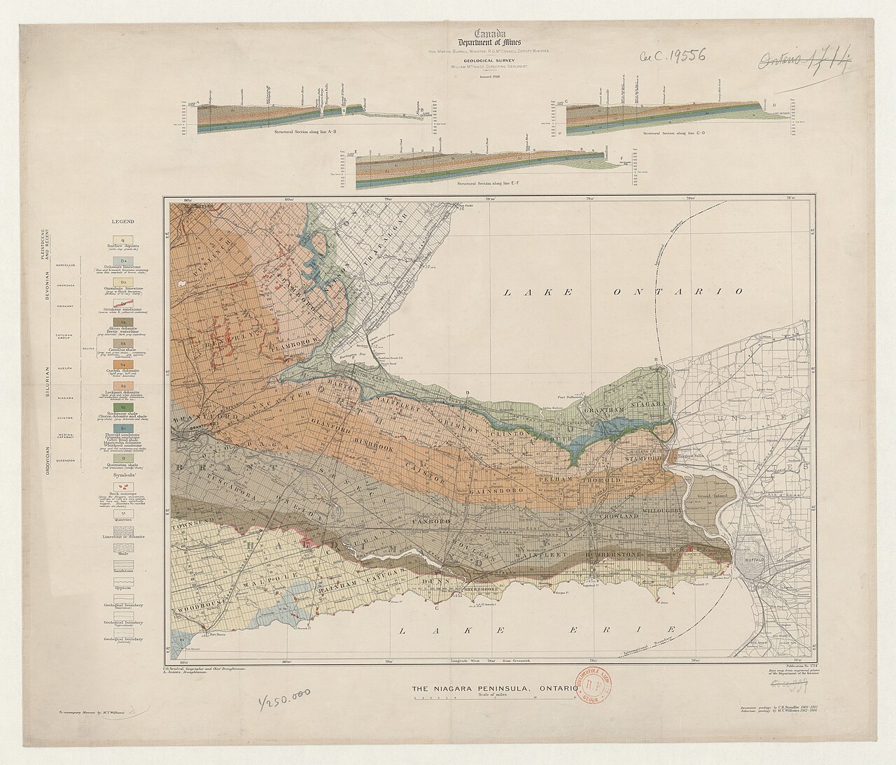
Williams, M.J. (18..-19..?). Auteur du texte Commission géologique du Canada. Au · Public domain
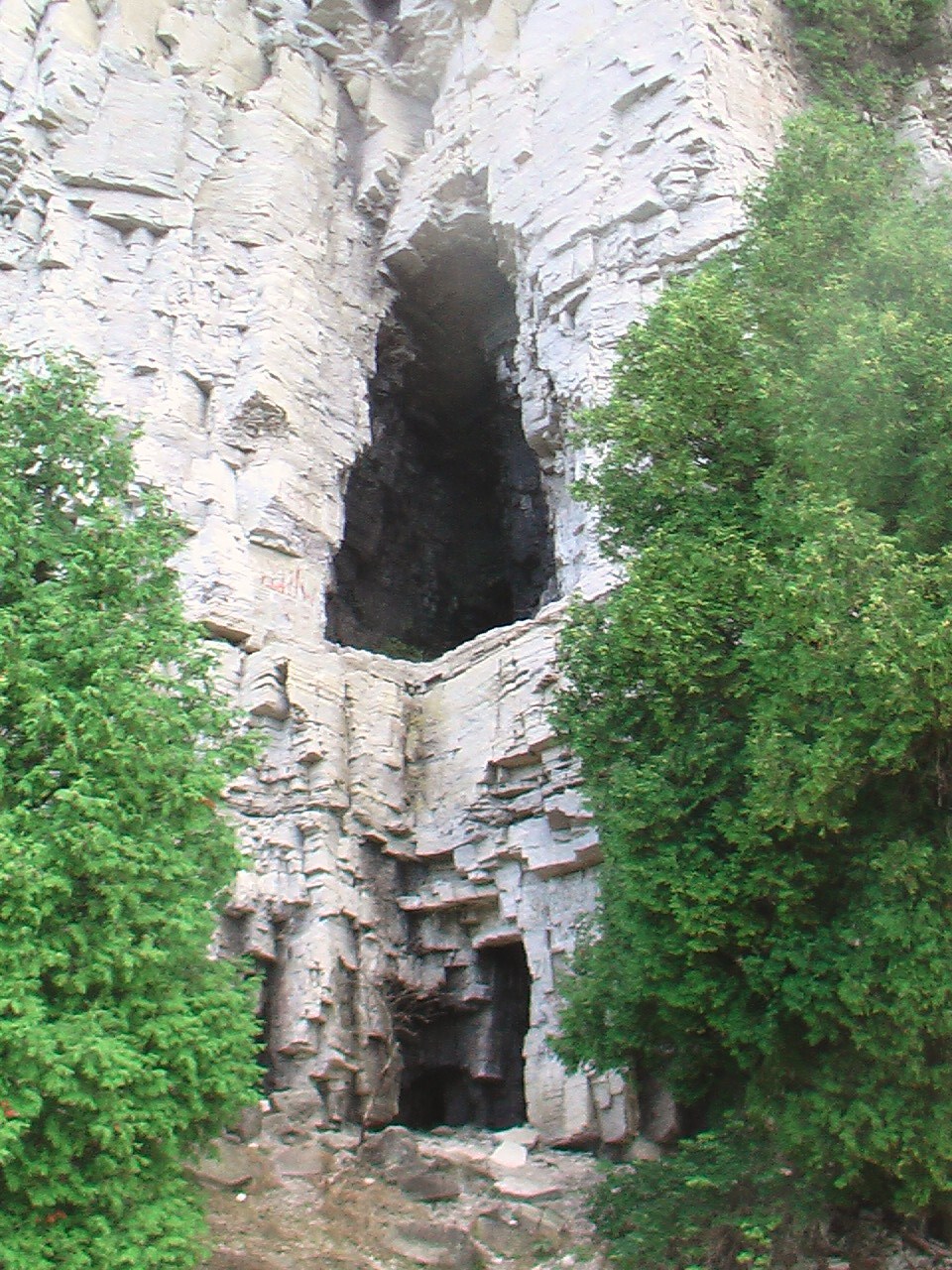
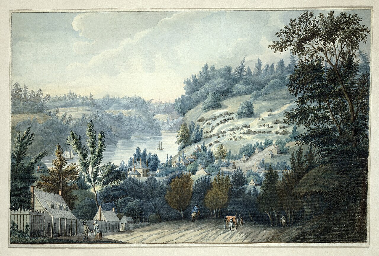
The Niagara Peninsula is actually an isthmus, not a true peninsula, located in Ontario, Canada. It sits between the southwest shore of Lake Ontario and the northeast shore of Lake Erie, running from the Niagara River in the east to Hamilton in the west. This area is part of the Golden Horseshoe region of Southern Ontario and is home to about 500,000 people. Across the Niagara River and Lake Erie in New York State, the corresponding area is called the Niagara Frontier. Most of the peninsula is governed as the Regional Municipality of Niagara. Its cities include St. Catharines, Niagara Falls, Thorold, Port Colborne, and Welland. Towns in the region are Niagara-on-the-Lake, Lincoln, Pelham, Grimsby, and Fort Erie, along with the townships of Wainfleet and West Lincoln. Parts of the City of Hamilton and Haldimand County also fall within the peninsula. Originally, the area was inhabited by the Neutral First Nations people, who got their name from trading goods like flint arrowhead blanks with both the Wyandot and Iroquois, who were at odds. Around 1650, the Iroquois wiped out the Neutrals during the Beaver Wars as they tried to expand their fur-trapping territory. After that, until United Empire Loyalists arrived following the American War of Independence, the region saw only occasional habitation, since the Iroquois didn’t set up permanent settlements there. The Niagara Peninsula became one of the first parts of Upper Canada settled by British Loyalists in the late 1700s. The colony’s capital was established at Niagara-on-the-Lake, then called Newark. Many English and Irish immigrants came, but by the 1800s, Italian and German immigrants made up the largest groups, followed by French, Polish, and other Central Europeans. After an agricultural period of European settlement, the area grew into an important industrial center. Water-powered mills were joined by hydro-electric power generation in Niagara Falls, along with electricity-intensive industry in both Niagara Falls and St. Catharines. Agriculture, especially fruit farming along Lake Ontario’s shore, remains important, but industrial developments began in the 1800s. A series of canals, including the Welland Canal, were built to connect the upper Great Lakes’ markets and mineral resources with the St. Lawrence Seaway. General Motors established a major presence in St. Catharines with auto plants and a foundry, drawing in auto-parts manufacturers. Dry docks were also built at Port Weller on Lake Ontario. In the 21st century, heavy industry has been declining for over a decade, mainly due to the slowdown of North American automotive manufacturers. Thousands of jobs have been lost at longtime employers like General Motors, Thompson Products, Deere & Company, Dana Canada Corp, Port Weller Drydocks, Domtar Papers, and Gallagher Thorold Paper. As a result, local municipalities have had to explore new and diverse opportunities to prevent an exodus of skilled workers. Hospitality and tourism have drawn visitors to the area for more than 150 years, largely because of Niagara Falls. Starting in the mid-1990s, new development sparked an upscale hospitality boom across the entire peninsula. Today, over 14 million guests visit annually to see the Falls and the Niagara Parks. Ecotourism has grown, with more people discovering out-of-the-way spots like the Niagara Escarpment, which UNESCO named a World Biosphere Reserve in 1990. Another major tourism growth area in the past thirty years is the grape and wine industry. The Niagara Peninsula is one of four recognized viticultural areas under the VQA in Ontario’s wine industry. European-style wineries and vineyards have become a big draw for visitors seeking a unique cultural experience. Most local wineries offer tours, and some feature pairings of Canadian cuisine with their VQA wines. Wineries may employ world-class chefs who use fresh, seasonal ingredients from local farms. During summer, many wineries host live music and theatrical performances in the vineyards. In the coldest months, usually December to February, visitors can watch grape varieties being harvested and pressed outdoors as part of making sweet, high-value ice wines, sometimes called “liquid gold.” A few Niagara Peninsula wineries have won top international awards for their ice wines, which may only be available directly from the vintner. An official Wine Routes Guide is available for self-driving, and transportation companies offering wine tours operate out of major hotels and bed and breakfasts in Niagara Falls, Niagara-on-the-Lake, and Toronto. Driving from downtown Toronto to the wine region takes about two hours. Niagara-on-the-Lake is a major draw for travelers seeking cultural activities, home to the famous Shaw Festival Theater, named for playwright George Bernard Shaw. A resident repertory company performs in three theaters over a six-month season. The town also features Fort George, a British-built and -occupied fort during the War of 1812, which was rebuilt for the public in the 1960s and is open in summer.
- Location
- Ontario, Canada
- Known For
- Niagara Falls, wine industry, Shaw Festival, historical sites
- Region Type
- Isthmus (technically not a peninsula)
Lore & Background
The Niagara Peninsula is an isthmus, not a true peninsula, situated between the southwestern shore of Lake Ontario and the northeastern shore of Lake Erie in Ontario, Canada. It extends from the Niagara River in the east to the city of Hamilton in the west, lying within the Golden Horseshoe region of Southern Ontario. The area was originally inhabited by the Neutrals, a First Nations people who traded goods such as flint arrowhead blanks with both the Wyandot and Iroquois. The Neutrals were wiped out by the Iroquois around 1650 during the Beaver Wars, after which the region saw only sporadic habitation until the arrival of United Empire Loyalists following the American War of Independence. The peninsula became one of the first areas settled in Upper Canada by British Loyalists in the late 18th century, with the capital established at Niagara-on-the-Lake, then called Newark. Early settlers were primarily English and Irish, later joined by Italian and German immigrants, followed by French, Polish, and other Central Europeans. The landscape features the Niagara Escarpment, designated a UNESCO World Biosphere Reserve in 1990. The region is defined by its agricultural and industrial history: fruit farming along the Lake Ontario shore remains important, while the 19th century brought water-powered mills, hydro-electric power generation at Niagara Falls, and electricity-intensive industry. A succession of canals, including the Welland Canal, connected the upper Great Lakes to the St. Lawrence Seaway. General Motors established auto plants and a foundry in St. Catharines, and dry docks were built at Port Weller on Lake Ontario. The peninsula is also one of four recognized viticultural areas in the Ontario wine industry, known for European-style wineries and ice wine production.
Reader's Guide
The Niagara Peninsula is an isthmus in Southern Ontario, lying between Lake Ontario and Lake Erie, stretching from the Niagara River to Hamilton. Originally inhabited by the Neutral First Nations, who traded with both the Wyandot and Iroquois, the Neutrals were wiped out by the Iroquois around 1650 during the Beaver Wars. The region was only sporadically inhabited until United Empire Loyalists arrived after the American War of Independence, making it one of the first areas settled in Upper Canada. The capital was established at Niagara-on-the-Lake, then called Newark. Early English and Irish settlers were later joined by Italian, German, French, Polish, and other Central European immigrants. Following an agricultural period focused on fruit farming along Lake Ontario, the area became an industrial centre, with water-powered mills and later hydro-electric power generation in Niagara Falls. A succession of canals, including the Welland Canal, connected the upper Great Lakes to the St. Lawrence Seaway. General Motors built auto plants and a foundry in St. Catharines, and dry docks were constructed at Port Weller. In the 21st century, heavy industry has diminished due to the slowdown of North American automotive manufacturers, leading to job losses at major employers. Tourism has grown significantly, with over 14 million annual visitors drawn to Niagara Falls, the Niagara Escarpment (a UNESCO Biosphere Reserve), and the expanding wine industry. The Niagara Peninsula is one of four recognized viticultural areas by the VQA, with wineries offering tours, pairings, and ice wine production. The Shaw Festival Theatre in Niagara-on-the-Lake, along with Fort George, a War of 1812 fort rebuilt in the 1960s, are major cultural attractions.
Did You Know?
- The Niagara Peninsula is technically an isthmus rather than a peninsula.
- The Neutrals, a First Nations people, originally inhabited the area and traded flint arrowhead blanks with both the Wyandot and Iroquois.
- The capital of Upper Canada was first established at Niagara-on-the-Lake, then called Newark.
- The Niagara Peninsula is one of four recognized viticultural areas by the VQA in Ontario.
The Word and the Shape
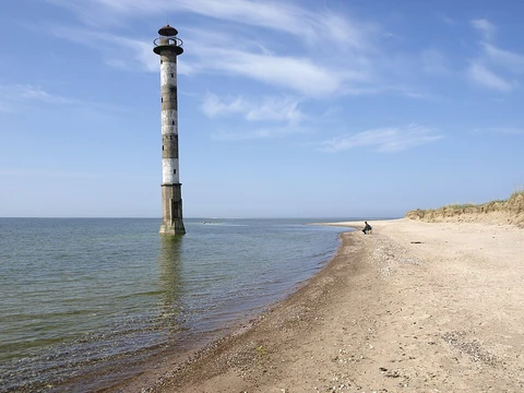
The very name "peninsula" carries a poetic image in its Latin roots: paene meaning "almost" and insula meaning "island." Together they paint a picture of land that nearly becomes an island but retains its tether to the mainland. In practice, a peninsula is a stretch of terrain ringed predominantly by water yet still joined to the larger landmass. The waters surrounding it are typically understood to form a continuous body, though they need not carry a single name. Geographers recognize a family of related forms: a headland, a cape, an island promontory, a bill, a point, or a spit. A point, specifically, is a tapering projection jutting into the water that is less prominent than a cape. Even a river carving through an extremely tight meander can be described as creating a "peninsula" within the nearly closed loop of its bend. In English, the plural may be rendered as "peninsulas" or, less frequently, "peninsulae."
A Feature on Every Continent
Peninsulas are not confined to any single region; they appear on every inhabited continent and even in the frozen reaches of Antarctica, where the Antarctic Peninsula, Edward VII Peninsula, Fletcher Peninsula, Fowler Peninsula, and Martin Peninsula all bear the name. In Africa, the Horn of Africa juts eastward into the Guardafui Channel, encompassing Djibouti, Eritrea, Ethiopia, and Somalia, while the Cape Peninsula defines the southern tip of South Africa and the Lekki Peninsula shapes the coast of Lagos, Nigeria. The disputed Bakassi region of Cameroon sits in a contested border with Nigeria. Across the Indian Ocean, the Deccan Peninsula stands as the sole and largest geographical feature of the entire Indian subcontinent, and the Arabian Peninsula holds the same distinction for Southwest Asia. In North America, the Labrador Peninsula covers all of Labrador and most of Quebec, while smaller examples like the Placencia Peninsula in Belize and the Dunlas, Natkusiak, and Storkerson peninsulas on Arctic islands of the Northwest Territories and Nunavut show the form persists even in polar latitudes.
Europe: A Continent That Is Also a Peninsula
One of the most striking facts in physical geography is that Europe is sometimes regarded as a single vast peninsula extending off the broader Eurasian landmass. By that reading, it ranks among the largest peninsulas on Earth and is the only one to enjoy the status of a full continent—a distinction that rests largely on convention rather than on any hard scientific boundary. Within this continental-scale peninsula, four major component peninsulas dominate the landscape: the Scandinavian, Iberian, Balkan, and Apennine. The Iberian Peninsula encompasses continental Portugal and Spain, Andorra, the British Overseas Territory of Gibraltar, and a small slice of southern France. The Apennine Peninsula is the defining geographical feature of Italy. The Balkan case is more contentious: because its natural borders do not align neatly with the technical definition of a peninsula, modern geographers tend to reject the label "Balkan Peninsula" even though the region spans Albania, Greece, Croatia, Serbia, and many other states.
The Korean Peninsula and Other Singular Landmasses
Some peninsulas are so dominant that they effectively define an entire region or nation. The Korean Peninsula is a prime example: the entire landmass shared by North and South Korea constitutes a single peninsula, flanked by the East Sea to the east and south and the Yellow Sea to the west and south, with the Korea Strait serving as the waterway that links the two seas. Similarly, in West Asia, the Anatolian Peninsula is described as the only and largest cape in that region, while in South Asia the Deccan holds the same singular position for the Indian subcontinent. In East Asia, China's Liaodong and Shandong peninsulas are prominent features, and Hong Kong itself is classified as a peninsula. Japan's archipelago is studded with named peninsulas across its main islands—Shiretoko and Shakotan on Hokkaido, Noto and Bōsō on Honshū, and Satsuma and Ōsumi on Kyūshū—demonstrating how the form recurs at every scale, from continental to local.
Gallery
Frequently Asked Questions
Who is Niagara Peninsula?
The Niagara Peninsula is a narrow stretch of land in southern Ontario, Canada, that links the southwestern edge of Lake Ontario to the northeastern edge of Lake Erie. It runs eastward from Hamilton all the way to the Niagara River.
What are Niagara Peninsula's powers/role?
The region is famous for hosting the world-renowned Niagara Falls and sustaining a thriving wine-producing industry. It also anchors the Shaw Festival theatre and a cluster of mid-sized cities including St. Catharines, Thorold, and Port Colborne.
How does Niagara Peninsula's story end?
Geographically, the landmass tapers to a close at Hamilton in the west, where it meets the Lake Ontario shoreline. To the east, the Niagara River forms its boundary, separating it from the Niagara Frontier area on the New York side.
Why is Niagara Peninsula important?
It sits inside the Golden Horseshoe corridor of Southern Ontario and supports roughly half a million residents across its towns and cities. Its position bridging two of the Great Lakes makes it a critical node for trade, tourism, and regional transportation.
Is Niagara Peninsula actually a peninsula?
Strictly by geographic definition, it is an isthmus rather than a true peninsula, since it connects two larger landmasses between two separate bodies of water. The popular name sticks out of tradition, but cartographers and geographers classify it as an isthmus.
More in Peninsulas And Capes 1-24
Related in Peninsulas And Capes
Links follow this subject's own source article.
Spotted an error? Know more?
This is a living reference — every entry is fact-audited, and reader corrections feed straight into our audit queue. Suggest an edit · See this site's audit record