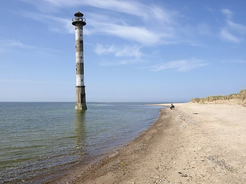
Al-Faw peninsula
Strategic Iraqi peninsula controlling access to the Shatt al-Arab waterway.

U.S. Navy photo by Photographer's Mate 2nd Class Richard J. Brunson. · Public domain
The Al-Faw peninsula is a marshy peninsula in the Persian Gulf, located in the extreme southeast of Iraq. It lies within the deltaic plain of the Shatt al-Arab river—itself formed by the confluence of the Euphrates and Tigris—and is bordered to the east by the Shatt al-Arab waterway, which marks the border with Iran, while its southwestern side faces Kuwait across the Khor Abdullah waterway. Its strategic location controlling access to the Shatt al-Arab waterway and the port of Basra has made it a site of major military conflicts and important oil installations.
The peninsula is sparsely populated outside its only significant town, Al-Faw, a fishing port that under Saddam Hussein housed the main naval base of the Iraqi Navy. Most residents work in fishing, oil, or shipping. The peninsula holds Iraq’s two main oil tanker terminals, Khor al-Amaya and Mina al-Bakr. During the Iran–Iraq War, Iranian forces launched a surprise attack on 11 February 1986, exploiting weak Iraqi defenses manned by poorly trained conscripts, and successfully occupied the peninsula for the first time. This placed Basra at risk and allowed Iran to launch Silkworm missiles against shipping and oil terminals, as well as Kuwait. On 17 April 1988, the Iraqi Army, using over 100,000 Republican Guard troops, sarin nerve gas, and heavy bombardment, expelled the Iranian defenders within 35 hours, capturing much equipment. The event was later celebrated as Faw City Liberation Day. In the 1991 Gulf War, Allied bombing heavily damaged the peninsula’s military installations and effectively shut down Iraq’s shipping access. During the 2003 invasion, British, American, and Polish forces conducted a midnight amphibious assault to secure the port of Umm Qasr and the oil terminals, which were seized by SEAL teams and GROM operators. The peninsula fell quickly, though Umm Qasr required several days of fighting. British forces later provided security from Camp Driftwood until its handover to Iraqi control in March 2007.
- Area
- 50 km (31 mi) southeast of Basra
Lore & Background
The Al-Faw peninsula is a marshy landform in the extreme southeast of Iraq, projecting into the Persian Gulf. It forms part of the delta of the Shatt al-Arab river, which is itself created by the confluence of the Euphrates and Tigris rivers. The peninsula lies southeast of Iraq’s third largest city, Basra. Its borders are defined by Iran to the northeast, with the cities of Abadan and Khorramshahr lying on the opposite bank of the Shatt al-Arab, and Kuwait to the southwest, opposite Bubiyan Island and Warbah Island, near the Iraqi town of Umm Qasr. The only significant settlement is the fishing town and port of Al-Faw, which served as the main naval base for the Iraqi Navy under Saddam Hussein. The rest of the peninsula is lightly populated, with few civilian buildings; most residents work in fishing, oil, or shipping industries. The area holds major oil infrastructure, including Iraq’s two primary oil tanker terminals, Khor al-Amaya and Mina al-Bakr. Its strategic importance stems from controlling access to the Shatt al-Arab waterway and thus the port of Basra. The peninsula is marshy and sparsely developed, with its value derived almost entirely from its geographic position and petroleum facilities.
Reader's Guide
The Al-Faw peninsula’s importance is rooted in its geography: it sits at the head of the Shatt al-Arab waterway, the confluence of the Euphrates and Tigris rivers, giving it control over access to the port of Basra and the Persian Gulf. This marshy delta region borders Iran to the northeast and Kuwait to the southwest. The peninsula is lightly populated, with the town of Al-Faw serving as a fishing port and, under Saddam Hussein, the main base of the Iraqi Navy. Most residents work in fishing, oil, or shipping. Its strategic value is underscored by the presence of Iraq’s two primary oil tanker terminals, Khor al-Amaya and Mina al-Bakr. During the Iran–Iraq War, the peninsula was fiercely contested. In 1986, Iranian forces launched a surprise attack, capturing the peninsula for the first time and threatening Basra. Iran used the position to fire Silkworm missiles at shipping, oil terminals, and Kuwait. Iraq recaptured the peninsula in 1988 through a major operation involving over 100,000 troops, using sarin gas and heavy bombardment. The victory was later celebrated as a national holiday. In the 1991 Gulf War, Allied bombing heavily damaged military installations and shut down Iraqi shipping. During the 2003 invasion, British, American, and Polish forces conducted a midnight amphibious assault to secure the oil terminals and the port of Umm Qasr, facing minimal resistance on the peninsula but several days of fighting in Umm Qasr itself.
Did You Know?
- The Al-Faw peninsula is 50 km southeast of Iraq's second largest city, Basra.
- It was the site of Iraq's two main oil tanker terminals: Khor al-Amaya and Mina al-Bakr.
Geography & Topography
The Kamchatka Peninsula stretches roughly 1,250 kilometres across the Russian Far East, encompassing approximately 270,000 square kilometres of land. Its western shore faces the Sea of Okhotsk, while the eastern coast opens onto the Bering Sea, a branch of the Pacific Ocean. The southernmost point, Cape Lopatka—whose name translates to "spade" in Russian—anchors the tip of the landmass. Moving northward along the Pacific-facing side, the coastline is punctuated by four distinct peninsulas: Shipunsky, Kronotsky, Kamchatsky, and Ozernoy Points. Beyond Ozernoy Point lies the expansive Karaginsky Bay, home to Karaginsky Island, while the opposite western shore features Shelikhov Gulf. Two major mountain ranges define the interior: the Kamchatka or Central Range forms the backbone of the peninsula, and the Eastern Range runs along the southeast coast. Between them stretches the central valley, through which the Kamchatka River flows from its source northwest of Avacha Bay, heading north before turning east to empty into the Pacific near Ust-Kamchatsk.
Climate & Weather Patterns
Kamchatka's climate is shaped by its position at latitudes comparable to Scotland's, yet cold arctic winds sweeping from Siberia and the frigid Oyashio ocean current keep the region blanketed in snow from October through late May. Under the Köppen system, most of the peninsula falls into the subarctic category, while higher and more northerly zones shift into polar territory, and the very highest peaks carry an ice-cap classification. The region is notably wetter and milder than eastern Siberia, acting as a transitional zone between the hypercontinental climate of Siberia and the rain-soaked subpolar oceanic conditions of the Aleutian Islands. Prevailing westerly winds carry moisture from the Sea of Japan, which rises against the peninsula's high topography and condenses into heavy rainfall, producing up to 2,700 millimetres of precipitation annually. The east coast, particularly the heavily glaciated Kronotsky Peninsula, receives the most moisture—around 2,500 millimetres—while the interior valley near Klyuchi gets only 450 to 650 millimetres. Summer maxima hover near 16 degrees Celsius on the coast but can reach 19 degrees in the valley, while winter lows plunge to minus 8 degrees near Petropavlovsk-Kamchatsky or as far as minus 41 degrees in the interior.
Volcanology & Protected Areas
Kamchatka sits squarely within the Ring of Fire, and its volcanic landscape is so extraordinary that the peninsula's volcanoes have been designated a UNESCO World Heritage Site. The Kuril-Kamchatka Trench, plunging to a depth of 9,600 metres, runs just offshore below the Bering Sea, underscoring the immense tectonic forces at work. The most prominent volcanic feature visible in the central valley is Klyuchevskaya Sopka, an isolated volcanic group situated southeast of the Kamchatka River's bend. Beyond the volcanoes, the peninsula hosts several remarkable protected zones. West of Kronotsky Point lies the Kronotsky Biosphere Reserve, which encompasses the famous Valley of Geysers. At the southern tip, the Southern Kamchatka Wildlife Refuge surrounds Kurile Lake. Hot springs scattered across the region have sustained dozens of species that were wiped out during the last ice age, making these thermal features not just scenic curiosities but critical refugia for biodiversity. The combination of active volcanism, geothermal activity, and glaciation creates a geologically dynamic environment where landforms are constantly being reshaped.
Population & Infrastructure
The Kamchatka Peninsula, together with the Commander Islands and Karaginsky Island, forms Kamchatka Krai within the Russian Federation. Its total population stands at approximately 322,079, the vast majority being ethnic Russians, with around 13,000 Koryaks as a significant indigenous minority. More than half of all residents concentrate in Petropavlovsk-Kamchatsky, the regional capital nestled in Avacha Bay, which had a population of 179,526 in 2010, and the nearby settlement of Yelizovo with 38,980 inhabitants. Transportation infrastructure reflects the sparse population spread: the highway linking Petropavlovsk-Kamchatsky to Ust-Kamchatsk is paved in its southern stretch but transitions to gravel roughly halfway north where settlements thin out. A separate road connects the capital to Bolsheretsk, a former port on the Sea of Okhotsk that once linked the peninsula to the Okhotsk region. Bus services run along both routes, while most other roads remain unpaved dirt tracks demanding off-road vehicles. Air travel provides semi-regular passenger connections, serving as a vital link for communities scattered across this vast, remote landscape.
Gallery
Frequently Asked Questions
Who is Al-Faw peninsula?
Al-Faw is a marshy landform jutting into the Persian Gulf at the far southeastern tip of Iraq, sitting roughly 50 km southeast of Basra. It occupies the deltaic plain where the Euphrates and Tigris merge into the Shatt al-Arab river.
What are Al-Faw peninsula's powers or role?
Its core 'power' is purely geographic: it sits directly at the mouth of the Shatt al-Arab waterway, effectively controlling the only navigable channel that links Basra's port to the open gulf. Whoever holds the peninsula can choke or open that waterway at will.
Where exactly does Al-Faw peninsula sit on the map?
The Shatt al-Arab borders its eastern side and doubles as the Iraq–Iran boundary, while the Khor Abdullah channel separates its southwestern edge from Kuwait. The landform is essentially a wedge of marshland crammed between those two waterways.
Why is Al-Faw peninsula so important to fans of geopolitics?
Because it guards the Shatt al-Arab entrance and hosts critical oil-export infrastructure, it has repeatedly become a flashpoint in regional military conflicts. Its marshy terrain and narrow waterway access make it a natural chokepoint that every neighboring power has sought to control.
How does Al-Faw peninsula's story end?
As a permanent geographic feature its 'story' never truly concludes; it remains a contested, oil-rich marshland at the crossroads of Iraq, Iran, and Kuwait. Its ongoing significance is tied to whatever geopolitical tensions continue to play out around the Shatt al-Arab and the wider Persian Gulf.
More in Peninsulas And Capes 1-24
Spotted an error? Know more?
This is a living reference — every entry is fact-audited, and reader corrections feed straight into our audit queue. Suggest an edit · See this site's audit record