North Cape (Norway)
Northernmost car-accessible point in Europe, popular tourist destination.

United Kingdom Hydrographic Office · Public domain
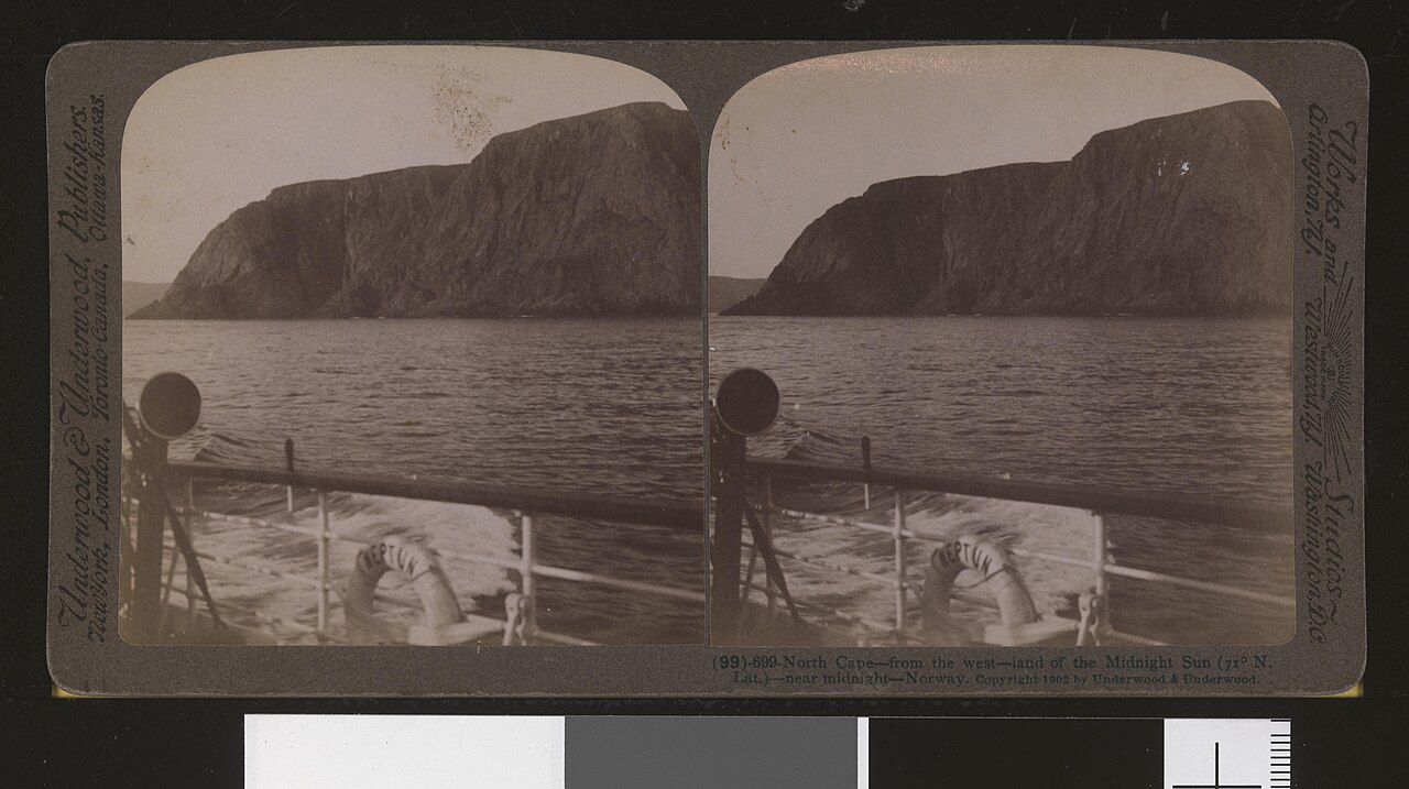
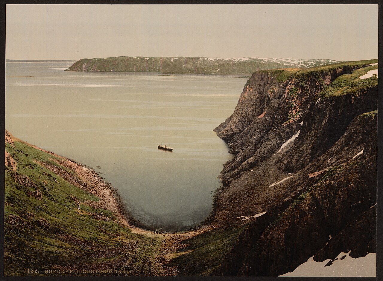
The North Cape (Norwegian: Nordkapp; Northern Sami: Davvenjárga) sits on the northern shore of the island of Magerøya, within Nordkapp Municipality in Finnmark county, Norway. European route E69 ends here, making this the northernmost spot in Europe reachable by car and giving the E69 the title of Europe’s northernmost public road. The cape features a 307-metre (1,007-foot) cliff topped by a broad, flat plateau. When weather cooperates, visitors can see the midnight sun and look out over the Barents Sea to the north. The North Cape Hall, a visitor centre built on the plateau in 1988, houses a café, restaurant, post office, souvenir shop, small museum, and video cinema.
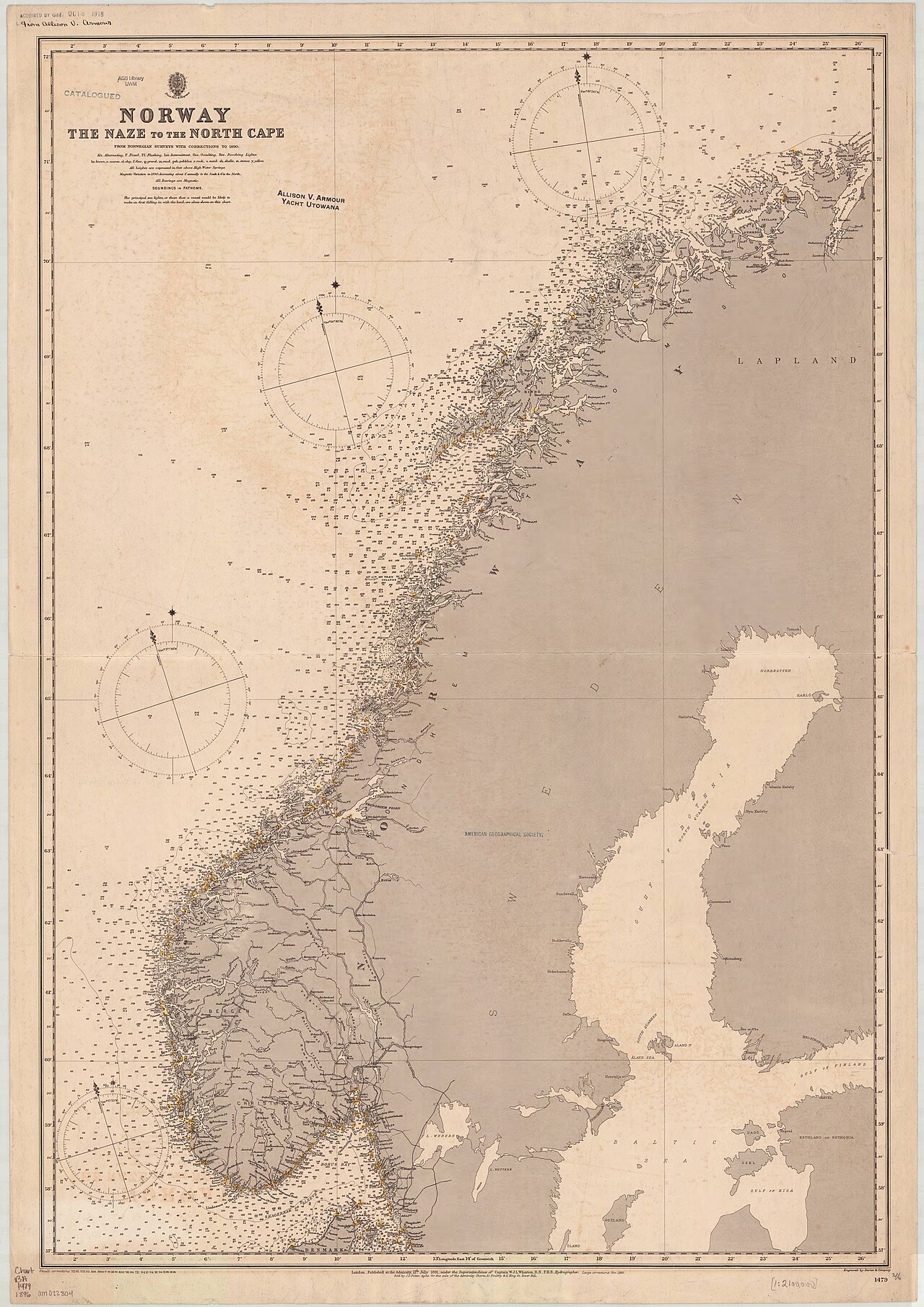
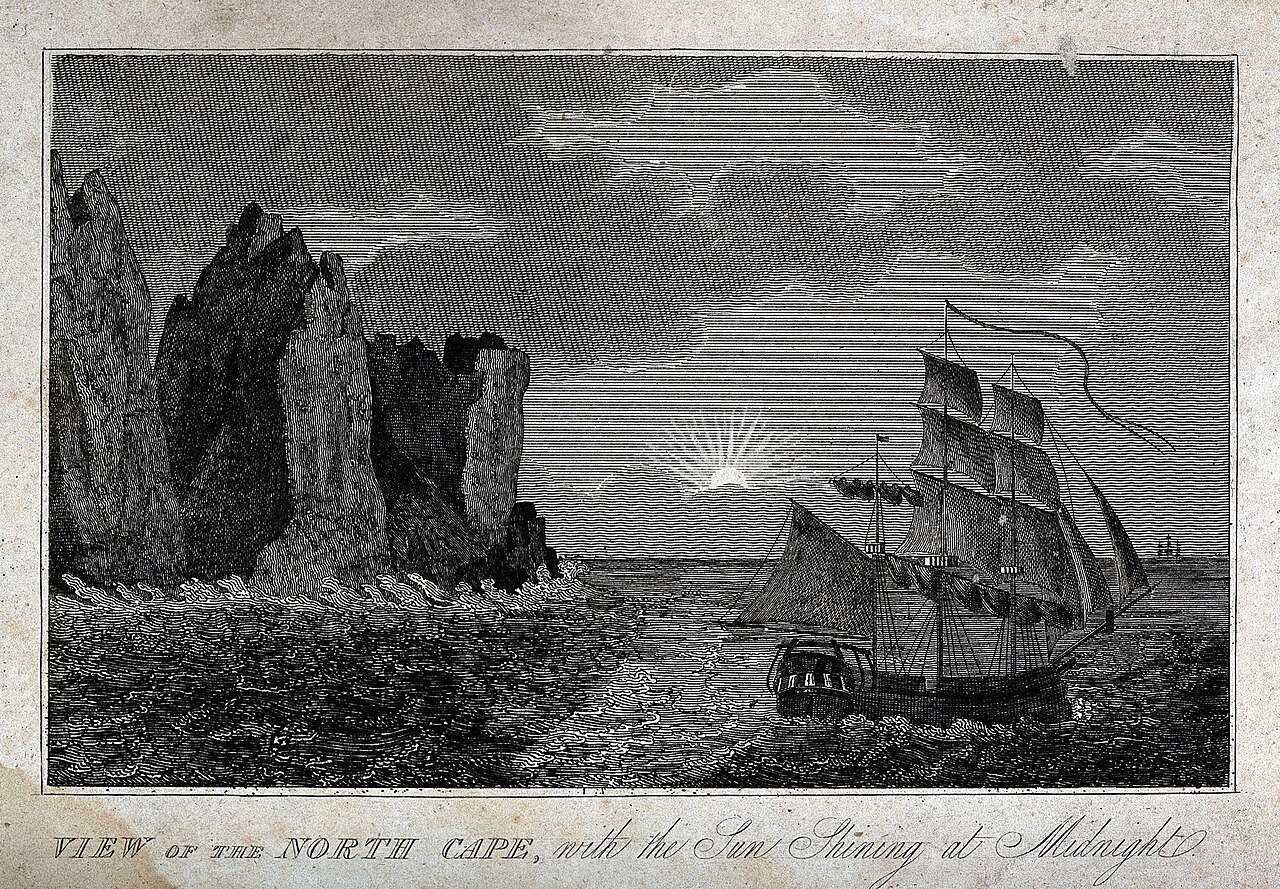
The cliff stands at 71°10′21″N 25°47′04″E, about 2,102.3 kilometres (1,306.3 miles) from the North Pole. Although often called the northernmost point of Europe, this is not accurate. Neighbouring Knivskjellodden Cape extends 1,450 metres (4,760 feet) farther north, and both points are on an island (Magerøya), though a road connects it to the mainland. The northernmost point on mainland Europe is Cape Nordkinn (Kinnarodden), about 5.7 kilometres (3.5 miles) south and 70 kilometres (43 miles) east, near the village of Mehamn on the Nordkinn Peninsula. Including islands, the northernmost point of Europe lies hundreds of kilometres farther north, either in Russia’s Franz Josef Land or Norway’s Svalbard archipelago, depending on whether Franz Josef Land is considered part of Europe or Asia. The North Cape marks where the Norwegian Sea (Atlantic Ocean) meets the Barents Sea (Arctic Ocean). The midnight sun is visible from 14 May to 31 July, with the sun at its lowest between 12:14 am and 12:24 am (00:14 and 00:24).
The North Cape is reached via the E69 highway, which uses the North Cape Tunnel, an undersea tunnel linking Magerøya to the mainland. EuroVelo bicycle routes EV1, EV7, and EV11 connect the cape to Sagres, Portugal; Malta; and Athens, respectively. Many cruise ships visit each year, and Honningsvåg is a main stop for the Havila Kystruten and Hurtigruten coastal ships. Regular buses run from Honningsvåg (33 kilometres, or 21 miles away), and coaches meet cruise ships docking there. The nearest airport is Honningsvåg Valan Airport (HVG), with several flights to and from Tromsø Langnes International Airport (TOS).
Winter visits are possible, but heavy snow and wind are common, and the final stretch of road opens only for convoys at certain times. Before this arrangement, the E69 was the only winter-closed E-route in Europe.
The cape was named by Englishman Steven Borough, captain of the *Edward Bonaventure*, which sailed past in 1553 while searching for the Northeast Passage.
Tourism grew in the late 1800s, especially after King Oscar II’s visit in 1873. Regular coastal steamer routes from Germany to Northern Norway made visits easier, and Thomas Cook & Son began arranging tours by 1875. Tourists often climbed the cape using a path with wired ropes from Hornviken and celebrated by writing “Cape cards” and watching the midnight sun.
A granite column commemorates King Oscar II’s 1873 visit, and a memorial marks German Kaiser Wilhelm II’s 1891 visit. In 1891–92, an octagonal wooden building called “Stoppenbrinck’s” (or “Stoppenbrink’s”) “Champagne Pavilion” was built on the plateau.
In 1943, the Battle of the North Cape took place in the Arctic Ocean off this cape, where the German battleship *Scharnhorst* was sunk by gunfire from the British battleship HMS *Duke of York* and torpedoes from the Norwegian destroyer HNoMS *Stord*, along with other British Navy ships.
A road to the North Cape was first built in 1956.
In July 2026, the County Governor of Troms and Finnmark ruled that no money may be charged for entering the plateau, and the practice must stop immediately. As of the third quarter of 2022, the courts decided that parking on the lot must be free; the government won in the appellate court, and the defendant appealed to the supreme court (the case began in 2021). In 2022, admission to the visitor centre cost 310 kr per adult (16 and older) and 90 kr per child (7 to 15). Fog often obscures the view because the plateau sits above the common cloud base; no discount is given for this, but a full-price ticket allows multiple entries within 24 hours. In 2000 and again in 2011, the Norwegian Ministry of the Environment, responding to interest groups, asked Nordkapps VEL (the company maintaining the site) to reduce the plateau admission fee. Nordkapps VEL replied that 8,000 daily visitors and the remote location demand heavy operations, maintenance, and security. Visitors arriving on foot, by bicycle, or by other non-motorized vehicles now enter for free.
- Location
- 71°10′21″N 25°47′04″E
- Notable feature
- Northernmost point in Europe accessible by car
- Midnight sun period
- 14 May to 31 July
Lore & Background
Early tourists reached the summit via a steep path from Hornviken, which was equipped with wired ropes for safety. Upon arrival, they celebrated by writing postcards known as "Cape cards" and watching the midnight sun. The cape itself is a steep cliff with a large flat plateau on top, offering views of the Barents Sea. It marks the meeting point of the Norwegian Sea and the Barents Sea, and the midnight sun is visible from mid-May through July. The North Cape is often mistakenly called Europe’s northernmost point, but the nearby Knivskjellodden extends further north, and both lie on the island of Magerøya, not the mainland. The cape was named by English captain Steven Borough in 1553. A road was first built in 1956, and today the European route E69 highway ends here, making it the northernmost point in Europe reachable by car. The North Cape Hall visitor centre, built in 1988, includes a café, restaurant, post office, souvenir shop, museum, and cinema. Monuments commemorate visits by King Oscar II in 1873 and Kaiser Wilhelm II in 1891. An octagonal wooden building called Stoppenbrinck’s Champagne Pavilion was erected in 1891–92. During World War II, the Battle of the North Cape occurred nearby, where the German battleship Scharnhorst was sunk.
Reader's Guide
The North Cape is a steep cliff on the island of Magerøya, marking the point where the Norwegian Sea meets the Barents Sea. Its plateau is a popular tourist destination, offering views of the midnight sun from mid-May to the end of July, when the sun dips lowest between roughly midnight and half past midnight. The site was named by an English captain in 1553 during a search for the Northeast Passage. Tourism grew in the late 19th century, especially after a royal visit in 1873, with steamer routes from Germany and tours arranged by a major travel company. Early visitors climbed the cape via a path with wired ropes and often celebrated by writing postcards. Monuments on the plateau commemorate visits by King Oscar II and Kaiser Wilhelm II, and a wooden building erected in the early 1890s was later known as a champagne pavilion. During World War II, the waters off the cape were the site of a naval battle in 1943, where a German battleship was sunk by British and Norwegian forces. A road to the cape was first built in 1956, and the E69 highway now provides the northernmost public road access in Europe, connecting via an undersea tunnel. The cape is also a terminus for several long-distance bicycle routes linking it to Portugal, Malta, and Greece.
Did You Know?
- The midnight sun can be seen from 14 May to 31 July, with the sun at its lowest between 12:14 am and 12:24 am.
Geography & the 'Northernmost' Myth
The North Cape sits on the island of Magerøya in Finnmark county, perched on a 307-metre cliff above the Barents Sea. Its coordinates—71°10′21″N, 25°47′04″E—place it roughly 2,102 kilometres from the North Pole, and it marks the dramatic meeting point where the Norwegian Sea, part of the Atlantic, flows into the Barents Sea, part of the Arctic. Despite its iconic status, Nordkapp is frequently mislabelled as Europe's northernmost point. In reality, the neighbouring Knivskjellodden Cape stretches about 1,450 metres further north, and both sit on Magerøya rather than the mainland. The true northernmost point of mainland Europe is Cape Nordkinn, roughly 5.7 kilometres south and 70 kilometres east. If islands are included, Norway's Svalbard archipelago or Russia's Franz Josef Land claim the title, hundreds of kilometres further north. The midnight sun graces the plateau from 14 May through 31 July, dipping to its lowest point just past midnight around 00:14 to 00:24.
History & Exploration
In 1553, English mariner Steven Borough, commanding the Edward Bonaventure, sailed past this headland while searching for the Northeast Passage and gave it the name that endures today. For centuries the cape remained remote, but the tide turned in the 1870s when King Oscar II of Norway and Sweden visited in 1873, sparking a wave of royal and aristocratic tourism. German Kaiser Wilhelm II followed in 1891, and both monarchs left granite monuments on the plateau. Thomas Cook & Son was arranging package tours to the cape by 1875, and coastal steamers from Germany made the journey accessible to a broader public. Visitors would climb a roped path from Hornviken and commemorate their arrival with the now-famous 'Cape cards.' In 1891–92, an octagonal wooden structure called the Champagne Pavilion was built atop the cliff. The cape's most violent chapter came in 1943, when the Battle of the North Cape saw the German battleship Scharnhorst destroyed by HMS Duke of York and the Norwegian destroyer HNoMS Stord in the Arctic waters just offshore.
Access & Infrastructure
Reaching the North Cape by road is a feat of Arctic engineering. The European route E69 motorway terminates here, making it the northernmost public highway in Europe. The final link is the North Cape Tunnel, an undersea passage connecting Magerøya to the mainland. The road itself was not built until 1956, so for most of its history the cape was accessible only by sea or on foot. Today, cruise ships—particularly the Havila Kystruten and Hurtigruten coastal vessels—dock at nearby Honningsvåg, 33 kilometres away, where coaches and regular buses shuttle visitors to the plateau. The nearest airport, Honningsvåg Valan, links to Tromsø Langnes International. For cyclists, EuroVelo routes EV1, EV7, and EV11 connect the cape to Sagres in Portugal, Malta, and Athens. Winter travel is more challenging: heavy snow and wind make the final stretch convoy-only at certain times, and E69 was once the only winter-closed European E-route. In 2026, the County Governor ruled that charging an admission fee for plateau entry must cease immediately, following earlier court decisions against parking fees.
Sport & Cultural Legacy
The North Cape has become a symbolic finish line for some of Europe's most ambitious endurance events. The 2009 Trans Europe Foot Race covered 4,485 kilometres from Bari, Italy, to the plateau. The NorthCape4000 bicycle race spans roughly 4,200 kilometres to the same destination. In August 2014, the first stage of the Arctic Race of Norway was staged on the cape, starting from Hammerfest. The plateau itself hosts North Cape Hall, a visitor centre opened in 1988 that houses a café, restaurant, post office, souvenir shop, small museum, and video cinema. The site draws around 8,000 visitors on busy days, a figure the operating company Nordkapps VEL has cited as justification for the operational demands of maintaining such a remote, exposed location. Visitors arriving on foot, by bicycle, or other non-motorized means have long enjoyed free entry. The plateau's position above the common cloud base means fog frequently obscures the view, though a full-price ticket remains valid for multiple entries within 24 hours.
Gallery
Frequently Asked Questions
How does North Cape (Norway)'s story end?
As a real geographic feature rather than a fictional character, North Cape has no narrative arc to conclude; it simply continues to stand as a well-visited landmark in Nordkapp Municipality. Its ongoing 'plot' is the daily cycle of tourists arriving to watch the sun trace its path above the sea.
More in Peninsulas And Capes 1-24
Spotted an error? Know more?
This is a living reference — every entry is fact-audited, and reader corrections feed straight into our audit queue. Suggest an edit · See this site's audit record