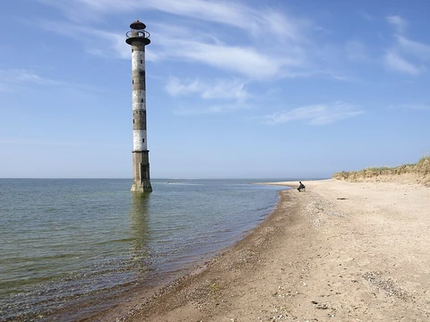
Tierra del Fuego
Archipelago at South America's tip, divided between Chile and Argentina.

Godot13 · CC BY-SA 4.0
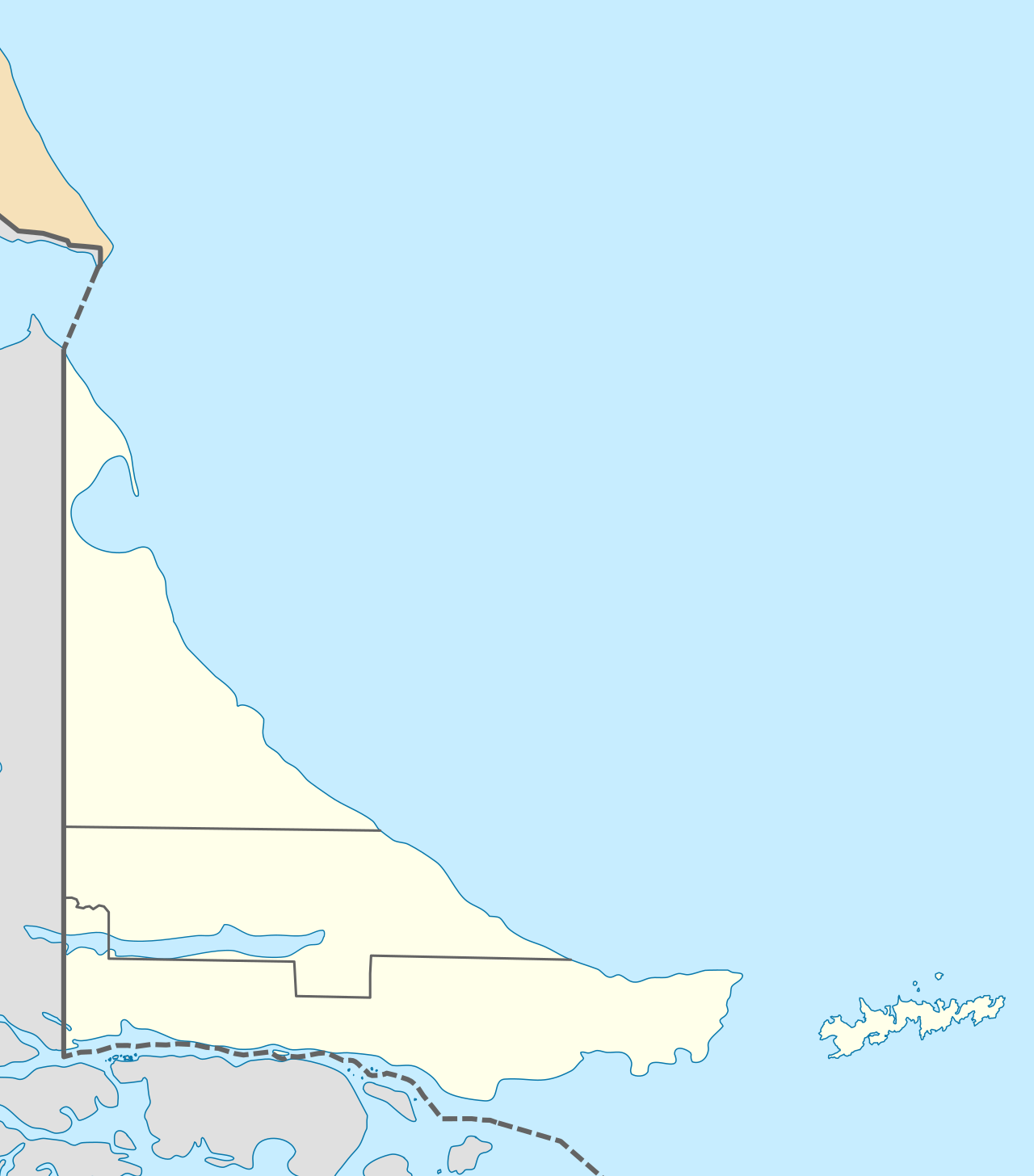
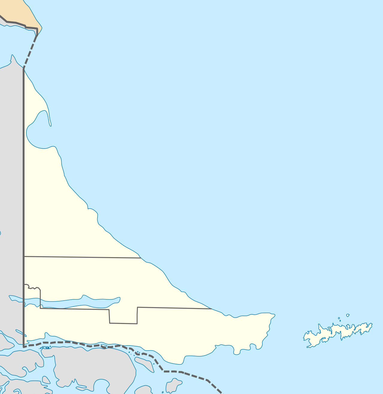
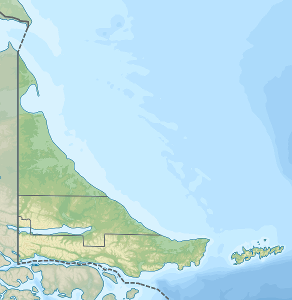
Tierra del Fuego is an archipelago located just off the southernmost tip of South America, separated from the mainland by the Strait of Magellan. The largest island is Isla Grande de Tierra del Fuego, and the group also includes Cape Horn and the Diego Ramírez Islands, among many smaller ones. Chile controls the western two-thirds of the archipelago, while Argentina controls the eastern portion. Cape Horn, the southernmost point, sits just north of 56° south latitude.
The first people arrived around 8,000 BC, with the Yahgan among the earliest known groups; their archaeological remains have been found on Navarino Island. Europeans first saw the islands in 1520 during Ferdinand Magellan’s expedition. Magellan named the region "Land of Fire" after spotting numerous fires built by the Indigenous inhabitants along the coast and in canoes for warmth and signaling. In 1525, Francisco de Hoces suggested it might be an island, not part of a southern continent. Later voyages by Francis Drake in 1578 and a Dutch East India Company expedition in 1616 clarified the geography; the Dutch named Cape Horn on Hornos Island.
In 1830, Robert FitzRoy brought four Fuegians, including Jemmy Button and Yokcushlu, to England. Three survived and met the king and queen before returning to Tierra del Fuego aboard the *Beagle* with FitzRoy and Charles Darwin, who recorded observations of the islands.
European settlement and displacement of native peoples began in the second half of the 19th century, driven by sheep farming and a gold rush. Salesian Catholic missions were established at Río Grande and Dawson Island, and Anglican missions at Ushuaia. Missionary Thomas Bridges learned the Yaghan language and compiled a 30,000-word grammar and dictionary, published later as an important ethnological work. An 1879 Chilean expedition reported placer gold, sparking immigration from 1883 to 1909. Argentines, Chileans, and Croatians settled on the main island, leading to conflicts with the Selkʼnam. Romanian explorer Julius Popper, granted gold rights by Argentina, has been linked to the Selkʼnam genocide. Contact with Europeans drastically reduced the Selkʼnam and Yaghan populations through conflict, disease, and forced relocation to the Salesian mission on Dawson Island. Today, few Selkʼnam remain; some Yaghan live in Villa Ukika on Navarino Island, with others scattered across Chile and Argentina. The Boundary Treaty of 1881 divided the archipelago between Argentina and Chile, ending earlier overlapping claims.
In 1945, oil was discovered in northern Tierra del Fuego, with extraction starting in 1949. Chile’s state-owned ENAP was founded in 1950, and until 1960 most of Chile’s oil came from this region. During the 1940s, both Chile and Argentina lodged Antarctic claims. In the 1950s, Chile founded Puerto Williams. Sovereignty disputes over Picton, Lennox, and Nueva Islands brought the two countries close to war in the 1960s and 1970s. In 1986, Argentina’s congress decided to make its portion of Tierra del Fuego a province, which took effect on 26 April 1990.
Today, petroleum extraction drives the economy in the north, while tourism, manufacturing, and Antarctic logistics are important in the south.
- division
- Chile (west) and Argentina (east)
- southernmost_point
- Cape Horn, just north of 56° south
- economic_activities
- petroleum, tourism, manufacturing, Antarctic logistics
Lore & Background
Tierra del Fuego is an archipelago situated off the southernmost tip of the South American mainland, separated from it by the Strait of Magellan. The archipelago’s defining feature is its main island, Isla Grande de Tierra del Fuego, which covers 73,746 square kilometers and is surrounded by numerous smaller islands, including Cape Horn and the Diego Ramírez Islands. The western portion of the archipelago, roughly two-thirds of its landmass including many of its islands, belongs to Chile, while the eastern portion belongs to Argentina. The southernmost point of the archipelago, Cape Horn, lies just north of 56° south latitude. The name “Tierra del Fuego,” meaning “Land of Fire,” was given by the Portuguese explorer Ferdinand Magellan in 1520, who observed numerous fires built by Indigenous inhabitants along the coastline and possibly in their canoes for warmth and signaling. The earliest known human settlement in the area dates to approximately 8,000 BC, with the Yahgan people among the first to live there. European exploration continued in the 16th and 17th centuries, with Francis Drake and a Dutch East India Company expedition contributing to geographic knowledge; the latter named Cape Horn. In the 19th century, European colonization and the displacement of native populations accelerated during the Patagonian sheep farming boom and a local gold rush. Today, petroleum extraction is the dominant economic activity in the northern part of Tierra del Fuego, while tourism, manufacturing, and Antarctic logistics are important in the south.
Reader's Guide
Tierra del Fuego is significant as the southernmost inhabited archipelago of the Americas, straddling the boundary between the Atlantic and Pacific Oceans. Its ecology and human history are deeply intertwined. The earliest known human settlement dates to around 8,000 BC, with the Yaghan people among the first inhabitants. European contact began with Ferdinand Magellan’s 1520 expedition, which named the region after observing fires lit by Indigenous peoples along the coast. The archipelago’s gold rushes in the late 19th century spurred a wave of immigration from Argentina, Chile, and Croatia, leading to violent conflicts with the native Selkʼnam and Yaghan populations. These encounters, combined with introduced diseases and forced relocation to missions such as the Salesian mission on Dawson Island, resulted in the near extinction of these groups. Missionary Thomas Bridges compiled a significant 30,000-word Yaghan grammar and dictionary during this period. In the 20th century, oil extraction became dominant in the north, while tourism, manufacturing, and Antarctic logistics grew in the south. Geologically, the region features the Magallanes–Fagnano Fault and the glaciers of the Cordillera Darwin, which remain subjects of scientific study. The archipelago’s unique position also made it a flashpoint in the 20th century, with sovereignty disputes over Picton, Lennox, and Nueva Islands bringing Argentina and Chile to the brink of war.
Did You Know?
- The archipelago is divided between Chile (western two-thirds) and Argentina (eastern part).
The Land of Fire: Naming and First Encounters
The name Tierra del Fuego was born from a moment of fear and wonder in 1520, when Ferdinand Magellan, a Portuguese navigator sailing under the Spanish flag, rounded the strait that now bears his name and glimpsed flickering lights along the dark coastline. Convinced the flames were signals from Indigenous warriors waiting in the forests to ambush his fleet, he christened the territory 'Land of Fire.' That dramatic misreading stuck, and the name endures to this day.
For decades afterward, European knowledge of the archipelago remained fragmentary. In 1525 Francisco de Hoces became the first to suggest the land was actually a collection of islands rather than part of the vast southern continent then called Terra Australis. Francis Drake charted additional coastline in 1578, and a Dutch East India Company expedition in 1616 gave Cape Horn its name after the Hornos Island where it anchored.
The most celebrated early encounter came aboard HMS Beagle in 1830, when Captain Robert FitzRoy brought four native Fuegians, including Orundellico—known in England as Jemmy Button—to London, where they briefly became court celebrities before returning home alongside a young naturalist named Charles Darwin.
Indigenous Roots and a Century of Loss
Human presence in Tierra del Fuego stretches back roughly ten millennia. Archaeological evidence at sites like Navarino Island points to the Yahgan as among the earliest known inhabitants, settling the archipelago around 8,000 BC. For millennia these communities thrived, building coastal fires for warmth—fires that would later terrify European sailors.
The nineteenth century brought a catastrophic turning point. Salesian Catholic and Anglican missionaries established outposts at Río Grande, Dawson Island, Keppel Island, and Ushuaia. The Anglican priest Thomas Bridges, working at Ushuaia, devoted decades to learning the Yaghan language and compiling a 30,000-word grammar and dictionary still regarded as a cornerstone of ethnological scholarship.
Yet goodwill could not halt the devastation. The gold rush that drew Argentines, Chileans, and Croatians to the main island between 1883 and 1909 intensified violent clashes with the Selk'nam. Infectious diseases to which Indigenous people had no immunity swept through communities, and mass transfers to the Dawson Island mission proved deadly. The Romanian entrepreneur Julius Popper, granted exploitation rights by the Argentine government, has been identified as a central figure in the Selk'nam genocide. Today only a handful of Selk'nam survive, and the few remaining Yaghan are scattered across Navarino Island and both nations.
From Gold to Oil: Economic Transformation
The late nineteenth century transformed Tierra del Fuego from a remote archipelago into a magnet for fortune-seekers. In 1879, a Chilean expedition led by Ramón Serrano Montaner reported substantial placer gold in the streams and riverbeds of the main island. The news triggered a wave of immigration between 1883 and 1909, drawing Argentines, Chileans, and Croatians who founded small settlements that would grow into the towns of Ushuaia, Río Grande, Porvenir, and Puerto Toro. The Patagonian sheep farming boom of the same era added another economic thread.
The twentieth century brought a different kind of wealth. In 1945, a division of Chile's state production corporation CORFO, engaged in oil exploration, struck petroleum in the northern part of the archipelago. Extraction began the following year, and in 1950 the Chilean state established ENAP, the National Petroleum Company. Until 1960, the majority of Chile's oil output came from Tierra del Fuego.
Today the economic landscape remains bifurcated: petroleum extraction still dominates the north, while the south leans on tourism, light manufacturing, and the logistics infrastructure that supports Antarctic operations.
Divided by Treaty, Defined by Tension
Before 1881, both Argentina and Chile claimed the entirety of Tierra del Fuego. The Boundary Treaty signed that year finally drew a line through the archipelago, allocating roughly two-thirds of the territory—including most of the smaller islands—to Chile, and the remaining eastern portion to Argentina. On the main island, Isla Grande, Chile holds about 61 percent of the land area while Argentina holds the rest, with the Beagle Channel running east–west just south of the island and the larger southern islands of Hoste and Navarino falling under Chilean jurisdiction.
The division, however, never fully resolved tensions. In the 1940s both nations lodged competing Antarctic claims, and in the 1950s the Chilean military founded Puerto Williams as a strategic outpost. The most dangerous flashpoint came in the 1960s and 1970s, when Argentine sovereignty claims over the Picton, Lennox, and Nueva Islands brought the two countries to the very brink of armed conflict.
Politically, the archipelago continues to evolve. In 1986 the Argentine congress voted to make its portion of Tierra del Fuego a new province, a split that took effect on 26 April 1990.
Gallery
Frequently Asked Questions
What is Tierra del Fuego?
Tierra del Fuego is a sprawling archipelago perched at the very bottom of South America, sitting just beyond the Strait of Magellan. It is made up of the large Isla Grande de Tierra del Fuego together with a string of smaller islands, among them Cape Horn and the Diego Ramírez group.
How is Tierra del Fuego divided politically?
The archipelago is split roughly down the middle, with Chile administering the western portion and Argentina holding the eastern side. This boundary runs through the heart of the main island.
What is the southernmost point of Tierra del Fuego?
Cape Horn, sitting just north of 56 degrees south latitude, marks the archipelago's extreme southern tip. It has long been one of the most notorious and feared waypoints for sailors crossing between the Atlantic and Pacific.
What does Tierra del Fuego's economy rely on?
The region leans on petroleum extraction, tourism, and light manufacturing as its primary economic engines. It also functions as a critical logistics staging ground for Antarctic research and supply operations.
More in Peninsulas And Capes 1-24
Spotted an error? Know more?
This is a living reference — every entry is fact-audited, and reader corrections feed straight into our audit queue. Suggest an edit · See this site's audit record