
Götaland
One of three lands of Sweden, home of the Geats.

Azurescapegoat · CC BY-SA 4.0
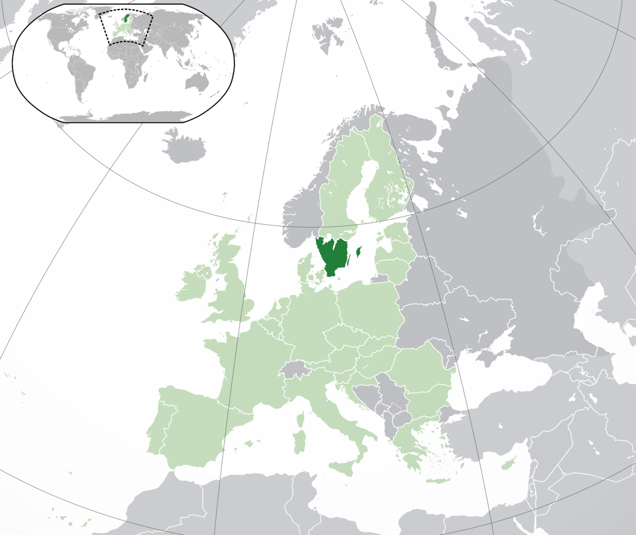
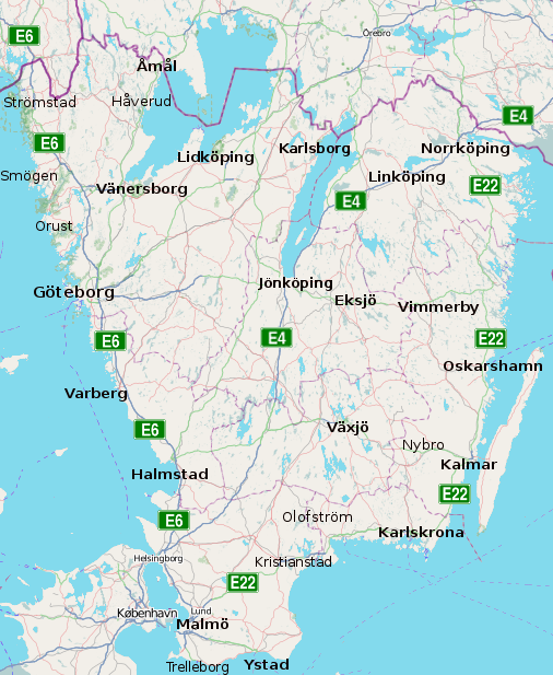
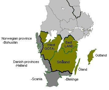
Götaland is one of the three lands of Sweden, situated in the southern part of the country and composed of ten provinces. Its historical inhabitants were known as the Gautar in Old Norse, a term primarily associated with the people of what is now Västergötland and synonymous with the Geats, the tribe featured in the Old English epic *Beowulf*. The region once consisted of several petty kingdoms. The unification of Sweden began as certain provinces within Götaland grew increasingly politically connected with those of Svealand, a process that can be traced back to at least the 10th century and continued for centuries. At that time, other parts of modern Götaland belonged to Denmark or Norway. The province of Småland, containing the historically important coastal city of Kalmar, was sparsely populated, while the status of the Baltic island of Gotland fluctuated during the Middle Ages. The provinces of Bohuslän, Scania, Halland, and Blekinge were ceded to Sweden by Denmark-Norway in the 17th century and have since been considered part of Götaland. The name Götaland replaced the older term Götland in the 15th century, likely to distinguish the broader region from the traditional heartland in Västergötland. Originally, the name probably referred only to Västergötland and Östergötland, which constitute Götaland proper and were once rival kingdoms. These two provinces feature large agricultural areas and the Göta Älv river, which drains Lake Vänern and historically provided access to the Kattegat sea. The small lands to the south—including Finnveden, Kind, and Möre—were merged into the province of Småland, while Dal became Dalsland. These provinces, along with Öland, were considered part of Götaland by the 12th to 15th centuries.
- Type
- Historical land of Sweden
- Provinces
- Ten
- Geographic location
- Southern Sweden, bounded north by Svealand
- Population
- Approximately 4.4 million
- Notable for
- Home of the Geats (Gautar), the people of Beowulf
- Historical status
- Unofficial entity, no administrative function today
Quick Facts
- Area Total Km2
- 97841
- Population As Of
- 31 December 2021
- Population Total
- 4995764
- Population Density Km2
- auto
- Timezone
- CET
- Utc Offset
- +1
- Timezone Dst
- CEST
- Utc Offset Dst
- +2
- Settlement Type
- Land of Sweden
Facts from the source article.
Lore & Background
Götaland is one of the three traditional lands of Sweden, located in the southern part of the country. Its northern border with Svealand is marked by the deep forests of Tiveden, Tylöskog, and Kolmården. The region comprises ten provinces. Historically, Götaland was made up of petty kingdoms whose inhabitants were called Gautar in Old Norse, a term that primarily referred to the people of the western part, modern Västergötland. The Gautar are agreed to be the same as the Geats, the people featured in the Anglo-Saxon epic *Beowulf*. The earliest known mention of the götar comes from the 2nd-century geographer Ptolemy, who referred to them as the Goutai. The core of Götaland proper consists of Västergötland and Östergötland, which were once rival kingdoms with large agricultural areas. The Göta Älv river, draining Lake Vänern, flows through Västergötland to the Kattegat sea. The modern state of Sweden began forming as provinces of Götaland became politically intertwined with those of Svealand, a process traceable to at least the 10th century. Other parts of modern Götaland, such as Bohuslän, Scania, Halland, and Blekinge, were originally Danish or Norwegian and were only ceded to Sweden in the 17th century. The island of Gotland, though it shifted allegiance between Swedes and Danes, is also counted as part of Götaland. The name Götaland replaced the older Götland in the 15th century, likely to distinguish the wider region from the traditional heartland in Västergötland.
Reader's Guide
Götaland's significance lies in its role as the heartland of the Geats, a people central to the Old English epic Beowulf, and as a foundational component of the modern Swedish state. The name Götaland replaced the old Götland in the 15th century, probably to distinguish the wider region from the traditional heartland in Västergötland. It was only late in the Middle Ages that Götaland began to be perceived as a part of Sweden; in Old Norse and Old English sources, Gautland/Geatland is treated as a separate country from Sweden. Today, Götaland has no administrative function but is generally considered one of three Swedish lands, roughly comprising the modern counties of Blekinge, Gotland, Halland, Jönköping, Kalmar, Kronoberg, Östergötland, Scania, and Västra Götaland. Its legacy endures in the cultural and historical identity of southern Sweden.
Did You Know?
- Götaland comprises ten provinces and is one of three lands of Sweden.
- The name Götaland replaced the old Götland in the 15th century.
- The earliest possible mention of the götar is by the 2nd-century geographer Ptolemy, who mentions the Goutai.
The Three-Tier Statistical Framework
The NUTS classification system, standing for Nomenclature of Territorial Units for Statistics, organizes Sweden's territory into three hierarchical levels, all prefixed with the country code SE. At the broadest tier, the nation is divided into three major zones: SE1 covering East Sweden (Östra Sverige), SE2 encompassing South Sweden (Södra Sverige), and SE3 representing North Sweden (Norra Sverige). Each of these first-level regions is further subdivided into second-level units, and those in turn break down into third-level units that align with individual counties. Below this NUTS structure, two additional Local Administrative Unit (LAU) levels exist, providing even finer granularity for statistical reporting. The entire coding scheme is designed to facilitate comparable data collection across European nations, with downloadable code lists available in ODS format for researchers and analysts working with Swedish territorial data.
Regional Groupings and County Composition
Sweden's NUTS framework groups its twenty-one counties into distinct statistical regions. East Sweden (SE1) contains Stockholm County as a standalone unit alongside a cluster of five counties in East Middle Sweden, including Uppsala, Södermanland, Östergötland, Örebro, and Västmanland. South Sweden (SE2) is the most internally complex region, splitting into Småland and the islands (comprising Jönköping, Kronoberg, Kalmar, and Gotland counties), a South Sweden sub-region with Blekinge and Skåne, and a West Sweden grouping of Halland and Västra Götaland. North Sweden (SE3) spans three sub-regions: North Middle Sweden with Värmland, Dalarna, and Gävleborg; Middle Norrland with Västernorrland and Jämtland; and Upper Norrland with Västerbotten and Norrbotten. This arrangement reflects geographic and economic logic rather than purely administrative boundaries.
The Pre-2008 Code System and Riksområden
Under that earlier framework, the country was organized into eight second-level subdivisions known as riksområden (singular: riksområde), a term that translates roughly to national areas. These eight units collectively encompassed all twenty-one Swedish counties. A notable peculiarity of the old system was that only Stockholm (designated SE01) mapped directly onto a single homonymous county, while the remaining seven riksområden each bundled multiple counties together. The transition to the current three-level NUTS structure represented a significant reorganization of how Swedish territory is statistically delineated, moving away from the riksområde model toward a more granular and internationally standardized classification that aligns with EU statistical reporting requirements.
NUTS Levels Versus Traditional Swedish Lands
A critical distinction exists between Sweden's NUTS statistical regions and the country's traditional historical lands. While the two systems share superficial similarities in their geographic groupings, the NUTS level-1 divisions do not correspond directly to the historical Lands of Sweden. This means a statistical region like SE2 (South Sweden) or SE3 (North Sweden) may cut across or combine territories belonging to different traditional lands, and conversely a single historical land might be split across multiple NUTS units. This disconnect is significant for anyone attempting to reconcile modern EU statistical data with historical or cultural geography. The NUTS system was designed for cross-border comparability within the European Union, whereas the traditional lands reflect centuries of local identity and governance. Researchers working with Swedish data must therefore be careful not to conflate these two fundamentally different organizational logics when interpreting regional statistics.
Gallery
More in Other European Regions 1-23
Spotted an error? Know more?
This is a living reference — every entry is fact-audited, and reader corrections feed straight into our audit queue. Suggest an edit · See this site's audit record