King Arthur's Great Halls
Last updated
Where it is
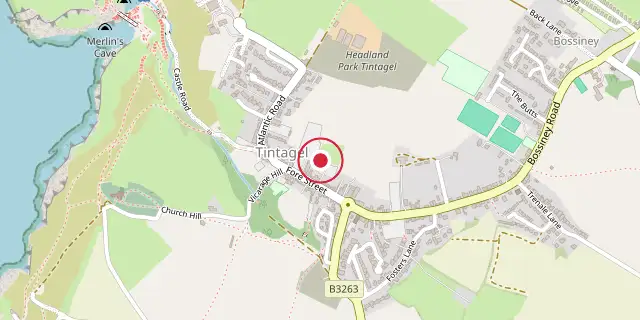
Coordinates: 50°39′50″N 4°45′04″W (50.6640, -4.7510) · Open in OpenStreetMap
Coordinates and connected clubs: the infobox of Wikipedia: King Arthur's Great Halls (CC BY-SA 4.0). Map: drawn by Codexery from OpenStreetMap tiles.
King Arthur's Great Halls, a Grade II listed building on Fore Street in Tintagel, Cornwall, was opened in 1933. It was built by Frederick Thomas Glasscock as the headquarters for the Fellowship of the Knights of the Round Table of King Arthur. The hall is a visitor attraction for those interested in Arthurian legend and includes a bookshop on the subject.
Quick Facts
- Location
- Tintagel, Cornwall, England
Facts from the source article.
Fellowship of the Knights of the Round Table of King Arthur
Frederick Thomas Glasscock founded the Fellowship of the Knights of the Round Table of King Arthur in 1927 to promote Christian ideals and his interpretation of medieval chivalry. Glasscock lived at Tintagel in the house Eirenikon, which he had built, and oversaw the construction of King Arthur's Hall. The hall was an extension of Trevena House, formerly John Douglas Cook's residence, built on the site of the old Town Hall and Market Hall. The Fellowship holds its annual dinner there on the first Saturday in June.
Did You Know?
- The 72 stained-glass windows illustrating Arthurian tales were designed by Veronica Whall.
- Whall designed 73 windows for the hall, making it the largest 20th-century collection of King Arthur stained glass panels as of 1997.
- Several paintings of scenes from King Arthur's life by William Hatherell are also in the hall.
More in Locations Associated with Arthurian Legend
Sources
Compiled from Wikipedia and the sources listed below. Text from Wikipedia is available under CC BY-SA 4.0; this entry is adapted from it.
- Wikipedia: King Arthur's Great Halls (CC BY-SA 4.0).
Spotted an error? Know more?
Reader corrections go straight into our review queue. Suggest an edit · How this site is sourced