King Arthur's Hall
Last updated

via Wikipedia: King Arthur's Hall · see source
Where it is
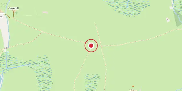
Coordinates: 50°34′05″N 4°38′35″W (50.5680, -4.6430) · Open in OpenStreetMap
Coordinates and connected clubs: the infobox of Wikipedia: King Arthur's Hall (CC BY-SA 4.0). Map: drawn by Codexery from OpenStreetMap tiles.
King Arthur's Hall (Hel Myghtern Arthur) is a megalithic enclosure on Bodmin Moor in Cornwall, UK. It is thought to be a late Neolithic or early Bronze Age ceremonial site. The monument consists of fifty-six stones arranged in a rectangle with a bank of earth around them, measuring approximately 20m by 47m. The interior fills with water, and a contemporary ground level has not been established.
It has suffered damage by cattle in the past and is now protected by a gated fence. It can be reached by footpaths east of St Breward. The surrounding area contains many stone circles, hut circles, cairns and cists.
Quick Facts
- Location
- Bodmin Moor, Cornwall
Facts from the source article.
Origin and use
For centuries, no one has been certain what King Arthur’s Hall was used for or when it was built. A similar enclosure in Brittany served as a Bronze Age cremation site, while a comparable rampart at Lough Gur in Ireland points to an even older Neolithic origin.
Some have suggested it was simply a medieval cattle pound, but the immense effort needed to construct the bank and raise the stone slabs implies a more significant purpose. They concluded that roughly 140 upright stones are now either buried, lying flat, or leaning at odd angles, and proposed the structure may have originally been a water-filled tank or used for rituals. A later excavation in September 2022, carried out by the Cornwall AONB’s Monumental Improvement project with the Cornwall Archaeological Unit, allowed specialists from several UK universities to date the site to the Neolithic period.
More in Locations Associated with Arthurian Legend
Sources
Compiled from Wikipedia and the sources listed below. Text from Wikipedia is available under CC BY-SA 4.0; this entry is adapted from it.
- Wikipedia: King Arthur's Hall (CC BY-SA 4.0).
Spotted an error? Know more?
Reader corrections go straight into our review queue. Suggest an edit · How this site is sourced