King Arthur's Round Table
Last updated
Where it is
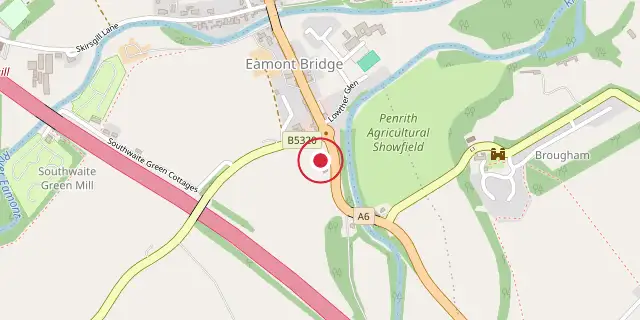
Coordinates: 54°38′53″N 2°44′24″W (54.6480, -2.7400) · Open in OpenStreetMap
Coordinates and connected clubs: the infobox of Wikipedia: King Arthur's Round Table (CC BY-SA 4.0). Map: drawn by Codexery from OpenStreetMap tiles.
King Arthur's Round Table is a Neolithic henge located in the village of Eamont Bridge, Cumbria, near Penrith. It is part of a larger henge complex that includes Mayburgh Henge and the Little Round Table. The site is managed by English Heritage and is open to the public free of charge.
Description
The henge lies in a field beside the A6 road in Eamont Bridge, south of Penrith. Its northern part is covered by the B5320 road and the Crown Hotel, while the A6 has encroached on the eastern side. Mayburgh Henge is 400 metres west, and the Little Round Table henge lies 200 metres south, suggesting a henge complex and possible ritual landscape similar to those at Thornborough or Salisbury Plain.
The henge measures about 90 metres in diameter, with an enclosed area roughly 50 metres across, a ditch up to 16 metres wide, a berm 7 metres wide, and a bank 13 metres wide. Originally two entrances existed, but only the south-east survives; the north-west entrance was largely destroyed by modern roads. Landscaping in the late 18th to early 19th century, possibly for a tea garden, altered parts of the site.
Archaeology
William Dugdale sketched the remains around 1664, showing two opposing entrances and two standing stones flanking the north-west entrance. By 1725, when William Stukeley visited, those stones had disappeared. C. W. Dymond produced a comprehensive record in 1891. Excavations in 1937 by R. G. Collingwood and in 1939 by Gerhard Bersu revealed that the ditch had been cleared and reshaped, and the entrance narrowed, in modern times.
Collingwood identified posthole structures and a cremation trench near the centre, but Bersu disputed these findings, arguing the postholes were not archaeologically significant and finding no evidence of cremation, though he allowed for a possible disturbed grave. Later assessments by Grace Simpson (1998) and Stephen Leach (2019) have questioned Bersu's work and largely supported Collingwood. A 1988 geophysical survey examined the north segment and south-east entrance, but results were affected by the 18th–19th century landscaping.
More in Locations Associated with Arthurian Legend
Sources
Compiled from Wikipedia and the sources listed below. Text from Wikipedia is available under CC BY-SA 4.0; this entry is adapted from it.
- Wikipedia: King Arthur's Round Table (CC BY-SA 4.0).
Spotted an error? Know more?
Reader corrections go straight into our review queue. Suggest an edit · How this site is sourced