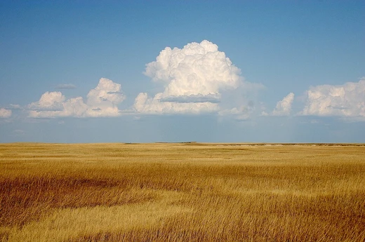
Simpson Desert
Australia's fourth-largest desert, home to the world's longest parallel sand dunes and ancient Aboriginal heritage.
The Simpson Desert is a large area of dry, red sandy plain and dunes in the Northern Territory, South Australia and Queensland in central Australia. It is the fourth-largest Australian desert, with an area of 176,500 sq km. The Wangkangurru Yarluyandi people know this area as Munga-Thirri. The desert is underlain by the Great Artesian Basin, one of the largest inland drainage areas in the world. Water from the basin rises to the surface at numerous natural springs, including Dalhousie Springs, and at bores drilled along stock routes, or during petroleum exploration. As a result of exploitation by such bores, the flow of water to springs has been steadily decreasing in recent years. It is also part of the Lake Eyre basin. The Simpson Desert is an erg that contains the world's longest parallel sand dunes. These north-south oriented dunes are static, held in position by vegetation. They vary in height from 3 m in the west to around 30 m on the eastern side. The largest dune, Nappanerica or Big Red, is 40 m in height.
- type
- Erg (sand desert)
- location
- Central Australia (Northern Territory, South Australia, Queensland)
- average_rainfall
- ~150 mm per year
- average_summer_temperature
- 28°C (up to 50°C)
Quick Facts
- Other Name
- Munga-Thirri
- Country
- Australia
- State
- Northern Territory
- State1
- Queensland
- State2
- South Australia
- Area Km2
- 176500
Facts from the source article.
Lore & Background
Aboriginal peoples have lived in the Simpson Desert for at least 5000 years and continue to do so today. However, when Europeans came to the area in the late 19th century, they thought that it was an uninhabitable desert that wasn't suitable for human life. The Lower Southern Arrernte and Eastern Arrernte communities inhabited the western regions, while the Karangura and Wanggamala resided in the east. The Wangkangurru people lived in the Simpson Desert using hand-dug wells called mikiri from long before European colonization until the Federation Drought. The diet of the Aboriginal peoples in the Simpson Desert before colonization consisted of breads and seed patties made out of Nardoo (Marsilea drummondii) and Pigweed (Aizoon quadrifidum) seeds. They also hunted game as well, there being a variety of fauna to hunt, such as kangaroos, wallabies, bandicoots, hopping mice, rats native to the area, lizards, snakes, and dingoes. Explorer Charles Sturt, who visited the region from 1844 to 1846, was the first European to see the desert. In 1880, Augustus Poeppel, a surveyor with the South Australian Survey Department, determined the border between Queensland and South Australia to the west of Haddon Corner, and in doing so, marked the corner point where the States of Queensland and South Australia meet the Northern Territory. After he returned to Adelaide, the links in his surveyor's chain were found to have been stretched. Poeppel's border post was too far west by 300 m. In 1884, surveyor Larry Wells moved the post to its proper position on the eastern bank of Lake Poeppel. The tristate border is now known as Poeppel Corner. In January 1886, surveyor David Lindsay ventured into the desert from the western edge, in the process discovering and documenting, with the help of a Wangkangurru Aboriginal man, 9 native wells, and travelling as far east as the Queensland/Northern Territory border. In 1936, Ted Colson became the first nonindigenous person to cross the desert in its entirety, riding camels. The name Simpson Desert was coined by Cecil Madigan, after Alfred Allen Simpson, an Australian industrialist, philanthropist, and geographer, and president of the South Australian branch of the Royal Geographical Society of Australasia. Mr Simpson was the owner of the Simpson washing machine company. In September 1962, geologist Reg Sprigg, his wife Griselda, and their tw
Reader's Guide
No maintained roads cross the desert. The Donohue Highway is an unpaved outback track passing from near Boulia towards the Northern Territory border in the north of the desert. Some tracks were created during seismic surveys in the search for gas and oil during the 1960s and 1970s. These include the French Line, the Rig Road, and the QAA Line. Such tracks are still navigable by well-equipped four-wheel drive vehicles that must carry extra fuel and water. Towns providing access to the South Australian edge of the Simpson Desert include Innamincka to the south and Oodnadatta to the southwest; and from the eastern (Queensland) side include Birdsville, Bedourie, Thargomindah, and Windorah. The last fuel on the western side is at the Mount Dare hotel and store. Before 1980, a section of the Commonwealth Railways Central Australian line passed along the western side of the Simpson Desert. The less travelled Madigan Line runs from Old Andado Station to Birdsville. The geographic centre of the desert can be reached by driving 80 km north from the French Line via the Centre Line. The French Line is the most popular track used to cross the Simpson Desert. Most people chose to cross from west to east as prevailing winds assist in the crossing and the west sides of the dunes are less steep making ascents easier. The desert is popular with tourists, particularly in winter, and popular landmarks include the ruins and mound springs at Dalhousie Springs, Purnie Bore wetlands, Approdinna Attora Knoll and Poeppel Corner (where Queensland, South Australia and the Northern Territory meet). Because of the excessive heat and inadequately experienced drivers attempting to access the desert in the past, the Department of Environment & Natural Resources has decided since 2008–2009 to close the Simpson Desert during the summer – to save unprepared 'adventurers' from themselves. Another attraction is the Big Red Bash, which is billed as the most remote music festival on Earth. The event features concerts and a Big Red Bash drag race across sand dunes to raise money for the Royal Flying Doctor Service. The desert can also be crossed by bicycle. The Simpson Desert Bike Challenge crosses the Simpson Desert every year in September.
Did You Know?
- The Simpson Desert is an erg that contains the world's longest parallel sand dunes.
- The largest dune, Nappanerica or Big Red, is 40 m in height.
- The Wangkangurru Yarluyandi people know this area as Munga-Thirri.
- In 1936, Ted Colson became the first nonindigenous person to cross the desert in its entirety, riding camels.
- The name Simpson Desert was coined by Cecil Madigan, after Alfred Allen Simpson, an Australian industrialist and philanthropist.
More in Desert Landscapes 1-18
Spotted an error? Know more?
This is a living reference — every entry is fact-audited, and reader corrections feed straight into our audit queue. Suggest an edit · See this site's audit record