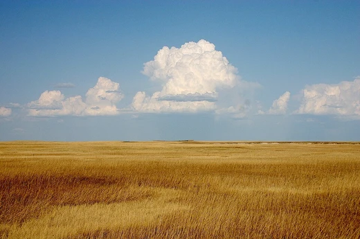
Bahariya Oasis
A historically rich oasis in Egypt's Western Desert.

Wikipedia / Wikimedia Commons
Bahariya Oasis is a fertile depression in Egypt’s Western Desert, lying about 370 kilometers from Cairo. The valley is roughly oval, stretching from northeast to southwest, 94 kilometers long and up to 42 kilometers wide, covering around 2,000 square kilometers. It sits in Giza Governorate, surrounded by mountains and dotted with springs. The economy relies on agriculture (guavas, mangos, dates, olives), iron ore mining, and tourism.
The oasis has gone by many names. In ancient Egypt, it was called Djesdjes, first recorded on a Middle Kingdom scarab, and later, during the New Kingdom, it appeared in the Temple of Luxor and in King Kamose’s account of his war against the Hyksos. From the 25th Dynasty onward, Djesdjes was the standard name. Another ancient name, “the Northern Oasis,” was used mainly in the New Kingdom, showing up on a local tomb and in the Temple at Edfu. After 45 CE, Romans knew it as Oasis parva (Small Oasis). The Greek historian Strabo called it the “Second Oasis,” and the 5th-century historian Olympiodorus of Thebes referred to it as the “Third Oasis.” In Coptic times, it was the “Oasis of Oxyrhynchus,” a name derived from Djesdjes. After Egypt’s Islamization, it became the Oasis of Bahnasa. Today it is called al-Wāḥāt al-Baḥriyya, meaning “the Northern Oases.” The southern part around El Heiz apparently never had a separate name.
The oasis includes many villages. El Bawiti is the largest and serves as the administrative center, with Qasr as its twin. About ten kilometers east lie Mandishah and el-Zabu, with el-‘Aguz in between. Harrah is the easternmost village, a few kilometers east of Mandishah and el-Zabu. El Heiz (or El-Hayez), about 50 kilometers south of El Bawiti, is sometimes considered separate because of its distance; mummies found there have been studied genetically.
People have lived in the depression since the Neolithic, though archaeological evidence is patchy. At El Heiz, a prehistoric hunter-gatherer site yielded grindstones, arrowheads, scrapers, chisels, and ostrich eggshells. A Czech team led by Miroslav Bárta found an Old Kingdom settlement at Qārat el-Abyaḍ. Rock inscriptions at el-Harrah and elsewhere date to the Middle Kingdom and later. The tomb of Amenhotep called Huy was built at Qarat Hilwah near the end of the 18th Dynasty. The oasis flourished culturally and economically during the 26th Dynasty, as seen in chapels at ‘Ain el-Muftilla, tombs at Qārat Qasr Salim and Qarat esh-Sheikh Subi, and the site of Qasr ‘Allam. The Greco-Roman period brought further prosperity. A ruined temple dedicated to Ammon by Alexander the Great stands at Qasr el-Miqisba, and some Egyptologists believe Alexander passed through Bahariya on his way back from the oracle at Siwa. Excavations of the Greco-Roman necropolis known as the Valley of the Golden Mummies, discovered in 1995, began in 1999; about thirty-four tombs have been uncovered. In Roman times, a large military fort was built at Qarat el-Toub.
During World War I, the Baharia Military Railway was built to reach the oasis. In the early 1970s, an asphalt road connecting Bahariya to Cairo was completed, bringing electricity, cars, television, phone lines, easier access to Cairo, and later the internet. The flow of people and ideas between Bahariya and Cairo increased dramatically, and the local Waḥātī language has shifted under the influence of the Cairo dialect heard on TV and in music.
In spring 2010, a Roman-era mummy was unearthed in a cemetery at el-Harrah. The female mummy, three feet tall, was covered with plaster decorated to resemble Roman dress and jewelry. Alongside it, archaeologists found clay and glass vessels, coins, anthropoid masks, and fourteen Greco-Roman tombs. Mahmoud Afifi, the director of Cairo and Giza Antiquities who led the dig, noted the tomb’s unique design with stairways and corridors, possibly dating to 300 BC. The discovery came during excavation for a youth center. In 2019, archaeologists found 19 structures and a church carved into bedrock from the fifth century CE, decorated with Greek religious inscriptions. In 2021, a complex with ruins of three churches and monks’ cells from the same century was uncovered. In August 2026, an Egyptian mission excavating the Sheikh Sobi necropolis uncovered three tombs representing different funerary traditions: a Late Period rock-cut communal tomb with five mummies in limestone coffins, an apparently unused tomb, and a more complex Roman-period communal tomb with limestone and pottery coffins. Finds included pottery vessels, offering tables, and terracotta votive figurines of female figures and stylized animals, reflecting changing funerary and religious practices.
- Location
- Western Desert, Egypt, Giza Governorate
- Area
- About 2000 km²
- Length
- 94 km
- Maximum width
- 42 km
- Distance from Cairo
- Approximately 370 km
- Main economic sectors
- Agriculture, iron ore mining, tourism
- Main agricultural products
- Guavas, mangos, dates, olives
Verified Timeline
Lore & Background
Bahariya Oasis has been populated since the Neolithic, though archaeological evidence is not continuous. In El Heiz, a prehistoric settlement site of hunter-gatherers was found with remains of grindstones, arrowheads, scrapers, chisels, and ostrich eggshells. In Qārat el-Abyaḍ, a Czech team led by Miroslav Bárta discovered a settlement of the Old Kingdom. In ancient Egypt, the oasis had two names: 'ḏsḏs' (Djesdjes), first mentioned on a scarab dating back to the Middle Kingdom, and wḥꜣt mḥtt ('the Northern Oasis'), used almost exclusively in the New Kingdom. The tomb of Amenhotep called Huy was erected in Qarat Hilwah at the end of the 18th dynasty. In the 26th dynasty, the depression was culturally and economically flourishing, as seen in the chapels in 'Ain el-Muftilla, the tombs in Qārat Qasr Salim and Qarat esh-Sheikh Subi, and the site of Qasr 'Allam.
Reader's Guide
The Greco-Roman period was a time of prosperity. There is the ruin of a temple dedicated to Ammon by Alexander the Great located in Qasr el-Miqisba ('Ain et-Tibniya). Excavations of the Greco-Roman necropolis found in 1995 and known as the Valley of the Golden Mummies began in 1999; approximately thirty-four tombs have been excavated from this area. In the spring of 2010, a Roman-era mummy was unearthed in a Bahariya Oasis cemetery in el-Harrah—the female mummy was 3 feet tall and covered with plaster decorated to resemble Roman dress and jewellery. In 2019, archaeologists discovered 19 structures and a church carved into the bedrock from the fifth century CE, decorated with religious inscriptions in Greek. In 2021, a complex with ruins of three churches and monks' cells dating to the fifth century CE was found. In August 2026, an Egyptian mission uncovered three tombs at the Sheikh Sobi necropolis, including a Late Period rock-cut communal tomb with five mummies in limestone coffins. Fossils of dinosaurs including Spinosaurus, Bahariasaurus, Aegyptosaurus, and Paralititan have been found in the Bahariya Formation, dating to the Cenomanian stage of the Late Cretaceous, around 100 to 95 million years ago. An asphalt road connecting Bahariya to Cairo was finished in the early 1970s, bringing electricity, cars, television, phone lines, and internet. The Waḥātī people, descendants of ancient inhabitants, maintain traditional music with flutes, drums, and the simsimiyya at social gatherings, and traditional women's dress called Magaddil, though these have largely been phased out by floral print dresses in recent times.
Did You Know?
- The oasis was known in Latin as Oasis parva ('Small Oasis') from 45 CE.
- The Valley of the Golden Mummies, a Greco-Roman necropolis, was discovered in 1995 and excavations began in 1999, with about thirty-four tombs excavated.
- Fossils of the dinosaurs Spinosaurus, Bahariasaurus, Aegyptosaurus, and Paralititan were found in the Bahariya Formation, dating to around 100 to 95 million years ago.
- A Roman-era female mummy unearthed in el-Harrah in 2010 was only 3 feet tall and covered with plaster decorated to resemble Roman dress and jewellery.
- In August 2026, an Egyptian mission uncovered three tombs at the Sheikh Sobi necropolis, including a Late Period communal tomb with five mummies in limestone coffins.
More in Desert Landscapes 1-18
Spotted an error? Know more?
This is a living reference — every entry is fact-audited, and reader corrections feed straight into our audit queue. Suggest an edit · See this site's audit record