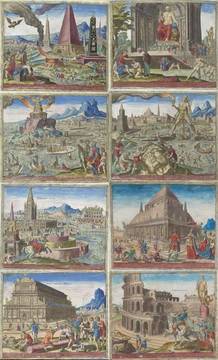
Chichen Itza
Major Maya city and regional capital in northern Yucatán.

via Wikipedia: Chichen Itza · see source
Chichen Itza was a pre-Columbian city built by the Maya during the Terminal Classic period. The archaeological site lies in Tinúm Municipality, in the Mexican state of Yucatán. From the Late Classic (around 600–900 AD) through the Terminal Classic (roughly 800–900 AD) and into the early Postclassic (about 900–1200 AD), it served as a major center in the Northern Maya Lowlands. The ruins display a wide range of architectural styles, including influences from central Mexico as well as the Puuc and Chenes traditions of the northern lowlands. Earlier scholars thought the central Mexican styles indicated direct migration or conquest, but today most experts see them as the result of cultural diffusion. Chichen Itza ranked among the largest Maya cities and was probably one of the legendary great cities, or Tollans, mentioned in later Mesoamerican writings. Its population may have been the most diverse in the Maya world, which could explain the variety of building styles found there.
The ruins are federal property, managed by Mexico’s National Institute of Anthropology and History (INAH). The land beneath the monuments was privately owned until March 29, 2010, when the state of Yucatán purchased it. Chichen Itza is one of Mexico’s most visited archaeological sites, drawing over 2.6 million tourists in 2017.
The Maya name “Chichén Itzá” means “At the mouth of the well of the Itzá.” It comes from *chi’* (“mouth” or “edge”) and *ch’en* or *ch’e’en* (“well”). Itzá refers to an ethnic-lineage group that came to dominate the northern peninsula politically and economically. One possible translation of Itzá is “enchanter (or enchantment) of the water,” from *its* (“sorcerer”) and *ha* (“water”). In Spanish, the name is spelled Chichén Itzá, and accents are sometimes kept in other languages to show that both parts are stressed on their final syllable. Modern Maya orthography prefers Chich’en Itza’ (pronounced [tʃitʃ’en itsáʔ]), which preserves the distinction between *ch’* and *ch*, since the base word *ch’e’en* begins with a postalveolar ejective affricate. Traditional Yucatec Maya spelling from the 16th to mid-20th century wrote it as “Chichen Itza,” without accents because final-syllable stress is standard in the language. The word “Itza’” has a high tone on the “a” followed by a glottal stop, shown by the apostrophe.
The Chilam Balam books suggest an earlier name for the city, used before the Itzá took control of northern Yucatán. Most sources agree the first word means “seven,” but the rest is debated due to inconsistent spelling. This earlier name appears in various forms: Uuc Yabnal (“Seven Great House”), Uuc Hab Nal (“Seven Bushy Places”), Uucyabnal (“Seven Great Rulers”), or Uc Abnal (“Seven Lines of Abnal”). Dating to the Late Classic, it is recorded in the book of Chilam Balam de Chumayel and in hieroglyphic texts at the ruins.
Chichen Itza sits in the eastern part of the Mexican state of Yucatán. The northern Yucatán Peninsula is karst terrain, with all interior rivers flowing underground. Four visible natural sinkholes, or cenotes, provided year-round freshwater at Chichén, making the area attractive for settlement. The most famous is the “Cenote Sagrado” (Sacred Cenote, also called the Sacred Well or Well of Sacrifice). In 2015, scientists discovered a hidden cenote beneath the Temple of Kukulkan, never seen by archaeologists. Geologically, the site’s water network connects to the Ring of Cenotes, a semicircular line of sinkholes formed along the buried rim of the Chicxulub impact crater, which helped collect accessible freshwater across the dry limestone plain.
According to post-Conquest sources (both Maya and Spanish), pre-Columbian Maya sacrificed objects and humans into the cenote to worship the rain god Chaac. Edward Herbert Thompson dredged the Cenote Sagrado from 1904 to 1910, recovering artifacts of gold, jade, pottery, and incense, along with human remains. A study of those remains showed wounds consistent with human sacrifice.
The settlement and growth of Chichen Itza were largely shaped by the local hydrogeochemistry of the northern Yucatán karst plain. With no surface rivers, the city depended on structural access to the regional underground aquifer, where rainwater dissolving the Tertiary limestone cap created deep collapse sinkholes (cenotes) that exposed the freshwater layer. The subterranean water network connecting the Cenote Sagrado, Xtoloc, and Holtún cenotes aligns structurally with the high-permeability breccia fractures of the buried Chicxulub crater rim, which directs groundwater flow toward the northern coast. The deep water table beneath the site core shows a distinct density stratification: a freshwater lens floats above an intrusive marine saline wedge, a geochemical boundary that preserved organic artifacts thrown into the cenotes from rapid oxidation. Geophysical electrical resistivity tomography has revealed sub-pyramid sinkhole connectivity.
- Location
- Tinúm Municipality, Yucatán, Mexico
- Period
- Late Classic through early Postclassic (c. 600–1200 AD)
- Founded by
- Local Mayans of Northern Yucatan
- Known for
- Diverse architectural styles, cenotes, and regional political and economic power
- Population diversity
- Possibly the most diverse population in the Maya world
- Stewardship
- Instituto Nacional de Antropología e Historia (INAH)
- Visitors (2017)
- Over 2.6 million tourists
Verified Timeline
Lore & Background
Chichen Itza was a large pre-Columbian city built by the Maya people during the Terminal Classic period, located in Tinúm Municipality, Yucatán, Mexico. It served as a major center in the Northern Maya Lowlands from the Late Classic (600–900 AD) through the Terminal Classic (800–900 AD) and into the early Postclassic (900–1200 AD). The site displays a mix of architectural styles, including those from central Mexico and the Puuc and Chenes styles of the Northern Maya lowlands. While central Mexican styles were once thought to indicate direct migration or conquest, modern interpretations view them as the result of cultural diffusion. Chichen Itza was among the largest Maya cities and may have been one of the mythical great cities, or Tollans, referenced in later Mesoamerican literature. Its population was likely the most diverse in the Maya world, contributing to the variety of architectural styles. The ruins are federal property, stewarded by Mexico’s Instituto Nacional de Antropología e Historia, and the land was privately owned until purchased by the state of Yucatán in 2010. The site is one of Mexico’s most visited archaeological sites, attracting over 2.6 million tourists in 2017. The Maya name means “At the mouth of the well of the Itzá,” from chi’ (“mouth” or “edge”) and ch’en or ch’e’en (“well”). Itzá refers to an ethnic-lineage group that dominated the northern peninsula. An earlier name, recorded in the Chilam Balam books, is debated but appears as Uuc Yabnal, Uuc Hab Nal, Uucyabnal, or Uc Abnal. The city’s location in eastern Yucatán on karst terrain features four visible cenotes, including the famous Sacred Cenote, which provided year-round water. A hidden cenote was discovered under the Temple of Kukulkan in 2015. Pre-Columbian Maya sacrificed objects and humans into the cenote as worship to the rain god Chaac. Dredging from 1904 to 1910 recovered gold, jade, pottery, incense, and human remains with wounds consistent with sacrifice. The site’s hydrologic network aligns with the Ring of Cenotes, formed along the buried Chicxulub impact crater rim, facilitating freshwater reservoirs. The water table exhibits a freshwater lens above a saline wedge, preserving organic artifacts from oxidation.
Reader's Guide
Chichen Itza was a major economic power in the northern Maya lowlands during its apogee, participating in water-borne circum-peninsular trade through its port site of Isla Cerritos. It obtained obsidian from central Mexico and gold from southern Central America. Between 900 and 1050 AD it expanded to become a powerful regional capital. The city's political organization may have been structured by a 'multepal' system (rulership through council), though this theory has been questioned in recent years. The ruins are federal property, stewarded by Mexico's INAH, and the land was purchased by the state of Yucatán on 29 March 2010. Chichen Itza is one of the most visited archaeological sites in Mexico, with over 2.6 million tourists in 2017.
Did You Know?
- The Maya name 'Chichén Itzá' means 'At the mouth of the well of the Itzá'.
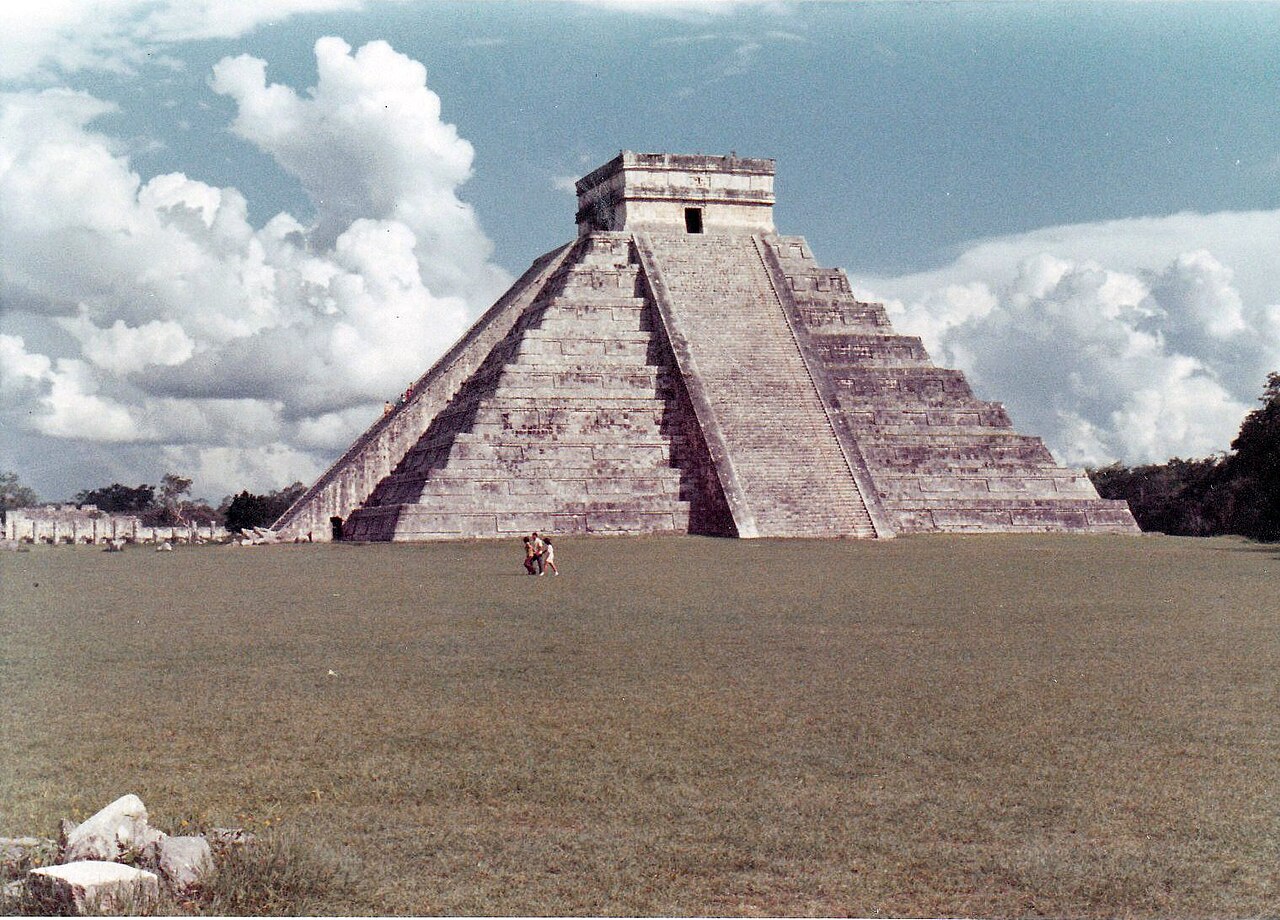
- In 2015, scientists discovered a hidden cenote under the Temple of Kukulkan that has never been seen by archaeologists.
- Edward Herbert Thompson dredged the Sacred Cenote from 1904 to 1910, recovering gold, jade, pottery, incense, and human remains with wounds consistent with human sacrifice.
- The site's cenotes are part of the Ring of Cenotes, a semicircular alignment of sinkholes formed along the buried rim of the Chicxulub impact crater.
- The land under the monuments was privately owned until 29 March 2010, when it was purchased by the state of Yucatán.
A Mosaic of Architectural Voices
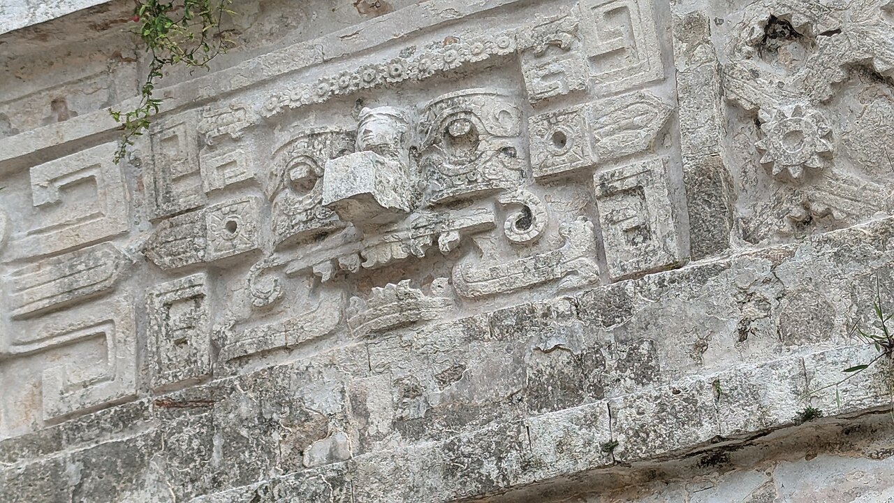
Standing among the most expansive Maya urban centers ever constructed, Chichen Itza presents a striking architectural tapestry that defies simple categorization. The site layers Puuc and Chenes design traditions—both native to the northern lowlands—alongside elements unmistakably rooted in central Mexican aesthetics. For decades, scholars interpreted this blend as evidence of direct migration or even military conquest emanating from the heart of Mesoamerica. Contemporary interpretation has shifted considerably: the prevailing view now treats these non-Maya stylistic influences as the product of broader cultural exchange rather than political domination. This architectural eclecticism likely mirrors the city's extraordinary demographic diversity. Chichen Itza may have housed the most heterogeneous population anywhere in the Maya world, a melting pot of lineages and traditions that naturally produced a built environment unlike any single regional style. Some later Mesoamerican texts even suggest the city was one of the legendary Tollans—mythical great cities that haunted the collective memory of postclassic peoples. Whatever its precise political identity, the physical record speaks to a place where many voices shaped stone.
Water, Sacrifice, and the Hidden Depths
The northern Yucatán Peninsula is a karst landscape where rivers vanish beneath the limestone and surface only as sinkholes. Chichen Itza sat at the intersection of four visible cenotes—natural wells that offered reliable freshwater in an otherwise arid plain. The most celebrated of these, the Sacred Cenote (also called the Well of Sacrifice), became the site of ritual offerings to Chaac, the Maya rain deity. Between 1904 and 1910, Edward Herbert Thompson dredged its depths, pulling up gold ornaments, jade pieces, pottery, incense, and human remains bearing wounds consistent with deliberate sacrifice. In 2015, researchers announced the discovery of a previously unknown cenote concealed directly beneath the Temple of Kukulkan, a water body no archaeologist had ever observed. The site's hydrology is even more remarkable in its geological context: the cenotes form part of the Ring of Cenotes, a semicircular chain of sinkholes aligned along the buried rim of the Chicxulub impact crater. This ancient asteroid scar, paradoxically, created the very freshwater reservoirs that made sustained settlement possible across the dry limestone expanse.
Maritime Trade and Regional Dominion
Between roughly 900 and 1050 AD, Chichen Itza grew into a dominant regional capital commanding both northern and central Yucatán. Its economic engine was maritime: the city anchored a water-borne circum-peninsular trade network that linked distant resource zones to the lowland interior. Through its port at Isla Cerritos on the north coast—and a secondary hub at Vista Alegre—Chichen Itza accessed materials it could not produce locally, including obsidian shipped from central Mexico and gold originating in southern Central America. Together, these two ports functioned as the principal nodes of a complex maritime market system under Chichen Itza's commercial influence. Yet the trading settlements themselves remained modest in physical scale; none stretched beyond roughly three hundred meters in length, suggesting that the ports served as focused exchange points rather than sprawling urban centers. This combination of wide-reaching trade connections and compact port infrastructure reveals a city whose power rested less on territorial sprawl than on its strategic control of the flows of prestige goods moving across the Yucatán's coastal waters.
Names, Lineages, and a Living Legacy
The city's very name encodes its political history. In Maya, Chichén Itzá translates to "at the mouth of the well of the Itzá," a reference to the ethnic-lineage group that rose to political and economic dominance across the northern peninsula. The word Itzá itself may derive from a term meaning "enchanter of the water," linking the ruling lineage to the sacred cenotes that gave the city its name. Before the Itzá hegemony, however, the site carried an older identity preserved in the Chilam Balam de Chumayel and in hieroglyphic inscriptions at the ruins. Most commonly rendered as Uuc Yabnal—"Seven Great House"—this Late Classic-era name has also been translated as "Seven Bushy Places," "Seven Great Rulers," or "Seven Lines of Abnal," reflecting the absence of a single standardized orthography. Today the ruins are federal property stewarded by Mexico's INAH, though the land beneath the monuments remained privately held until March 29, 2010, when the state of Yucatán acquired it. As one of the most visited archaeological sites in the country, drawing over 2.6 million tourists in 2017 alone, Chichen Itza endures as a living focal point for millions who walk its ancient avenues.
Common Misconceptions (Editorial)
1. Some believe Chichen Itza was built by the Aztecs or a non-Maya civilization, but the facts confirm it was built by the Maya people of the Terminal Classic period. 2. A common misconception is that the site was always known as Chichen Itza; however, an earlier name recorded in the Chilam Balam books is debated as Uuc Yabnal or similar variants. 3. Many assume the site's cenotes formed independently of any ancient impact, but the facts state they are part of the Ring of Cenotes, aligned along the buried rim of the Chicxulub impact crater.
Why It Matters (Editorial)
Chichen Itza endures as a powerful testament to Maya engineering, astronomy, and political ambition, drawing millions of visitors each year who marvel at its architectural diversity and the sacred cenotes that defined both its name and its rituals. Its continued study—including the 2015 discovery of a hidden cenote under the Temple of Kukulkan—reveals that even a site so well-known still holds secrets, reminding us how much of the ancient world remains to be understood.
Gallery
Frequently Asked Questions
Who is Chichen Itza?
Chichen Itza is a major pre-Columbian Maya city in the northern Yucatán region of Mexico. It functioned as a regional capital and one of the largest urban centers in the Maya world, thriving from roughly 600 to 1200 AD.
What is Chichen Itza's role or significance?
The site served as a political and economic hub for the Northern Maya Lowlands, blending central-Mexican architectural traditions with local Puuc and Chenes styles. It was likely home to one of the most ethnically diverse populations in the entire Maya civilization.
How does Chichen Itza's story end?
The city's prominence gradually faded during the early Postclassic period as political power shifted across the region. Today the ruins are preserved and overseen by Mexico's INAH as a major archaeological site.
Why is Chichen Itza important to Maya history?
It stands as one of the largest Maya cities ever built and a key crossroads connecting northern lowland culture with broader Mesoamerican traditions. Its cenotes, varied architecture, and evidence of multi-ethnic settlement make it a cornerstone for understanding Terminal Classic Maya society.
Where exactly is Chichen Itza located?
The site sits within Tinúm Municipality in the state of Yucatán, Mexico. It lies in the Northern Maya Lowlands, a region that served as a major crossroads of trade and cultural exchange for centuries.
More in World Wonders 1-22
Spotted an error? Know more?
This is a living reference — every entry is fact-audited, and reader corrections feed straight into our audit queue. Suggest an edit · See this site's audit record