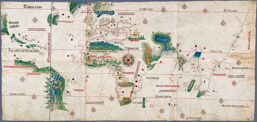
Theory of the Portuguese discovery of Australia
Theory that Portuguese reached Australia before 1606, based on Dieppe maps.
The theory of the Portuguese discovery of Australia holds that Portuguese navigators sighted the continent between 1521 and 1524, predating the generally accepted first European discovery by Dutch navigator Willem Janszoon in 1606. The theory lacks generally accepted evidence but draws on the Dieppe maps, a group of 16th-century French world maps depicting a large landmass called Java la Grande, which some interpret as Australia's northwestern and eastern coasts. Other claimed pre-Dutch visits include those by China, France, Spain, and Phoenicia, also without generally accepted evidence.
Quick Facts
- Proposed discovery period
- 1521–1524
- Key map evidence
- Dieppe maps (16th-century French world maps)
- Landmass on dieppe maps
- Java la Grande
- First significant proponent
- Richard Henry Major (1859)
- Notable later proponent
- George Collingridge (1895)
Facts from the source article.
Historiography
The theory was first significantly advanced in 1859 by Richard Henry Major, Keeper of Maps at the British Museum, who used the Dieppe maps as his main evidence. In 1861, Major announced the discovery of a map by Manuel Godinho de Eredia, claiming it proved a Portuguese visit to North Western Australia possibly dated to 1601; the map's origins were later found to be from 1630, and the planned voyage had never taken place. Major published a retraction in 1873, but his reputation was destroyed. Portuguese historian Joaquim Pedro de Oliveira Martins critically examined Major's interpretation and concluded that neither the patalie regiã on Antoine de La Sale's 1521 world map nor the Jave la Grande on the Dieppe Maps was evidence of a Portuguese visit, but that the feature derived from native informants' descriptions of islands of the Sunda archipelago. In 1895, George Collingridge produced The Discovery of Australia, using the Dieppe maps to argue for Portuguese visitation. Fluent in Portuguese and Spanish, Collingridge was inspired by copies of Dieppe maps purchased by Australian libraries. Despite errors and untenable theories, his book was a remarkable effort given limited access to maps and documents. His theory did not find public approval, and Professors G. Arnold Wood and Ernest Scott publicly criticized his work. A shorter version for New South Wales schools was not used.
Purported evidence and arguments
The central argument of the theory is that the continent Jave la Grande on the Dieppe maps represents Australia. In 1982, Kenneth McIntyre described the Dieppe maps as the only evidence of Portuguese discovery of Eastern Australia, stating that the Mahogany Ship and Geelong Keys are not part of the proof but that the maps prove the discovery. Later writers such as Fitzgerald, McKiggan, and Peter Trickett also concentrate primarily on Jave la Grande. Critics including A. Ariel, M. Pearson, W. A. R. Richardson, Gayle K. Brunelle, and Robert J. King also focus on this landmass. W. A. R. Richardson argues that Jave la Grande is at least partly based on Portuguese sources that no longer exist. McIntyre attributed discrepancies between Jave la Grande and Australia to difficulties in determining longitude and map projection conversions. In the late 1970s, mathematician Ian McKiggan developed exponential longitude error theory to explain discrepancies, later modified after exchange with Richardson. McIntyre's distortion theory has also been challenged. Fitzgerald and Trickett argue Jave la Grande is based on lost Portuguese sea charts misaligned by Dieppe mapmakers, and both compare coastal features by realigning them. In 1994, McIntyre suggested that writings of Pedro Nunes supported his interpretation of the distortion.
Criticisms and alternative views of the Dieppe Maps
The theory has faced numerous critics, possibly due to its degree of conjecture. Matthew Flinders in A Voyage to Terra Australis (1814) cast a skeptical eye over the Great Java of the Dieppe maps. Kenneth McIntyre challenged critics to provide an alternative explanation for the Dieppe maps. The most prolific writer on the theory and its most consistent critic has been Flinders University Associate Professor W. A. R. (Bill) Richardson, who has written 20 articles on the topic since 1983. Richardson initially approached the Dieppe maps to prove they related to Portuguese discovery but quickly realized there was no connection between them and Australia's coastline. He argues that the case rests entirely on imagined resemblances between Jave La Grande and Australia, noting that no surviving Portuguese 16th-century charts show any trace of land in that area and no records of any voyage along the Australian coastline before 1606 exist. He dismisses the claim that Cristóvão de Mendonça sailed down the east coast as sheer speculation, and states that reassembling sections of Jave La Grande to fit Australia's outline relies on assumptions and could be made to look like anything.
More in Portuguese Exploration in the Age of Discovery
Spotted an error? Know more?
Reader corrections go straight into our review queue. Suggest an edit · How this site is sourced