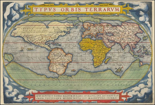
Geographical zone
Earth's five main latitude regions, divided by major circles of latitude, define climatic zones from the frigid poles to the torrid tropics.
Last updated

SurinameCentral · CC BY-SA 4.0
The five main latitude regions of Earth's surface, known as geographical zones, are defined by the major circles of latitude and their differences are primarily climatic. The Torrid Zone, or tropics, lies between the Tropic of Cancer and the Tropic of Capricorn. Within this zone, the Sun passes directly overhead twice a year, except at the bounding tropics where this occurs only once annually—at the June solstice for the Tropic of Cancer and the December solstice for the Tropic of Capricorn. This zone covers 39.78% of Earth’s surface and includes regions such as Central America, northern South America, much of Africa, southern Arabia, the southern Indian subcontinent, Southeast Asia, northern Australia, and parts of Oceania.
Temperate zones
The two temperate zones, north and south, are characterized by mild climates where the Sun is never directly overhead, and they experience four distinct seasons. The North Temperate Zone (25.99% of the surface) spans North America, Europe, North Africa, northern Asia, and the northern Middle East. The South Temperate Zone (also 25.99%) includes southern Australia, New Zealand, southern South America, and southern Africa.
Frigid zones
The two frigid zones, or polar regions, are the coldest areas, generally covered in ice and snow. They experience the midnight sun and polar night; at the zone’s edge, the winter solstice brings a day without sunrise, and the summer solstice a day of 24-hour sunlight. At the poles, this cycle extends to six months of daylight and six months of night.
History
The North Frigid Zone (4.12% of the surface) includes Alaska, northern Canada, Greenland, and northern Scandinavia and Russia. The South Frigid Zone (also 4.12%) consists solely of Antarctica. The concept of geographical zones was first proposed by the ancient Greek scholar Parmenides and later refined by Aristotle, who both theorized three climatic zones based on distance from the equator. Aristotle, believing the equatorial region too hot for habitation, named it the Torrid Zone.
Lore & Background
The concept of a geographical zone was first hypothesized by the ancient Greek scholar Parmenides and lastingly modified by Aristotle. Both philosophers theorized the Earth divided into three types of climatic zones based on their distance from the equator. Like Parmenides, thinking that the area near the equator was too hot for habitation, Aristotle dubbed the region around the equator (from 23.5° N to 23.5° S) the 'Torrid Zone.' Both philosophers reasoned the region from the Arctic Circle to the pole to be permanently frozen.
This region thought uninhabitable, was called the 'Frigid Zone.' The only area believed to be habitable was the northern 'Temperate Zone' (the southern one not having been discovered), lying between the 'Frigid Zones' and the 'Torrid Zone.' However, humans have inhabited almost all climates on Earth, including inside the Arctic Circle. As knowledge of the Earth's geography improved, a second 'Temperate Zone' was discovered south of the equator, and a second 'Frigid Zone' was discovered around the Antarctic. Although Aristotle's map was oversimplified, the general idea was correct.
Reader's Guide
The Torrid Zone is also known as the tropics. This zone is bounded on the north by the Tropic of Cancer and on the south by the Tropic of Capricorn; these latitudes mark the northern and southern extremes in which the Sun passes directly overhead. This happens once annually on these cusps, but in the tropics proper, the Sun passes overhead twice a year. In the two temperate zones, consisting of the tepid latitudes (including subtropical areas), the Sun is never directly overhead, and the climate is mild, generally ranging from warm to cool.
Four annual seasons, spring, summer, autumn, and winter, occur in these areas. The two frigid zones, or polar regions, experience the midnight sun and the polar night for part of the year – at the edge of the zone there remains one day, the winter solstice, when the Sun is too low to rise, and one day at the summer solstice when the Sun remains above the horizon for 24 hours. In the center of the zone (the pole), the day is one year long, with six months of daylight and six months of night. The frigid zones are the coldest regions of Earth and are generally covered in ice and snow.
More in Physical Geography & Elevation
Sources
Compiled from Wikipedia and the sources listed below. Text from Wikipedia is available under CC BY-SA 4.0; this entry is adapted from it.
- Wikipedia: Geographical zone (CC BY-SA 4.0).
Spotted an error? Know more?
Reader corrections go straight into our review queue. Suggest an edit · How this site is sourced