Sokoto State
Northwestern Nigerian state, seat of the Sokoto Caliphate.

via Wikipedia: Sokoto State · see source
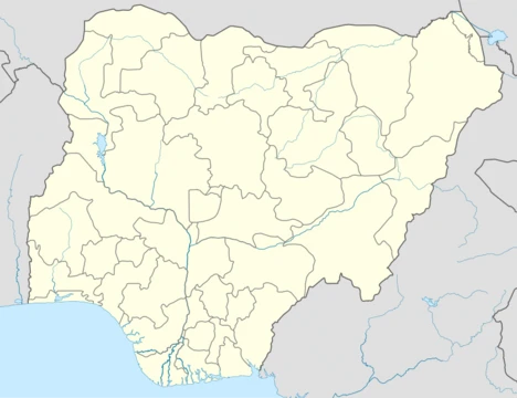
Sokoto State, one of Nigeria’s 36 states, lies in the country’s far northwest. It shares a 363-kilometer border with the Republic of the Niger to the north and west, and is bordered by Zamfara State to the east and Kebbi State to the south and west, partly along the Ka River. The state capital and largest city, also called Sokoto, sits near where the Sokoto and Rima rivers meet. In 2022, its population was estimated at over 6.3 million. As the historic center of the Sokoto Caliphate, the city is overwhelmingly Muslim and serves as a major hub for Islamic scholarship in Nigeria. The Sultan, who leads the caliphate, acts as the spiritual leader of Nigerian Muslims.
The name Sokoto comes from the Arabic word *suk*, meaning “market,” and is an anglicized version of the local name Sakkwato. It is also known as Sakkwato, Birnin Shaihu da Bello, or “Sokoto, Capital of Shaihu and Bello.”
Sokoto State was created in 1976 when the former North-Western State was split into Sokoto and Niger States. Since then, the state has been governed by a series of administrators, mostly former military officers, who succeeded one another in quick succession. The region itself has a much longer history. During the 19th century, under the Fulani Empire, Sokoto was an important Fula state and city in what was then west-central Nigeria. Around 1900, with British colonization, Sokoto—then covering the entire northwest corner of Nigeria—became a province of the British protectorate. Soon after, Gando was added as a sub-province, forming a double province of about 90,000 square kilometers with an estimated population over 500,000. This territory included the kingdoms of Zamfara and Argungu (or Kebbi).
According to the 1911 Encyclopædia Britannica, the British organized the province similarly to other parts of Northern Nigeria. A first-class British resident was stationed in Sokoto, with assistant residents at other centers. British courts and governors were established, and civil police detachments were placed at major stations. The land was assessed for taxes and opened for trade. After British rule began, farmers and herders returned to abandoned areas, and city dwellers rebuilt villages that had been deserted for fifty years. Horse breeding and cattle raising were the main sources of wealth, along with some ostrich farming. Agriculture was widespread except in sandy areas, including rice and cotton, with special irrigated crops in valleys. Weaving, dyeing, and tanning were key local industries. Roads were being built, trade grew, and a cash currency was introduced.
In 1906, a revolt near Sokoto, attributed to religious fanaticism, resulted in the deaths of three British officers. The emir disavowed the uprising’s leader, who claimed to be a Mahdi sent to expel Europeans. British forces defeated the rebels with heavy losses in March 1906. The leader was condemned to death in the emir’s court and executed in Sokoto’s market square. The event was notable for the loyalty shown to British rule by local rulers. After Nigeria’s independence, the region became the Northwestern State in 1967. This was split into Sokoto and Niger States in 1976. Later, Kebbi State (1991) and Zamfara State (1996) were carved out of Sokoto State.
The population is mostly Hausa, with Gobirawa found in Gobir and Isa Local Government Areas (LGAs). The vast majority of residents are Sunni Muslims, with a Shia minority; violence between the two groups is rare. Over 80% of the state’s people work in agriculture.
Hausa and Fulfulde are the dominant languages. The Kainji language Ut-Ma’in is spoken in Kebbe LGA, and Kamuku is spoken in Sokoto LGA. Smaller groups speak Zarma and Tuareg. Languages vary by LGA.
Sokoto State lies in the dry Sahel, with sandy savannah and isolated hills. The average annual temperature is 28.3°C, making it very hot overall, though daytime highs usually stay below 40°C, and the dryness makes the heat tolerable. The hottest months are February to April, when temperatures can exceed 45°C. The rainy season runs from June to October, with daily showers that are brief and far lighter than the torrential rains of wetter tropics. From late October to February, the Harmattan wind blows Sahara dust over the land, dimming sunlight, lowering temperatures, and covering everything in dust. The floodplains of the Sokoto-Rima river system, rich in alluvial soil, are vital for crop farming. Elsewhere, the dryness limits crops; millet is most common, along with rice, corn, other cereals, and beans. Few vegetables, aside from tomatoes, grow in the region.
Sokoto State has twenty-three Local Government Areas. Its tertiary education institutions include [list not provided in source].
- Capital
- Sokoto
- Population (2022 est.)
- More than 6.3 million
- Area
- 90,000 square kilometres (historical province)
- Major Languages
- Hausa and Fulfulde
- Religion
- Predominantly Sunni Muslim
- Date of Creation
- 1976
- Climate
- Hot, dry Sahel with average temperature 28.3°C
Verified Timeline
Lore & Background
Sokoto State was created in 1976 from the bifurcation of the erstwhile North-Western State into Sokoto and Niger States. Since then, it has been ruled by governors, most ex-military officers, who succeeded each other at short intervals. The region has a longer history: during the reign of the Fulani Empire in the 19th century, Sokoto was an important Fula state, in addition to being a city, of what was then west central Nigeria. From around 1900, with the British take-over, Sokoto became a province of the British protectorate of Nigeria. Not long after, Gando was added as a sub-province. This double province then covered an area of 90,000 square kilometres with an estimated population over 500,000. It included the then Zamfara and Argungu, or Kebbi, kingdoms. In 1967, not long after Nigeria's independence from the British, the region became known as the Northwestern State. This territory was, in 1976, split into Sokoto State and Niger State. Later on, Kebbi State (1991) and Zamfara State (1996) split off from Sokoto State.
Reader's Guide
Sokoto State holds significance as the seat of the former Sokoto Caliphate, making it a key spiritual and Islamic learning center for Nigerian Muslims. Its history includes British colonial administration, which organized the province with a British resident of the first class at Sokoto and assistant residents at other centres, British courts of justice, and detachments of civil police. The country was assessed under a new system for taxes and opened for trade. A 1906 rising attributed to religious fanaticism occurred near Sokoto, in which three white officers lost their lives. The emir heartily repudiated the leader, who claimed to be a Mahdi inspired to drive the white man out. A British force marched against the rebels, who were overthrown with great loss in March 1906; the leader was condemned to death in the emir's court and executed in the market place of Sokoto. The state's economy is dominated by agriculture, employing a majority percent of the state's working population, yet it is one of the poorest in Nigeria with one of the highest incidences of extreme poverty (around 80% of the population) according to World Bank data from 2018. The dry Sahel climate, with an annual average temperature of 28.3 °C, and reliance on the floodplains of the Sokoto-Rima river system for crops shape its geography and livelihoods.
Did You Know?
- Sokoto State is bounded by the Republic of the Niger to the north and west for 363 km.
- The name Sokoto is of Arabic origin, representing suk, 'market'.
- A 1906 rising near Sokoto attributed to religious fanaticism resulted in the death of three white officers; the leader was executed in the market place of Sokoto.
- Over 80% of people living in the state practice agriculture.
- The state has one of the highest incidences of extreme poverty in Nigeria, around 80% of the population according to World Bank data from 2018.
Frequently Asked Questions
Who is Sokoto State?
Sokoto State is a northwestern Nigerian state carved out in 1976, named after its capital city where the Sokoto and Rima rivers converge. It is home to more than 6.3 million residents who primarily speak Hausa and Fulfulde.
What role does Sokoto State play in Nigeria?
As the historic seat of the Sokoto Caliphate, the state functions as the country's leading center of Islamic scholarship, and its Sultan is widely regarded as the spiritual head of Nigeria's Muslim community.
Where exactly is Sokoto State located on the map?
It occupies the extreme northwest tip of Nigeria, sharing its northern and western borders with the Republic of the Niger, while Zamfara and Kebbi states border it to the south and east.
Why is Sokoto State considered so important?
The region was the political and religious heart of the Sokoto Caliphate, one of West Africa's largest pre-colonial empires, and that legacy still defines the state as a major hub of Islamic learning and tradition.
How big is Sokoto State and how many people live there?
Spanning roughly 90,000 square kilometres, the state had an estimated population exceeding 6.3 million as of 2022, making it a densely populated area in the northwest.
More in Nigerian States 1-24
Spotted an error? Know more?
This is a living reference — every entry is fact-audited, and reader corrections feed straight into our audit queue. Suggest an edit · See this site's audit record