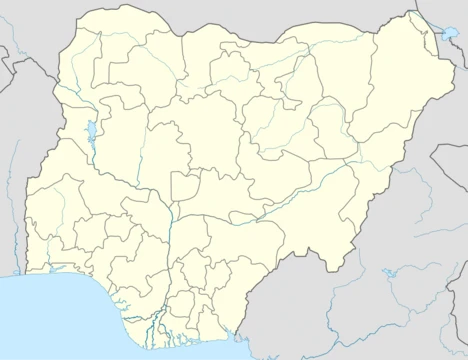
Ebonyi State
A southeastern Nigerian state formed in 1996 from Abia and Enugu.

via Wikipedia: Ebonyi State · see source
Ebonyi State (Igbo: Alaọha Ebonyi) lies in Nigeria’s South-East geopolitical zone. It shares borders with Benue State to the north and northeast, Enugu State to the west, Cross River State to the east and southeast, and Abia State to the southwest. The state takes its name from the Abonyi (Aboine) River, much of which flows through its southern area. Created in 1996 from parts of Abia and Enugu states, its capital is Abakaliki. Among Nigeria’s smallest states, Ebonyi ranks 33rd in land area and 29th in population, with an estimated 2.9 million residents as of 2016.
Geographically, the far south features Cross–Niger transition forests, while the rest of the state is covered by drier Guinean forest–savanna mosaic. Key water bodies include the Cross River and its tributary, the River Aloma, which trace the southeastern and eastern borders; interior rivers such as the Abonyi (Aboine), Asu, and Eze Aku also flow through the state. Smaller rivers like Ichelle and Igbe help mark the western boundary with Benue State.
After Nigeria’s independence in 1960, the area now known as Ebonyi was part of the Eastern Region until 1967, when it became part of East Central State. Shortly after, the former Eastern Region attempted to secede as Biafra, leading to the three-year Nigerian Civil War, during which Ebonyi was within Biafra. Following the war and reunification, East Central State was reorganized; in 1976, its northern part became Anambra State and its southern part Imo State. Fifteen years later, Anambra and Imo were further divided, creating Enugu State in the east and Abia State in the northeast. Finally, in 1996, eastern Enugu and northeastern Abia were combined to form Ebonyi State.
Economically, Ebonyi relies on agriculture—chiefly yams, rice, oil palm, and cassava. Mining is a minor but notable industry, with lead, zinc, and limestone deposits near Abakaliki, and handwoven baskets of various sizes are produced locally in Ntezi. The state holds the joint-twentieth highest Human Development Index in Nigeria and hosts numerous tertiary institutions.
Geography: Ebonyi was one of six states created in 1996 by the military government of General Sani Abacha. It stretches about 96 km along the border with Benue (partly via the Ichelle and Igbe Rivers), 198 km along Cross River State (partly via the River Aloma and Cross River), 70 km along Abia to the south, and borders Enugu to the west. The state was formed from the Abakaliki division of Enugu State and the Afikpo division of Abia State. It has three senatorial zones: Ebonyi North and Ebonyi Central from the Abakaliki division, and Ebonyi South from the Afikpo, Edda, Ohaozara, Onicha, and Ivo divisions. There are thirteen local government areas, plus additional local development centres created by the state government. Notable higher institutions include Ebonyi State University, Abakaliki; Alex Ekwueme Federal University Ndufu Alike Ikwo; Akanu Ibiam Federal Polytechnic, Unwana; Federal College of Agriculture, Ishiagu; Evangel University, Okpoto; Federal College of Education (Technical), Isu; Ebonyi State College of Education Ikwo; College of Health Sciences, Ezzamgbo; School of Nursing and Midwifery at Mater Misericordiae Hospital, Afikpo; School of Nursing and Midwifery at Alex Ekwueme Federal University Teaching Hospital, Abakaliki; and Ebonyi State College of Health and Midwifery, Uburu. In 2021, Governor David Umahi introduced three additional universities: an aeronautical engineering university and a technology university in Ezza and Izzi Local Government Areas, and King David University of Medical Science in Uburu, Ohaozara LGA.
Climate: Ebonyi has a humid tropical climate with one rainy season (eight months) and one dry season (four months). Temperatures typically range from 20–38°C (68–100°F) in the dry season and 16–28°C (60–82°F) in the rainy season. Harmattan winds occur between December and January. The average annual temperature is 28°C (82°F), humidity averages 50–60%, and annual precipitation is about 2,500 mm (98 inches).
Demographics: The state is home to several distinct Igbo and Korring dialects, spoken in communities such as Edda, Ehugbo (Afikpo), Izzi, Ezza, Ohofia, Mgbo, Ikwo, Oshiri, Unwana, Akpoha, Okposi, Amasiri, and Onicha. In areas like Amuda-Okpolo, Ntezi-Okpoto, and Effium, a mixed dialect combining Igbo and Korring elements is spoken, sharing similarities with Kukelle (spoken in Ukelle, Cross River State) and Kufia (spoken in Ufia/Utonkon, Benue State).
Politics: The state government is led by a democratically elected governor who works with the state house of assembly. The capital is Abakaliki.
Electoral system: State elections use a modified two-round system. To win in the first round, a candidate must receive a plurality of the vote and over 25% of the vote in at least two-thirds of the state’s local government areas. If no candidate meets this threshold, a second round is held between the top candidate and the candidate with the next highest number of votes in the most local government areas.
Administration: In 1999, Dr. Sam Ominyi Egwu was elected as the state’s first governor.
- created
- 1996
- capital
- Abakaliki
- area_rank
- 33rd largest in area
- population_estimate_2016
- nearly 2.9 million
- geopolitical_zone
- South-East geopolitical zone
- named_after
- Abonyi (Aboine) River
- human_development_index_rank
- joint-twentieth highest
Verified Timeline
Quick Facts
- Flag Alt
- Flag of Ebonyi State
- Seal Alt
- Seal of Ebonyi State
- Nickname
- Salt of the Nation / Igbo: Nnu nke Mba
- Subdivision Type
- Country
- Subdivision Name
- Nigeria
- Subdivision Type1
- LGAs
- Subdivision Name1
- 13
- Established Title
- Date created
- Established Date
- 1 October 1996
- Seat Type
- Capital
- Seat
- Abakaliki
- Website
- http: · www.ebonyistate.gov.ng
Facts from the source article.
Lore & Background
After independence in 1960, the area of present Ebonyi was a part of the post-independence Eastern Region until 1967 when the region was split and the area became part of the East Central State. Less than two months afterwards, the former Eastern Region attempted to secede in the three-year long Nigerian Civil War with Ebonyi as a part of the secessionist state of Biafra. At the war's end and the reunification of Nigeria, the East Central State was reformed until 1976 when the state's north became Anambra State and the south became Imo State. Fifteen years afterwards, Anambra and Imo states were divided with their eastern parts becoming Enugu State and Abia State, respectively. It was not until 1996, when Enugu State's east and Abia's northeast were split off and joined to form Ebonyi State. It was one of the six states created in 1996 by the then federal military government of General Sani Abacha. The state has three senatorial zones: the Abakaliki division make up Ebonyi North and Ebonyi Central senatorial zones, while the Afikpo, Edda, Ohaozara, Onicha and Ivo division make up the Ebonyi South senatorial zone. Ebonyi has thirteen local government areas.
Reader's Guide
Economically, Ebonyi State is based around agriculture, mainly of yams, rice, oil palm, and cassava crops. A key minor industry is mining due to lead, zinc, and limestone deposits around Abakaliki, and locally hand-made baskets of various sizes at Ntezi. Ebonyi is called 'the salt of the nation' for its huge salt deposit at the Okposi and Uburu Salt Lakes. The state has invested in infrastructure, including the Ebonyi State International Airport, built on the Abakaliki end of the Abakaliki-Afikpo Expressway, and 23 flyovers, the highest in South East Nigeria. Ebonyi state is known for its trademark concrete roads and multicolored infrastructure, began by former governor Dave Umahi. Politically, in 1999, Dr. Sam Ominyi Egwu was elected as the first governor of the state under the People's Democratic Party (PDP). He was succeeded by Martin Elechi who was elected in 2007 and successfully ran for re-election in 2011, under the same PDP. Gov Martin Elechi was succeeded by Governor Dave Umahi, who was elected in the March 2015 election and re-elected in March 2019 for a second term in office. During his second tenure, Governor Dave Umahi defected to All Progressive Congress (APC) just prior to the 2023 General elections. His new party (APC) subsequently produced the Governor that succeeded him, Governor Francis Ogbonna Nwifuru, whose first tenure will elapse on May 29th, 2027. Ebonyi has the joint-twentieth highest Human Development Index in the country and numerous institutions of tertiary education.
Did You Know?
- Ebonyi State was formed from parts of Abia and Enugu states in 1996 by the federal military government of General Sani Abacha.
- The state is named after the Abonyi (Aboine) River, a large part of which is in the state's south.
- Ebonyi has 23 flyovers, the highest number in South East Nigeria.
- The state is called 'the salt of the nation' for its huge salt deposit at the Okposi and Uburu Salt Lakes.
- Ebonyi has the joint-twentieth highest Human Development Index in the country.
Frequently Asked Questions
Who is Ebonyi State?
Ebonyi is a compact state in Nigeria's South-East geopolitical zone, established in 1996 by carving territory out of Abia and Enugu. Its capital is Abakaliki, and the state takes its name from the Abonyi (Aboine) River that flows through the region.
What are Ebonyi State's powers or role?
The state functions mainly as an agricultural engine for the South-East, producing yams, rice, oil palm, and cassava at scale. It also holds underground deposits of lead, zinc, and limestone that give it a secondary industrial identity.
How does Ebonyi State's story end?
Because Ebonyi is a living political entity rather than a fictional narrative, it has no fixed ending — it simply continues as one of Nigeria's 36 states. Its ongoing story is shaped by agricultural output, population growth, and the pace of its mining sector's development.
Why is Ebonyi State important?
Though it ranks 33rd in area and 29th in population (roughly 2.9 million people as of 2016), it punches above its size in feeding the South-East zone. Its mineral reserves also position it as a potential contributor to Nigeria's broader industrial supply chain.
Where did Ebonyi State come from?
It was formally created in 1996 by splitting land from both Abia and Enugu states. The name honours the Abonyi River, a long-standing geographic landmark that gave the surrounding communities their identity long before the state existed.
More in Nigerian States 1-24
Related in Nigerian States
Links follow this subject's own source article.
Spotted an error? Know more?
This is a living reference — every entry is fact-audited, and reader corrections feed straight into our audit queue. Suggest an edit · See this site's audit record