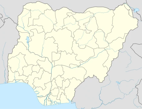
Niger State
Largest state in Nigeria, key in energy and agriculture.

via Wikipedia: Niger State · see source
Niger State, located in Nigeria’s North Central region, is the country’s largest state by land area. Its eastern neighbors are Kaduna State and the Federal Capital Territory; to the north lie Kebbi and Zamfara states; to the south are Kogi and Kwara states; and its western edge forms part of Nigeria’s international boundary with Benin. The capital is Minna, and the state is split into 25 local government areas. Other notable towns include Bida, Kontagora, and Suleja. With an estimated 6.7 million people as of 2020, it ranks as the eleventh most populous among Nigeria’s 36 states. The state’s landscape is ecologically divided: the east falls within the West Sudanian savanna, while the rest belongs to the Guinean forest–savanna mosaic. Major waterways include Kainji Lake and the Niger and Kaduna rivers; the Niger River flows from Kainji Lake through the western part of the state, forming the border with Kwara. Niger is home to three major hydroelectric dams—Kainji, Jebba, and Shiroro—which are vital to Nigeria’s power supply. It also contains Kainji National Park, the largest national park in the country, which encompasses Kainji Lake, the Borgu Game Reserve, and the Zugurma Game Reserve. Ethnically, Niger State is highly diverse, with communities such as the Adara, Fulani, Gbagyi, Hausa, Hun-Saare, Kambari, Kamuku, Koro Gungawa, Nupe, and others. In pre-colonial times, parts of the area were centers of powerful states, including the Nupe Kingdom, Gbagyi states, and portions of the Hausa Bakwai states. During the early 1800s, the Fulani jihad brought parts of the region into the Sokoto Caliphate. British colonization in the early 1900s folded the area into the Northern Nigeria Protectorate. After Nigeria’s independence in 1960, the territory was part of the Northern Region until 1967, when it became part of the North-Western State. Niger State was created as a separate entity in 1976 following the breakup of North-Western State, and in the 1990s it acquired the Borgu region from Kwara. Since the late 2010s, the state has been among those most severely affected by banditry and terrorism. Agriculture, along with livestock farming and herding, drives Niger’s economy. Its hydroelectric dams give it a central role in Nigeria’s energy sector. Though it holds the tenth-highest GDP in the country, its Human Development Index ranking remains low. **Government** Niger State, like most Nigerian states, is run by a democratically elected governor—currently Mohammad Umar Bago—who works alongside the Niger State House of Assembly. The capital is Minna. The state is divided into three senatorial zones: Niger East, Niger North, and Niger South. **Electoral system** The governor is chosen through a modified two-round system. To win in the first round, a candidate must secure a plurality of the vote and at least 25% of the vote in two-thirds of the state’s local government areas. If no candidate meets these thresholds, a runoff is held between the top candidate and the one who received a plurality of votes in the highest number of local government areas. **Local government** The state’s 25 local government areas are each headed by a chairman. These areas are further divided into districts (each with a district head) and villages (each with a village head). **Education** Tertiary institutions in Niger State include: Federal College of Education, Kontagora; Federal Polytechnic, Bida; Federal University of Technology Minna; Ibrahim Badamasi Babangida University, Lapai; Niger State College of Education Minna; and Niger State Polytechnic, Zungeru. **Transport** Federal highways include: A1, running north from Ilorin in Kwara State across the Niger River via a four-lane bridge at Jebba for 388 km (part of the African Unity Road, TAH2) to Kontagora, then through Ibeto to Yelwa in Kebbi State; A125, continuing TAH2 east from A1 at Kontagora via Tegina to Gishiri in Kaduna State; A124, heading east from A1 north of Mokwa via Bida and Agaie as the Bida-Abuja Road to Kudan in the FCT; and two roads to Benin—the Wana-Babana Road at Babana to Basso, and the Agwara Tungar Jatau Swate Maje Road from Agwarra via Konkwesso to RNIE 7 toward Ségbana. Other major roads include the Minna-Tagbari Road northeast to Kaduna State (as the Chibian-Zazaga-Sarkin Pawa Road), the Minna-Bida Road, the Mararaba-Makutu-Mapi Road southeast from Minna via Matumbi and Paiko to A124 at Daga, and the Yelwa-Mokwa Road crossing the Niger River via a bridge from Kato to Jinjima. Railways consist of the Western Line north from Lagos via Ibadan and Ilorin, crossing the Niger at Jebba by a 547-meter bridge (built 1915) through Minna to Kaduna, with a 155 km branch line from Minna to the port of Baro on the Niger River, which connects with Kano via the Northern Line. The main airport is Minna Airport. **Natural resources** Niger State is rich in natural resources. **Languages** Languages spoken in Niger State vary by local government area. **Geography** The state’s climate is very warm, with an annual average temperature of 34°C. It remains warm or hot year-round, though humidity can be uncomfortably high from June to September. The best travel period is November to April, when rainfall is lower. The rainiest months are May through October, with September seeing the most rainy days and December the fewest. January is the sunniest month, while August is the least sunny.
- Capital
- Minna
- Area
- Largest state in Nigeria by area
- Population
- Approximately 6.7 million as of 2020
- Major Rivers
- Niger and Kaduna rivers
- Major Dams
- Kainji, Jebba, and Shiroro Dams
- National Park
- Kainji National Park, the largest in Nigeria
- GDP Rank
- Tenth-highest GDP in Nigeria
Verified Timeline
Lore & Background
Niger State was created in 1976 from the breakup of North-Western State, and later gained the Borgu region from Kwara in the 1990s. Its territory includes areas that were once part of the Nupe Kingdom, Gbagyi states, and Hausa Bakwai states before being incorporated into the Sokoto Caliphate in the early nineteenth century. During British colonization in the early 1900s, the area became part of the Northern Nigeria Protectorate, and after Nigeria's independence in 1960, it was part of the Northern Region until 1967, then North-Western State until 1976. The state is governed by a democratically-elected governor, currently Mohammad Umar Bago, who works with the Niger State House of Assembly. The state has three Senatorial Zones: Niger East, Niger North, and Niger South. The governor is selected using a modified two-round system requiring a plurality and over 25% of the vote in at least two-thirds of local government areas.
Reader's Guide
Niger State is significant as Nigeria's largest state by area and a major contributor to the country's energy sector through its hydroelectric dams—Kainji, Jebba, and Shiroro—which provide substantial power. The state also hosts Kainji National Park, the largest national park in Nigeria, encompassing Kainji Lake and the Borgu and Zugurma Game Reserves. Economically, Niger State is driven by agriculture, livestock farming, and herding, and it holds the tenth-highest GDP in Nigeria, though its Human Development Index ranking is low. The state's diverse ethnic composition includes Adara, Fulani, Gbagyi, Hausa, Hun-Saare, Kambari, Kamuku, Koro Gungawa, Nupe, and others. Historically, it was a center of pre-colonial states and later part of the Sokoto Caliphate and British Northern Nigeria Protectorate. Since the late 2010s, Niger has been heavily affected by banditry and terrorism. Its transport infrastructure includes federal highways, railways, and Minna Airport, supporting connectivity within Nigeria and to Benin.
Did You Know?
- Niger State is the largest state in Nigeria by area.
- The state is home to Kainji National Park, the largest national park in Nigeria.
- Niger State has three major hydroelectric dams: Kainji, Jebba, and Shiroro.
- The state was created in 1976 from the breakup of North-Western State.
- Niger State gained the Borgu region from Kwara State in the 1990s.
Frequently Asked Questions
What is Niger State?
Niger State is one of Nigeria's 36 states, situated in the North Central region. It holds the distinction of being the country's largest state by land area and is bordered by Kaduna, Kebbi, Zamfara, Kogi, Kwara, and the Federal Capital Territory, with its western edge forming part of the international border with Benin.
What is the capital of Niger State?
Minna serves as the state capital. The state is further divided into 25 local government areas, with Bida, Kontagora, and Suleja among its other notable cities.
What major rivers and dams are found in Niger State?
The Niger and Kaduna rivers flow through the state, and it hosts three significant hydroelectric dams: Kainji, Jebba, and Shiroro. Kainji National Park, located within the state, is the largest national park in Nigeria.
How populous is Niger State?
As of 2020, the state had an estimated population of roughly 6.7 million people, making it the eleventh most populous among Nigeria's 36 states.
Why is Niger State important to Nigeria?
The state plays a critical role in the nation's energy sector through its major hydroelectric dams and supports agricultural production across its vast territory. Its size and resource base make it a key contributor to Nigeria's infrastructure and food supply.
More in Nigerian States 1-24
Spotted an error? Know more?
This is a living reference — every entry is fact-audited, and reader corrections feed straight into our audit queue. Suggest an edit · See this site's audit record