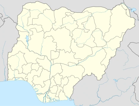
Plateau State
Nigerian state known for its plateau, tourism, and mineral resources.

via Wikipedia: Plateau State · see source
Plateau State, in Nigeria’s North Central geopolitical zone, has Jos as its capital. Its official nickname is the “Home of Peace and Tourism,” and roughly 4.7 million people live there. The state sits on the Jos Plateau, a highland of hills and bare rock scattered across grasslands. This elevation gives it a climate that is nearly temperate, despite being in the tropics, with average temperatures ranging from 13 to 22 °C. Several major rivers in northern Nigeria, including the Kaduna, Gongola, Hadeja, and Damaturu, begin on the plateau.
The state’s geology is shaped by younger granite, about 160 million years old, that intruded through older granite. Volcanic activity around 50 million years ago added volcanoes and basaltic plateaus, along with deep valleys and rounded hills with sheer rock faces. Decades of mining for tin and columbite have left behind deep gorges and lakes. Natural resources found here include barite, bauxite, bentonite, bismuth, cassiterite, clay, coal, emeralds, fluoride, granite, iron ore, kaolin, lead/zinc, marble, molybdenite, pyrochlore, salt, tantalite/columbite, and tin/wolfram.
Plateau State borders Bauchi State to the northeast for 360 km, Kaduna State to the northwest, Nasarawa State to the southwest for 219 km, and Taraba State to the southeast for 202 km. Its altitude ranges from about 1,200 metres to a peak of 1,829 metres in the Shere Hills near Jos. The coolest weather comes with the Harmattan winds from December to February, while the warmest months are March and April. Annual rainfall varies from 1,317 mm in the south to 1,460 mm on the plateau, with the heaviest rains in July and August. The cooler conditions reduce the prevalence of some tropical diseases like malaria.
Tourism, though hampered by ongoing security problems and government neglect, still draws visitors, mostly from within Nigeria. Attractions include the Wildlife Safari Park, set in 8 km² of savanna about 4 km from Jos. The National Museum in Jos, founded in 1952, is known for its archaeology and pottery, including Nok terracotta heads from 500 BC to 200 AD. Next to it, the Museum of Traditional Nigerian Architecture has life-size replicas of buildings, from Kano’s walls to a Tiv village, plus colonial-era items tied to railways and tin mining. Solomon Lar Amusement Park in Jos is named after a former state governor. Jos Zoo, established in 1957, houses animals, birds, and reptiles. Assop Falls, about 64 km from Jos on the road to Abuja, is a notable waterfall used in soap operas and ads. Kurra Falls, 77 km southeast of Jos, hosts the state’s first hydroelectric station. Wase Rock, a dome-shaped inselberg 216 km southeast of Jos, rises 450 metres and is one of only five African breeding sites for the white pelican; 130 hectares around it are protected as a bird sanctuary. The Kerang highlands, 88 km from Jos, have volcanic hills with natural springs used for bottled water. The Shere Hills, east of Jos, offer high peaks and views for climbers. Riyom Rock is a formation 25 km southwest of Jos. Pandam Game Reserve is a largely untouched wildlife area with hippos, crocodiles, and snakes, where rangers guide visitors on foot. Kahwang Rock Formation, made of basalt, is in Bangai village in Riyom.
The state’s borders have shifted many times. Colonial changes aimed to protect the railway and tin shipments to the coast, and initially to create a non-Muslim province under one Resident. Later adjustments came from local demands for self-government. British control began in the early 1900s, when most of the area was part of Bauchi Province. In 1926, Plateau Province, with Jos and Pankshin Divisions, was split from Bauchi. Borders changed further to avoid splitting ethnic groups. In May 1967, Benue and Plateau Provinces merged into Benue-Plateau State, one of Nigeria’s twelve states at the time. After the civil war, that large state was broken up again due to pressure for more local governance.
- Capital
- Jos
- Population
- ~4.7 million
- Geopolitical Zone
- North Central
- Nickname
- Home of Peace and Tourism
- Highest Point
- 1,829 m (Shere Hills)
- Average Temperature
- 13–22 °C
Verified Timeline
Lore & Background
Plateau State is situated between latitude 8°24' N and 10°30' N and longitude 8°32' E and 10°38' E, encompassing the Jos Plateau with its hills, rock formations, and bare rocks scattered across grasslands. Its altitude ranges from about 1,200 metres to a peak of 1,829 metres in the Shere Hills. The state borders Bauchi, Kaduna, Nasarawa, and Taraba states. Despite being in the tropical zone, the higher altitude gives it a near-temperate climate, with average temperatures between 13 and 22 °C. Harmattan winds cause the coldest weather from December to February, while the warmest months are March and April. Mean annual rainfall varies from 1,317 mm in the south to 1,460 mm on the plateau, with the wet season peaking in July and August. The Jos Plateau is the source of many rivers in northern Nigeria, including the Kaduna, Gongola, Hadeja, and Damaturu rivers. The geology of Plateau State is formed on younger granite intruding through older granite, with the younger granites about 160 million years old. Volcanic activity 50 million years ago created volcanoes, basaltic plateaus, and valleys. Tin and columbite mining have left deep gorges and lakes. The state's natural resources include barite, bauxite, bentonite, bismuth, cassiterite, clay, coal, emeralds, fluoride, granite, iron ore, kaolin, lead/zinc, marble, molybdenite, pyrochlore, salt, tantalite/columbite, and tin/wolfram. Tourism attractions include the Wildlife Safari Park, National Museum in Jos (founded 1952), Museum of Traditional Nigerian Architecture, Solomon Lar Amusement Park, Jos Zoo (established 1957), Assop Falls, Kurra Falls, Wase Rock, Kerang highlands, Shere Hills, Riyom Rock, Pandam Game Reserve, and Kahwang Rock Formation.
Reader's Guide
Plateau State's significance lies in its unique geography, mineral wealth, and history as a center of tin mining and tourism in Nigeria. The state's elevated plateau provides a cooler climate that reduces the incidence of tropical diseases like malaria, and its rivers are vital sources for northern Nigeria. The Jos Plateau's younger granite formations and volcanic past create distinctive landscapes that attract tourists, though the tourism sector is not thriving due to perennial security issues and state government failure. Historically, the state was shaped by colonial manipulation to protect railway construction and tin mining, which began in 1902 under the British. Its borders have changed multiple times, including the creation of Plateau Province from Bauchi in 1926, the merger into Benue-Plateau State in 1967, and the carving out of Nasarawa State in 1996. In the 21st century, Plateau State has experienced significant violence, including riots, bombings, and clashes between ethnic and religious groups, with attacks attributed to various actors including Boko Haram, Fulani herders, Christian militias, and other armed groups. The conflict is complex, with factors such as climate change, competition over land, and political instability playing roles. The state government is led by a governor, with the current governor being Caleb Manasseh Mutfwang, sworn in on 29 May 2023 under the PDP party. The House of Assembly consists of 25 members, with the current Speaker being Rt. Hon. Naanlong Daniel, elected on 2 July 2025 by the members of the 10th assembly after former speaker Gabriel Dewan resigned.
Did You Know?
- The Jos Plateau is the source of many rivers in northern Nigeria, including the Kaduna, Gongola, Hadeja, and Damaturu rivers.
- Wase Rock is one of only five breeding sites of the white pelican in Africa, with about 130 hectares protected as a bird sanctuary.
- Tin mining activities began in 1902 under the British and continue to the present day.
- The National Museum in Jos was founded in 1952 and is known for its Nok terracotta heads and artefacts dating from 500 BC to 200 AD.
- The state's altitude peaks at 1,829 metres above sea level in the Shere Hills near Jos.
Frequently Asked Questions
Who is Plateau State?
Plateau State is a Nigerian state situated in the North Central geopolitical zone, governed from its capital city of Jos. It is home to roughly 4.7 million residents and is widely recognized for its elevated landscape, mild weather, and rich tourism offerings.
What is Plateau State's nickname and why does it carry that name?
The state is officially called the 'Home of Peace and Tourism.' This moniker reflects its reputation as a calm, welcoming destination whose natural scenery—rolling plateaus, waterfalls, and cool highlands—draws visitors seeking relaxation and outdoor exploration.
How does Plateau State's climate differ from most of Nigeria?
Because of its plateau terrain, the state enjoys a notably temperate climate with average temperatures hovering between 13 °C and 22 °C year-round. This makes it one of the cooler regions in the country and a popular escape from the intense heat found in the south.
What is Plateau State's highest point and how tall is it?
The Shere Hills hold the title of the state's highest elevation, reaching 1,829 metres above sea level. Their dramatic ridgelines are a key landmark that reinforces Plateau State's identity as a highland region.
Why do fans and travelers consider Plateau State important in the Nigerian States lineup?
It stands out as a go-to destination for nature-based tourism, mineral exploration, and cultural experiences tied to its diverse ethnic communities. Its combination of scenic highlands, moderate climate, and economic resources gives it a distinctive role among the 24 states in this fan-encyclopedia series.
More in Nigerian States 1-24
Spotted an error? Know more?
This is a living reference — every entry is fact-audited, and reader corrections feed straight into our audit queue. Suggest an edit · See this site's audit record