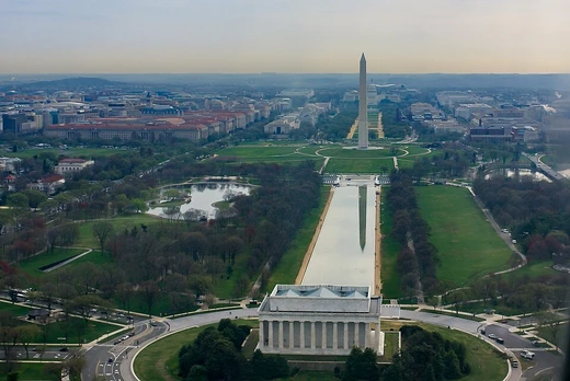
Fort Dupont Park
A wooded park with Civil War fort remains and diverse recreation.
Last updated

via Wikipedia: Fort Dupont Park · see source
Where it is
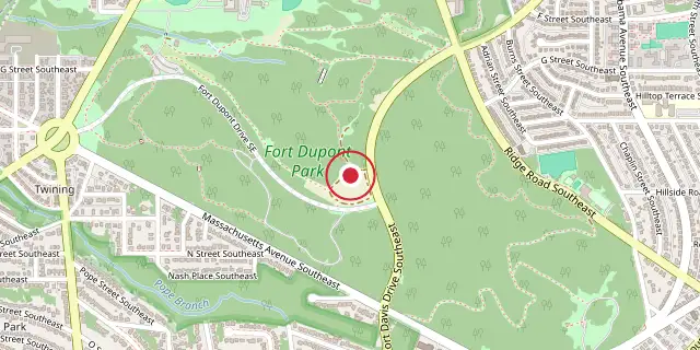
Coordinates: 38°52′37″N 76°57′00″W (38.8770, -76.9500) · Open in OpenStreetMap
Connected teams and clubs
Coordinates and connected clubs: the infobox of Wikipedia: Fort Dupont Park (CC BY-SA 4.0). Map: drawn by Codexery from OpenStreetMap tiles.
Fort Dupont Park is a 376-acre wooded park in Washington, D.C., managed by the National Park Service. The name comes from the old Civil War earthwork fort that lies within the park, one of several designed to defend Washington from a Confederate attack.
Few remains of the actual fortifications survive. The park protects an important sub-watershed of the Anacostia River and is a popular place for picnics, nature walks, indoor ice skating, mountain bike riding, gardening, environmental education, music, skating, sports, and ranger-led Civil War programs. It was purchased by the National Capital Park and Planning Commission, authorized by the Capper-Cramton Act, along with other circle parks in the 1930s and '40s.
History
Fort Dupont was an earthwork fort built in 1861 as part of the Civil War Defenses of Washington, completed in spring 1862, and in use until 1865 when it was abandoned. The land was owned by Micheal Canton before the war and returned to him afterward. The fort was a hexagon with 100-foot sides; inside were a flagpole, a deep well, officer quarters, and barracks, while outside was a guard house. It was an artillery installation defending the eastern approaches of Washington.
During the war, the fort mounted three 8-inch howitzers (en embrasure), three 24-pounder seacoast guns (en barbette), two 6-pounder field guns, and one 24-pounder Coehorn mortar. Fort Dupont never fired guns in hostile action. However, after the surrender of Confederate forces at Appomattox Court House on April 9, 1865, according to John Longyear, 'the Chain of forts around the city and the batteries of field artillery between, made a ring of cannons around the city which were fired for several hours.
The line of cannon salutes running round and round the other always proceeding in the same direction, so that it went round and round the circuit 20 to 30 miles.'
Facilities
Fort Dupont has a 40-year history of offering a summer concert series, with many famous musicians and bands in the Washington, D.C., area playing this venue. The primary trail is the unpaved Fort Circle Hiker-Biker Trail, with various side spur trails totaling about 10 miles. The Fort Circle is a 7-mile trail that runs north from the Anacostia Community Museum through six adjacent Fort Circle Parks—Fort Ricketts Park, Fort Stanton Park, Fort Davis Park, Fort Dupont Park, Fort Chaplin Park, and Fort Mahan Park—and several smaller NPS parkland sections, ending at the north end of Marvin Gaye Park at Hunt Place NE, where it connects to the Marvin Gaye Trail.
The 1902 McMillan Plan envisioned connecting the circle forts with a road called Fort Circle Drive. The New Deal's Civilian Conservation Corps completed a section at Fort Dupont, south toward Good Hope Road. Another section was completed near Fort Reno by the Works Progress Administration. Military Drive through Rock Creek—considered part of the Fort Circle Drive at the time—was completed in the 1950s.
No further progress was made, and by 1962 the idea was abandoned due to changes in the urban environment, right-of-way limitations, and traffic on cross streets. In 1965, the National Capital Planning Commission proposed renaming it the Fort Park System and replacing the scenic drive with a Greenway trail. In 1968, the National Park Service issued a master plan that included the Fort Circle Trail, originally envisioned as a 32-mile network. Only three sections were built; two are no longer labeled as such.
The first section was a four-mile stretch of the C&O Canal towpath from the Foundry Tunnel to Chain Bridge built in 1967. The second was a short section in Rock Creek Park along the north side of Military Road, past Fort DeRussy, opened in 1968. The first 3,000 feet of trail in the Fort Dupont area, from Pennsylvania Ave to Ridge Road, opened on November 10, 1968. The complete east-of-the-river section, from the Fort Rickets area to north of Fort Mahan, was dedicated as a national recreation trail by Interior Secretary Rogers C. B. Morton in 1971, by which point the trail had been descoped to 23 miles.
The 1968 master plan was approved in 1974, but no further work was done. In 2004, NPS updated its management plan and replaced the completed trail with a guided walking route, dropping the bicycle trail due to narrow trails, difficult topography requiring bridges and tunnels, and a loss of wildness. A 2010 report by NCPC, NPS, and DC called for a similar greenway connection, but none of these plans have been implemented. The park has three picnic areas that can be reserved for group use; otherwise, tables are first come, first served.
More in National Park Service Areas in Washington, D.C.
Sources
Compiled from Wikipedia and the sources listed below. Text from Wikipedia is available under CC BY-SA 4.0; this entry is adapted from it.
- Wikipedia: Fort Dupont Park (CC BY-SA 4.0).
Spotted an error? Know more?
Reader corrections go straight into our review queue. Suggest an edit · How this site is sourced