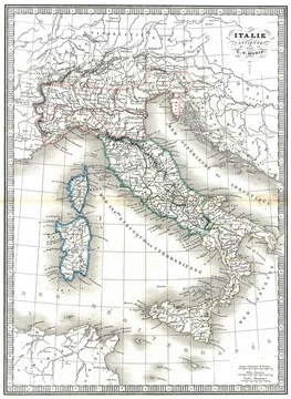
Monte San Michele
Heavily fortified hill on the Karst, bitterly contested in the Isonzo battles.
Last updated

via Wikipedia: Monte San Michele · see source
Where it is
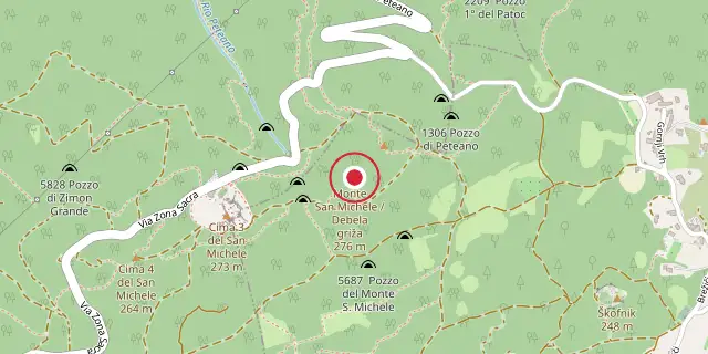
Coordinates: 45°53′10″N 13°32′49″E (45.8860, 13.5470) · Open in OpenStreetMap
Coordinates and connected clubs: the infobox of Wikipedia: Monte San Michele (CC BY-SA 4.0). Map: drawn by Codexery from OpenStreetMap tiles.
Monte San Michele (Debela griža) is a hill on the Karst Plateau in the Italian province of Gorizia, sitting on the border between the municipalities of Sagrado (Zagraj) and Savogna d'Isonzo (Sovodnje ob Soči). It lies eight kilometres southwest of Gorizia on the left bank of the Isonzo and has four peaks: Cima Uno at 237 meters, Cima Due and Cima Tre both at 275 meters, and Cima Quattro at 264 meters.
Because it commanded the lower Isonzo valley and the plain of Gorizia, it saw heavy fighting during the First World War. Along with Sabotin and Podgora, it was one of the main bulwarks of the Austro-Hungarian defense of Gorizia in the early battles of the Isonzo, heavily fortified with trenches, barbed wire, heavy artillery, tunnels, and machine-gun posts. It was bitterly contested during the first six battles of the Isonzo.
Did You Know?
- Monte San Michele was the site of the first poison gas attack on the Italian Front, on 29 June 1916.
- The gas used was a mix of chlorine and phosgene, which killed 2,700 Italian troops and poisoned 4,000.
- A wind change blew some gas back, killing about 250 Austro-Hungarian soldiers and poisoning 1,500.
- Poet Giuseppe Ungaretti fought on the San Michele and wrote about it in his collection Allegria di naufragi.
- The hill was declared a 'monumental area' in 1922 and turned into an open-air museum.
More in Military History of Italy During World War I
Sources
Compiled from Wikipedia and the sources listed below. Text from Wikipedia is available under CC BY-SA 4.0; this entry is adapted from it.
- Wikipedia: Monte San Michele (CC BY-SA 4.0).
Spotted an error? Know more?
Reader corrections go straight into our review queue. Suggest an edit · How this site is sourced