Tlalnepantla de Baz
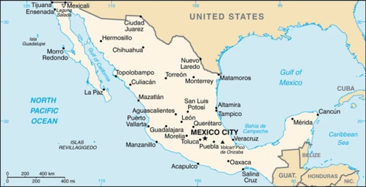
Municipality in Mexico State, north of Mexico City.

Tlalnepantla de Baz is a municipality in the State of Mexico, one of 125 in the state, situated north of Mexico City in the Valley of Mexico. Its main city and administrative center is Tlalnepantla, a name derived from the Náhuatl words *tlalli* (land) and *nepantla* (middle), meaning "middle land." The "Baz" in its name honors Gustavo Baz Prada, a politician and soldier who fought with Emiliano Zapata during the Mexican Revolution and later served as Governor of the State of Mexico and President of the National Autonomous University of Mexico (UNAM). The municipality has an exclave to the west, separated by Mexico City’s Gustavo A. Madero borough, and together with Atizapán forms the densely populated Region XII of the State of Mexico.
Around the 11th century, the Amaquemecan people, after whom Amecameca is named, migrated here under leader Xolotl in search of better climate and food. Xolotl founded the Tenayuca Oztopolco chiefdom and conducted what is considered the first census in the Americas. The area was already home to Acolhuas, Tepanecas, and Otomis, with whom alliances were formed, but it was later conquered and made a tributary of the Aztec Empire. After the Spanish conquest, Franciscans evangelized the region. Modern Tlalnepantla was founded as a compromise between the towns of Tenayuca and Teocalhueyacan, which disputed where to build a Franciscan monastery. The monastery, Corpus Christi, was built in 1550 at the midpoint between them, giving the city its name. Following independence, Tlalnepantla was part of Mexico City until 1825, when it became a district of the State of Mexico. Industrial development began under Porfirio Díaz, and after being declared a city in 1948, it experienced a population boom in the 1950s. The 2010 census recorded 653,410 residents, accounting for 98.37% of the municipality’s population. On January 16, 1977, a bus driver trying to cross railroad tracks ahead of a train caused one of Mexico’s worst railway disasters, killing 42 people, including the driver.
Tlalnepantla is a large city with a major mall called Mundo E and several hotels. Key roads include Gustavo Baz Avenue, Mario Colin Avenue, Adolfo Lopez Mateos Boulevard, and Presidente Juárez Avenue, as well as the Periférico and the Mexico-Querétaro Freeway—a 15-lane section of Mexican Federal Highway 57, part of the Pan-American Highway. Public transit includes local peseros, the Mexibús system, intercity buses, and the Tren Suburbano at Tlalnepantla and San Rafael stations. The eastern area is served by the Mexicable.
Educational institutions in the city include UNAM’s Facultad de Estudios Superiores Iztacala (FES Iztacala), the Instituto Tecnológico de Tlalnepantla (ITTLA), Centro Universitario Emilio Cardenas (CUDEC), Escuela Bancaria y Comercial (EBC Tlalnepantla), Universidad Latinoamericana (ULA), Sistema Educativo Indoamericano (INDO), Centro Eleia, Universidad Interamericana para el Desarrollo (UNID), Universidad de Cuautitlan Izcalli (UCI), Ateneo de Tlalnepantla, and Universidad ETAC. Private schools include Instituto Thomas Jefferson.
With over 2,700 industries, Tlalnepantla is one of the most industrialized areas in the country, alongside Naucalpan and Monterrey, ranking first in the State of Mexico. Common industries include food processing, bottling, tobacco, textiles, paper, non-metallic minerals, metals, chemicals, petroleum products, machinery, and wood products. Its industrial zone is among the largest in the nation, and the area also hosts more than 15,000 retail businesses, including the Mundo E Mall and several large tianguis.
Notable sites include the church and monastery of Corpus Christi, built by Nahuas and Otomis from pink and gray stone. Its side gate, the Porciúncula, reflects the influence of both groups. The church was elevated to cathedral status in 1963. The colonial-era aqueduct running from Tlalnepantla to Villa de Guadalupe and the Caja del Agua are preserved, as are the Haciendas of Santa Mónica and de Emmedio. The Centro Cultural Sor Juana Inés de la Cruz holds 130 photographs of Tlalnepantla from the late 19th century to 1960, along with other historical objects. Two notable pyramids lie within municipal limits: Tenayuca and Santa Cecilia Acatitlan. Tenayuca’s pyramid is a smaller version of the Aztec Templo Mayor in Tenochtitlan, with dual staircases on the west side leading to two temples—one for Tlaloc and one for Huizilopochtli. Serpent sculptures surround it on three sides, possibly pre-Aztec in origin. A small museum on site displays artifacts, diagrams, and models of the site and its history. The smaller pyramid at Santa Cecilia Acatitlan, just north of Tenayuca, was rebuilt after the original was destroyed, with some of its blocks used to construct the Santa Cecilia church.
- location
- State of Mexico, north of Mexico City
- municipal seat
- Tlalnepantla
- area
- Part of Region XII of Mexico State
- notable for
- One of the most industrialized areas in Mexico
Verified Timeline
Lore & Background
Around the 11th century, a people called the Amaquemecan migrated to this area following their leader Xolotl to look for a better climate and more food. Xolotl founded the Tenayuca Oztopolco chiefdom and made the first census ever in the Americas. The Acolhuas, Tepanecas and Otomis were already established, so alliances were made, but the region was eventually conquered and made a tributary of the Aztec Empire. After the Spanish Conquest, the area was evangelized by the Franciscans. The founding of modern Tlalnepantla was the result of a dispute between Tenayuca and Teocalhueyacan over where to place a Franciscan monastery; it was built at the midpoint, hence the name 'middle land.' This monastery, named Corpus Christi, was built in 1550. After independence, Tlalnepantla was originally part of Mexico City, but in 1825 it was recognized as a district of the State of Mexico. The municipality is divided almost entirely by Mexico City's Gustavo A. Madero delegation. On January 16, 1977, Tlalnepantla del Baz was the site of one of the worst railway disasters in Mexico's history when a bus driver attempted to cross a railroad ahead of an oncoming train; the driver was one of 42 people killed.
Reader's Guide
Tlalnepantla de Baz is one of the most industrialized areas in the country, along with Naucalpan and Monterrey, ranking first in the state of Mexico. More than 2,700 industries are located here, including food processing, bottling, tobacco products, textiles, paper products, non-metallic mineral products and metals, chemicals and petroleum products, machinery and wood products. The area also includes more than 15,000 retail businesses, including the Mundo E Mall and several large tianguis. Important avenues include Gustavo Baz Ave., Mario Colin Ave., Adolfo Lopez Mateos Blvd., and Presidente Juárez Ave., as well as the Periférico and the Mexico-Querétaro Freeway with 15 lanes in Tlalnepantla. The city is served by the local pesero, the Mexibús system, an intercity bus network, and the Tren Suburbano at Tlalnepantla and San Rafael stations; the Eastern area is served by the Mexicable service. Notable sites include the church and monastery of Corpus Christi, built by both Nahuas and Otomis of pink and gray stone, which gained cathedral status in 1963; the pyramids at Tenayuca and Santa Cecilia Acatitlan; and the Hacienda of Santa Mónica and the Hacienda de Emmedio.
Did You Know?
- The name Tlalnepantla comes from the Náhuatl words tlalli (land) and nepantla (middle) to mean 'the middle land.'
- The municipality's name includes 'Baz' to honor Gustavo Baz Prada, a soldier in Emiliano Zapata's army who later became Governor of the State of Mexico and President of UNAM.
- Around the 11th century, leader Xolotl founded the Tenayuca Oztopolco chiefdom and made the first census ever in the Americas.
- On January 16, 1977, Tlalnepantla del Baz was the site of one of Mexico's worst railway disasters, killing 42 people including a bus driver who tried to cross ahead of a train.
- The pyramid at Tenayuca is a smaller version of the Templo Mayor the Aztecs built in Tenochtitlan, with dual staircases leading to temples dedicated to Tlaloc and Huizilopochtli.
Frequently Asked Questions
Who is Tlalnepantla de Baz?
Tlalnepantla de Baz is a municipality in the State of Mexico, positioned just north of Mexico City. Its central city, Tlalnepantla, gets its name from Nahuatl roots that roughly translate to 'middle land.'
What are Tlalnepantla de Baz's powers/role?
The municipality functions as one of Mexico's most heavily industrialized zones, driving manufacturing and economic activity for the surrounding region. Administratively it sits within Region XII of Mexico State.
How does Tlalnepantla de Baz's story end?
Rather than a fixed ending, the municipality's arc is still unfolding as a living industrial and residential hub. Its narrative stretches from pre-Hispanic settlement through colonial-era evangelization into ongoing modern development.
Why is Tlalnepantla de Baz important?
The area carries layered historical weight as a site of indigenous settlement, Spanish colonial religious activity, and later key industrial growth. Its proximity to Mexico City makes it a critical node in the greater metropolitan economy.
Where does Tlalnepantla de Baz originate?
The municipality is rooted in the State of Mexico, lying to the north of Mexico City proper. The Nahuatl-derived name of its seat city references a central or middle position within the surrounding landscape.
More in Mexican Cities 1-20
Spotted an error? Know more?
This is a living reference — every entry is fact-audited, and reader corrections feed straight into our audit queue. Suggest an edit · See this site's audit record