Carmarthen
Last updated
Where it is
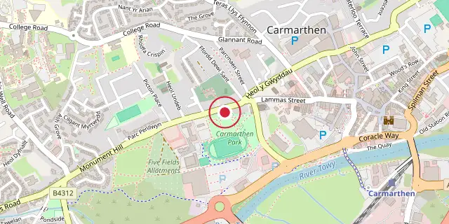
Coordinates: 51°51′22″N 4°18′58″W (51.8560, -4.3160) · Open in OpenStreetMap
Coordinates and connected clubs: the infobox of Wikipedia: Carmarthen (CC BY-SA 4.0). Map: drawn by Codexery from OpenStreetMap tiles.
Carmarthen (Caerfyrddin) is a market town and the county town of Carmarthenshire in Wales, situated on the River Towy. It stands on the site of the Roman town of Moridunum and has a claim to be the oldest town in Wales. In the 16th–18th centuries it was the most populous borough in Wales, described by William Camden as the 'chief citie of the country'.
History
Carmarthen began as the Roman civitas capital of the Demetae tribe, called Moridunum ('Sea Fort'), recorded by Ptolemy and in the Antonine Itinerary. The Roman fort is believed to date from about AD 75; a coin hoard was found nearby in 2006. One of only two Roman amphitheatres in Wales survives near the fort, excavated in 1968, with an arena of 50 by 30 yards and a cavea of 100 by 73 yards. Michael Veprauskas (1998) argued for identifying the site as the Cair Guorthigirn ('Fort Vortigern') listed by Nennius among the 28 cities of Britain.
In the Middle Ages the settlement, then called Llanteulyddog, was one of the seven principal sees in Dyfed. William fitz Baldwin built a castle there about 1094; the current castle site has been occupied since 1105. Llywelyn the Great destroyed the castle in 1215, but it was rebuilt in 1223, when permission was given for a town wall and crenellations, making Carmarthen one of the first medieval walled towns in Wales. Owain Glyndŵr captured the town and sacked the castle in 1405.
The Black Book of Carmarthen, from about 1250, is associated with the town's Priory of SS John the Evangelist and Teulyddog. The Black Death arrived in 1347–1349 via river trade, devastating villages such as Llanllwch. The ancient Clas church of Llandeulyddog became the Benedictine Priory of St Peter in 1110, replaced 15 years later by the Augustinian Priory of St John the Evangelist and St Teulyddog, which stood near the river at what is now Priory Street.
Governance
Carmarthen has two tiers of local government: Carmarthen Town Council and Carmarthenshire County Council. The town council is based at St Peter's Civic Hall, a 19th-century building bought by the council in 1977. The county council is headquartered at County Hall on Castle Hill, occupying much of the site of Carmarthen Castle. The ancient parish of Carmarthen, also known as St Peter's, included rural areas north and west of the town.
Old Carmarthen existed before the castle and the Anglo-Norman town of New Carmarthen, which was administered as a borough from at least the 13th century. The borough boundary was tightly drawn around New Carmarthen, excluding the castle and Old Carmarthen. In 1546 the borough was enlarged to cover the whole parish, merging the two settlements. A 1604 charter from James I made Carmarthen a county corporate, independent from the Sheriff of Carmarthenshire.
The borough was reformed into a municipal borough in 1836 under the Municipal Corporations Act 1835. When elected county councils were created in 1889, Carmarthen was not made a county borough and was included in the administrative county of Carmarthenshire. Carmarthen Castle, historically a detached part of the parish of Newchurch, was transferred to the parish of Carmarthen in 1885 and brought within the borough boundaries in 1898.
Religion
St Peter's Church in Carmarthen is the largest parish church within the Diocese of St David's, with its nave stretching 200 feet from the west porch to the east window and spanning 50 feet across the nave and south aisle. Constructed from local red sandstone and grey shale, the building includes a west tower, nave, chancel, south aisle, and a consistory court. It was designated a Grade I listed structure in 1954. The tower holds eight bells; the heaviest, tuned to E, weighs 15 cwt 46 lb.
By the early 1800s, the church could no longer accommodate its growing congregation, leading to the consecration of St David's in 1841 and the opening of Christ Church in 1869 for English-speaking worshippers. St Mary's, also in Carmarthen, falls under the Carmarthen Deanery. Several nonconformist chapels have long histories in the town. A Baptist congregation began at Dark Gate in 1762, relocated to Waterloo Terrace in 1812 under Titus Lewis, and became known as the Tabernacle.
The English Baptist Church on Lammas Street opened in 1870; both chapels remained active in 2024. Penuel Baptist Chapel on Priory Street dates from 1786, with its current building erected in 1872; the structure was sold in 2024, but the congregation continues to meet at Building 4, Parc Dewi Sant. Lammas Street Chapel, the oldest Congregational or Independent chapel, traces back to 1726, with its present building completed a century later. Union Street Chapel, now closed, resulted from a split in the Lammas Street congregation.
Priory Chapel, on Priory Street, began in 1872 as an offshoot of Ebenezer in Abergwili. The earliest Calvinistic Methodist chapel was Water Street Chapel, now closed, which had connections to Peter Williams. Bethania Chapel on Priory Street, built in 1909, closed shortly after its centenary.
Landmarks
Little remains of the medieval castle at Carmarthen, but the old Gatehouse dominates Nott Square and the motte is accessible to the public. Castle House, within the old walls, serves as a museum and Tourist Information Centre. The concrete A484 road bridge across the River Tywi, designed by Clough Williams-Ellis, was completed in 1937 and Grade II listed in 2003; its replacement of the original medieval bridge caused controversy. A cable-stayed pedestrian bridge built in 2005 for £2.8 million links the railway station to the town centre and was commended in 2007 for high-quality detailing.
A monument to Lieutenant General Sir Thomas Picton was erected in 1828 at the west end of the town, a 75 ft pillar designed to echo Trajan's Column, but it became dilapidated and was taken down in 1846; replacement sculptures rediscovered in the 1970s are now in Carmarthenshire County Museum. A campaign to remove the monument arose after the removal of the Statue of Edward Colston in Bristol in June 2020, due to Picton's treatment of slaves. A statue of General Nott was erected in 1851.
A small plaque below that statue marks the place where Bishop Robert Ferrar was burned at the stake in March 1555 during the Marian Persecutions.
Did You Know?
- Dyfed–Powys Police headquarters, Glangwili General Hospital and a campus of the University of Wales Trinity Saint David are located in Carmarthen.
- The former cattle market became a shopping centre with a multi-screen cinema, market hall, restaurants and multi-storey car park, opening in 2010.
- Carmarthen has two rugby union teams: Carmarthen Quins and Carmarthen Athletic.
More in Locations Associated with Arthurian Legend
Sources
Compiled from Wikipedia and the sources listed below. Text from Wikipedia is available under CC BY-SA 4.0; this entry is adapted from it.
- Wikipedia: Carmarthen (CC BY-SA 4.0).
Spotted an error? Know more?
Reader corrections go straight into our review queue. Suggest an edit · How this site is sourced