
Bog
A peat-accumulating wetland that is acidic and nutrient-poor.

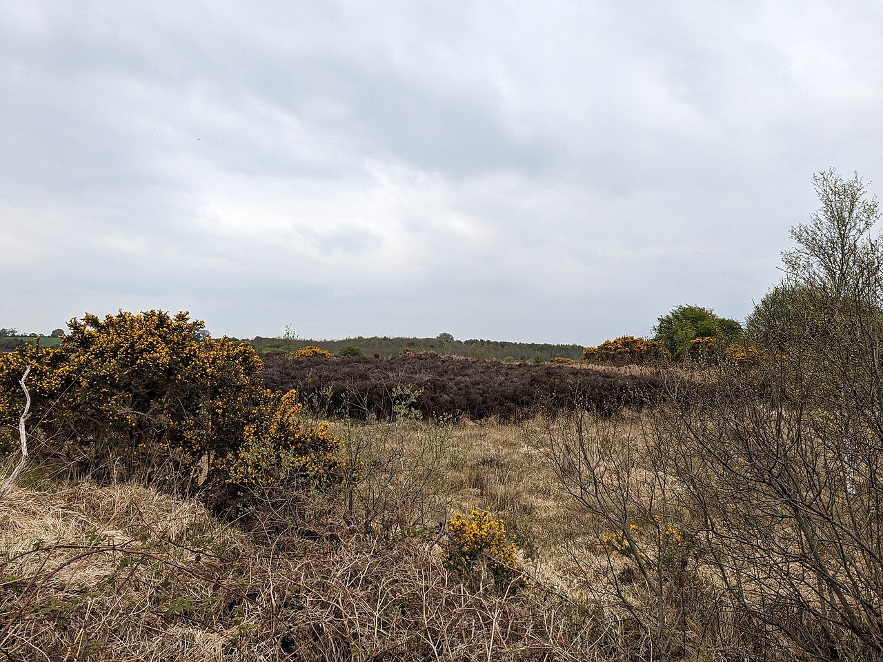
CaitNi · CC BY-SA 4.0
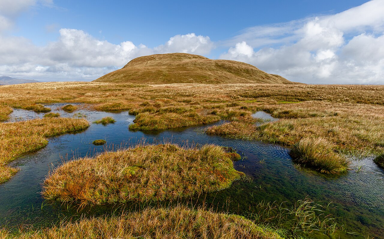
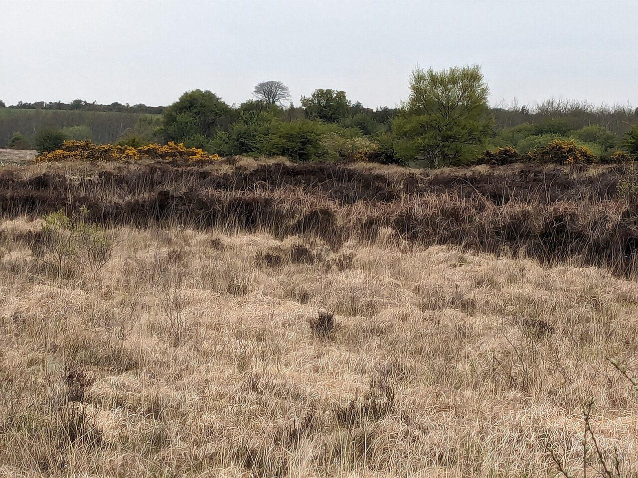
A bog is a type of wetland where dead plants, especially sphagnum moss, build up as peat. It is one of the four main wetland categories. Bogs form in cool northern climates, often in lake basins that drain poorly, and their surface water is acidic and low in nutrients. These wetlands are crucial for biodiversity, especially in areas otherwise developed for farming or settlement.
Bogs are also called mires, mosses, quagmires, or muskeg, while alkaline versions are known as fens. A bayhead is a bog type found in Gulf Coast forests of the United States. They are often covered with heath or heather shrubs rooted in sphagnum and peat. As dead plant matter slowly accumulates, the bog acts as a carbon sink.
Unlike fens, bogs get most of their water from rain, not from mineral-rich ground or surface water. The water draining from bogs is brown from dissolved peat tannins. Plant growth is slow due to low fertility and cool temperatures, but decay is even slower because saturated bog soils lack oxygen, so peat piles up—sometimes many meters deep across large areas.
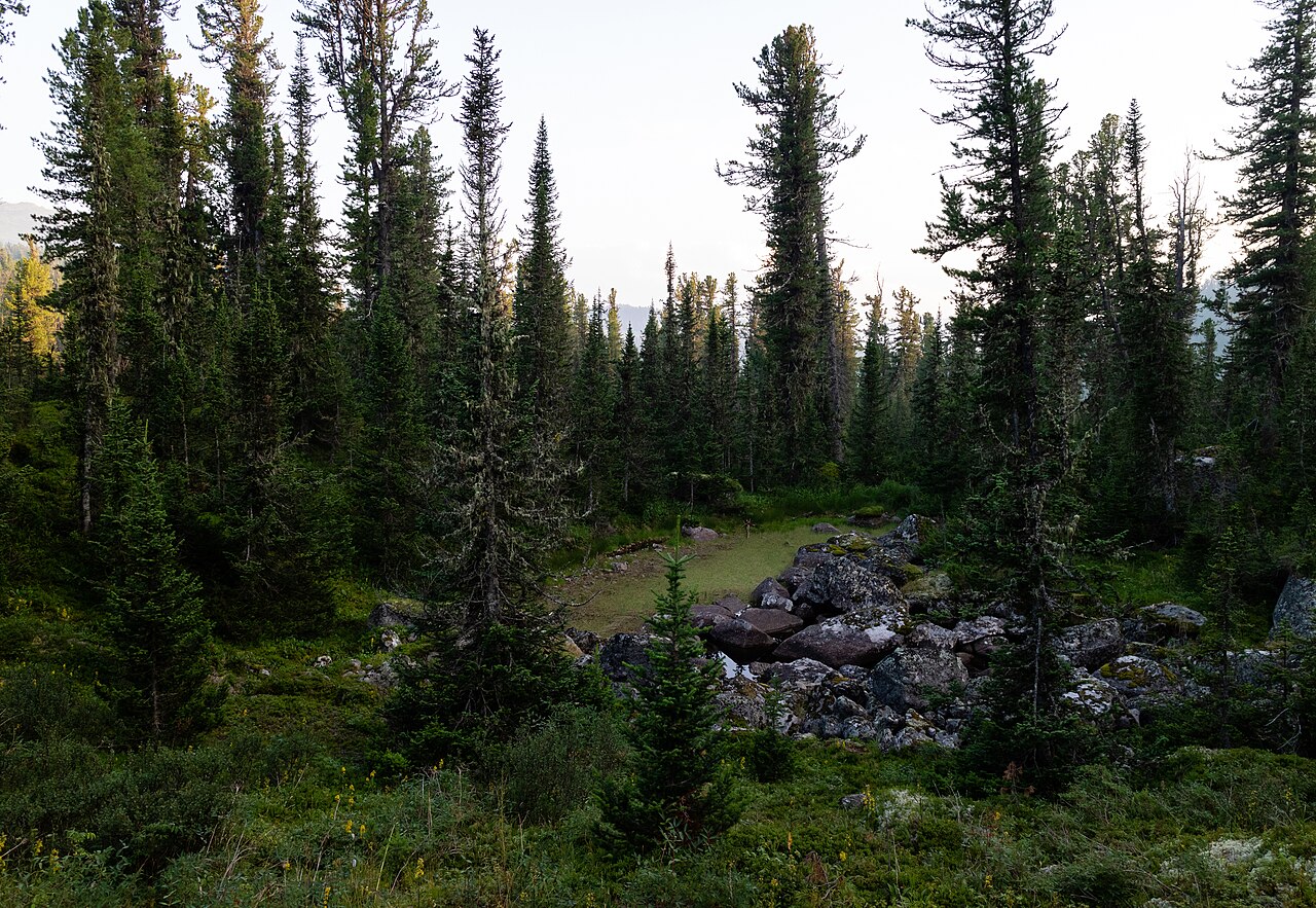
Bogs host unique communities of animals, fungi, and plants. Many species tolerate low nutrients and waterlogging. Sphagnum moss is common, along with evergreen shrubs that conserve nutrients. In drier spots, evergreen trees appear, blending into boreal forest. Carnivorous plants like sundews and pitcher traps catch insects for nutrients, while orchids use fungi to extract food. Some shrubs, such as bog myrtle, fix nitrogen in root nodules.
Bogs provide habitat for mammals like caribou, moose, and beavers, and for nesting shorebirds such as Siberian cranes and yellowlegs. Reptiles like the bog turtle live there, and distinctive insects include the hairy canary fly in English bogs and the bog copper butterfly in North America. Ireland’s only native reptile, the viviparous lizard, dwells in bogland.
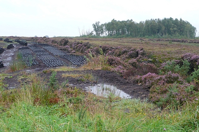
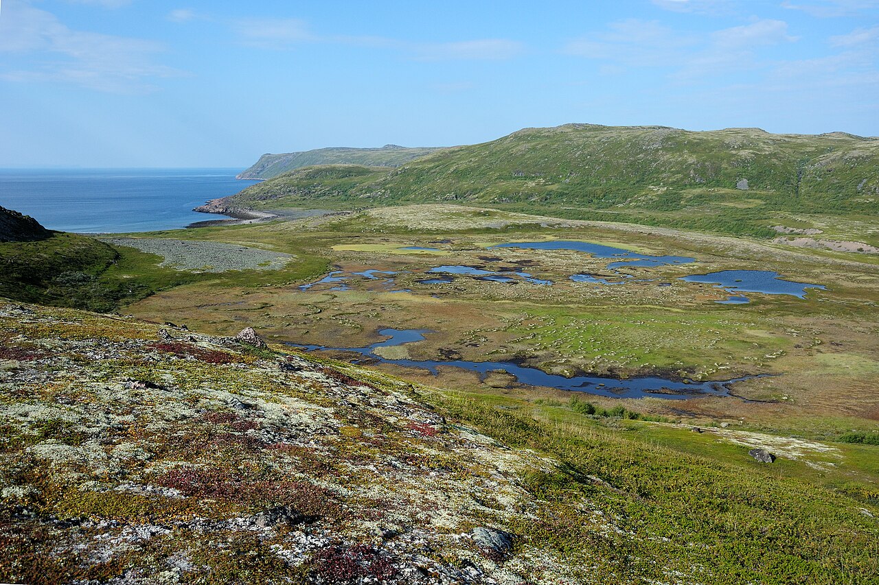
Bogs are widespread in cold, temperate regions, mostly in northern boreal ecosystems. The largest wetland on Earth is the Western Siberian Lowlands peat bogs in Russia, covering over a million square kilometers. Large bogs also exist in North America’s Hudson Bay Lowland and Mackenzie River Basin. In the Southern Hemisphere, the biggest is the Magellanic moorland in southern South America, about 44,000 square kilometers. Sphagnum bogs were once common in northern Europe but have often been drained for farming. A 2019 study led by Graeme T. Swindles found that European peatlands have dried rapidly in recent centuries due to drainage, peat cutting, and burning. A 2014 expedition from Itanga village in the Republic of the Congo discovered a peat bog the size of England stretching into the Democratic Republic of Congo. Ireland’s landscape was once covered in bogs before widespread deforestation in the 1800s.
Defining bogs is tricky because wetlands sit between land and water, and classification systems vary. But all bogs share key traits: peat at least 30 centimeters thick, water and nutrients mostly from rain (ombrotrophic), low nutrient levels (oligotrophic), and strong acidity (though coastal bogs may be less acidic from sea spray). Bogs are a type of peatland and, along with fens, are classified as mires. Fens differ by getting mineral-rich water from ground or surface sources, making them less acidic. Geography and geology affect bog hydrology; groundwater mineral content reflects bedrock, and coastal areas bring higher sulfate and sodium levels.
Many governments and conservation agencies recognize bogs as a significant habitat. The United Kingdom’s Biodiversity Action Plan lists bogs as a priority habitat.
- type
- Wetland ecosystem
- also_known_as
- Mire, mosses, quagmire, muskeg
- key_feature
- Accumulates peat, functions as a carbon sink
- distribution
- Cold, temperate climes, mostly boreal ecosystems in the Northern Hemisphere
- largest_example
- Western Siberian Lowlands in Russia, covering more than a million square kilometres
- water_source
- Primarily precipitation (ombrotrophic)
- acidity
- Strongly acidic
Lore & Background
Bogs are widely distributed in cold, temperate climes, mostly in boreal ecosystems in the Northern Hemisphere. The world's largest wetland is the peat bogs of the Western Siberian Lowlands in Russia, which cover more than a million square kilometres. Large peat bogs also occur in North America, particularly the Hudson Bay Lowland and the Mackenzie River Basin.
Reader's Guide
Bogs are significant as a type of peatland and carbon sink, storing large amounts of decayed plant material. They have distinctive assemblages of animal, fungal, and plant species, including specialized carnivorous plants such as sundews and pitcher plants, and provide habitat for mammals like caribou, moose, and beavers, as well as nesting shorebirds and vulnerable reptiles like the bog turtle. Bogs are recognized as a significant habitat type by governmental and conservation agencies. However, they are fragile ecosystems that have been deteriorating quickly. Bone material found in bogs has had accelerated deterioration from first analyses in the 1940s, attributed to fluctuations in groundwater and increased acidity. Since bogs take thousands of years to form, once they are gone they are extremely hard to recover. Arctic and sub-Arctic circles where many bogs are located are warming at 0.6 °C per decade, twice the global average, and as bogs warm they release large amounts of greenhouse gases.
Did You Know?
- Bogs derive most of their water from precipitation rather than mineral-rich ground or surface water.
- Water flowing out of bogs has a characteristic brown colour from dissolved peat tannins.
- Carnivorous plants such as sundews and pitcher plants have adapted to low-nutrient bog conditions by using invertebrates as a nutrient source.
- The world's largest wetland is the peat bogs of the Western Siberian Lowlands in Russia, covering more than a million square kilometres.
Formation: The Glacial Birth of Kettle Bogs
Kettle bogs originate as a byproduct of glacial retreat. When a glacier recedes, blocks of dead ice calve from its leading edge and become partially or fully entombed beneath sediment carried by meltwater streams. These streams deposit material across broad outwash plains called sandurs, and the friction of flowing water helps bury the ice fragments. As the trapped ice slowly melts, it leaves a depression in the landscape. In other cases, the trigger is not gradual retreat but the catastrophic sudden drainage of an ice-dammed lake, an event termed a jökulhlaup. These floods hurl sediment-rich ice blocks across the sandur surface and bury them rapidly. Maizels, working in 1992 with both field observations and laboratory simulations, confirmed that ramparts develop around the edges of jökulhlaup-generated kettles. The specific shape of those ramparts depends on how much rock debris was trapped within the ice block and how deeply the block was buried by surrounding sediment.
Ecological Niche: The Closed World of Acidic Kettles
Once a kettle hole has accumulated water, its chemical trajectory determines whether it becomes a bog or a peatland. When decomposing organic plant matter drives the water into acidity, the kettle transforms into a kettle bog. If the underlying soils happen to be lime-based, they partially neutralize the acid, producing a kettle peatland instead. What makes kettle bogs particularly remarkable is their status as closed ecosystems: they receive no external water input beyond precipitation alone. This isolation creates a self-contained chemical and biological environment. Both acidic kettle bogs and fresh-water kettles serve as critical ecological niches, supporting symbiotic relationships among specialized flora and fauna that depend on these precise conditions. The absence of river or stream inflow means the water chemistry evolves purely through internal processes, making each kettle bog a distinct microcosm shaped by its own organic decomposition cycle rather than by external hydrological forces.
Geographic Footprint: From Wisconsin to the Prairies
Kettle bogs and their associated landforms are scattered across vast stretches of North America. The Kettle Moraine in Wisconsin, stretching from Green Bay down to south-central Wisconsin, is a prime example, containing numerous kettles, moraines, and other glacial features, with some of its kettle lakes reaching depths of 100 to 200 feet. Further west, the Prairie Pothole Region spans from northern Alberta in Canada all the way to Iowa in the United States, hosting thousands of small sloughs and lakes born from the same glacial processes. Individual kettle lakes vary enormously in size: Puslinch Lake in Ontario, Canada, at 160 hectares, is the largest in that country, while Fish Lake in Washington's Cascade Mountains covers 200 hectares. Most kettle holes measure under two kilometres in diameter, though some in the U.S. Midwest surpass ten kilometres. This wide geographic spread demonstrates that kettle formation is not a localized curiosity but a fundamental feature of post-glacial landscapes across the continent.
Water, Depth, and Fate: The Lifecycle of a Kettle
The water dynamics of a kettle determine its classification and ultimate fate. Most kettles are shallow, rarely exceeding ten metres in depth. If a kettle is fed by surface or underground rivers and streams, it is designated a kettle lake. When its water comes solely from precipitation, the groundwater table, or a combination of both, it is called a kettle pond or, if vegetated, a kettle wetland. Kettle ponds that sit above the groundwater table tend to dry out during warm summer months, earning the label ephemeral. Over geological time, most kettles fill with sediment or vegetation, gradually disappearing from the landscape. The ramparts that sometimes ring the edge of a kettle hole further modify the local topography. When numerous kettle holes disrupt a sandur surface, the result is a jumbled mosaic of ridges and mounds known as kame and kettle topography, a lasting signature of the glacial era's final retreat across the continent.
Gallery
Frequently Asked Questions
What is a bog?
A bog is a wetland ecosystem defined by the long-term buildup of peat from decomposed plant matter, frequently including sphagnum moss. It is one of the four principal wetland types and is distinguished by its acidic, nutrient-poor surface water.
How does a bog differ from a marsh or swamp?
Unlike marshes and swamps, bogs draw their water almost exclusively from rainfall rather than rivers or groundwater, a condition known as ombrotrophy. This reliance on precipitation gives bogs their signature acidic chemistry and allows peat to accumulate over centuries.
Where in the world are bogs most common?
Bogs thrive in cool temperate and boreal climates, with the overwhelming majority found in the Northern Hemisphere. They typically develop in poorly draining lake basins where cold temperatures slow down organic decomposition.
What is the largest bog on Earth?
The Western Siberian Lowlands in Russia hold the record, stretching over a million square kilometres of peat-accumulating wetland. It dwarfs every other bog system on the planet in total area.
Why are bogs ecologically important?
Bogs act as major carbon sinks, sequestering vast quantities of organic material within their peat layers. They also shelter specialized plant and animal communities, making them especially valuable in landscapes that have otherwise been converted to farmland or urban development.
More in Geology And Landforms 1-17
Spotted an error? Know more?
This is a living reference — every entry is fact-audited, and reader corrections feed straight into our audit queue. Suggest an edit · See this site's audit record