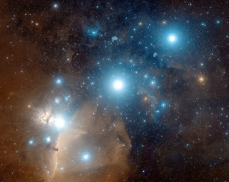
Astrometric solving
Matching image stars to catalogues for precise celestial coordinates.

Astrometric solving, also known as plate solving or astrometric calibration, is a technique used in astronomy to determine the celestial coordinates of every pixel in an astronomical image by matching the stars in the image to a star catalogue. It produces a mathematical model that includes the image's reference point, scale, orientation, and sometimes distortion, enabling precise celestial positioning.
- Reference catalogue example
- Gaia catalogue
- Transformation conventions
- World Coordinate System (linear), SIP (Simple Imaging Polynomial, for non-linear distortion)
- Grouping methods
- three-star triangles or four-star quads
- Solving type
- blind solving (no initial guess needed) for images with sufficient stars
Lore & Background
In the past, plate solving was done manually by accurately measuring photographic glass plates taken with an astrograph (astrographic camera). Currently, astrometric solving is exclusively done by software programs. The program extracts the star x,y positions from the celestial image, groups them in three-star triangles or four-star quads, then calculates for each group a geometric hash code based on the distance and/or angles between the stars in the group. It then compares the resulting hash codes with the hash codes created from catalogue stars to find a match. If it finds sufficient statistically reliable matches, it can calculate transformation factors. The solver should be fast and reliable with no false matches.
Reader's Guide
Astrometric solving is significant because it enables accurate measurement of celestial positions, which is essential for professional astrometry—such as precisely measuring the positions of minor planets or comets to calculate orbital parameters. It also allows telescope mounts to be synchronized to the celestial position of the image center, improving pointing accuracy. The technique relies on high-accuracy astrometric reference catalogues like the Gaia catalogue. The solution includes a reference point (often the image centre), image scale, image orientation, and optionally a distortion model. Two common conventions for modeling the transformation are the linear World Coordinate System and the more advanced SIP (Simple Imaging Polynomial) for handling non-linear geometric distortion caused by optics. Some programs can perform blind solving, requiring no initial guess, as long as the image contains enough stars.
Did You Know?
- Astrometric solving is also called plate solving or astrometric calibration.
- The solution includes a reference point, image scale, image orientation, and sometimes a distortion model.
- Blind solving can work on any image with sufficient stars, without needing an initial guess.
- The Gaia catalogue is an example of an astrometric reference catalogue used for high-accuracy star positions.
The Elusive Celestial Pole
The fundamental goal of polar alignment is to parallel a telescope's equatorial mount axis—or a sundial's gnomon—with Earth's rotational axis, pointing it toward a celestial pole. In the Northern Hemisphere, this is relatively straightforward: Polaris sits roughly three-quarters of a degree from the North Celestial Pole and is bright enough for naked-eye identification. The Southern Hemisphere presents a far greater challenge. σ Octantis, often called the South Star, sits at magnitude +5.6, making it difficult for inexperienced observers to spot, and its declination of -88° 57′ 23″ places it about 1° 2′ 37" from the true South Celestial Pole. An even closer companion, BQ Octantis at magnitude +6.9, lies only 10 arcminutes from the pole as of 2016, though it will reach a minimum of 9 arcminutes in 2027. Neither southern star is visible without optical aid, so observers must rely on polar scopes or other instruments to locate them.
Rough Alignment and Its Practical Limits
For quick setups, observers in the Northern Hemisphere can simply sight Polaris and orient the mount's axis toward it. Where Polaris is invisible, a rough alignment involves leveling the mount, setting the latitude pointer to the observer's geographic latitude, and using a magnetic compass—corrected for local magnetic declination—to point the axis toward true south or north. This level of precision often suffices for casual eyepiece observing or very wide-angle astro-imaging on a tripod, and serves as a common starting point in amateur astronomy. Accuracy can be improved by replacing the built-in latitude scale with a calibrated precision inclinometer to measure the polar axis altitude, then using the mount's setting circles to locate a bright star of known coordinates. If the alignment is correct, the star will mismatch only in azimuth, and centering it by adjusting azimuth completes the process. This refined rough alignment typically delivers enough precision for motorized telephoto sky tracking, but falls short for astro-imaging through lenses or telescopes of significant magnification, where more sophisticated methods become necessary.
Polarscopes and Drift Alignment
A polar scope—a low-magnification telescope mounted coaxially with the equatorial mount—enables alignment suitable for visual observation and short-exposure imaging lasting a few minutes. A special reticle guides the observer to position Polaris, or a group of stars near the southern polar region, at the correct location. Early polarscopes required manual adjustment for the time of year and day, but modern computer applications now calculate the proper reticle position automatically. A newer northern-hemisphere reticle employs a clock-face design with 72 divisions representing 20-minute intervals, plus circles that compensate for Polaris's drift over roughly thirty years, achieving alignment within an arc minute or two. For higher precision, drift alignment refines the initial rough setup by tracking stars with the clock drive and observing any residual drift in the eyepiece or sensor. Altitude errors are corrected by tracking a star low in the east or west, while azimuth errors are addressed by tracking a star near the meridian at a declination about 20 degrees from the celestial equator, in the hemisphere opposite the observer's location. The process is iterated until tracking is satisfactory.
Computational and Mathematical Refinement
When a telescope is paired with an imaging camera and computer, astrometric plate solving can achieve polar alignment accuracy within 0.1 minutes of arc. The procedure begins with a rough polar-scope alignment, followed by capturing an image of stars near the pole. A star database identifies the exact field of view—the plate solve. The telescope is then rotated ninety degrees around its right ascension axis, and a second plate solve is performed. Software automatically calculates the error in the rotation center compared to the true celestial pole and provides the operator with simple adjustment instructions. An alternative mathematical approach uses two stars or two astrometric solves at different positions. By measuring the error in right ascension and declination and comparing the telescope encoder readings against the second star's coordinates, the elevation and azimuth errors of the polar alignment can be derived through trigonometric formulas involving the observer's latitude, the star's declination, and the hour angle.
Frequently Asked Questions
What is Astrometric solving?
Astrometric solving (often called plate solving) is the process of determining exactly where every pixel in an image falls on the celestial sphere. It does this by recognising the stars visible in the frame and cross-referencing them against a reference catalogue such as Gaia.
How does Astrometric solving actually work?
The solver groups detected stars into small geometric patterns—typically three-star triangles or four-star quads—and searches a star catalogue for matching configurations. Once a confident match is found, it constructs a mathematical transformation that maps pixel coordinates to right ascension and declination.
What does Astrometric solving output?
It produces a coordinate model encoding the image's reference point, pixel scale, rotation, and any non-linear distortion. Well-corrected optics are described with a linear World Coordinate System, while fields with residual distortion use the Simple Imaging Polynomial (SIP) convention.
Does Astrometric solving need an initial guess?
No—when the field contains enough stars, the technique performs what's called blind solving, locating the correct sky region from scratch without any prior coordinate estimate. This makes it especially handy for wide-field shots or unfamiliar targets.
Why is Astrometric solving important for astrophotographers?
It lets you stack, align, and annotate frames with accurate celestial coordinates rather than relying on approximate mount readings. Without it, tasks like building mosaics, overlaying star charts, or registering multiple exposures quickly devolve into guesswork.
More in Astrophotography 1-24
Spotted an error? Know more?
Reader corrections go straight into our review queue. Suggest an edit · How this site is sourced