Tel Hazor
Largest fortified city in the region from Middle Bronze to Iron Age.
Last updated
Where it is
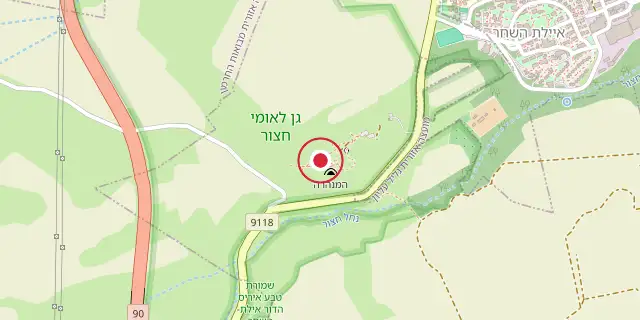
Coordinates: 33°01′01″N 35°34′01″E (33.0170, 35.5670) · Open in OpenStreetMap
Coordinates and connected clubs: the infobox of Wikipedia: Tel Hazor (CC BY-SA 4.0). Map: drawn by Codexery from OpenStreetMap tiles.
Tel Hazor, known in the Septuagint as Hasōr and in Arabic as Tell Waqqas or Tell Qedah el-Gul, is a tell in the Upper Galilee, north of the Sea of Galilee on the northern Korazim Plateau. Between the Middle Bronze Age (circa 1750 BCE) and the ninth century BCE, it was the region’s largest fortified city and a key center in the Fertile Crescent, trading with Babylon and Syria and importing tin for bronze production. The Book of Joshua calls it “the head of all those kingdoms,” a status confirmed by excavations.
Excavations
The site covers about 200 acres, with an upper city roughly one-eighth of that area and a 40-meter-high mound. John Garstang conducted initial soundings in 1926. Major digs led by Yigael Yadin for Hebrew University ran from 1955 to 1958, with a final season in 1968, supported by James A. de Rothschild and published in a five-volume set by the Israel Exploration Society. Excavations resumed in 1990 under Amnon Ben-Tor, joined by the Complutense University of Madrid, and continue today; work from 1990 to 2012 appears in two IEF books.
In 2010, two cuneiform fragments from the same tablet, made of local clay, were found dating to the Old Babylonian period of the Middle Bronze Age. The smaller fragment has only seven signs. They contain seven laws in the style of Hammurabi’s Code, the Laws of Eshnunna, and Hittite laws, covering body parts and damages, including those involving slaves. Late Bronze Age monumental structures on the acropolis combine palatial and religious functions, a practice previously undocumented in northern Palestine.
The “Ceremonial Palace,” or “Black Building,” has a large throne room and follows a Syrian architectural tradition, paralleling the Royal Palace of Ugarit at Ras-Shamra. To its east, separated by a central courtyard, is the “White Building,” a Levantine long-room temple type. North of the palace complex, at the acropolis’s top, lies another long-room temple similar to one at Tell Kazell on the Syrian Euphrates.
The 2013 season worked on Late Bronze Age areas M-East and M-West, with M-East showing small Middle Bronze elements and evidence of a major destruction event with extensive burning. The 2014 and 2015 seasons focused on Iron Age II layers (eighth century BCE) in area M3 and Iron Age M4, where unbaked loom weights were found. In 2016, the LBA administrative palace destruction layer in M3 yielded fragments of an Egyptian statue; a tenth-century BCE standing stone complex and ninth-century fortifications built atop the LBA destruction layer were also explored.
The 2017 season concentrated on the LBA M3 administrative palace, which has a basalt monumental entrance stair, and continued work on Iron Age II fortifications. The 2018 season (the 29th overall) worked on LBA M3, eighth-century BCE and Persian M4, and eighth- and tenth-century BCE M68. The 2019 season (the 13th of the current excavation) worked on Iron Age areas M4 and M68.
Hazor has yielded more cuneiform tablets than any other site in the Southern Levant. Middle Bronze tablets are in standard Old Babylonian Akkadian; Late Bronze tablets use a local dialect typical of New Kingdom Egyptian times. Finds are housed in a museum at Kibbutz Ayelet HaShahar, where some artifacts were damaged in a 2008 earthquake. In 2005, the remains were designated a World Heritage Site as part of the Biblical Tels—Megiddo, Hazor, Beer Sheba.
Lore & Background
Late Bronze Age monumental structures in the acropolis combine palatial and religious functions, a practice previously undocumented in northern Palestine. A 'Ceremonial Palace' with a large throne room dubbed the 'Black Building' exhibits a Syrian architectural tradition, with parallels found in the Royal Palace of Ugarit. To its east lies the 'White Building,' aligned with the Levantine long-room temple type. Hazor has provided more cuneiform tablets than any other site in the Southern Levant, falling into two groups: Middle Bronze period tablets in standard Old Babylonian Akkadian, and Late Bronze Age tablets in a local dialect typical of New Kingdom Egyptian times.
Reader's Guide
Tel Hazor is significant as the largest archaeological site in northern Israel and a key to understanding urban development and international trade in the ancient Near East. Its extensive remains, including a 12-hectare upper tell and a lower city of over 70 hectares, reveal a major fortified center that connected Babylon, Syria, and the Southern Levant. The discovery of cuneiform law fragments similar to Hammurabi's Code underscores its legal and administrative sophistication.
The site's stratigraphy, particularly stratum X, is central to debates over biblical chronology, with scholars like Israel Finkelstein proposing an Omride (9th century BCE) date, while others like Amnon Ben-Tor support a 10th-century attribution. The ongoing excavations continue to yield artifacts such as Egyptian statue fragments and loom weights, contributing to a nuanced understanding of the region's history. Hazor's designation as a World Heritage Site in 2005 highlights its global cultural value.
More in World Heritage Sites in Israel
Sources
Compiled from Wikipedia and the sources listed below. Text from Wikipedia is available under CC BY-SA 4.0; this entry is adapted from it.
- Wikipedia: Tel Hazor (CC BY-SA 4.0).
Spotted an error? Know more?
Reader corrections go straight into our review queue. Suggest an edit · How this site is sourced