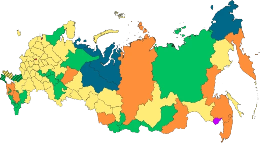
Komi Republic
A republic of Russia in northeast European Russia, known for its vast forests, mineral wealth, and the Manpupuner rock formations.

The Komi Republic, sometimes simply referred to as Komi, is a republic of Russia situated in the northeast of European Russia. Its capital is the city of Syktyvkar. The population of the republic at the 2021 census was 737,853, down from 901,189 at the 2010 census.
- Capital
- Syktyvkar
- Area
- 415,900 square kilometers
- Population (2021 census)
- 737,853
- Highest point
- Mount Narodnaya (1,894 m)
- Official language
- Russian (Komi also recognized)
- Head of government (2024)
- Rostislav Goldshteyn
Lore & Background
The Komi people first feature in the records of the Novgorod Republic in the 11th century. The Novgorodians called these lands Zavolochye and referred to the Komi as 'the Chud beyond the portage'. The Moscow principality expanded into Komi territories in the 14th and 15th centuries. Stephen of Perm created the first alphabet for the Komi. After Novgorod was annexed by Moscow, the Komi territories came under Moscow's influence in the late 15th and early 16th century. The site of Syktyvkar, settled from the 16th century, was known as Sysolskoye; in 1780 it was renamed Ust-Sysolsk and used as a penal colony. The Komi-Zyryan Autonomous Oblast was established on August 22, 1921, and on December 5, 1936, it was reorganized into the Komi Autonomous Soviet Socialist Republic. Many early 20th-century settlers were Gulag prisoners who built cities including Ukhta, Pechora, Vorkuta, and Inta, as well as railways and roads. On 21 March 1996 the Komi Republic signed a power-sharing agreement with Russia, which was abolished on 20 May 2002.
Reader's Guide
The republic is situated west of the Ural Mountains, in the northeast of the East European Plain. Area: 415,900 km². Borders: Nenets, Yamalo-Nenets, Khanty–Mansi, Sverdlovsk, Perm Krai, Kirov, and Arkhangelsk. Highest point: Mount Narodnaya (1,894 m). Major rivers include Izhma, Mezen, Pechora, Sysola, Usa, Vashka, Vychegda, and Vym. Major lakes include Sindorskoye and Yam-Ozero. Natural resources include coal, oil, natural gas, gold, diamonds, and timber. The Virgin Komi Forests are a UNESCO World Heritage Site. Winters are long and cold; summers short and warm. Average January temperature: −17 °C (south) to −20 °C (north). Average July temperature: 11 °C (north) to 15 °C (south). Lowest recorded temperature: −58.1 °C (village of Ust-Shchuger). Average annual precipitation: 625 mm. Manpupuner, a site of seven rock towers, is one of the 'Seven Wonders of Russia'. The republic is divided into 12 raions. Major industries include oil processing, timber, woodworking, paper, natural gas, and electric power. Major industrial centers: Syktyvkar, Inta, Pechora, Sosnogorsk, Ukhta, and Vorkuta. Railroad transportation is well developed; the most important line is Kotlas–Vorkuta–Salekhard. Rivers Vychegda and Pechora are navigable. Airports in Syktyvkar, Ukhta, and Vorkuta.
Did You Know?
- The Komi Republic is the second-largest federal region by area in European Russia after Arkhangelsk Oblast.
- The Virgin Komi Forests are the first natural UNESCO World Heritage Site in Russia and the largest expanse of virgin forests in Europe.
- The highest point in the republic is Mount Narodnaya at 1,894 m.
- The Manpupuner rock formations are considered one of the 'Seven Wonders of Russia'.
More in Russian Federal Subjects 1-20
Spotted an error? Know more?
This is a living reference — every entry is fact-audited, and reader corrections feed straight into our audit queue. Suggest an edit · See this site's audit record