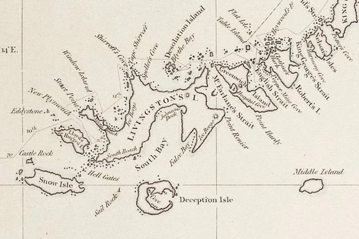
Gazetteer
A geographical dictionary or directory used with maps.

A gazetteer is a type of geographical dictionary or directory designed to be used alongside a map or atlas. It typically includes details on a place’s geography, social statistics, and physical features, such as location, the dimensions of peaks and waterways, population, gross domestic product, and literacy rate. This information is usually organized by topic, with entries listed alphabetically.
Gazetteers have ancient roots. The earliest known examples come from the Hellenistic era in Greece. The first Chinese gazetteer appeared by the first century, and after the rise of print media in China during the ninth century, the local gentry began producing them as sources of information and local pride. In the sixth century, the geographer Stephanus of Byzantium wrote a geographical dictionary (now partially lost) that later influenced European compilers. Modern gazetteers are found in library reference sections and online.
**Etymology**
The Oxford English Dictionary defines a "gazetteer" as a "geographical index or dictionary." The word entered English in 1693, when British historian Laurence Echard published "The Gazetteer's: or Newsman's Interpreter: Being a Geographical Index." Echard noted that the title "Gazetteer's" was suggested by a "very eminent person" he did not name. In the 1704 second part, he referred to the book simply as "the Gazeteer." Historian Robert C. White suggests the unnamed person was Echard’s colleague Edmund Bohun, whom Echard likely avoided mentioning because Bohun became linked to the Jacobite movement. Since the 18th century, "gazetteer" has also been used to mean a daily newspaper, such as the *London Gazetteer*.
**Types and organization**
Gazetteers are categorized by the type and scope of information they present. World gazetteers typically list countries alphabetically with statistics for each, and some include data on cities, towns, villages, and other settlements. Short-form gazetteers, often used with computer mapping and GIS systems, may simply list place-names with their latitude and longitude or other spatial references (e.g., British National Grid). These short-form versions appear as place-name indexes in major atlases. Descriptive gazetteers include lengthy text about places, covering industries, government, geography, history, maps, and photographs. Thematic gazetteers list places or features by theme, such as fishing ports, nuclear power stations, or historic buildings; their common element is that geographic location is a key attribute. Editors gather facts from official government reports, censuses, chambers of commerce, and other sources, organizing them into digest form.
**History**
**Western world: Hellenistic and Greco-Roman eras**
In his 1923 article "Alexander and the Ganges," historian W.W. Tarn called a list and description of satrapies from Alexander’s Empire, written between 324 and 323 BC, an ancient gazetteer. Tarn noted the document dates no later than June 323 BC because it shows Babylon not yet divided by Alexander’s generals. It was later revised by the Greek historian Diodorus Siculus in the 1st century BC. In the 1st century BC, Dionysius of Halicarnassus described the chronicle-style writing of logographers before Herodotus (before the 480s BC), saying they wrote separate accounts for each people and city rather than connected histories. Historian Truesdell S. Brown argued this work should be categorized as a gazetteer, not a true history. Francis Celoria noted that both Ptolemy and Pausanias of the 2nd century AD provided gazetteer information on geographical terms.
Perhaps predating Greek gazetteers were those from ancient Egypt. Penelope Wilson (Department of Archaeology, Durham University) described an Egyptian papyrus from Tanis (a city founded during the Twentieth Dynasty) that lists for each administrative area: the name of a nome capital, its sacred barque, sacred tree, cemetery, festival date, forbidden objects, local god, land, and lake. This data codification, likely made by a priest, parallels similar editions on temple walls at Edfu.
**Medieval and early modern eras**
The Domesday Book, initiated by William I of England in 1086, was a government survey of all English administrative counties, used to assess farmsteads and landholders for taxation. It listed numerous English castles, though scholars debate the exact count. The book details that out of 3,558 registered houses destroyed in 112 boroughs, 410 of these destructions occurred in a specific context.
- first_known_Chinese_gazetteer
- Ninth century
Lore & Background
The Oxford English Dictionary defines a gazetteer as a 'geographical index or dictionary'. Echard wrote that the title was suggested by a 'very eminent person' he did not name. Historian Robert C. White suggests this person was Edmund Bohun, whom Echard may have avoided mentioning due to Bohun's association with the Jacobite movement. Since the 18th century, 'gazette' has also been used to mean a daily newspaper, such as the London Gazette. Ancient Greek gazetteers existed since the Hellenistic era. The first known Chinese gazetteer was released by the ninth century, and with print media in China by the ninth century, the Chinese gentry produced local gazetteers as sources of information and local pride. The geographer Stephanus of Byzantium wrote a geographical dictionary in the sixth century (now partially missing) that influenced later European compilers. Modern gazetteers are found in libraries and on the internet.
Reader's Guide
Gazetteers serve as essential reference tools that organize geographical information in digest form. They are often categorized by type and scope: world gazetteers list countries with statistics; short-form gazetteers provide place-names with coordinates and appear as indexes in atlases; descriptive gazetteers include lengthy textual descriptions with maps and photographs; thematic gazetteers list places by theme (e.g., fishing ports, nuclear power stations). Editors gather facts from official government reports, censuses, chambers of commerce, and other sources. Historically, gazetteers have been used for administration, taxation, and military conscription. Pierre Duval wrote various geographical dictionaries on abbeys and ancient sites. Gazetteers remain vital for mapping, GIS systems, and general reference.
Did You Know?
- The first known Chinese gazetteer was released by the ninth century.
More in Phantom Places & Discovery 1-24
Spotted an error? Know more?
This is a living reference — every entry is fact-audited, and reader corrections feed straight into our audit queue. Suggest an edit · See this site's audit record