Cape Reinga
Sacred Māori departure point for spirits and popular tourist destination.

via Wikipedia: Headland · see source
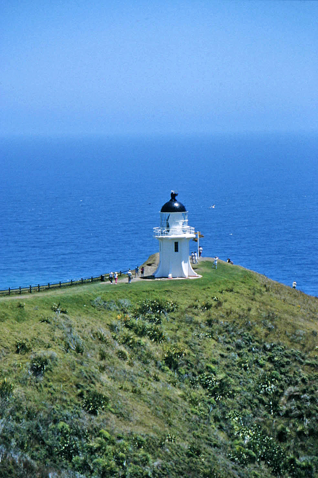
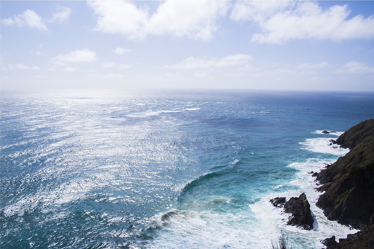
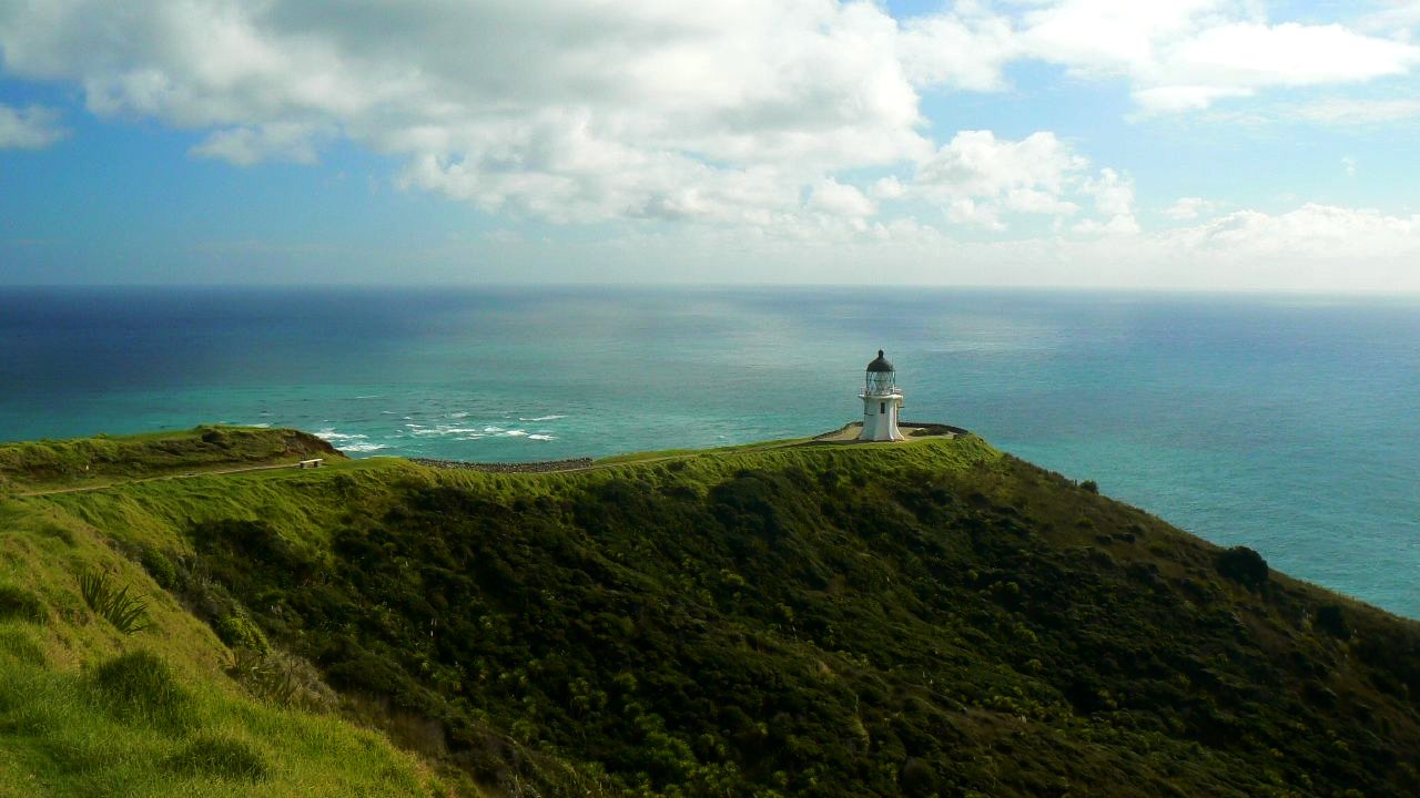
Cape Reinga, officially known as Cape Reinga / Te Rerenga Wairua, is a headland situated at the northwesternmost tip of the Aupōuri Peninsula, at the northern end of New Zealand’s North Island. It lies more than 100 kilometers north of the nearest small town, Kaitaia. In Māori, the name Te Rerenga Wairua translates to “the leaping-off place of spirits,” while Reinga refers to the underworld. These names stem from the Māori belief that the cape is the point where the spirits of the dead depart the mainland, climbing the roots of an 800-year-old pōhutukawa tree to descend into the underworld and return to their traditional homeland of Hawaiki. A spring on the hillside, Te Waiora-a-Tāne, once played a role in ceremonial burials, representing spiritual cleansing, but it disappeared after being capped for a reservoir. Geographically, the cape is widely considered the separation marker between the Tasman Sea to the west and the Pacific Ocean to the east, where the two seas clash to create unsettled waters. Māori refer to this meeting as the joining of Te Moana-a-Rehua and Te Tai-o-Whitirea. Although often mistaken for the northernmost point of mainland New Zealand, the Surville Cliffs at North Cape, 30 kilometers east, extend three kilometers further north. The cape is a major tourist destination, attracting over 500,000 visitors annually, with numbers growing by about five percent each year. Access is via State Highway 1, which was fully sealed in 2010 after years of being an unsealed gravel road for its final 19 kilometers. The cape also serves as the northern terminus of the Te Araroa hiking trail. The lighthouse, built in 1941, replaced an earlier one on Motuopao Island and was automated in 1987. In 2007, protests and rising visitor numbers led the Department of Conservation to move the carpark and toilet facilities away from sacred ground, completing the work in 2009.
- location
- North Island, New Zealand
Quick Facts
- Native Name
- mi · Te Rerenga Wairua
- Location
- Northland, New Zealand
- Water Bodies
- Tasman Sea
- Elevation Ft
- <!-- or
Facts from the source article.
Lore & Background
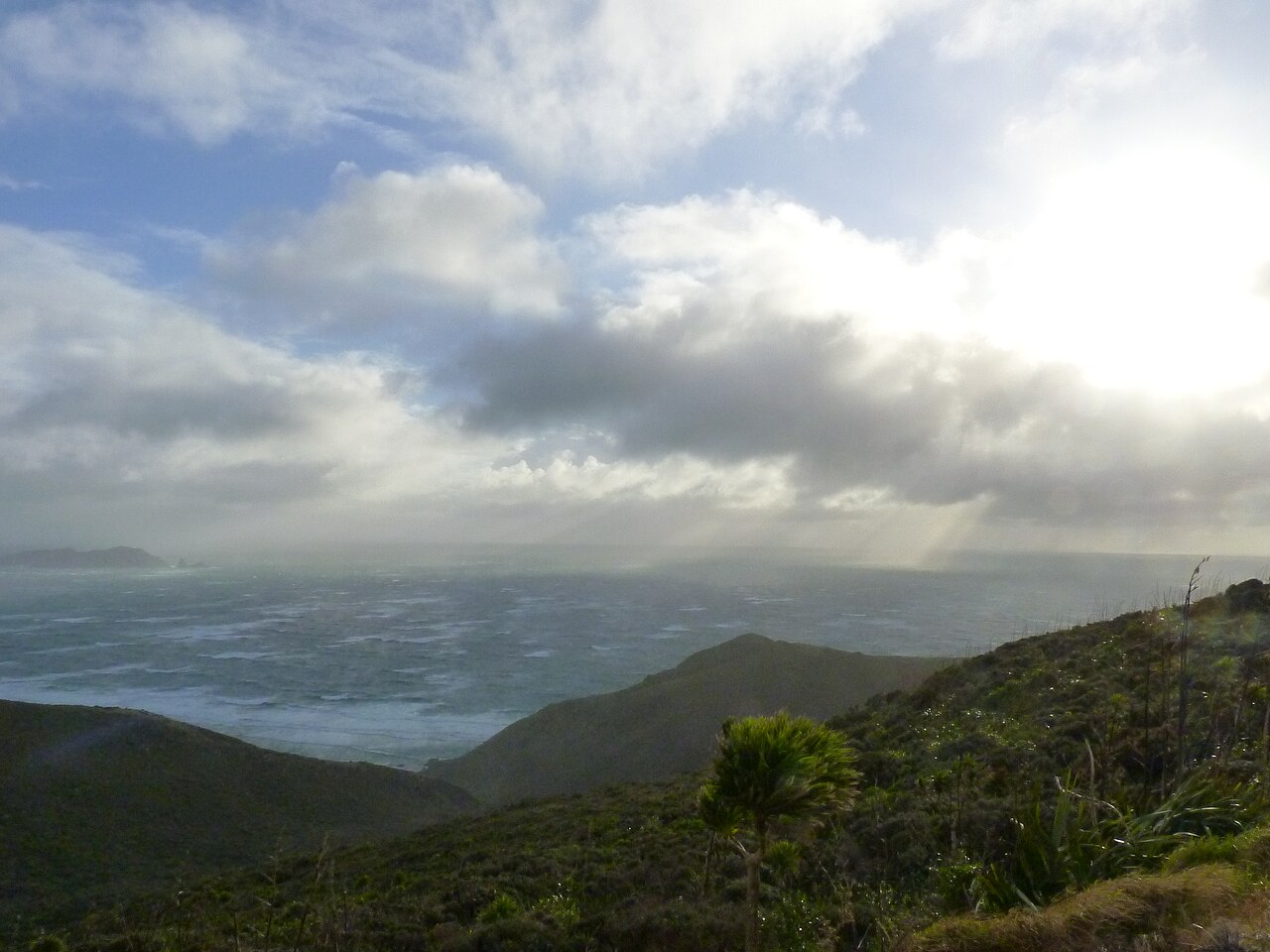
Cape Reinga, officially Cape Reinga / Te Rerenga Wairua, marks the northwesternmost tip of the Aupōuri Peninsula at the northern end of New Zealand’s North Island. It is often mistaken for the country’s northernmost point, but that distinction belongs to the Surville Cliffs at North Cape, located some 30 kilometres to the east. Another nearby headland, Cape Maria van Diemen, lies just to the west and was named by Dutch explorer Abel Tasman in 1642. The cape is generally considered the separation point between the Tasman Sea to the west and the Pacific Ocean to the east. From the lighthouse, visitors can observe the tidal race where these two bodies of water clash, creating unsettled waters; Māori refer to this meeting as that of Te Moana-a-Rehua and Te Tai-o-Whitirea. The cape is more than 100 kilometres north of the nearest small town, Kaitaia. State Highway 1 extends all the way, though until 2010 the final 19 kilometres were an unsealed gravel road. The cape also serves as the northern terminus of the Te Araroa hiking trail. The lighthouse, built in 1941, replaced an earlier one on Motuopao Island from 1879; it was fully automated in 1987, and its original 1000-watt light and Fresnel lens were later replaced by a small 50-watt flashing beacon. The climate is a mild oceanic type with high rainfall and little seasonal temperature variation. Annual visitor numbers exceed 500,000 and are growing by about five percent each year.
Reader's Guide
Cape Reinga holds dual significance as a sacred Māori site and a major tourist attraction. Its cultural importance stems from the belief that spirits of the dead depart here for the underworld, a tradition reflected in its name and mythology. According to Māori tradition, the spirits travel to the cape, leap from the headland, and climb the roots of an 800-year-old pōhutukawa tree to descend to the underworld, briefly pausing at the Three Kings Islands for a final look back. The spring Te Waiora-a-Tāne played a role in burial rites across New Zealand until Christian conversion led to its capping and subsequent disappearance. Ecologically, the cape marks the meeting of the Tasman Sea and the Pacific Ocean, creating a visible tidal clash. The area’s mild oceanic climate supports high precipitation and minimal seasonal temperature variation. The cape is the northern terminus of the Te Araroa hiking trail. A lighthouse, built in 1941 and automated in 1987, now uses a small flashing beacon in place of its original 1000-watt light and Fresnel lens. Annual visitor numbers exceed 500,000 and grow by about five percent each year. In 2007, protests by Māori and rising tourism prompted the Department of Conservation to relocate carpark and toilet facilities away from sacred ground at a cost of NZ$6.5 million, completed in 2009. The final stretch of State Highway 1 to the cape was sealed in 2010, with roadside revegetation using over 150,000 plants to prevent erosion.
Did You Know?
- Cape Reinga is the leaping-off place of spirits in Māori tradition.
- The spring Te Waiora-a-Tāne was used in ceremonial burials for spiritual cleansing.
- After the local population mostly converted to Christianity, the spring was capped with a reservoir, then disappeared and reappeared at the bottom of the cliff.
- From the lighthouse, visitors can watch the tidal race where the two seas clash, known in Māori as the meeting of Te Moana-a-Rehua and Te Tai-o-Whitirea.
- Cape Reinga serves as the northern terminus of the Te Araroa hiking trail.
Defining the Landform
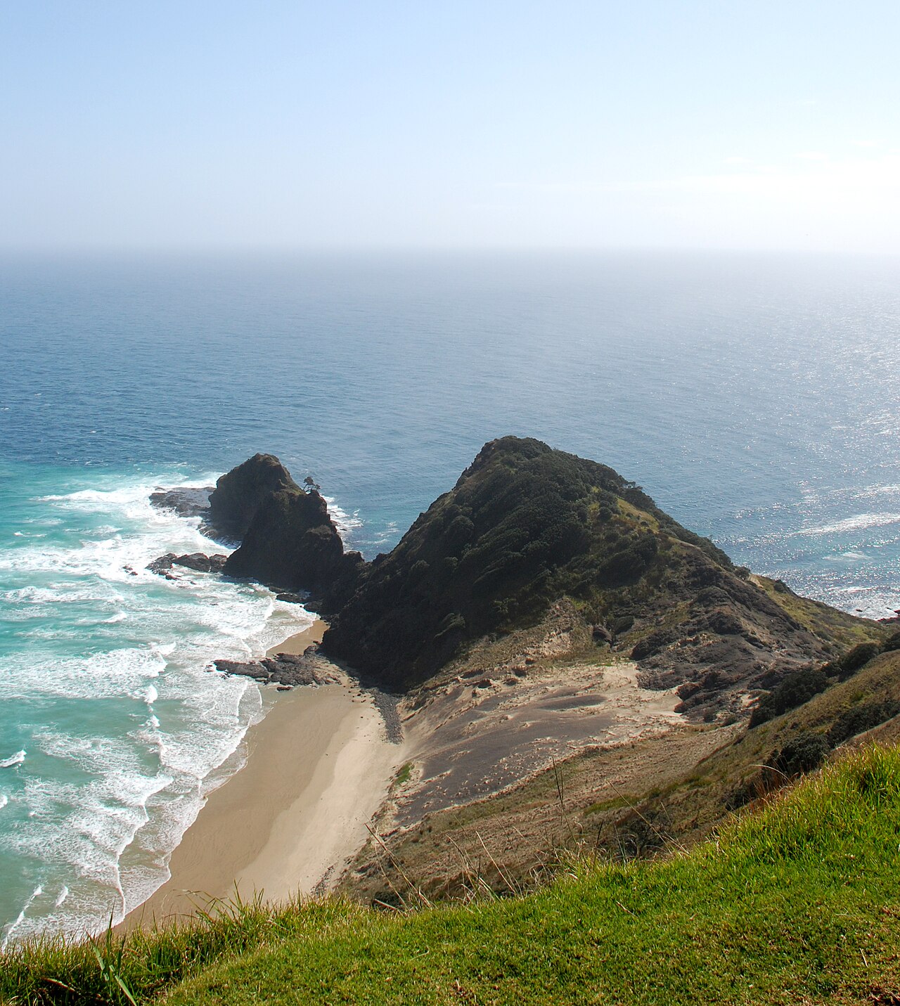
Cape Reinga is classified as a headland — a coastal landform where a point of land, typically elevated and often featuring a sheer drop, extends outward into a body of water. As a type of promontory, it sits at the more prominent end of the coastal landform spectrum; when such a feature reaches considerable size, it earns the designation of a cape, which is precisely the label applied here. The defining physical traits of headlands like this one include high, breaking waves crashing against rocky shores, intense ongoing erosion, and steep sea cliffs that drop dramatically toward the water. These characteristics make headlands among the most visually striking and geologically active features along any coastline, where the relentless force of the sea meets resistant rock in a constant battle of attrition.
The Erosion Engine
The formation of a headland such as Cape Reinga is rooted in the geology of discordant coastlines, where bands of rock with varying degrees of resistance run perpendicular to the shore. Over vast stretches of time, the sea preferentially attacks the weaker strata — sands and clays that yield relatively easily — while the more resistant layers, composed of materials like chalk, limestone, or granite, survive the assault and project outward as prominent points of land. This differential erosion is what sculpts the headland from the surrounding coastline. The result is a feature flanked by water on three sides, in contrast to a bay, which is enclosed by land on three sides. The headland and its adjacent bay are, in essence, two halves of the same geological story, born from the same alternating rock bands and shaped by the same relentless hydraulic force.
A Cyclical Coastal Story
The lifecycle of a headland is not static but part of a long, repeating coastal rhythm. As the sea gnaws at the headland's cliffs, sediment is deposited within the neighboring bay, gradually filling it in. Simultaneously, the headland itself is worn back, its sheer cliffs retreating and its rocky shores reshaped by the high, breaking waves that define these features. Eventually, the coastline straightens out as the bay fills and the headland diminishes, after which the same erosional process begins anew elsewhere along the shore. This cyclical pattern of creation, erosion, and renewal means that a headland like Cape Reinga is never truly finished; it is perpetually being remade by the interplay of resistant rock, weak strata, and the ceaseless motion of the sea.
Among New Zealand's Promontories
Cape Reinga occupies a place within a broader family of notable headlands that dot the New Zealand coastline. It is listed alongside Cape Egmont, Cape Foulwind, East Cape, North Cape, and Young Nick's Head — a collection of prominent coastal points that together illustrate the diversity of headland forms found across the country. Each of these features shares the fundamental headland character: a point of land extending into water, typically elevated, often with a sheer drop, and subject to the high breaking waves, rocky shores, and intense erosion that define the category. Yet each presents its own particular expression of that template, shaped by the specific rock bands and coastal dynamics of its location. Cape Reinga's inclusion among these named sites underscores its recognition as a headland of considerable size — the threshold at which a promontory earns the more prestigious title of cape.
Gallery
Frequently Asked Questions
What is Cape Reinga?
Cape Reinga, also called Te Rerenga Wairua in Māori, is the northwesternmost point of the Aupōuri Peninsula. It sits at the very top of New Zealand's North Island and is recognized as one of the country's most iconic cape landforms.
What is Cape Reinga's spiritual significance to Māori?
In Māori tradition, the cape is believed to be the place where the spirits of the deceased leave the physical world and depart toward the afterlife. This belief makes it a deeply sacred site for Māori communities.
How popular is Cape Reinga as a tourist destination?
The cape draws well over half a million visitors every year, making it one of New Zealand's most heavily visited natural landmarks. Its dual identity as a dramatic scenic headland and a culturally significant site keeps it at the top of travelers' itineraries.
More in Peninsulas And Cape Landforms 1-24
Related in Peninsulas And Cape Landforms
Links follow this subject's own source article.
Spotted an error? Know more?
This is a living reference — every entry is fact-audited, and reader corrections feed straight into our audit queue. Suggest an edit · See this site's audit record