Cape Canaveral
Historic cape and major U.S. rocket launch site.

via Wikipedia: Cape (geography) · see source
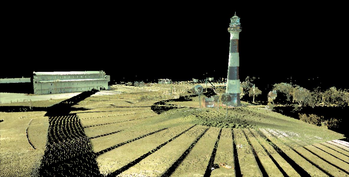
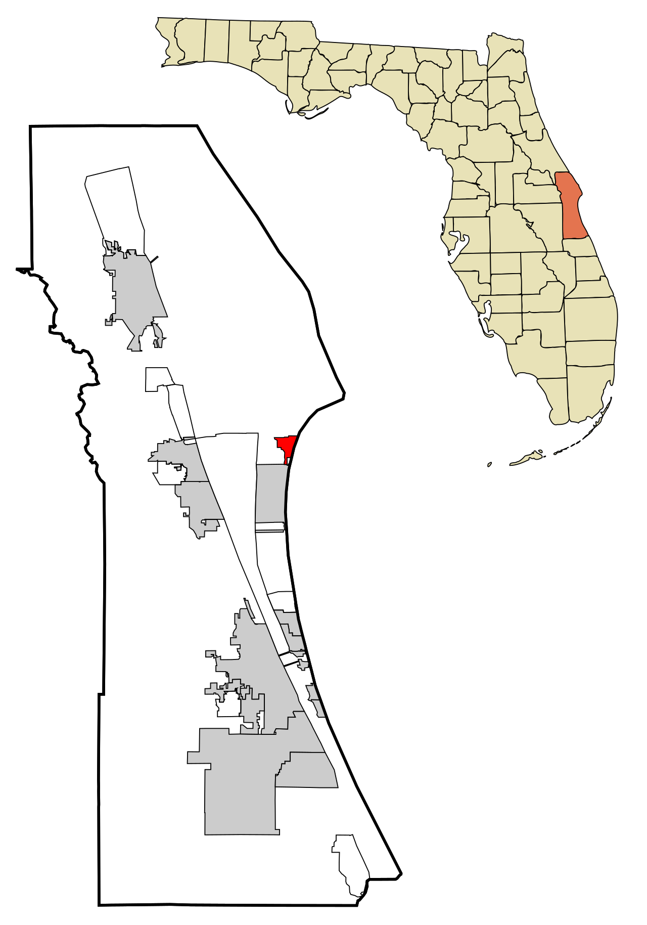
Cape Canaveral is a cape on Florida’s Atlantic coast, near the center of the state, lying east of Merritt Island and separated from it by the Banana River. It is part of the Space Coast region and hosts the Cape Canaveral Space Force Station, a major launch site for U.S. spacecraft. The adjacent Kennedy Space Center on Merritt Island is often conflated with the station due to the many launches from both locations. Other notable features include Port Canaveral, a leading cruise port, and the Cape Canaveral Lighthouse. The nearby city of Cape Canaveral lies south of the port district, while the area also encompasses Mosquito Lagoon, the Indian River, the Merritt Island National Wildlife Refuge, and the Canaveral National Seashore.
Human habitation in the area dates back at least 12,000 years. During the middle Archaic period (5000–2000 BC), the Mount Taylor period culture covered northeast Florida, including the cape. It was succeeded by the Orange culture (2000–500 BC), one of the earliest in North America to produce pottery, and then by the St. Johns culture (500 BC to after European contact). The Indian River area was part of the St. Johns culture’s Indian River variant, with influences from the Belle Glade culture to the south. During the first Spanish colonial period, the Ais people occupied the Indian River area south of the cape, while the Surruque people lived north around Mosquito Lagoon; the Surruque were allied with the Ais, though their language affiliation is unclear.
Spanish explorers named the cape “Canaveral” in the first half of the 16th century, meaning “reed bed” or “sugarcane plantation.” It is the third oldest surviving European place name in the United States, first applied during Francisco Gordillo’s 1521–1525 explorations. An early alternative name was “Cape of Currents,” and the name appeared on maps by at least 1564. The cape became a landing spot for shipwrecked sailors, including English privateer John Hawkins and his journalist John Sparke in the 16th century, as well as French survivors from Jean Ribault’s colony who built a fort from their wrecked ship’s timbers in 1565. In December 1571, Spanish governor Pedro Menéndez was wrecked there and encountered the Ais. From 1605 to 1606, Governor Pedro de Ibarra sent Alvaro Mexia on a successful diplomatic mission to the Ais, securing ransoms for returned shipwrecked sailors.
The fir
- Location
- Brevard County, Florida, United States
- Notable features
- Cape Canaveral Space Force Station, Port Canaveral, Cape Canaveral Lighthouse
Lore & Background
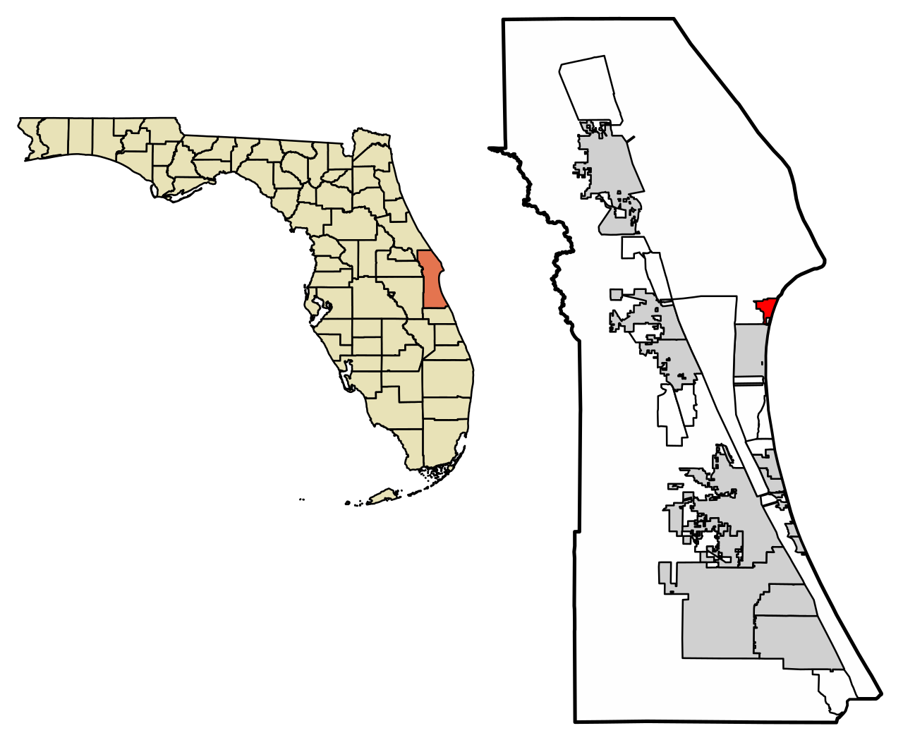
Cape Canaveral is a cape situated on the Atlantic coast of Florida, near the center of that coastline, within Brevard County. It lies east of Merritt Island, from which it is separated by the Banana River. The cape is part of the Space Coast region and is the location of the Cape Canaveral Space Force Station. The area also includes Port Canaveral, a major cruise port, and the Cape Canaveral Lighthouse. The city of Cape Canaveral is located just south of the port district. Nearby natural features include Mosquito Lagoon, the Indian River, the Merritt Island National Wildlife Refuge, and the Canaveral National Seashore. The cape is a point of land projecting into the Atlantic Ocean, where swift currents historically made it a landing site for shipwrecked sailors, leading to an early alternative name, "Cape of Currents." The name "Canaveral," meaning a reed bed or sugarcane plantation in Spanish, is the third oldest surviving European place name in the United States. The cape was noted on maps by the early 16th century, with the name first applied during Spanish explorations in the 1520s. The area has been inhabited by humans for at least 12,000 years, with successive Indigenous cultures including the Mount Taylor, Orange, and St. Johns cultures. In the early Spanish colonial period, the Ais people occupied the area south of the cape, while the Surruque people lived to the north.
Reader's Guide
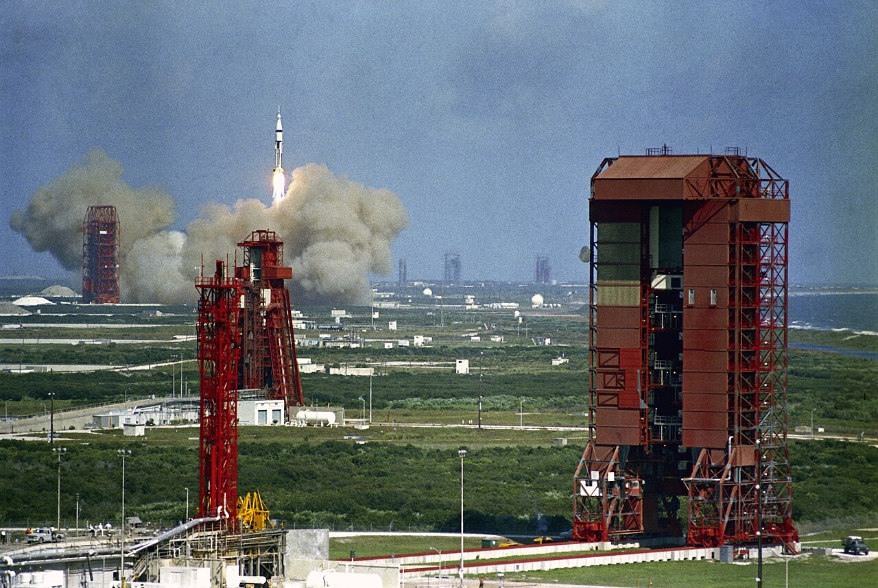
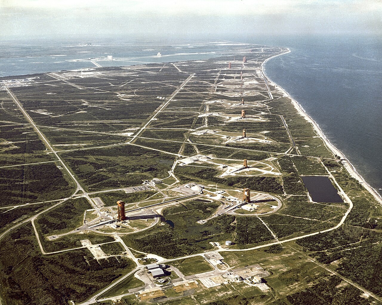
Cape Canaveral’s significance is rooted in its selection as a rocket launch site, a decision that leveraged the Earth’s rotational speed and the open ocean downrange. This role began in 1950 with the first paved access road and permanent launch pad, followed by the launch of a V-2 rocket that July. The cape is the location of the Cape Canaveral Space Force Station, and because spacecraft have also launched from the adjacent Kennedy Space Center on Merritt Island, the two facilities are often mistaken for one another. Ecologically, the cape is part of a region that includes Mosquito Lagoon, the Indian River, the Merritt Island National Wildlife Refuge, and the Canaveral National Seashore. Its human history spans at least 12,000 years, with successive Indigenous cultures—the Mount Taylor, Orange, and St. Johns peoples—occupying the area. By the early 16th century, Spanish explorers had named the cape “Canaveral,” meaning reed bed, making it the third oldest surviving European place name in the United States. The cape’s strong currents made it a landing point for shipwrecked sailors, and a lighthouse was completed in 1848 to warn of coral shoals. A hurricane in 1885 pushed a wall of water over the barrier island, eroding the beach and forcing the lighthouse’s relocation inland. In the 20th century, the area developed as a farming and fishing community, with Port Canaveral, now a major cruise port, constructed starting in 1950.
Did You Know?
- The cape was officially renamed Cape Kennedy from 1963 to 1973, after President John F. Kennedy.
- The Kennedy Space Center on adjacent Merritt Island retains the Kennedy name after the cape's original name was restored.
A Promontory Defined
Cape Canaveral is a headland or promontory extending into a body of water, situated on the Florida coast in the United States. Like all capes, it represents a marked change in the trend of the coastline, making it a conspicuous visual landmark for those traveling along the shore. Its position as a point where the land juts outward into the sea gives it a distinctive silhouette that sets it apart from the surrounding coastal terrain. As a geographic feature, it belongs to the broader category of capes found worldwide, from Cape Horn in Chile to the Cape of Good Hope in South Africa, each representing a dramatic shift in the direction of the shoreline. In the United States, it shares this classification with other well-known points such as Cape Hatteras in North Carolina, Cape Fear also in North Carolina, and Cape Lookout, all of which serve as prominent markers along their respective coasts.
Forged by Earth's Forces
The creation of capes like Cape Canaveral involves powerful geological processes. Erosion plays a central role in shaping these landforms, as waves and currents gradually wear away softer rock while leaving behind more resistant formations. In some cases, movements of the Earth's crust uplift land to create new coastal protrusions, as seen with the Cape of Good Hope formed by tectonic forces. Volcanic activity can also deposit lava that solidifies into new land, as demonstrated by Cape Verde. Glacial carving during periods of ice advance and retreat has shaped other capes, such as Cape Cod in Massachusetts. While the specific formation mechanism for Cape Canaveral is not detailed in the available records, it shares the fundamental characteristic of all capes: a landform sculpted by the interplay of geological forces and coastal erosion over time.
A Beacon for Navigators
Capes have served as critical visual reference points for sailors since antiquity, and Cape Canaveral's position as a marked change in the Florida coastline places it within this long tradition of maritime wayfinding. In the ancient world, Greek and Roman mariners relied on headlands to orient their vessels, and some were even considered sacred, with temples erected nearby in honor of sea deities. Greek peripli, such as the Periplus of Pseudo-Scylax, documented the capes a sailor would encounter along specific routes, using them to define the shape of islands and coasts. Homer's epics reference capes like Cape Malea and Cape Sounion as points of peril or passage. The three great capes, Cape of Good Hope, Cape Leeuwin, and Cape Horn, defined the traditional clipper routes between Europe and the Far East. Cape Canaveral, as a prominent Florida headland, fits into this global network of coastal landmarks that have guided seafarers for millennia.
Launch Station on a Shifting Coast
Cape Canaveral's modern identity is inseparable from its role as the site of Cape Canaveral Space Force Station, a launch station operated by the United States Space Force. This designation transforms a natural coastal promontory into a critical node in the nation's space infrastructure. Yet the very geology that made this cape a striking landmark also renders it vulnerable. Capes are prone to natural erosion, primarily through tidal actions, which gives them a relatively short geological lifespan compared to other landforms. The constant assault of waves and currents against the exposed headland means that the shoreline at Cape Canaveral is not static but subject to gradual reshaping. This tension between the enduring human purpose built upon the cape and the impermanent nature of the landform itself creates a unique dynamic: a place where the most advanced technology in human history operates atop a piece of coastline that the sea is slowly reclaiming.
Gallery
Frequently Asked Questions
What is Cape Canaveral?
Cape Canaveral is a coastal cape in Brevard County, Florida, sitting along the Atlantic shoreline within the Space Coast region. It is best known as the home of America's primary rocket launch facility, the Cape Canaveral Space Force Station.
Why is Cape Canaveral so important to space history?
The cape has served as the launch site for countless U.S. spacecraft, with its very first rocket launch—a V-2 Bumper 8 missile—taking place on July 24, 1950. That single event kicked off decades of milestone spaceflights originating from this stretch of Florida coast.
What was Cape Canaveral called before its current name?
Between 1963 and 1973, the cape carried the official name Cape Kennedy in tribute to President John F. Kennedy. In 1973 the name was reverted to the original Spanish-derived Cape Canaveral.
Who first named Cape Canaveral and when?
Spanish explorer Francisco Gordillo assigned the cape its original name, Cabo Cañaveral, during early European voyages along Florida's coast between 1521 and 1525.
What notable landmarks can visitors find on Cape Canaveral?
In addition to the Space Force Station, the cape features the historic Cape Canaveral Lighthouse and the commercial Port Canaveral. The surrounding area has been served by the 321 telephone area code since 1999.
More in Peninsulas And Cape Landforms 1-24
Related in Peninsulas And Cape Landforms
Links follow this subject's own source article.
Spotted an error? Know more?
This is a living reference — every entry is fact-audited, and reader corrections feed straight into our audit queue. Suggest an edit · See this site's audit record