Bōsō Peninsula
Peninsula on Honshū, Japan.

Copernicus Sentinel-2, ESA · CC BY-SA 3.0 igo
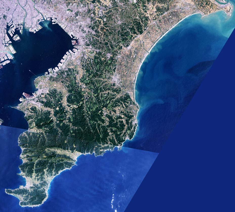
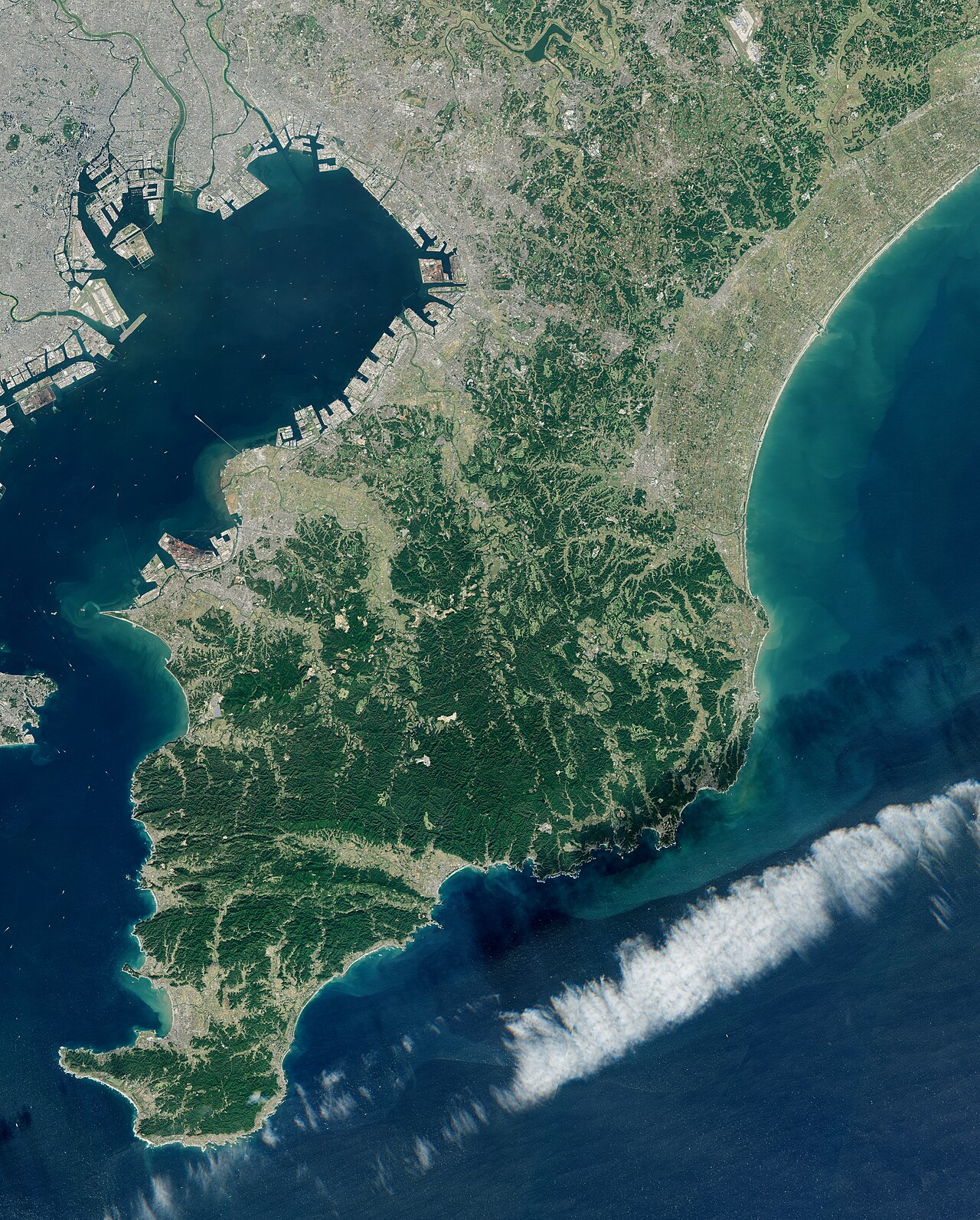
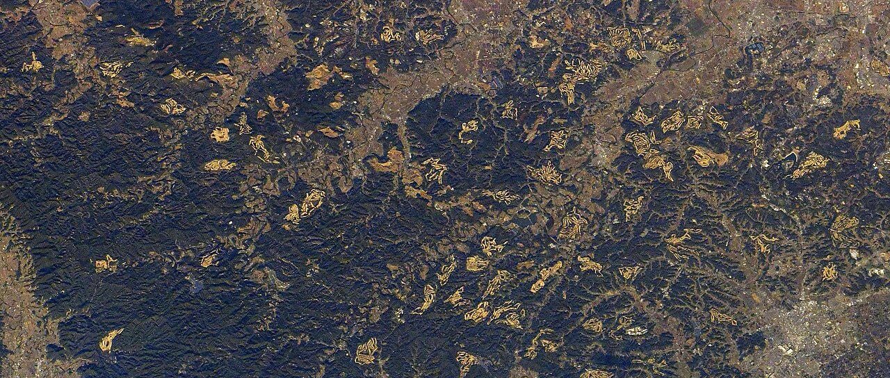
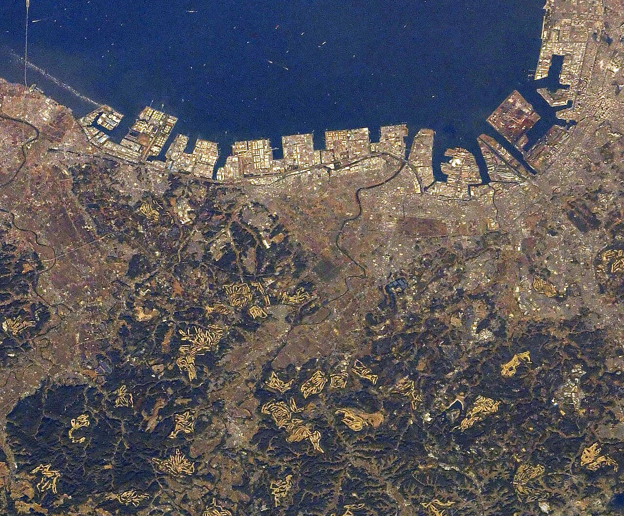
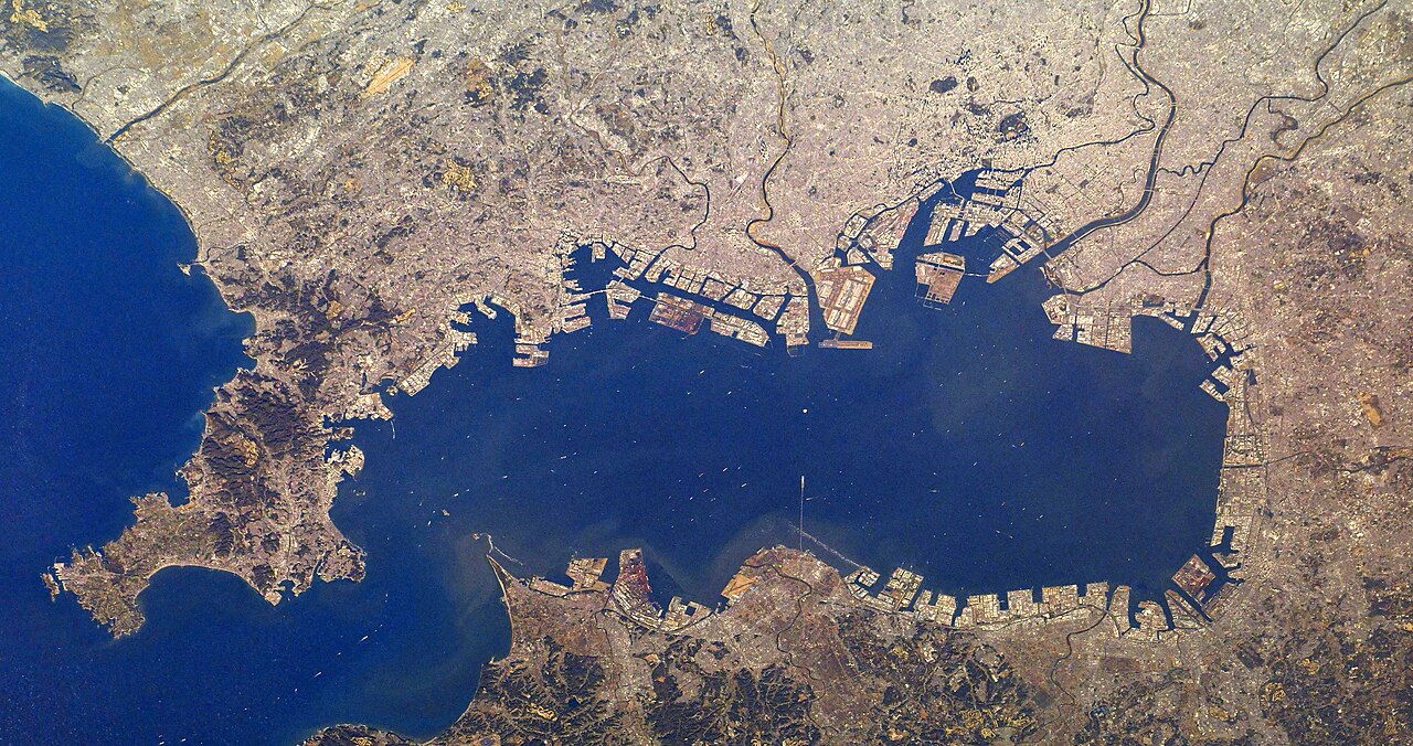
The Bōsō Peninsula comprises the entirety of Chiba Prefecture on Honshu, Japan’s largest island, and forms part of the Greater Tokyo Area. It serves as the eastern boundary of Tokyo Bay, separating that body of water from the Pacific Ocean. The peninsula covers roughly 5,034 square kilometers. Its natural borders are defined by the Pacific Ocean to the east and south, Tokyo Bay to the west, and the Edo and Tone rivers to the north. The southern portion of the peninsula is dominated by the Bōsō Hill Range, which forms its backbone; the highest point is Mount Atago, located in Minamibōsō and Kamogawa, reaching an elevation of 408.2 meters. Moving from south to north, the hill range transitions into the Shimōsa Plateau, which covers much of northern Chiba Prefecture, eventually giving way to lower terrain near the Tone River. The northern and western parts of the peninsula are heavily urbanized. The Shimōsa Plateau, along with coastal lowlands and interior river valleys, is primarily used for rice cultivation. The western coast hosts the Keiyō Industrial Zone, stretching from Urayasu near Tokyo’s border in the northwest down to Futtsu in the south. The Tokyo Bay Aqua-Line, a combined bridge and tunnel, connects Kisarazu on the peninsula with Kawasaki in Kanagawa Prefecture across Tokyo Bay. The northeastern portion of the peninsula contains Suigo-Tsukuba Quasi-National Park, which extends into Ibaraki Prefecture, while much of the eastern coast is designated as Minami Bōsō Quasi-National Park. The name Bōsō derives from the former provinces of Awa, Kazusa, and Shimōsa. The Japan Meteorological Agency refers to the western and eastern coasts as Uchibō and Sotobō, respectively.
- Location
- Honshu, Japan
Quick Facts
- Map Image
- Japan · relief=yes · mark=Red circle.svg · marksize=23 · lat_deg=35 · lat_min=26 · lat_sec=19 · lat_dir=N · lon_deg=140 · lon_min=14 · lon_sec=50 · lon_dir=E
- Location
- Kantō Region, Chiba Prefecture, Japan
- Surface Elevation Ft
- <!-- or
- Highest Point
- Mount Atago
- Highest Elevation
- 408.2 m
- Area
- 5034 km2
- Free Label 1
- River
- Free Data 1
- Tone River, Edo River, Obitsu River, Yōrō River, Koito River
Facts from the source article.
Lore & Background
The Bōsō Peninsula is one of five peninsulas on the island of Honshū. It shares this distinction with Oshika-hanto, Noto-hanto, Oga-hanto, and Miura-hanto, each representing a distinct projection of land into the surrounding waters. The listing places Bōsō-hanto as the final entry in the Honshū sequence, following the other four. Each of these peninsulas, by definition, is bordered predominantly by water while maintaining its connection to the mainland body of Honshū. The surrounding waters are understood to be continuous, even if they are not all given a single collective name. This grouping of five coastal projections on a single island highlights the complexity of Japan's main island and the variety of shapes that peninsular landforms can assume, from the more prominent cape-like extensions to the subtler tapering points.
Reader's Guide
The Bōsō Peninsula is significant as one of five peninsulas on Honshū. Its geography is defined by its classification as a peninsula: a piece of land that is bordered mostly by water but connected to mainland. The surrounding water is usually understood to be continuous, though not necessarily named as such. A peninsula can also be a headland, cape, island promontory, bill, point, or spit. A point is generally considered a tapering piece of land projecting into a body of water that is less prominent than a cape. Bōsō-hanto occupies this spectrum of coastal terminology, representing one of the many ways land and water interact along Japan's main island. The name Bōsō-hanto follows the Japanese convention of appending the suffix -hanto to a place name, paralleling the way English uses the word "peninsula" from the Latin paeninsula, itself a compound of paene ("almost") and insula ("island").
Did You Know?
- Bōsō-hanto is one of five peninsulas on the island of Honshū, alongside Oshika-hanto, Noto-hanto, Oga-hanto, and Miura-hanto.
- The name Bōsō-hanto follows the Japanese convention of appending the suffix -hanto to a place name.
- The term 'peninsula' comes from the Latin paeninsula, combining paene ('almost') and insula ('island').
- A point is generally considered a tapering piece of land projecting into a body of water that is less prominent than a cape.
Defining the Bōsō Peninsula
Bōsō-hanto is a landform classified under the broader category of peninsulas, a term rooted in the Latin paeninsula, combining paene, meaning "almost," with insula, meaning "island." In practical geographical terms, a peninsula is a stretch of territory that is predominantly enclosed by water yet remains physically attached to a larger landmass. The waters surrounding such a feature are generally understood to form a continuous body, even when they lack a single unified name. Bōsō-hanto, situated on the island of Honshū, fits squarely within this definition. The taxonomy of coastal landforms is not rigid: a single projection can be described as a headland, a cape, an island promontory, a bill, a point, or a spit depending on its shape and prominence. A point, for instance, is typically a tapering extension into the water that is considered less prominent than a cape. Bōsō-hanto occupies this spectrum of coastal terminology, representing one of the many ways land and water interact along Japan's main island.
Bōsō Among Honshū's Coastal Projections
On the island of Honshū, Bōsō-hanto is one of five peninsulas identified in the geographical record. It shares this distinction with Oshika-hanto, Noto-hanto, Oga-hanto, and Miura-hanto, each representing a distinct projection of land into the surrounding waters. Together, these five features illustrate how Honshū's coastline is far from a simple, smooth boundary; instead, it is punctuated by multiple landforms that extend outward into the sea. The listing places Bōsō-hanto as the final entry in the Honshū sequence, following the other four. Each of these peninsulas, by definition, is bordered predominantly by water while maintaining its connection to the mainland body of Honshū. The surrounding waters are understood to be continuous, even if they are not all given a single collective name. This grouping of five coastal projections on a single island highlights the complexity of Japan's main island and the variety of shapes that peninsular landforms can assume, from the more prominent cape-like extensions to the subtler tapering points.
A Peninsula-Rich Archipelago
Bōsō-hanto does not exist in isolation within Japanese geography. The archipelago as a whole is characterized by a remarkable density of peninsular landforms spread across its major islands. On Hokkaidō, the northernmost of the main islands, both the Shiretoko and Shakotan peninsulas project into the surrounding seas. On Honshū, Bōsō-hanto joins four others in defining the island's irregular coastline. Further south, Kyūshū contributes its own set: Nishi-sonogi-hanto, Satsuma-hanto, Ōsumi-hanto, and Shimabara-hanto. This pattern of multiple peninsulas per island suggests that the Japanese archipelago is, in a sense, a landscape shaped by the repeated interplay of land thrusting into water. Bōsō-hanto is thus one thread in a broader tapestry of coastal projections that defines the physical character of Japan. The fact that peninsulas appear on at least three of the main islands underscores how fundamental this landform is to the country's geography.
Nomenclature and Global Placement
The name Bōsō-hanto follows the Japanese convention of appending the suffix -hanto to a place name, paralleling the way English uses the word "peninsula" from the Latin paeninsula, itself a compound of paene ("almost") and insula ("island"). In English, the plural of this term can be rendered as either "peninsulas" or, less commonly, "peninsulae." Bōsō-hanto appears in a global catalogue of peninsulas that spans every inhabited continent and even Antarctica, where features like the Antarctic Peninsula, Edward VII Peninsula, Fletcher Peninsula, Fowler Peninsula, and Martin Peninsula are listed. The catalogue also includes peninsulas in Africa, Europe, North America, and across Asia. Within this vast list, Bōsō-hanto is one of many coastal landforms that share the same fundamental characteristic: a piece of territory predominantly surrounded by water yet tethered to a larger landmass. Its inclusion alongside features as diverse as the Arabian Peninsula, the Deccan Peninsula, and the Iberian Peninsula places it within a universal geographical category.
Gallery
Frequently Asked Questions
What is the Bōsō Peninsula?
It is a large landform that makes up the entirety of Chiba Prefecture on Honshu, Japan's main island. Covering roughly 5,034 square kilometres, it sits within the Greater Tokyo Area.
Where exactly is the Bōsō Peninsula located?
It stretches along the eastern shore of Tokyo Bay on Honshu, acting as the boundary between that bay and the open Pacific Ocean. The Edo and Tone rivers also border portions of its coastline.
What role does the Bōsō Peninsula play geographically?
It forms the eastern rim of Tokyo Bay, effectively separating the bay from the Pacific. This positioning makes it a defining coastal feature of the Greater Tokyo Area.
What is the highest point on the Bōsō Peninsula?
Mount Atago holds that title at 408.2 metres (1,339 ft) above sea level.
Why is the Bōsō Peninsula important?
Because it encompasses all of Chiba Prefecture, it constitutes a major landmass within one of the world's largest metropolitan regions. Its position guarding the eastern entrance to Tokyo Bay gives it lasting geographic and strategic significance for the area.
More in Peninsulas And Cape Landforms 1-24
Related in Peninsulas And Cape Landforms
Links follow this subject's own source article.
Spotted an error? Know more?
This is a living reference — every entry is fact-audited, and reader corrections feed straight into our audit queue. Suggest an edit · See this site's audit record