
Geostationary orbit
A fixed point in the sky for global communications and observation.

NOAA · Public domain
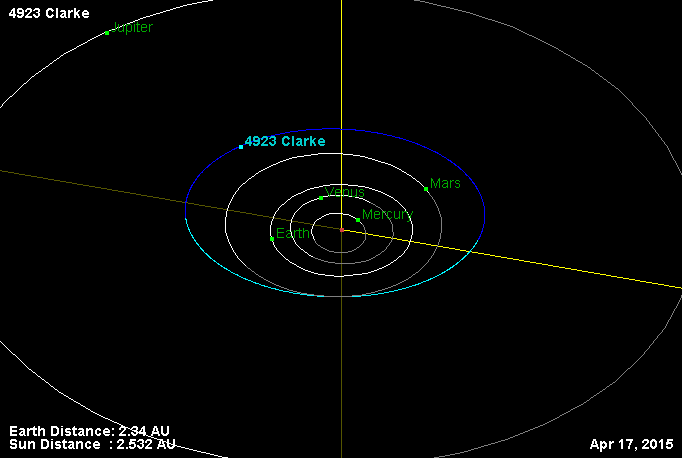
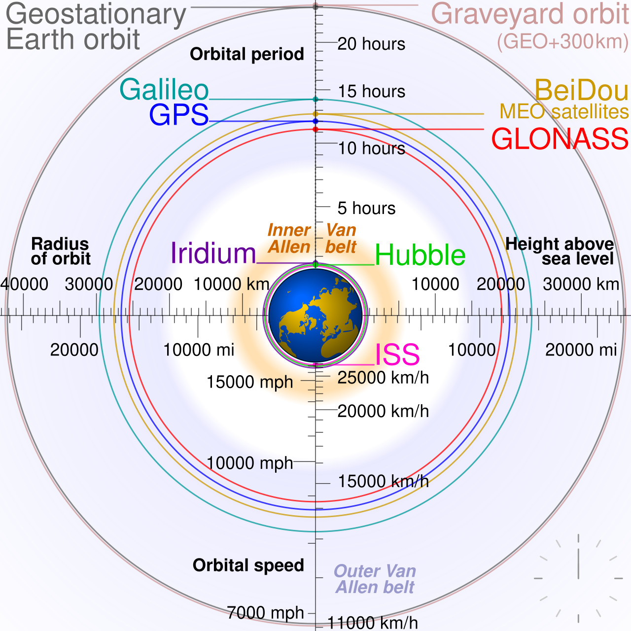
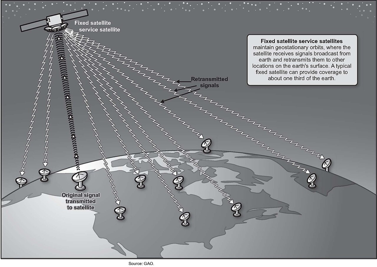
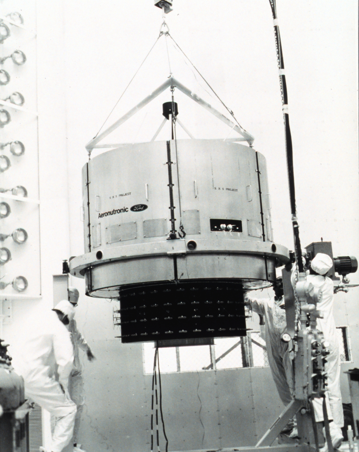
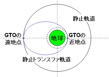
A geostationary orbit is a circular path above Earth’s equator, at an altitude where the orbital period matches Earth’s rotational period—one sidereal day. An object in this orbit follows the direction of Earth’s rotation and, to an observer on the ground, appears fixed in the sky. The concept was popularized by science fiction writer Arthur C. Clarke in the 1940s as a means to revolutionize telecommunications, and the first satellite placed in this orbit was launched in 1963. Communications satellites are commonly positioned here so that ground antennas can be pointed permanently at the satellite without needing to move. Weather satellites also use this orbit for real-time monitoring and data collection, and navigation satellites rely on it to provide a known calibration point for improved positioning accuracy. Geostationary satellites are launched via a temporary orbit and then placed into a specific slot above a point on Earth’s surface, requiring periodic station-keeping to maintain their position. When retired, modern satellites are moved to a higher graveyard orbit to avoid collisions. The first geostationary satellite was designed by Harold Rosen at Hughes Aircraft in 1959, inspired by Sputnik 1. Despite initial skepticism about rocket power and satellite longevity, Syncom 3 became the first satellite in a geostationary orbit in 1964, transmitting live coverage of the Summer Olympics from Japan to America. Today, hundreds of geostationary satellites provide remote sensing and communications, serving areas where terrestrial facilities are unavailable.
- orbital_period
- One sidereal day
- popularized_by
- Arthur C. Clarke (1940s)
- common_uses
- Communications, meteorology, navigation augmentation
Lore & Background
A geostationary orbit is a circular path located directly above Earth's equator, following the planet’s direction of rotation. Its altitude and radius are such that an object in this orbit completes one revolution in exactly one sidereal day, matching Earth’s rotation. To an observer on the ground, the satellite appears fixed in the sky, motionless at a single point. This characteristic makes it ideal for communications, as ground antennas can be aimed permanently at the satellite without needing to track its movement. Weather satellites also use this orbit for continuous real-time monitoring, and navigation satellites rely on it to provide a stable calibration reference. The orbit is sometimes called the Clarke orbit, and the collection of satellites in it is known as the Clarke Belt, after Arthur C. Clarke, who popularized the concept in a 1945 paper for broadcast and relay purposes. The first geostationary satellite was Syncom 3, launched in 1964, which transmitted live coverage of the Summer Olympics from Japan to America. Today, hundreds of such satellites provide remote sensing and communications. Satellites are launched into a temporary orbit before being placed into a specific slot above a point on Earth, requiring periodic station-keeping to maintain position. Retired satellites are moved to a higher graveyard orbit to prevent collisions.
Reader's Guide
The geostationary orbit is a circular path above the equator, at an altitude where a satellite’s orbital period matches Earth’s sidereal day, making it appear fixed in the sky. This concept was popularized by science fiction author Arthur C. Clarke in the 1940s as a means to transform telecommunications, and the first satellite to occupy this orbit was launched in 1963. The orbit is sometimes called the Clarke orbit, and the collection of satellites there is known as the Clarke Belt. Early efforts focused on low and medium Earth orbit constellations, such as the Echo balloons and Telstar 1, because placing a satellite in geostationary orbit was initially considered too costly and impractical. Harold Rosen at Hughes Aircraft designed the first geostationary satellite, overcoming skepticism. Syncom 2, launched in 1963, achieved a geosynchronous but inclined orbit, enabling a phone call between the U.S. President and the Nigerian prime minister. Syncom 3, launched in 1964, became the first true geostationary satellite, transmitting live coverage of the Summer Olympics from Japan to America. Today, hundreds of such satellites provide remote sensing and communications. They are placed in specific slots above the equator and require periodic station-keeping; retired satellites are moved to a higher graveyard orbit. The orbit is vital for communications, as ground antennas can be fixed and inexpensive, though signal latency is significant. It also supports weather satellites for real-time monitoring and navigation satellites that enhance positioning accuracy.
Did You Know?
- Geostationary satellites are placed in a higher graveyard orbit after retirement to avoid collisions.
- At latitudes above about 81°, geostationary satellites are below the horizon and cannot be seen.
The Geometry and Physics of Orbital Paths
An orbit, in the language of celestial mechanics, describes the curved path an object traces when pulled by an attracting force. Whether a planet circles a star, a moon circles a planet, or a human-made satellite loops around a body or even a fixed point in space such as a Lagrange point, the underlying idea is the same: a body in revolution around something external to itself. In the vast majority of practical cases, these paths are not perfect circles but ellipses, with the object being orbited sitting at one of the ellipse's two focal points rather than at its geometric center. This elliptical geometry is a direct consequence of what Kepler codified in his laws of planetary motion. For most everyday calculations, Newtonian mechanics—treating gravity as an inverse-square force—gives results accurate enough. Yet when the highest precision is demanded, Einstein's general theory of relativity offers a deeper picture: gravity is not a force in the Newtonian sense but a manifestation of curved spacetime, and orbiting bodies simply follow the straightest possible paths, called geodesics, through that curvature.
From Celestial Spheres to Elliptical Reality
For centuries, European and Arabic scholars explained the wandering of the planets through a model of nested celestial spheres. Attributed to Hellenistic thinkers like Eudoxus and Aristotle, this framework imagined perfect, rigid rings carrying the stars and planets across an otherwise fixed sky, with no concept of gravitational attraction whatsoever. When observations grew more precise, Ptolemy layered on deferents and epicycles—circles riding on circles—to keep predictions aligned with the sky. The scheme worked, but each new measurement demanded yet another epicycle, making the architecture increasingly baroque. Copernicus later shifted the Sun to the center, trimming the complexity, and the model faced a fresh crisis when comets were seen streaking through the supposed solid spheres. The true breakthrough came from Johannes Kepler, who showed that planetary orbits are ellipses with the Sun at one focus, that a planet's speed varies with its distance from the Sun, and that a single mathematical relationship ties every planet's orbital period to its average distance. These three laws replaced the ancient sphere-and-epicycle picture with a clean, quantitative description of orbital geometry.
Newton's Synthesis and the Conic-Section Framework
Isaac Newton took Kepler's empirical laws and demonstrated that they fall naturally out of a universal law of gravitation. In doing so, he showed that any two bodies attracting each other trace conic-section paths—ellipses, parabolas, or hyperbolas—provided the gravitational influence is assumed to act instantaneously. Newton also established the precise relationship among orbital size, period, and the combined mass of the two bodies, proving that they revolve around their shared center of mass. When one object dwarfs the other, as a satellite does relative to its host planet, it is a convenient approximation to place that center of mass at the center of the heavier body. This framework became the workhorse of orbital calculations for centuries. Building on it, Joseph-Louis Lagrange introduced an energy-centered reformulation of Newtonian mechanics and, together with Euler, identified the special equilibrium positions now called Lagrangian points—locations where a small body can maintain a stable configuration relative to two larger ones. These points remain central to modern mission design, including the placement of satellites at fixed positions in space.
Perturbations, Prediction, and the Relativistic Correction
The tidy two-body picture of a Kepler orbit is only a first approximation. Real systems involve the gravitational tugs of additional bodies and the fact that planets and moons are not perfect spheres, so their surfaces bulge at the equator. Newtonian mechanics was extended to handle these perturbations, and the payoff came in 1846 when Urbain Le Verrier, analyzing unexplained wobbles in Uranus's orbit, pinpointed the location of an unseen planet—Neptune—before it was ever observed through a telescope, a stunning validation of classical gravitational theory. Yet even Newton's framework carries a hidden assumption: that changes in the gravitational field propagate with infinite speed. Einstein's 1916 general theory of relativity removed that assumption by recasting gravity as the curvature of spacetime itself. In this picture, orbiting bodies follow geodesic trajectories, and the Newtonian predictions, while extraordinarily close, are ultimately approximations. Where extreme precision is required, the relativistic corrections become measurable, revealing that the true mechanics of orbital motion are richer than the inverse-square law alone can capture.
Gallery
Frequently Asked Questions
What are Geostationary orbit's powers/role?
Its defining ability is holding a fixed position over a single equatorial point, making it the go-to parking spot for telecom satellites, weather-observation platforms, and navigation-aid spacecraft. Ground stations can aim a dish at one spot in the sky and maintain a continuous link without any tracking motion.
Why is Geostationary orbit important to the canon?
It provides the entire planet with a single, unchanging window in the sky through which global communications, real-time weather imaging, and supplemental navigation data flow. Without that fixed vantage point, continuous coverage over a given region would require constantly repositioning hardware.
More in Orbits And Celestial Mechanics 1-24
Spotted an error? Know more?
This is a living reference — every entry is fact-audited, and reader corrections feed straight into our audit queue. Suggest an edit · See this site's audit record