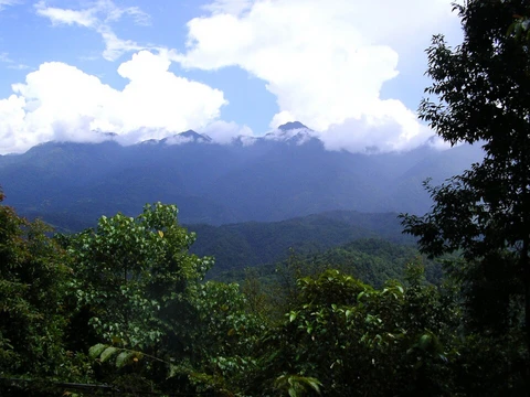
Gates of the Arctic National Park and Preserve
Protects the central Brooks Range, entirely north of the Arctic Circle.

Gates of the Arctic National Park and Preserve safeguards a large section of the central Brooks Range in northern Alaska. As the northernmost U.S. national park, it lies completely above the Arctic Circle. Combined, the park and preserve cover 8,472,506 acres, making it the second-largest unit in the national park system. The national park portion alone, at 7,523,897 acres, is also the second-largest in the country, surpassed only by the national park section of Wrangell–St. Elias.
Originally established as a national monument on December 1, 1978, it was redesignated as a national park and preserve in 1980 with the passage of the Alaska National Interest Lands Conservation Act. Roughly 85% of the combined area—7,167,192 acres—is further protected as the Gates of the Arctic Wilderness. This wilderness adjoins the Noatak Wilderness, and together they form the largest contiguous wilderness area in the United States.
The park’s purpose, as stated by the National Park Service, is to preserve the vast, wild, and undeveloped character of Alaska’s central Brooks Range while offering opportunities for wilderness recreation and traditional subsistence uses.
Geographically, the park lies west of the Dalton Highway, centered on the Brooks Range and covering both its northern and southern slopes. It includes the Endicott Mountains and part of the Schwatka Mountains. The eastern boundary runs a few miles from the Dalton Highway, with the Arctic National Wildlife Refuge about 10 miles farther east. Kanuti National Wildlife Refuge sits near the southeastern boundary, Noatak National Preserve borders the west, and the National Petroleum Reserve–Alaska adjoins the northwest corner. Almost all of the park is designated wilderness, except for the area around Anaktuvuk Pass, an Iñupiat settlement within the park. A detached portion surrounds Fortress Mountain and Castle Mountain to the north.
The Brooks Range contains numerous mountain lakes, many formed in glaciated rock basins or behind moraine dams. Walker Lake, on the southern slope, is the largest at 14 miles long and 1 mile wide. The park also features six Wild and Scenic Rivers: the Alatna (83 miles), John (52 miles), Kobuk (110 miles), the North Fork of the Koyukuk (102 miles), part of the Noatak, and the Tinayguk (44 miles).
Most of Gates of the Arctic is national park, where only subsistence hunting by local rural residents is allowed. Sport hunting is permitted only in the national preserve, requiring all standard licenses and permits. Ten small communities outside the park—Alatna, Allakaket, Ambler, Anaktuvuk Pass, Bettles, Evansville, Hughes, Kobuk, Nuiqsut, Shungnak, and Wiseman—are classified as resident zone communities, relying on park resources for food and livelihood. About 259,000 acres of the park and preserve are owned by native corporations or the State of Alaska, while 7,263,000 acres are protected in the Gates of the Arctic Wilderness, the third-largest designated wilderness in the U.S. (after Wrangell-Saint Elias and Mollie Beattie wildernesses, both also in Alaska). There are no established roads, trails, visitor facilities, or campgrounds, though some informal ATV trails lead to and from Anaktuvuk Pass. The Dalton Highway comes within five miles of the eastern boundary, but reaching the park requires crossing a river.
Under the Köppen climate classification, the park has a subarctic climate with cool summers and year-round rainfall (Dfc). At the Anaktuvuk Pass Ranger Station, the plant hardiness zone is 2b, with an average annual extreme minimum temperature of −42.6 °F. Perennial snowfields and glaciers, vital to local ecosystems, are shrinking rapidly due to warming temperatures; from 1985 to 2017, their area decreased by 13 square kilometers. Thawing permafrost has also destabilized soils, leading to erosion and slope failures.
Geologically, the park covers much of the central and eastern Brooks Range, extending east to the Middle Fork of the Koyukuk River, which runs parallel to the Dalton Highway and the Trans-Alaska Pipeline. It straddles the continental divide, separating Pacific and Arctic Ocean drainages. The northernmost section includes small areas of Arctic foothills tundra. The Brooks Range runs east–west through the center, while the Ambler-Chandalar Ridge runs east–west to the south. Between these mountains lie remote glacier-carved valleys dotted with alpine lakes. The southernmost part includes the Kobuk-Selawik Lowlands and the headwaters of the Kobuk River. The Brooks Range experienced repeated glaciations, the most recent being the Itkillik glaciation, which lasted from about 24,000 years ago to roughly 1,500–1,200 years before the present.
The boreal forest extends to about 68 degrees north latitude.
- Location
- Northern Alaska, entirely north of the Arctic Circle
- Largest Lake
- Walker Lake, 14 miles long and 1 mile wide
- Highest Point
- Not specified in source
Lore & Background
Gates of the Arctic National Park and Preserve lies west of the Dalton Highway, centered on the Brooks Range and covering both the north and south slopes of the mountains. The park includes the Endicott Mountains and part of the Schwatka Mountains. The eastern boundary generally follows the Dalton Highway at a distance of a few miles, with the westernmost part of the Arctic National Wildlife Refuge 10 miles farther east. The park features six Wild and Scenic Rivers: the Alatna River, John River, Kobuk River, North Fork of the Koyukuk River, part of the Noatak River, and the Tinayguk River. Almost all of the park is designated as wilderness, except for areas around Anaktuvuk Pass, an Iñupiat settlement in the middle of the park.
Reader's Guide
Gates of the Arctic National Park and Preserve is significant for preserving the vast, wild, undeveloped character and environmental integrity of Alaska's central Brooks Range, providing opportunities for wilderness recreation and traditional subsistence uses. About 85% of the combined park and preserve is protected as the Gates of the Arctic Wilderness, which adjoins the Noatak Wilderness, together forming the largest contiguous wilderness in the United States. The park contains no established roads, trails, visitor facilities, or campgrounds, though some informal ATV trails exist to and out of Anaktuvuk Pass. The Dalton Highway comes within five miles of the park's eastern boundary but requires a river crossing to reach the park. The park's perennial snowfields and glaciers are decreasing rapidly due to warming temperatures, and permafrost thaw is causing erosion and slope failures. More than half a million caribou migrate through the central Brooks Range twice yearly, and the park is the northernmost range limit for Dall sheep.
Did You Know?
- Gates of the Arctic National Park and Preserve is the second largest national park in the U.S. by area, after Wrangell–St. Elias National Park and Preserve.
Vast Geography and Mountain Majesty
Stretching entirely above the Arctic Circle, it is the nation's northernmost national park, centered on the central Brooks Range and extending across both its north and south slopes. The park also encompasses the Endicott Mountains and portions of the Schwatka Mountains, with a small detached section wrapping around Fortress Mountain and Castle Mountain to the north. The range straddles the continental divide, separating watersheds that flow toward the Pacific from those draining into the Arctic Ocean. Walker Lake, nestled on the south slope, stretches 14 miles in length and a mile in width, the largest body of water in the park. Between the peaks, glacier-carved valleys hold numerous alpine lakes, many formed within basins sculpted by ancient ice or dammed by moraines.
From Monument to Wilderness: A Layered Legacy of Protection
Critically, this wilderness borders the Noatak Wilderness, and together the two form the largest contiguous wilderness block in the entire United States. The layered protections—national park, national preserve, and wilderness—create a mosaic of rules that balance conservation with the subsistence needs of local communities.
A World of Extremes: Ecology and a Shifting Climate
The park sits squarely above the Arctic Circle, where the boreal forest—dominated by black and white spruce intermixed with poplar—reaches its northernmost limit at roughly 68 degrees north latitude. Beyond that line, along the spine of the Brooks Range, the landscape shifts to tundra blanketed in mosses and lichens, punctuated by patches of low, shrubby willows. Temperature swings are dramatic: winters can plunge to minus 75 degrees Fahrenheit, while brief summer spells can hit 90 degrees. The plant hardiness zone at the Anaktuvuk Pass Ranger Station is a frigid 2b, with an average annual extreme minimum of minus 42.6 degrees. Fauna include brown bears, black bears, muskoxen, and moose roaming these vast stretches. Yet the climate is shifting. Warming temperatures are also thawing permafrost, destabilizing soil, and triggering erosion and slope failures across the landscape.
Life at the Edge: Human Presence in a Roadless Wild
Despite its enormous size, Gates of the Arctic contains no established roads, trails, visitor centers, or campgrounds. The only human settlement within the park is Anaktuvuk Pass, an Iñupiat community situated in the park's heart, reachable by informal ATV trails. The Dalton Highway, Alaska State Highway 11, passes within five miles of the park's eastern boundary, but reaching the park from that road still demands a river crossing. Ten communities beyond the park's borders—Alatna, Allakaket, Ambler, Anaktuvuk Pass, Bettles, Evansville, Hughes, Kobuk, Nuiqsut, Shungnak, and Wiseman—hold resident zone status, meaning their residents draw on park resources for sustenance and daily life. Within the national park portion, only subsistence hunting by local rural residents is permitted; sport hunting is confined to the preserve, where hunters must hold all required state licenses and permits. The park exists to maintain the wild, undeveloped character of the central Brooks Range and to ensure that wilderness recreation and traditional subsistence activities remain possible.
Frequently Asked Questions
Who is Gates of the Arctic National Park and Preserve?
It is the northernmost national park in the United States, shielding a vast expanse of the Central Brooks Range in northern Alaska. Every acre of its territory sits above the Arctic Circle, making it one of the most remote protected landscapes in the country.
What are Gates of the Arctic National Park and Preserve's powers or role?
Its core function is to protect roughly 8.47 million acres of alpine tundra, Brooks Range peaks, and wild habitat from development. Approximately 85 percent of that land carries a formal wilderness designation, keeping the area free from roads, logging, and other human infrastructure.
Where exactly is Gates of the Arctic National Park and Preserve located?
It occupies the Central Brooks Range in the far northern reaches of Alaska, with its full footprint lying north of the Arctic Circle. This places it further north than any other national park in the United States.
More in Mountain And Alpine Reserves 1-19
Spotted an error? Know more?
This is a living reference — every entry is fact-audited, and reader corrections feed straight into our audit queue. Suggest an edit · See this site's audit record