Flow map
Thematic map using linear symbols to show movement between locations.

Unknown author · Public domain
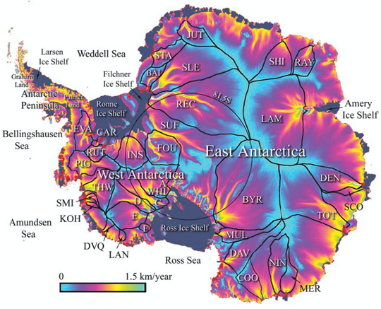
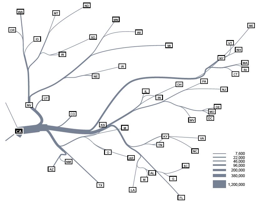
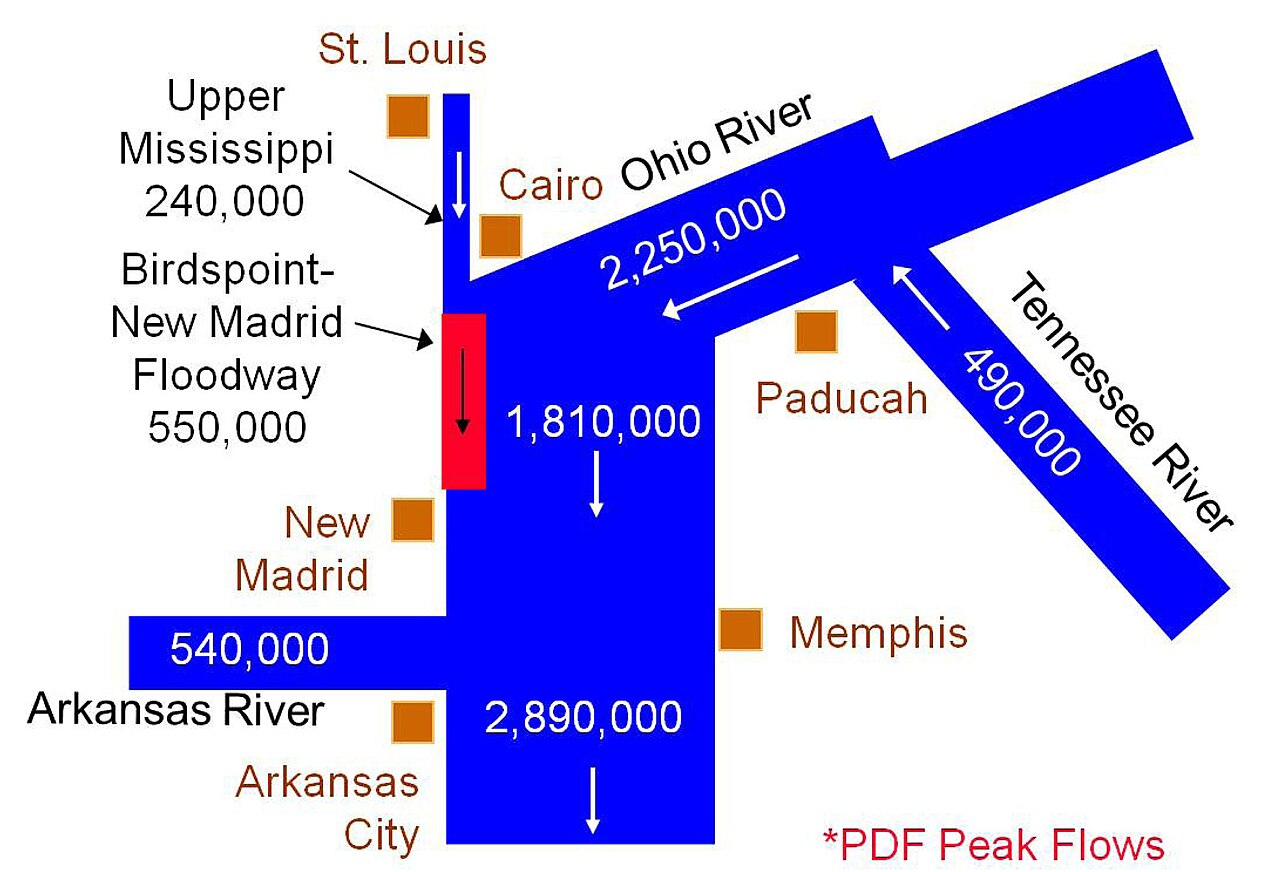
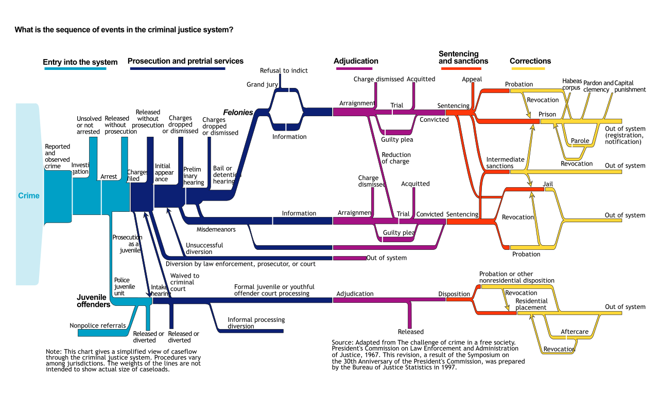
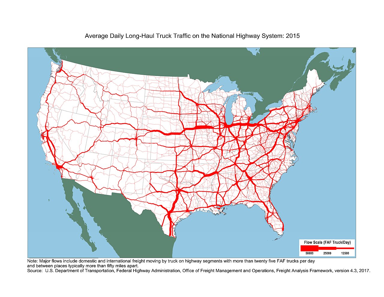
A flow map is a type of thematic map that uses linear symbols to represent movement between locations, functioning as a hybrid of a map and a flow diagram. It can depict the movement of people, highway traffic, trade goods, water, ideas, telecommunications data, and other phenomena. The wide variety of moving material and geographic networks has led to many design strategies, with some cartographers expanding the term to any thematic map of a linear network, while others restrict it to maps that specifically show movement. Many flow maps use line width proportional to the amount of flow, making them similar to other maps that use proportional size, including cartograms and proportional point symbols.
The earliest known maps to visually represent the volume of flow were created by engineer Henry Drury Harness in 1838, showing cargo traffic by road and canal in Ireland as part of a report on potential railroad construction. In subsequent years, others experimented with the technique in Europe until it was mastered by Charles Joseph Minard. During the 1850s and 1860s, Minard published forty-two flow maps on a wide variety of topics, including his famous 1869 map of the French invasion of Russia, often called the best statistical graphic ever drawn. Many of Minard’s design techniques remain unsurpassed even in the age of computer graphics. During the 1980s, Waldo Tobler conducted experiments to create flow maps by computer, though early results were not up to Minard’s standards; geographic information system and graphics software have since improved.
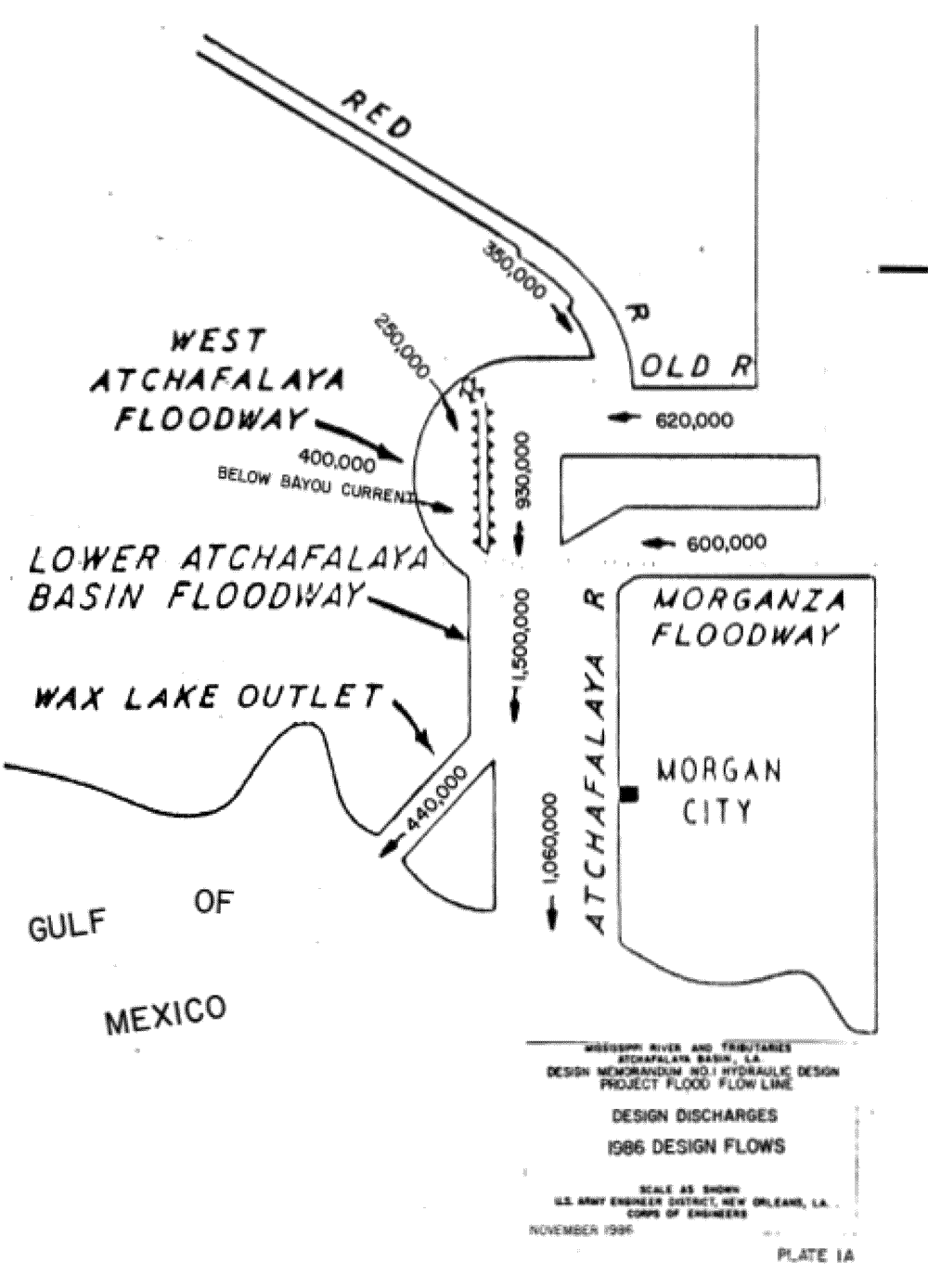
Flow maps can represent several aspects of movement, including origin and destination, route, type of movement, amount of movement, direction, and flow velocity. Topics range from human geography—such as migration, trade, traffic, and public utilities—to physical geography, including streamflow, wind, and wildlife migration. Different design strategies have emerged, such as origin-destination maps, which focus on connections between places, often using curved lines for aesthetic clarity, and distribution maps, which balance focus on nodes and routes.
- key_innovator
- Charles Joseph Minard (1840s–1870s)
Lore & Background
A flow map is a type of thematic map that uses linear symbols to represent movement between locations, functioning as a hybrid of a map and a flow diagram. The movement depicted can involve people, highway traffic, trade goods, water, ideas, or telecommunications data. The wide variety of moving materials and geographic networks has led to many design strategies; some cartographers apply the term to any thematic map of a linear network, while others restrict it to maps specifically showing movement. Many flow maps use line width proportional to the amount of flow, similar to cartograms and proportional point symbols. The earliest known map to visually represent flow volume was created by engineer Henry Drury Harness in 1838, showing cargo traffic by road and canal in Ireland. Charles Joseph Minard later mastered the technique, publishing forty-two flow maps during the 1850s and 1860s, including his renowned 1869 map of the French invasion of Russia. Flow maps can represent origin and destination, route, type of movement, amount of movement, direction, and flow velocity. Topics include human geography (migration, travel, trade, logistics, utilities, traffic) and physical geography (streamflow, wind, wildlife migration). Distinct types include origin-destination maps, which focus on connections between places with straight or curved lines, and distribution maps, which balance focus on origin-destination nodes.
Reader's Guide
Flow maps are significant because they provide a visual method for understanding the movement of diverse phenomena across geographic space, combining spatial location with quantitative flow data. The development of computer-generated flow maps began in the 1980s with Waldo Tobler, though early results did not meet Minard's standards; subsequent improvements in GIS and graphics software have enhanced automated design capabilities. Flow maps can represent multiple aspects of movement simultaneously, including origin and destination, route, type of movement, amount, direction, and velocity. Different design strategies have emerged for specific purposes: origin-destination maps focus on connections between places, distribution maps balance nodes and routes, network route maps emphasize the network itself, and continuous or mass flow maps visualize vector fields such as ocean currents or wind. The most common technique for showing amount or speed is line weight scaling, similar to proportional symbol maps.
Did You Know?
- Waldo Tobler conducted experiments to create flow maps by computer during the 1970s.
Gallery
Frequently Asked Questions
What is a flow map in cartography?
A flow map is a thematic map that uses linear symbols—such as arrows or lines—to visualize movement between two or more locations. It essentially blends a geographic map with a flow diagram, making the direction and volume of movement the central visual element.
Who is considered the key innovator behind flow maps?
Charles Joseph Minard is widely credited as the pioneering figure, producing landmark flow-map illustrations during the 1840s through the 1870s. His work set the visual and conceptual template that later cartographers built upon.
What kinds of movement can a flow map depict?
Flow maps can represent anything that travels across space: people migrating, highway traffic, trade goods, water currents, ideas, or telecommunications data. The wide range of possible subjects has driven cartographers to develop many different design strategies for encoding volume, direction, and origin-destination pairs.
How does a flow map differ from a standard thematic map?
While a typical thematic map shades regions or places points to show a static attribute, a flow map specifically encodes the act of movement between locations using linear symbols. Its primary purpose is to make the path and magnitude of transfer visible rather than to classify a fixed area.
Do cartographers all agree on what counts as a flow map?
Not quite. Some practitioners use the term broadly to cover any thematic map of a linear network, while others insist it must explicitly depict movement from one point to another. This definitional split is one reason the category can look quite different across textbooks and atlases.
More in Maps & Their Symbols 1-24
Spotted an error? Know more?
This is a living reference — every entry is fact-audited, and reader corrections feed straight into our audit queue. Suggest an edit · See this site's audit record