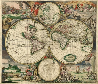
Geographic coordinate system
A spherical system using latitude and longitude to locate positions on Earth.

A geographic coordinate system (GCS) uses latitude and longitude to describe positions on Earth. It is the oldest and most common type of spatial reference system, and many others are built upon it. Unlike a Cartesian system, a GCS is not planar; its coordinates are angles, not distances.
The system's invention is credited to Eratosthenes of Cyrene, who wrote his *Geography* in the 3rd century BC. Hipparchus of Nicaea later improved it by using stars for latitude and lunar eclipses for longitude. In the 1st or 2nd century, Marinus of Tyre created a world map with coordinates measured from a prime meridian at the Fortunate Isles (near the Canary or Cape Verde Islands) and a latitude baseline at Rhodes. Ptolemy’s 2nd-century *Geography* kept that prime meridian but measured latitude from the Equator. After translation into Arabic in the 9th century, Al-Khwārizmī corrected errors in the Mediterranean’s length, shifting the prime meridian about 10° east in medieval Arabic cartography. Ptolemy’s text was recovered by Maximus Planudes around 1300 and translated into Latin in Florence by Jacopo d’Angelo around 1407. In 1884, the International Meridian Conference in the United States saw 22 of 25 nations adopt the Royal Observatory in Greenwich as the zero meridian; the Dominican Republic voted against, while France and Brazil abstained. France switched to Greenwich Mean Time in 1911.
Latitude is defined as the angle between the equatorial plane and a line from the surface point to a second point on that plane. The second point varies: in an astronomical system, it is where the plumb bob vertical meets the plane; in a geodetic system, it is where the ellipsoid’s normal vector meets the plane; in a geocentric system, it is Earth’s center. Lines of equal latitude are called parallels, with the equator at 0° and the poles at 90° N and 90° S. Longitude is the angle east or west of a reference meridian. All meridians are halves of great ellipses converging at the poles. The international prime meridian runs through Greenwich, though some organizations use others. The 180° meridian is the antipode of Greenwich, but the International Date Line diverges from it in places for political reasons. Together, latitude and longitude specify any location on Earth’s surface (ignoring altitude). The grid they form is a graticule; its origin, at 0° latitude and 0° longitude in the Gulf of Guinea, is sometimes called Null Island.
To measure actual locations, a geodetic datum is required. A horizontal datum binds a reference ellipsoid to Earth for latitude and longitude; a vertical datum uses a geoid for elevation. Traditionally, these datums relied on networks of surveyed control points and were accurate only regionally. Newer datums are global.
- invention_credited_to
- Eratosthenes of Cyrene
- century_of_origin
- 3rd century BC
- key_improver
- Hipparchus of Nicaea
- early_compiler
- Marinus of Tyre
- influential_text
- Ptolemy's Geography
- modern_standard_meridian
- Royal Observatory in Greenwich, England
Lore & Background
The invention of a geographic coordinate system is generally credited to Eratosthenes of Cyrene, who composed his now-lost Geography at the Library of Alexandria in the 3rd century BC. A century later, Hipparchus of Nicaea improved on this system by determining latitude from stellar measurements rather than solar altitude and determining longitude by timings of lunar eclipses, rather than dead reckoning. In the 1st or 2nd century, Marinus of Tyre compiled an extensive gazetteer and mathematically plotted world map using coordinates measured east from a prime meridian at the westernmost known land, designated the Fortunate Isles, off the coast of western Africa around the Canary or Cape Verde Islands, and measured north or south of the island of Rhodes off Asia Minor. Ptolemy credited him with the full adoption of longitude and latitude, rather than measuring latitude in terms of the length of the midsummer day. Ptolemy's 2nd-century Geography used the same prime meridian but measured latitude from the Equator instead. After their work was translated into Arabic in the 9th century, Al-Khwārizmī's Book of the Description of the Earth corrected Marinus' and Ptolemy's errors regarding the length of the Mediterranean Sea, causing medieval Arabic cartography to use a prime meridian around 10° east of Ptolemy's line. Twenty-two of them agreed to adopt the longitude of the Royal Observatory in Greenwich, England as the zero-reference line. The Dominican Republic voted against the motion, while France and Brazil abstained.
Reader's Guide
The geographic coordinate system is foundational to modern mapping, navigation, and spatial data. Its development from Eratosthenes through Ptolemy and later Arabic and European scholars established the framework for global positioning. The system's reliance on a geodetic datum is critical: different datums yield different latitude and longitude values for the same location, sometimes deviating several hundred meters. This means that any spatial reference system or map projection must clearly state its datum. Modern global datums like WGS 84 and ITRF2020 account for continental drift and crustal deformation, while regional datums remain in use for national mapping. The system's simplicity and universality have made it the basis for most other spatial reference systems, from UTM coordinates to GPS.
Frequently Asked Questions
Who is Geographic coordinate system?
It is a spherical or geodetic framework for pinpointing locations on Earth using latitude and longitude, with its invention credited to Eratosthenes of Cyrene in the 3rd century BC. It is the simplest and oldest spatial reference system still in everyday use.
What are Geographic coordinate system's powers/role?
It expresses every position on a globe as a pair of angular measurements rather than planar distances, making it fundamentally non-Cartesian. It serves as the foundational reference upon which most other spatial and mapping systems are constructed.
How does Geographic coordinate system's story end?
It has no true ending—it remains the universal baseline for locating points on the planet, anchored today by the standard prime meridian at the Royal Observatory in Greenwich, England.
Why is Geographic coordinate system important?
As the oldest and most widely adopted spatial reference framework, it underpins virtually every other mapping, navigation, and positioning system in modern use. Without its latitude-longitude logic, cartography and global positioning would lack a shared common language.
Who are Geographic coordinate system's key allies in the canon?
Hipparchus of Nicaea refined its mathematical foundations, Marinus of Tyre compiled early practical coordinate tables, and Ptolemy's Geography became the influential text that codified the system for centuries.
More in Map Projections & Cartography Foundations 1-24
Spotted an error? Know more?
This is a living reference — every entry is fact-audited, and reader corrections feed straight into our audit queue. Suggest an edit · See this site's audit record