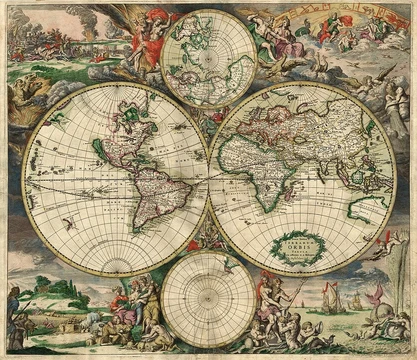
Computer cartography
Computer cartography shifted mapmaking from paper to digital systems.

Computer cartography, also known as digital cartography, applies the art, science, and technology of mapmaking and map use to computers. While it marked a major shift in production methods, it remains a branch of traditional cartography. Its core job is creating maps—whether accurate road networks and points of interest for navigation or thematic maps. It serves as a key function within geographic information systems (GIS), but GIS is not required for computer cartography and does other things besides making maps. The first peer-reviewed studies on using computers for cartography appeared several years before full GIS was introduced. Computer cartography supports many applications, often by linking with the Global Positioning System (GPS) satellite network. This enables real-time, automated map generation, such as in car navigation systems. **History**
*From paper to paperless* In 1959, Waldo Tobler published "Automation and Cartography," which proposed the first use of computers as aids in cartography. He described a "map in–map out" (MIMO) system that digitized traditional maps, allowed changes, and reproduced them. Though simple, MIMO established computers in cartographic literature and paved the way for later geographic information systems developed by geographers like Roger Tomlinson. Rapid progress followed, leading to a shift from traditional to computer-aided cartography. Mark Monmonier predicted this in his 1985 book *Technological Transition in Cartography*, stating that GIS-driven computer cartography would largely replace pen-and-paper methods. The milestone of more maps being created and distributed by computer than by hand is believed to have occurred around the mid-1990s. *Expanded capabilities* Early digital maps worked much like paper ones—they offered a "virtual view" of roads outlined by surrounding terrain. But as GPS technology expanded over the past decade, features like live traffic updates, points of interest, and service locations were added, making maps more "user conscious." Traditional virtual views are now just one option. Users can often choose between virtual maps, satellite (aerial) views, or hybrid views combining both. Because digital maps can be updated, newly built roads and places can be added. Three-dimensional landscapes can be generated using 3D scanners or 3D reconstruction software. *Data collection* Digital maps depend on large amounts of data gathered over time. Most of the information comes from satellite imagery and street-level data. Maps must be updated frequently to stay accurate. Although many companies specialize in digital mapping, the basic goal is the same: to portray roads as they actually appear, giving users a "life-like experience."
**Functionality and use**
*Computer applications* Both proprietary and non-proprietary programs and apps provide imagery and street-level map data for much of the world. *Scientific applications* The rise of mobile computing (PDAs, tablet PCs, laptops) since around 2000 has boosted digital mapping in science and applied science. By 2009, fields using it included geology (digital geological mapping), engineering, architecture, land surveying, mining, forestry, environmental science, and archaeology. *GPS navigation systems* The main driver of digital mapping’s growth in the past decade has been its link to GPS technology. GPS is the foundation of digital mapping navigation systems. *How it works* A terrestrial GPS receiver gets coordinates, position, and atomic time from GPS satellites orbiting Earth. This data gives the digital mapping software a starting point and a destination, which it uses to calculate distance. The software then analyzes and compiles the information to create a map showing the easiest, most efficient route. More technically: - The GPS receiver collects data from at least four satellites, calculating position in three dimensions. - It uses that position to provide GPS coordinates—exact latitude and longitude points from the satellites. - These coordinates are accurate to within about 10–20 meters of the actual location. - The starting point (from GPS coordinates) and the ending point (address or coordinates entered by the user) are fed into the digital mapping software. - The software outputs a real-time visual route. The map moves along the driver’s path. - If the driver leaves the designated route, the system uses current coordinates to recalculate a new route to the destination.
- milestone
- Gradual transition from paper to computer-aided map production; integration with GPS for real-time navigation
Lore & Background
Computer cartography, also known as digital cartography, is the art, science, and technology of producing and using maps with a computer, representing a paradigm shift from traditional methods while remaining a subset of that field. Its primary function is creating accurate representations of areas, such as detailing major roads and points of interest for navigation, or generating thematic maps. It is a main function of geographic information systems (GIS), though GIS is not required for computer cartography and has broader capabilities beyond mapmaking. The first peer-reviewed publications on using computers for cartography predate the introduction of full GIS by several years. The technology integrates with the Global Positioning System (GPS) satellite network to enable real-time automated map generation, such as in automotive navigation systems. Early digital maps offered a basic virtual view of roads outlined by terrain, but with GPS expansion, features like live traffic updates and service locations have been added. Users can now often choose between virtual maps, satellite aerial views, or hybrid combinations. Three-dimensional landscapes can be generated using 3D scanners or reconstruction software. Digital maps rely on vast data from satellite imagery and street-level information, requiring frequent updates for accuracy. The technology is employed in fields including geology, engineering, architecture, land surveying, mining, forestry, environmental science, and archaeology.
Reader's Guide
Computer cartography represents a fundamental shift in how maps are produced, moving from manual pen-and-paper methods to computer-aided processes. Its significance lies in enabling real-time, interactive mapping integrated with GPS, which has transformed navigation for everyday users. The technology also supports scientific fields such as geology, engineering, architecture, land surveying, mining, forestry, environmental science, and archaeology. The legacy of computer cartography includes the development of geographic information systems, though the two are not synonymous. The ability to update maps frequently and incorporate live data has made digital maps more 'user conscious' than their paper predecessors.
Did You Know?
- The first peer-reviewed publications on using computers in cartography predate the introduction of full GIS by several years.
- The transition from paper to digital maps was gradual, and no specific year or period is widely canonized as the point when digital maps surpassed paper maps in production and distribution.
- GPS receivers collect data from at least four satellites to calculate position in three dimensions, with modern civilian accuracy typically within 5–10 meters under open sky, and sub-meter with augmentation systems.
From Clay Tablets to Digital Screens
The story of mapmaking stretches back to a clay tablet inscribed in the Akkadian Empire, located in what is now Iraq, around 2300 BCE. By the fifth century BCE, Greek cartographers were sketching representations of their known world, covering the Mediterranean basin, much of Europe, North Africa, and the Middle East. These early efforts served as essential tools during the Age of Discovery, when sailors depended on them to chart unknown territories. A significant shift arrived in the late seventeenth century with the emergence of thematic maps, which redirected attention from physical features like rivers and mountains to specific data layers such as rainfall patterns or population density. The twentieth century brought yet another transformation as sprawling road networks and mass transit systems created demand for mass-produced maps aimed at ordinary travelers. This long trajectory set the stage for the digital revolution that would ultimately redefine what a map could be and who could use one.
The Digital Leap: Computer Cartography and GIS
The mid-twentieth century marked a watershed moment when computer cartography and geographic information systems entered the field. For the first time, enormous volumes of geographic data could be stored, dynamically displayed, and analyzed in ways that paper simply could not support. The raw material feeding these systems is remarkably diverse: satellite and aerial imagery, scanned versions of older paper maps, precise surveying measurements, delineated geographic features, and detailed terrain data. Perhaps the most visible change for end users is interactivity. Where a printed map was a fixed, static image, a digital map invites the viewer to zoom in or out, pan across regions, and toggle individual data layers on or off. This shift transformed maps from passive reference documents into responsive analytical tools, opening the door to entirely new workflows in science, governance, and everyday navigation.
The Art and Science of Map Design
Creating a map is far from a simple act of copying the landscape onto a surface. Designers must select, arrange, and balance graphical elements so the final product is informative, genuinely useful, and free of visual clutter. A central challenge is generalization: the sheer volume of available geographic data almost always exceeds what can be meaningfully shown on a single sheet or screen, forcing cartographers to make deliberate choices about what to include and what to leave out. Map scale, expressed as a ratio between a measured distance on the map and the corresponding real-world distance, directly governs how much detail is appropriate. Equally fundamental is the choice of projection, since every mathematical projection introduces its own characteristic distortions of shape, area, or distance. Coordinates can be rendered as latitude and longitude or as a Cartesian grid. Beyond the core geographic data, a finished map typically carries supplemental elements—legends, scale bars, north arrows, and inset maps—that help the reader orient and interpret the visual information.
Maps in Service of Society
Maps underpin an astonishing breadth of human activity. In daily life, they guide navigation and route planning, helping people locate hospitals, gas stations, restaurants, or parks, and assisting vacationers in identifying destinations through road and tourist maps. Specialized charts serve nautical and aeronautical navigation, keeping ships and aircraft on safe courses. Scientists in geology, meteorology, seismology, and demographics rely on maps to organize and interpret spatial data. Governments deploy maps for census operations, drawing electoral districts, assessing property taxes, dispatching police, and coordinating disaster relief. Local authorities use them for urban planning—designing roads, transit lines, housing, and green spaces—while utilities maintain distribution networks for water, electricity, gas, telecommunications, and sewers. Military and security organizations depend on maps for mission planning, surveillance, border management, logistics, and intelligence analysis. Emergency and fire services use them for evacuation planning and responder dispatch. In the commercial sphere, maps appear in advertising and persuasive communication, and politicians have long used them to advance agendas or frame international disputes.
Frequently Asked Questions
What is Computer cartography?
Computer cartography (also called digital cartography) is the discipline of creating and utilizing maps through computer technology. It represents a fundamental shift from traditional paper-based mapmaking while remaining a branch of cartography as a whole.
What are Computer cartography's core powers or role?
Its primary function is producing maps, from accurate area representations used in navigation to thematic maps that visualize specific data layers. It also integrates with GPS technology to enable real-time navigation, marking a major milestone in how people interact with spatial information.
How did Computer cartography's story evolve?
The field emerged through a gradual transition from paper-based production to computer-aided mapmaking, fundamentally changing the workflow for cartographers. Rather than replacing traditional cartography, it absorbed and extended those methods into digital systems.
Why is Computer cartography important to the broader field?
It marks a paradigm shift in how maps are produced, making the process faster, more precise, and accessible to a wider audience. It is one of the main operational functions within geographic information systems (GIS), though it can exist independently of GIS and has its own distinct purpose beyond general spatial analysis.
How does Computer cartography relate to GIS?
Computer cartography is a core function of GIS, but the two are not synonymous—GIS encompasses many tasks beyond mapmaking, and computer cartography does not require a full GIS platform to operate. Think of cartography as the map-producing engine that sits inside the larger GIS toolkit.
More in Map Projections & Cartography Foundations 1-24
Spotted an error? Know more?
This is a living reference — every entry is fact-audited, and reader corrections feed straight into our audit queue. Suggest an edit · See this site's audit record