Tropic of Cancer
Northernmost latitude where the Sun appears directly overhead.

The Tropic of Cancer is the northernmost latitude on Earth where the Sun appears directly overhead at noon, an event that occurs on the June solstice when the Northern Hemisphere is tilted most steeply toward the Sun. At the same time, on the December solstice, the Sun at solar midnight is 90 degrees below the horizon in all directions along this circle. It forms the northern counterpart to the Tropic of Capricorn, and together these two lines are among the seven major circles of latitude, which also include the Arctic and Antarctic circles, the Equator, and the poles. The circle’s exact position is not fixed; it shifts due to changes in Earth’s axial tilt, which varies over a 41,000-year cycle between about 22.1 and 24.5 degrees. Currently, the tilt is roughly 23.4 degrees, and the Tropic of Cancer is drifting southward by nearly half an arcsecond of latitude per year. It was located at exactly 23°27′N in 1917 and will reach 23°26′N in 2045. The name originates from the zodiacal constellation Cancer, because when the line was named in the last centuries BC, the Sun was in Cancer at the June solstice; precession of the equinoxes has since moved the Sun into Taurus at that time. The word "tropic" comes from the Greek "tropē," meaning turn or inclination, referring to the Sun’s apparent reversal of direction at the solstices. In geopolitics, the Tropic of Cancer marks the southern limit for mutual defense obligations under NATO. The climate along this latitude is generally hot and dry, except in cooler highland regions, marine areas like Hawaii, and easterly coasts where orographic rainfall can be extremely heavy. Much of the land near the Tropic lies within the Sahara Desert, while eastern areas experience a torrid monsoonal climate with a short wet season. The highest mountain on or adjacent to this circle is Yu Shan in Taiwan, which hosted glaciers during the Last Glacial Maximum. For aviation records, a round-the-world flight must cover a distance no less than the length of the Tropic of Cancer, crossing all meridians.
Lore & Background
The Tropic of Cancer is the northernmost latitude on Earth where the Sun can appear directly overhead, an event that occurs on the June solstice when the Northern Hemisphere is tilted maximally toward the Sun. At solar midnight on the December solstice, the Sun at this latitude is 90 degrees below the horizon in all directions. Its position is not fixed; due to axial precession and variations in Earth’s axial tilt (which ranges from about 22.1 to 24.5 degrees over a 41,000-year period), the circle drifts southward at nearly half an arcsecond per year. In 1917 it lay at exactly 23°27′N, and by 2045 it will reach 23°26′N. The name originates from the last centuries BC, when the June solstice Sun was in the zodiacal constellation Cancer (Latin for Crab); precession has since shifted it into Taurus. The Greek word “tropē,” meaning turn or inclination, reflects the Sun’s apparent reversal at the solstices. Geographically, the Tropic of Cancer marks the boundary between the tropics and the North Temperate Zone. It passes through 17 countries and 8 water bodies. The climate along its path is generally hot and dry, though highland regions in China, marine areas like Hawaii, and easterly coasts can receive heavy orographic rainfall. Most areas experience a scorching summer with temperatures often exceeding 45°C and a warm winter. Much of the land lies within the Sahara Desert, while eastern sectors have a torrid monsoonal climate with a brief wet season. The highest mountain on or near the Tropic is Yu Shan in Taiwan, which hosted glaciers during the Last Glacial Maximum. For a flight to qualify for a round-the-world speed record under Fédération Aéronautique Internationale rules, it must cover a distance no less than the Tropic of Cancer’s length, cross all meridians, and end at its starting airfield.
Reader's Guide
The Tropic of Cancer is the northernmost latitude where the Sun appears directly overhead, an event that occurs on the June solstice when the Northern Hemisphere is maximally tilted toward the Sun. At solar midnight on the December solstice, the Sun at this latitude is 90 degrees below the horizon in all directions. Its name originates from the last centuries BC, when the Sun was in the zodiacal constellation Cancer during the June solstice; due to the precession of the equinoxes, the Sun now resides in Taurus at that time. The term "tropic" derives from the Greek word for "turn," referencing the Sun's apparent reversal of direction at the solstices. The circle's position is not fixed: Earth's axial tilt varies over a 41,000-year cycle between about 22.1 and 24.5 degrees, currently near 23.4 degrees. This wobble causes the Tropic of Cancer to drift southward by almost half an arcsecond of latitude per year. Its location was exactly 23°27′N in 1917 and will reach 23°26′N in 2045. Geographically, the tropic passes through 17 countries and 8 water bodies. North of it lie the subtropics and the North Temperate Zone. In the year 2000, more than half the world's population lived north of this line. The climate along the Tropic is generally hot and dry, except in cooler highland regions of China, marine areas like Hawaii, and easterly coasts where orographic rainfall can be very heavy. Much of the land on or near the tropic belongs to the Sahara Desert. The highest mountain on or adjacent to the Tropic is Yu Shan in Taiwan, which had glaciers descending during the Last Glacial Maximum; surviving glaciers near the tropic include the Minyong and Baishui in the Himalayas and Pico de Orizaba in Mexico. In geopolitics, the Tropic of Cancer marks the southern limit of NATO's mutual defence obligation. For aviation, round-the-world speed records under Fédération Aéronautique Internationale rules require a flight to cover at least the length of the Tropic of Cancer, crossing all meridians and ending at the starting airfield.
Did You Know?
- The highest mountain on or adjacent to the Tropic of Cancer is not Mount Everest, which lies about 4.5 degrees north of the line; instead, the honor goes to a peak in the Sierra Madre Oriental or the Himalayas that actua
- During the summer solstice, the Tropic of Cancer experiences approximately 13 hours, 30 minutes of daylight.
Astronomical Definition and Solar Significance
It marks the northernmost latitude at which the Sun can appear directly overhead, a phenomenon that occurs specifically at the June solstice. Its latitude is mathematically determined by Earth's axial tilt — the angle between the planet's rotational axis and the plane of its orbit around the Sun. Unlike the Equator, which sits at 0° and is the only great circle among the parallels, the Tropic of Cancer is a small circle centered on Earth's axis rather than its center. It serves as a boundary between the Northern Hemisphere's tropical zone and the temperate zone, forming one of the five principal geographical divisions alongside the Equator, the Tropic of Capricorn, and the two polar circles.
A Moving Line — The Influence of Axial Tilt
The Tropic of Cancer is not a permanent, unchanging line etched into the planet. Its position is entirely dependent on the obliquity of the ecliptic — the tilt of Earth's axis relative to its orbital plane. If Earth's axis were perfectly perpendicular to its orbital path, no tropical or polar circles would exist at all; the Sun would always rise due east, pass overhead at the equator, and set due west everywhere. In reality, the axial tilt undergoes a slow, complex oscillation driven by the superposition of numerous cycles of varying periods.
Geometry and Cartographic Representation
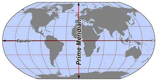
As a circle of latitude, the Tropic of Cancer is an abstract east–west small circle connecting all points at that specific angular distance from the Equator, ignoring elevation. Like all parallels except the Equator, it is smaller than the great circle and its circumference can be calculated using a cosine function. On spherical or ellipsoidal models, it functions as a rhumb line — a path that crosses every meridian at the same angle. In cartographic practice, its appearance varies dramatically depending on the projection chosen. On Mercator and Gall–Peters maps, it appears as a straight horizontal line perpendicular to all meridians, though the vertical spacing between parallels differs: Mercator stretches them near the poles to preserve local shapes, while Gall–Peters compresses them to maintain accurate area comparisons. On non-cylindrical projections, the Tropic of Cancer may curve and lose its parallel relationship with neighboring lines.
Practical Applications and Geopolitical Relevance
Circles of latitude, including the Tropic of Cancer, have long served as practical tools for defining boundaries where natural landmarks are absent. In regions such as deserts, or when nations and states are delineated by straight lines on a map, arcs of latitude provide a convenient and objective reference. North American borders are a notable example: Colorado's northern boundary sits at 41° N and its southern edge at 37° N, while roughly half the United States–Canada border traces the 49th parallel. Though the Tropic of Cancer itself is less commonly used as a political border than mid-latitude parallels, it remains a critical reference point in geography, navigation, and climate science. Its position, together with the Tropic of Capricorn, defines the tropical belt — the zone where the Sun reaches the zenith at least once per year — making it a foundational concept in understanding seasonal patterns, solar energy distribution, and the division of Earth's five principal geographical zones.
Frequently Asked Questions
Who is Tropic of Cancer?
Tropic of Cancer is the northernmost circle of latitude on Earth where the Sun can appear directly overhead in the sky. It currently sits at roughly 23°26′10.5″ north of the Equator and is one of the seven principal latitude circles.
What are Tropic of Cancer's powers or role?
It serves as the northern boundary of the tropical zone, meaning it is the furthest north a person can stand and watch the Sun pass directly overhead. That direct-overhead event happens once a year, at the June solstice.
Why is Tropic of Cancer important?
It defines the edge of the tropics, separating regions where the Sun can be directly overhead from those where it never is. As one of the seven major latitude circles, it is a key reference point in navigation, climate science, and cartography.
Why is it called 'Cancer' if the Sun isn't in Cancer anymore?
The name comes from the zodiacal constellation Cancer, which occupied that position of the Sun at the June solstice in ancient times. Due to the slow wobble of Earth's axis (axial precession), the Sun now sits against Taurus at that solstice, but the traditional name stuck.
More in Lines & Hemispheres 1-24
Spotted an error? Know more?
This is a living reference — every entry is fact-audited, and reader corrections feed straight into our audit queue. Suggest an edit · See this site's audit record