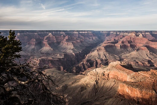
Geomorphology
Study of Earth's surface form and change.

Geomorphology is the scientific study of the origin and evolution of topographic and bathymetric features generated by physical, chemical, or biological processes operating at or near Earth's surface. Geomorphologists seek to understand why landscapes look the way they do, to understand landform and terrain history and dynamics, and to predict changes through field observations, physical experiments, and numerical modeling. The field intersects with disciplines such as physical geography, geology, geodesy, engineering geology, archaeology, climatology, and geotechnical engineering.
Earth’s surface is shaped by a combination of surface processes—such as the action of water, wind, ice, wildfire, and life, along with chemical reactions that form soils—and geologic processes like tectonic uplift, volcanic growth, isostatic adjustments, and the formation of sedimentary basins. These processes interact across scales: mountain belts rise through geologic forces, while denudation erodes them, transporting sediment for deposition elsewhere. Feedbacks are common; for instance, ice sheets and water loads alter topography through flexural isostasy, and topography can modify local climate via orographic precipitation, which in turn influences landscape evolution. The field thus examines the intersection of the lithosphere with the hydrosphere, atmosphere, and biosphere.
Geomorphologists address both broad-scale questions and specific local issues. Glacial geomorphologists study deposits like moraines and eskers, as well as erosional features, to reconstruct glacier histories. Fluvial geomorphologists focus on river sediment transport, migration, and response to tectonic and environmental change. Soils geomorphologists analyze soil profiles and chemistry to understand landscape history, while others investigate hillslope dynamics or the links between ecology and landforms. Techniques include fieldwork, remote sensing, geochemical analysis, numerical modeling, and geochronology to measure rates of change. Terrain measurement uses differential GPS, digital terrain models, and laser scanning. Practical applications include landslide prediction, river restoration, and coastal protection. Planetary geomorphology extends these studies to other terrestrial planets, using Earth analogues to interpret landforms shaped by wind, water, ice, volcanism, and tectonics.
- field
- Earth science
- focus
- Origin and evolution of landforms and terrain
- methods
- Field observations, physical experiments, numerical modeling
- related_disciplines
- Physical geography, geology, geodesy, engineering geology, archaeology, climatology, geotechnical engineering
- applications
- Hazard assessment, river control, stream restoration, coastal protection
Lore & Background
Geomorphology examines how Earth's surface is modified by surface processes—water, wind, ice, wildfire, life, chemical reactions, gravity, and human activity—and by geologic processes such as tectonic uplift, volcanic growth, isostatic changes, and sedimentary basin formation. These processes intersect climatic, hydrologic, and biologic action with geologic action, or the lithosphere with the hydrosphere, atmosphere, and biosphere. Broad-scale topographies like mountain belts illustrate this intersection: uplift produces sediment that is transported and deposited elsewhere, while individual landforms evolve from the balance of additive processes (uplift and deposition) and subtractive processes (subsidence and erosion). Feedbacks occur, such as topography modifying local climate via orographic precipitation, which in turn alters the hydrologic regime and topography.
Reader's Guide
Geomorphology provides a framework for understanding landscape evolution and dynamics across scales, from mountain belts to individual hillslopes. Its practical applications include hazard assessment (e.g., landslide prediction and mitigation), river control and stream restoration, and coastal protection. The field also extends to planetary geomorphology, studying landforms on other terrestrial planets such as Mars, using Earth analogues to aid interpretation. Geomorphologists employ diverse techniques: fieldwork, remote sensing, geochemical analyses, numerical modeling, geochronology, and terrain measurement (differential GPS, digital terrain models, laser scanning). The discipline's broad base of interests—spanning physical geography, geology, geodesy, engineering geology, archaeology, climatology, and geotechnical engineering—contributes to many research styles.
Did You Know?
- Ancient Greek historian Herodotus argued from soil observations that the Nile Delta was actively growing into the Mediterranean Sea.
- Song dynasty scientist Shen Kuo theorized that a cliff with marine fossils was once a prehistoric seashore that had shifted hundreds of miles.
- Planetary geomorphology studies landforms on other terrestrial planets such as Mars, including effects of wind, fluvial, glacial, and volcanic processes.
More in Geology 1-24
Spotted an error? Know more?
This is a living reference — every entry is fact-audited, and reader corrections feed straight into our audit queue. Suggest an edit · See this site's audit record