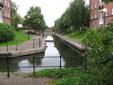
North Jiangsu Main Irrigation Canal
Multi-purpose canal for flood control, irrigation, and power generation.

The North Jiangsu Main Irrigation Canal, commonly referred to as the Subei Canal, is a major waterway situated in the lower reaches of the Huai River in northern Jiangsu Province, China. The canal originates at Gaoliangjian on Hongze Lake and traverses through the counties and districts of Hongze, Qingpu, Huai’an, Funing, Sheyang, and Binghai before terminating at the artificial estuary of Biandan Harbour. Stretching 168 kilometers in length, the canal is capable of irrigating 1,720,000 hectares of farmland. Its construction was organized and directed by the headquarters of the Jiangsu Huai River management program, with work carried out between October 1951 and May 1952.
The canal is part of a larger irrigation system that includes three related main canals. The Grand Canal, which runs through the western part of northern Jiangsu and crosses the Subei Canal, is known as the “west main canal.” The Chuanchang River forms a “T” junction with the main irrigation canal, designated the “east main canal.” The Tongyang Canal, located in the southern part of northern Jiangsu, connects the start and ending points and is called the “south main canal.” Together, these four canals form a quadrangle linking inland rivers into a cohesive irrigation network. A parallel canal to the north was also built to direct additional water to the sea.
Historically, the canal was first constructed between 1934 and 1937 to divert part of the Huai River and mitigate catastrophic flooding. In 1938, Japanese forces destroyed many dams, causing the Yellow River to flow into the Huai and severely flooding the region, which largely destroyed the canal. After the Chinese Civil War, the government planned to rebuild it for flood management, but the Korean War strained economic resources. Premier Zhou Enlai, who came from the Huai River drainage basin, insisted on proceeding due to the suffering caused by floods and waterlogging in his hometown. After particularly serious inundation in 1950, Chairman Mao Zedong and Zhou Enlai instructed relevant departments to develop a water conservancy plan. In 1951, Zhou Enlai held a conference where Li Baohua, undersecretary of the Ministry of Water Resources, proposed a project plan that was approved. The project began on November 2, 1951, with over 1,190,000 civilian workers participating.
The canal serves multiple purposes, including flood control, ir
- location
- Lower reaches of Huai River, northern Jiangsu Province, China
- type
- Multi-purpose canal for flood control, irrigation, and power generation
Lore & Background
The North Jiangsu Main Irrigation Canal, also known as the Subei Canal, is a 168-kilometer artificial waterway located in the lower reaches of the Huai River in northern Jiangsu Province, China. It begins at Gaoliangjian on Hongze Lake and flows through Hongze, Qingpu, Huai'an, Funing, Sheyang, and Binghai before reaching the artificial estuary at Biandan Harbour. The canal is a central component of a larger irrigation system that forms a quadrangle with three other main canals: the Grand Canal (the west main canal), the Chuanchang River (which forms a T-junction with the main canal as the east main canal), and the Tongyang Canal (the south main canal), which connects the start and ending points. A parallel canal to the north was built to direct more water to the sea.
Originally constructed between 1934 and 1937 to divert the flood-prone Huai River, the canal was largely destroyed in 1938 when Japanese forces damaged dams, causing the Yellow River to flow into the Huai and resulting in severe flooding. After the Chinese Civil War, the government sought to rebuild it for flood management, but the Korean War strained economic resources. Premier Zhou Enlai, who came from the Huai River basin, insisted on proceeding due to his knowledge of local suffering from flood and waterlogging. In 1950, particularly serious inundation prompted Chairman Mao and Premier Zhou to order a water conservancy plan. Following a 1951 conference where Li Baohua presented a project proposal, Zhou Enlai approved the plan, and construction began on November 2, 1951, involving over 1,190,000 civilian workers. The project was completed between October 1951 and May 1952 under the Jiangsu Huai River management program.
The canal serves multiple purposes: flood control, irrigation, ship navigation, and power generation. It is a flood-relief canal designed to transfer water at a speed of 5,000 stere per second, with a drainage canal on its north side to drain flood areas. It can discharge floodwaters at 800 stere per second. The canal irrigates 1,720,000 hectares of farmland in north Jiangsu and the Lixiahe area, bringing water from Hongze Lake to land along the southern Yellow River basin. Associated structures include the Gaoliangjian intake sluice, the east canal diversion sluice, the Funing Waist gate, and the Liuduo tidal sluice. There are 36 culverts, 2 flood-release sluices, and 4 ro
Reader's Guide
The North Jiangsu Main Irrigation Canal is a multi-purpose project for flood control, irrigation, and power generation. A drainage canal on its north side drains flood areas, and the canal helps discharge floods when water volumes in the north area become serious. The canal also supports ship navigation and electricity generation, with hydroelectric power generators and ship locks built near sluices at Gaoliangjian and Buning. Associated structures include 36 culverts, 2 flood-release sluices, 4 road bridges, and a cross sluice at Gaoliangjian that strengthens draining capacity. The Jiangsu Irrigation Canal Management Office administers riverine engineering and resource provision, while counties and districts along the canal handle bank repair and administration.
More in Canals And Waterways 1-24
Spotted an error? Know more?
This is a living reference — every entry is fact-audited, and reader corrections feed straight into our audit queue. Suggest an edit · See this site's audit record