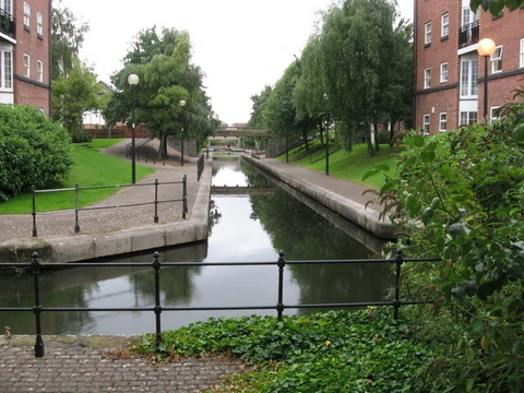
Grand Canal (China)
Longest artificial waterway in the world, linking northern and southern China.

The Grand Canal is a linked network of canals that connect major rivers and lakes across northern and eastern China. It was a crucial water transport route between the country’s north and south during medieval and premodern times. Recognized as the world’s longest man-made waterway, it is also a UNESCO World Heritage Site.
Over history, the canal’s route has shifted several times. Today, its main section is called the Jing–Hang Grand Canal, stretching roughly 1,776 km (1,104 mi) from Beijing in the north to Hangzhou in the south. This route is split into six main parts. The southernmost sections have stayed mostly the same over the centuries. The Jiangnan Canal begins at the Qiantang River in Hangzhou’s Jianggan District, loops east of Lake Tai through Jiaxing, Suzhou, and Wuxi, and ends at the Yangtze River in Zhenjiang. The Inner Canal starts in Yangzhou, across the Yangtze from Zhenjiang, passes through Gaoyou Lake, and meets the Huai River at Huai’an—which for a long time also connected to the old course of the Yellow River. The Middle Canal runs from Huai’an to Luoma Lake near Suqian, then to the Nansi Lakes at Weishan. The Lu Canal goes from the Nansi Lakes at Jining into the current Yellow River at Liangshan, splits off downstream at Dong’e County in Liaocheng, and continues to the Wei River at Linqing. The Southern Canal (named for its location in Hebei) runs from Linqing to the Hai River at Tianjin. The Northern Canal goes from Tianjin to Tongzhou, on the outskirts of Beijing. In total, the canal passes through Zhejiang, Jiangsu, Shandong, and Hebei provinces, plus the municipalities of Tianjin and Beijing. In 2014, the Chinese government and UNESCO also added the Eastern Zhejiang Canal—from Hangzhou to Ningbo, following the old Tongji and Yongji Canals—as official parts of the Grand Canal.
The oldest parts of today’s Grand Canal were finished in the early 5th century BC, during the Spring and Autumn period. They were built to supply and move troops for the states of Wu and Yue amid their conflicts. Emperor Yang of Sui expanded and completed the network in 609, linking the fertile Jiangnan region in the south to his capital at Luoyang in the Central Plain and to his armies on the northern frontiers. His unsuccessful and unpopular war against Goguryeo, along with the huge forced labor used to build the canals, were major reasons for the widespread rebellions during his rule and the Sui dynasty’s quick collapse. Still, the connection of major river systems and population centers proved very beneficial under the later Tang dynasty.
Under the Tang, additional canals were rebuilt to supply Chang’an (now Xi’an) further west, better linking the Guanzhong heartland to the Central Plain. Towns along the main canal route grew into economic centers of the empire. During the Five Dynasties and Ten Kingdoms period and the Song dynasty, sections of the canal slowly decayed and fell into ruin. Flooding from the Yellow River, linked to climate changes during the Medieval Warm Period, eroded and threatened the canal’s safety and function. In wartime, the river’s high dikes were sometimes deliberately broken to delay or sweep away advancing enemy troops. Even so, each successive dynasty took on the duty of restoring and improving the canal and its flood control systems. The canal was key in periodically reuniting northern and southern China, and officials in charge of it and nearby salt works grew very wealthy. Despite damage from floods, rebellions, and wars, the canal’s importance only increased when the national capital moved to Khanbaliq (now Beijing) under Kublai Khan during the Mongol Yuan dynasty, and again under the Yongle Emperor in the Ming dynasty and the Shunzhi Emperor in the Manchu Qing dynasty. Although railways and highways have become important in modern times, the People’s Republic of China has worked to improve the canal’s navigability since the end of the Chinese Civil War. The section south of the Yellow River is still heavily used by barges carrying bulk cargo. Growing concern over pollution in China, especially because the Grand Canal serves as the eastern route of the South-North Water Diversion Project (which aims to provide clean drinking water to the north), has led to regulations and projects to improve water quality along the canals.
The canal’s highest point is 42 meters (138 feet) above sea level, in the foothills of Shandong. Ships in Chinese canals had no trouble reaching higher elevations after the Song official and engineer Qiao Weiyue (926–1001) invented the pound lock in the 10th century. Over its history, the canal has been admired by many visitors, including the Japanese monk Ennin (794–864), the Persian historian Rashid al-Din Hamadani (1247–1318), the Korean official Choe Bu (1454–1504), and the Italian missionary Matteo Ricci (1552–1610).
**History**
**Early periods** During the late Spring and Autumn period, King Fuchai of Wu, whose capital was in present-day Suzhou, planned an attack northward on the State of Qi. He ordered a canal built for trade and to ship supplies north in case his forces fought the northern states of Song and Lu. This waterway became known as the Han or Hangou Canal. Work began in 486 BC, from south of Yangzhou to north of Huai’an in Jiangsu. Within three years, the Han Canal had connected the Yangtze with the Huai River by using existing waterways, lakes, and marshes. The Han Canal is considered the second oldest section of the later Grand Canal, since the Hong Canal (also called the “Canal of the Wild Geese” or “Far-Flung Canal”) likely came before it. That earlier canal linked the Yellow River near Kaifeng to the Si and Bian rivers.
Quick Facts
- Date Began
- Sui dynasty
- Start Point
- Beijing
- End Point
- Hangzhou
- Connects To
- Hai River, Yellow River, Huai River, Yangtze, Qiantang River
- Length Km
- 1776
Facts from the source article.
Lore & Background
The oldest sections of the Grand Canal were completed in the late 6th century BC (c. His massive conscription efforts contributed to rebellions and the fall of the Sui, but the canal proved beneficial during the subsequent Tang dynasty. The canal underwent route changes over centuries, with its current main stem—the Jing–Hang Grand Canal—extending from Beijing to Hangzhou. It is divided into six subsections: the Jiangnan Canal, Inner Canal, Middle Canal, Lu Canal, Southern Canal, and Northern Canal. The canal played a major role in reuniting northern and southern China, and officials in charge grew enormously wealthy. Despite damage from floods, rebellions, and wars, its importance grew under the Yuan, Ming, and Qing dynasties. The greatest height on the canal is 42 m above sea level in Shandong. The pound lock, invented by Song official Qiao Weiyue in the 10th century, allowed ships to reach higher elevations. The canal has been admired by visitors including the Japanese monk Ennin, Persian historian Rashid al-Din Hamadani, Korean official Choe Bu, and Italian missionary Matteo Ricci.
Reader's Guide
The Grand Canal's significance lies in its role as a central artery for economic and political integration across China for over two millennia. By connecting the Yellow River, Huai River, Yangtze, and other waterways, it enabled the transport of grain, goods, and troops between the agricultural south and the political north. This infrastructure supported the stability and expansion of successive dynasties, from the Sui through the Qing. The canal also facilitated cultural exchange and the growth of economic hubs along its route. In modern times, the People's Republic of China has worked to improve navigability, and the portion south of the Yellow River remains heavily used by barges. The canal also serves as the eastern path of the South-North Water Diversion Project, aimed at providing clean water to the north, leading to regulations and projects to improve water quality.
Did You Know?
- The pound lock was invented by Song official Qiao Weiyue in the 10th century to help ships reach higher elevations.
- The canal was admired by visitors including the Japanese monk Ennin, Persian historian Rashid al-Din Hamadani, Korean official Choe Bu, and Italian missionary Matteo Ricci.
Frequently Asked Questions
What is the Grand Canal (China)?
It is a vast network of linked artificial waterways threading through northern and eastern China, connecting major rivers and lakes into a single navigable corridor. It holds the distinction of being the longest man-made waterway on the planet.
What was the Grand Canal (China) used for?
Throughout medieval and premodern China it served as the principal artery for moving grain, troops, and commercial goods between the north and the south. Portions of the route still function as working shipping channels today.
Why is the Grand Canal (China) important?
Its sheer scale and continuous use over centuries made it a defining piece of Chinese infrastructure, shaping trade routes, population movement, and political cohesion. In recognition of that legacy, it was inscribed on the UNESCO World Heritage list.
Where does the Grand Canal (China) run?
The waterway stretches roughly from Beijing in the north down to Hangzhou in the south, stitching together the Yellow, Huai, Yangtze, and Qiantang river basins along the way. This north-south orientation is what made it such a critical link between China's two great economic zones.
More in Canals And Waterways 1-24
Spotted an error? Know more?
This is a living reference — every entry is fact-audited, and reader corrections feed straight into our audit queue. Suggest an edit · See this site's audit record