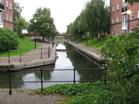
Lake Washington Ship Canal
Canal linking Lake Washington to Puget Sound via Seattle.

The Lake Washington Ship Canal cuts east–west across Seattle, connecting the freshwater of Lake Washington to the saltwater of Puget Sound. Along its route, it passes through Union Bay, the Montlake Cut, Portage Bay, Lake Union, the Fremont Cut, Salmon Bay, and Shilshole Bay. The Hiram M. Chittenden Locks manage the roughly twenty-foot (6.1 m) elevation change between the lake and the sound.
Before the canal was built, water drained from Lake Washington through the Black River, which flowed from the lake’s south end into the Duwamish River. The project was first discussed in 1854 as a way to move logs, milled lumber, and fishing vessels. The U.S. Navy endorsed it in 1867, including plans for a naval shipyard on Lake Washington. The Army Corps of Engineers began planning in 1891, with preliminary work in 1906 and full construction starting in 1911. The canal was officially completed in 1934. Delays in planning and building led the Navy to locate the Puget Sound Naval Shipyard in Bremerton, across the sound from Seattle.
For centuries, people had dragged boats between the lakes, calling the crossing points something like “carry a canoe.” In 1854, Seattle pioneer Thomas Mercer proposed canals linking Lake Union and Lake Washington to Puget Sound during a speech at the area’s first Independence Day celebration. Mercer gave the lakes their current names—Lake Union to suggest future canals merging the waters, and Lake Washington for George Washington—over the original Lushootseed names used by the Duwamish: tenas Chuck (or XáXu7cHoo) for Lake Union, and hyas Chuck (or Xacuabš) for Lake Washington.
In 1860, landowner Harvey L. Pike tried digging a ditch alone at Montlake to float logs between Portage Bay and Union Bay, hoping to raise his property’s value. He gave up and, in 1871, joined Thomas Burke and Daniel Gilman to form the Lake Washington Canal Company, deeding his land to it. Instead of finishing a canal, the company built a tramway for coal brought by barge across Lake Washington. In 1883, David Denny and Burke hired Chinese laborers to complete a 16-foot channel at Montlake, including a lock, that could float logs from Lake Washington to Lake Union.
The Army Corps of Engineers surveyed Puget Sound for military defense and chose Lake Washington as the best site for a naval base, citing secure waters, access to fresh water, coal, and timber, and the less corrosive effect of freshwater on wooden hulls. A report by Lieutenant Thomas H. Hardy on October 13, 1871, forwarded to Congress by General Barton S. Alexander, noted that the Seattle Coal and Transportation Company’s coal fields, two miles east of Lake Sammamish, supplied 1,500 tons of steamship-grade coal monthly, with potential to double that. The report rejected a route straight across Seattle’s narrowest part (Semple’s Canal from Leschi to present-day Harbor Island) because of 200- to 300-foot hills. The route via the Black and Duwamish Rivers was dismissed as crooked, long, ending in shoals, and needing frequent dredging. General Alexander had “serious objections” to the route ultimately chosen—connecting Lake Union to Shilshole Bay—citing expense, dredging needs, exposure to heavy seas, and vulnerability to enemy cannonade. He preferred a route from Lake Union through Mercer’s Farm into Elliott Bay, estimating the project’s cost at $4.7 million.
In the Rivers and Harbors Act of 1902, Congress ordered the Secretary of War to appoint three officers to study a canal and lock system linking Puget Sound to Lake Washington. Lieutenant Colonel William H. Heuer, Captain William C. Langfitt, and Lieutenant Robert P. Johnson met in Seattle in August 1902 and surveyed possible routes, including the Lake Washington Waterway Company’s Shilshole Bay route, a Lake Union-to-Smith Cove route, the Montlake coal tramway, and Thomas Mercer’s farm. A public meeting in November 1902 at the Chamber of Commerce hall was quickly adjourned because no one attended.
In 1906, as local debate over canal locations continued and federal funding stalled, Seattle developer James A. Moore—known for the Moore Theatre and Moore Haven, Florida—proposed a canal for small ships with two wooden locks connecting Salmon Bay to Shilshole Bay. Moore secured congressional approval for his project. That same April, Hiram M. Chittenden arrived in Seattle.
- length_of_canal
- runs east–west through Seattle
- water_level_difference
- approximately 20 feet (6.1 m)
- key_structure
- Hiram M. Chittenden Locks
- original_name
- Salmon Bay Waterway
Lore & Background
The Lake Washington Ship Canal is an artificial waterway crossing Seattle, linking the freshwater of Lake Washington to the saltwater of Puget Sound. The canal runs east to west, connecting a series of bodies: Union Bay, the Montlake Cut, Portage Bay, Lake Union, the Fremont Cut, Salmon Bay, and Shilshole Bay. Its defining feature is the Hiram M. Chittenden Locks, which manage the water level difference between the lake and the sound. Before the canal’s construction, Lake Washington drained naturally through the Black River at its southern end, flowing into the Duwamish River. For centuries prior, people had portaged boats between the lakes at crossing points. Early efforts to create a navigable link included a local landowner’s attempt to dig a ditch by hand at Montlake to float logs, and later a company built a tramway there to carry coal. The U.S. Army Corps of Engineers surveyed the area for a naval base, favoring Lake Washington for its fresh water, security, and proximity to coal and timber, but delays in the canal project led the Navy to instead establish its shipyard in Bremerton, across the sound. The canal’s construction began in 1911 and was completed in 1934.
Reader's Guide
The Lake Washington Ship Canal is significant as a major infrastructure project that connected two large water bodies, enabling commercial and recreational navigation through Seattle. Its construction involved decades of planning, debate over routes, and engineering challenges, including the need for locks to manage the water level difference. The canal's history reflects competing interests—military, commercial, and local—and the eventual adoption of Hiram M. Chittenden's design for concrete locks over earlier wooden proposals. The canal remains in use today, with regulated traffic and ongoing environmental concerns regarding stormwater and wastewater spills into the waterway.
Did You Know?
- The canal runs east–west and connects Union Bay, the Montlake Cut, Portage Bay, Lake Union, the Fremont Cut, Salmon Bay, and Shilshole Bay.
- Prior to construction, water exited Lake Washington via the Black River into the Duwamish River.
- The U.S. Navy built the Puget Sound Naval Shipyard in Bremerton instead of on Lake Washington due to delays in canal planning and construction.
Frequently Asked Questions
How does the Lake Washington Ship Canal manage the water-level gap?
The canal spans roughly a twenty-foot (6.1 m) difference between Lake Washington and the Sound. That drop is handled by the Hiram M. Chittenden Locks, which raise and lower vessels between the two levels.
Which water bodies does the Lake Washington Ship Canal pass through?
The route threads sequentially through Union Bay, the Montlake Cut, Portage Bay, Lake Union, the Fremont Cut, Salmon Bay, and Shilshole Bay before opening into Puget Sound.
Why is the Lake Washington Ship Canal significant to Seattle?
It provides the city's only practical maritime corridor linking its inland freshwater lakes to the Pacific via Puget Sound. Without the canal and its locks, vessels could not move between the two water systems through Seattle.
More in Canals And Waterways 1-24
Spotted an error? Know more?
This is a living reference — every entry is fact-audited, and reader corrections feed straight into our audit queue. Suggest an edit · See this site's audit record