Lolo Pass (Idaho–Montana)
Mountain pass on the historic Lolo Trail, used by Lewis and Clark.
Last updated
Where it is
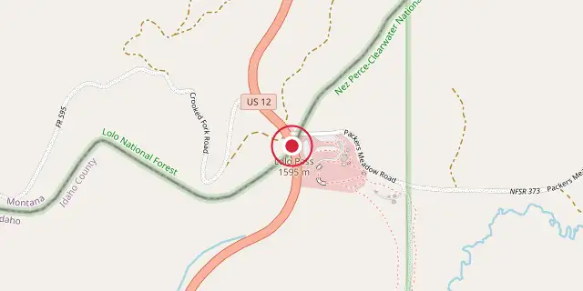
Coordinates: 46°38′06″N 114°34′48″W (46.6350, -114.5800) · Open in OpenStreetMap
Coordinates and connected clubs: the infobox of Wikipedia: Lolo Pass (Idaho–Montana) (CC BY-SA 4.0). Map: drawn by Codexery from OpenStreetMap tiles.
Lolo Pass, elevation 5233 feet, is a mountain pass in the Bitterroot Range of the northern Rocky Mountains, on the border between Montana and Idaho about 40 miles west-southwest of Missoula, Montana. It is the highest point of the historic Lolo Trail, a National Historic Landmark used by the Nez Perce in the 18th century and by the Lewis and Clark Expedition in September 1805. The pass was also used during the 1877 Nez Perce War. U.S. Highway 12, completed in 1962, crosses the pass.
More in Trails and Roads in the American Old West
Sources
Compiled from Wikipedia and the sources listed below. Text from Wikipedia is available under CC BY-SA 4.0; this entry is adapted from it.
- Wikipedia: Lolo Pass (Idaho–Montana) (CC BY-SA 4.0).
Spotted an error? Know more?
Reader corrections go straight into our review queue. Suggest an edit · How this site is sourced