
Sindh
Sindh is a Pakistani province, cradle of the Indus Valley Civilisation.

Baba66 · CC0
Sindh, a province in southeastern Pakistan, ranks as the country’s third-largest by land area and second-largest by population. Its capital and biggest city, Karachi, sits on the southern coast and serves as Pakistan’s primary financial hub. The province is bordered by the Arabian Sea to the south, Balochistan to the west, Punjab to the north, and the Indian states of Gujarat and Rajasthan to the east. Its terrain features alluvial plains along the Indus River, the Thar Desert in the east near the Indian border, and the Kirthar Mountains in the west along the Balochistan boundary. The earliest settled life in South Asia began around Sindh and Punjab some 9,000 years ago in the Indus River basin, eventually developing into the Indus Valley Civilisation. After 2000 BCE, as this civilisation declined, the Aryans migrated from Central Asia. Around 1000 BCE, the Indo-Aryan kingdom of Sindhu-Sauvīra arose in the region, lasting until 518 BCE when the Achaemenids took control. A succession of powers followed: the Macedonians, Mauryans, Indo-Greeks, Indo-Scythians, Guptas, and, in the 3rd century CE, the Sasanians. The Rai dynasty made Sindh an independent kingdom in the 5th century, succeeded by the Chach dynasty in the 7th. In 712 CE, the Umayyad Caliphate conquered Sindh, establishing it as a caliphal province and marking the start of over a millennium of Muslim rule in South Asia. The Habbari Emirate emerged in the 9th century, nominally loyal to the Abbasid Caliphate. From the 11th to the 16th centuries, the Soomra, Samma, and Arghun dynasties ruled Sindh, mostly as vassals of the Delhi Sultanate. The Mughal Empire took over in the late 16th century, governing directly until 1701, when the Kalhora dynasty became local rulers under Mughal, then Afsharid and Durrani, suzerainty. The Talpur dynasty’s rule began in 1783 and ended in 1846 when the East India Company captured Sindh, though a branch continued in Khairpur under British suzerainty. Initially part of the Bombay Presidency, Sindh became a separate province in 1936 following demands by the Muslim League, led by Muhammad Ali Jinnah. After the Lahore Resolution in 1940, Sindh was the first province to officially back the Pakistan Movement, joining the Dominion of Pakistan upon independence in 1947. It was merged into West Pakistan in 1955 but restored to provincehood in 1970, including its historic territories of Khairpur and Karachi. Sindh has the second-largest economy in Pakistan. Karachi, the most populous city in the country, is a major industrial hub and hosts two of Pakistan’s busiest commercial seaports: Port Qasim and the Port of Karachi. The rest of the province relies on agriculture, producing fruits, consumer goods, and vegetables for other parts of Pakistan. Often called Bāb-ul Islām (Gateway of Islam) or simply Mehrān (Gateway), Sindh was among the first parts of the Indian subcontinent to come under Islamic rule. Its distinct culture is heavily shaped by Sufism, a key element of Sindhi identity for both Muslims and Hindus. The province is renowned for its Bronze Age history under the Indus Valley civilisation and is home to two UNESCO World Heritage Sites: the Makli Necropolis and Mohenjo-daro.
- Capital
- Karachi
- Largest city
- Karachi
- Land area rank
- Third-largest in Pakistan
- Population rank
- Second-largest in Pakistan
- Economy rank
- Second-largest in Pakistan
- UNESCO World Heritage Sites
- Makli Necropolis and Mohenjo-daro
- Historical epithet
- Bāb-ul Islām (Gateway of Islam)
Quick Facts
- Etymology
- from Sindhū (Indus River), literally meaning 'river'
- Nicknames
- Mehrān (Gateway) · Bāb-ul-Islām (Gateway of Islam)
- Subdivision Type
- Country
- Subdivision Name
- Pakistan
- Established Title
- Established
- Established Date
- 1970-07-01 (current form)
- Established Title1
- Before was
- Established Date1
- Part of West Pakistan
- Seat Type
- Capital / and largest city
- Seat
- Karachi
- Parts Type
- Divisions
- Parts Style
- coll,para
Facts from the source article.
Lore & Background
Sindh's landscape consists mostly of alluvial plains flanking the Indus River, the Thar Desert in the east, and the Kirthar Mountains in the west. It was abandoned in the 19th century BCE as the civilisation declined, and was rediscovered in the 1920s. After the decline of the Indus Valley Civilisation, the region saw successive rulers including the Achaemenids, Macedonians, Mauryans, Indo-Greeks, Indo-Scythians, Guptas, and Sasanians. The Rai dynasty emerged in the 5th century, followed by the Chach dynasty in the 7th century. Later dynasties included the Habbari Emirate, Soomra, Samma, Arghun, Mughal, Kalhora, and Talpur.
Reader's Guide
Sindh holds profound significance in South Asian history as the birthplace of the Indus Valley Civilisation, one of the world's earliest urban societies, exemplified by the UNESCO World Heritage Site of Mohenjo-daro. The province's distinct culture is strongly influenced by Sufism, an important marker of Sindhi identity for both Muslims and Hindus. Economically, Sindh is the second-largest economy in Pakistan, with Karachi serving as the country's main financial hub and home to two of its busiest commercial seaports: Port Qasim and the Port of Karachi. The remainder of Sindh has an agriculture-based economy, producing fruits, consumer items, and vegetables. Its legacy includes two UNESCO World Heritage Sites—the Makli Necropolis and Mohenjo-daro—and a history of successive empires from the Achaemenids to the British, reflecting its enduring strategic and cultural importance.
Did You Know?
- Sindh is sometimes referred to as Bāb-ul Islām, meaning 'Gateway of Islam,' as it was one of the first regions of the Indian subcontinent to be brought under Islamic rule.
- The word Sind is a Persian derivative of the Sanskrit term Sindhu, meaning 'river,' a reference to the Indus River.
Cradle of the Indus: Nine Millennia of Civilisation
Long before written records, the banks of the Indus River witnessed the first settled communities of South Asia roughly nine thousand years ago. Over centuries, those riverine settlements matured into the Indus Valley Civilisation, one of the ancient world's great urban cultures. Mohenjo-daro, constructed around 2500 BCE, stands as the province's most celebrated archaeological treasure. Its standardized brickwork, gridded streets, and covered drainage networks reveal a sophistication contemporaneous with the pyramids of Egypt, the ziggurats of Mesopotamia, and the palaces of Minoan Crete. Scholars suggest a slow drying of the region during the third millennium BCE may have initially driven people to cluster into planned cities, yet the same aridification ultimately starved the water supply and scattered the population eastward. The site lay forgotten until the 1920s, when excavation teams uncovered its ruins. UNESCO granted it World Heritage status in 1980, though erosion and poorly executed restoration work now threaten its survival. Around 1000 BCE, the Indo-Aryan kingdom of Sindhu-Sauvīra rose over the lower Indus basin, with its capital at Roruka, a name that echoes in the modern town of Rohri.
A Corridor of Conquerors: Two Millennia of Dynastic Rule
From the sixth century BCE onward, Sindh's strategic position along the Indus made it a prize that successive empires could not ignore. The Achaemenid Persians seized the territory in 518 BCE and administered it as the satrapy of Hindush, a designation that endured until Alexander the Great's Macedonian forces swept through in the late fourth century. In the centuries that followed, the region passed through Mauryan, Indo-Greek, Indo-Scythian, Gupta, and Sasanian hands before the Rai dynasty reasserted local independence in the fifth century CE. The Chach dynasty followed in the seventh century, only to be displaced in 712 CE when Umayyad Muslim armies crossed into the subcontinent and established Sindh as a caliphal province. The Habbari Emirate of the ninth century, the Soomra, Samma, and Arghun dynasties spanning the eleventh through sixteenth centuries, and the Mughal conquest of the late 1500s each layered new chapters onto the province's story. The Kalhora family governed from 1701 under shifting suzerainties, and the Talpur dynasty held power from 1783 until the East India Company's military capture in 1846, after which a Talpur branch continued to rule Khairpur under British oversight.
Bāb-ul Islām: Faith, Language, and Identity
Sindh carries the honorific Bāb-ul Islām, or simply Mehrān, meaning 'Gateway,' a title rooted in the 712 CE Umayyad conquest that introduced Islamic governance to the Indian subcontinent and set the stage for more than a thousand years of Muslim political and cultural presence. That early encounter did not erase the region's layered past; instead, it wove into a distinctive Sindhi identity in which Sufism occupies a central place, shaping spiritual life for both Muslim and Hindu communities alike. The very name of the province is a linguistic palimpsest. The Sanskrit root Sindhu, meaning 'river,' refers to the mighty Indus. The Greeks who followed Alexander in 325 BCE called that river Indós, giving the world the word 'Indus.' Ancient Iranian speakers applied the term hind to everything lying east of the waterway. The Perso-Arabic spelling Sind, written سند, remained in official use until a 1988 amendment in the Sindh Assembly retired it. Two UNESCO World Heritage Sites—the Makli Necropolis and Mohenjo-daro—anchor the province's claim to a heritage that spans Bronze Age urbanism to medieval Islamic funerary architecture.
Economic Engine and Political Pioneer
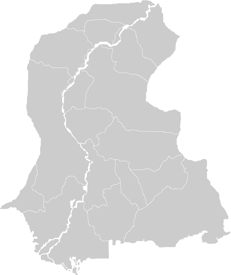
Today Sindh ranks as Pakistan's second-largest province by population and third by land area, stretching from the Arabian Sea coastline in the south to the Punjab border in the north, with the Thar Desert pressing against the Indian frontier to the east and the Kirthar Mountains marking the western edge along Balochistan. Its capital, Karachi, is the country's most populous city and its principal financial center, while Port Qasim and the Port of Karachi handle a substantial share of national maritime trade. The province anchors a large portion of Pakistan's industrial output and, beyond its urban core, sustains an agricultural economy that supplies fruits, vegetables, and consumer goods to other regions. Politically, Sindh's modern trajectory is inseparable from the creation of Pakistan itself. Muhammad Ali Jinnah pressed the Muslim League's demand for a separate Sindh province, which was granted in 1936. After the Lahore Resolution of 1940, Sindh became the first province to formally back the Pakistan Movement. It entered the Dominion of Pakistan in 1947, was absorbed into the merged West Pakistan in 1955, and regained full provincial status in 1970, with its historic territories of Khairpur and Karachi restored to its fold.
Gallery
Frequently Asked Questions
What is Sindh?
Sindh is a province in southeastern Pakistan that ranks third in land area and second in both population and economic output among the country's provinces. It is the home of Karachi, the nation's primary financial center.
Why is Sindh historically important?
The region is where the Indus Valley Civilisation flourished, representing one of humanity's first urban societies. It also holds the distinction of being the first area on the Indian subcontinent to come under Islamic governance, earning it the nickname Gateway to Islam.
What is Sindh's capital and largest city?
Karachi holds both the title of provincial capital and the distinction of being Sindh's most populous settlement, while also functioning as Pakistan's central hub for finance and commerce.
What UNESCO World Heritage Sites are located in Sindh?
Two sites within the province carry this designation: the Makli Necropolis and the ancient city of Mohenjo-daro. Both reflect the deep archaeological and cultural layers that make the region unique.
How does Sindh rank among Pakistan's provinces?
By land area it is the third-largest province, but it holds the second position in both population size and economic contribution to the national economy.
More in States And Regions 1-15
Spotted an error? Know more?
This is a living reference — every entry is fact-audited, and reader corrections feed straight into our audit queue. Suggest an edit · See this site's audit record