
Sakha Republic
World's largest country subdivision, extreme cold, diamond-rich republic.

sakha.gov.ru · CC BY 4.0
The Sakha Republic, also called the Republic of Sakha (Yakutia), is a federal subject of Russia. It is the largest such division in the country by area, and also the largest subnational entity in the world, spanning more than 3,083,523 square kilometers. Situated in the Russian Far East along the Arctic Ocean, it has a population of roughly one million. Its capital, Yakutsk, holds the title of the coldest major city on Earth. The region is notorious for its harsh climate: Verkhoyansk and Oymyakon have recorded the second-lowest temperatures in the Northern Hemisphere, and winter averages in Yakutsk regularly fall below −35 °C. Despite the cold, summers are warm across much of the republic due to its hypercontinental tendencies.
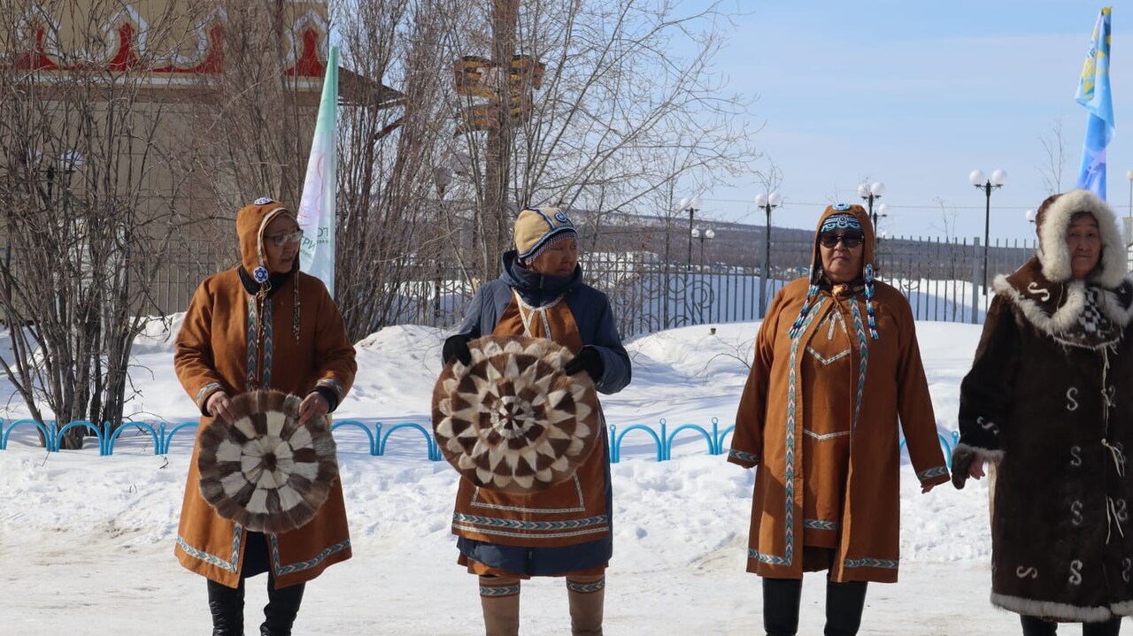
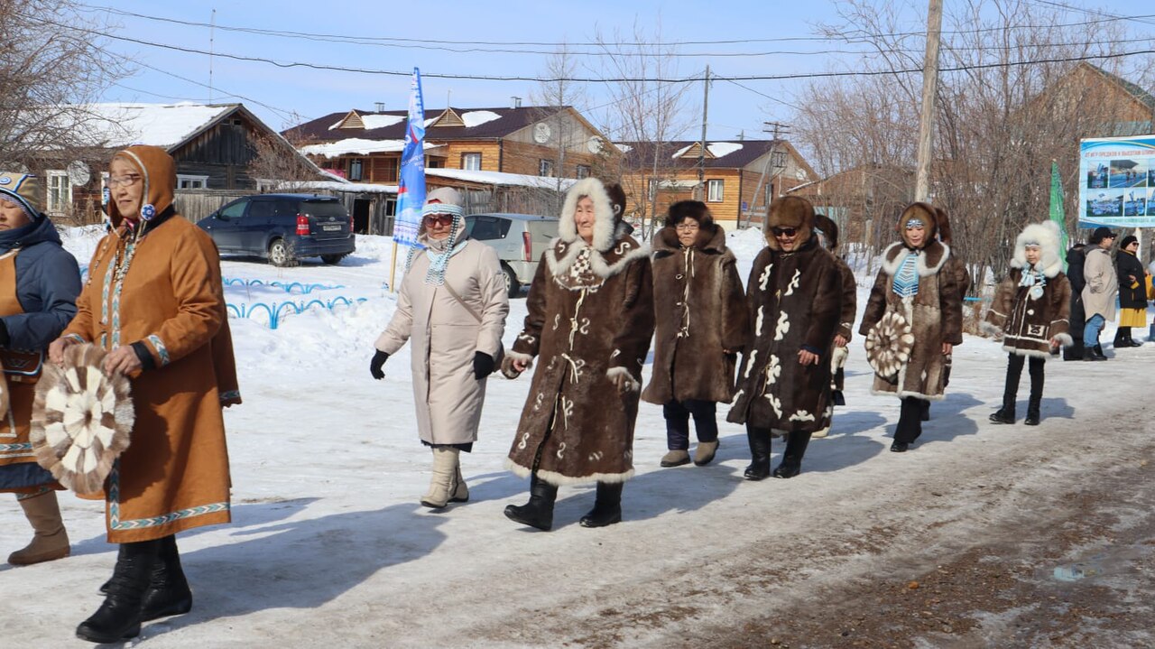
Before Russian contact, the area was home to Tungusic and Paleosiberian peoples like the Evenks and Yukaghirs, who lived by hunting, gathering, and reindeer herding. The Turkic Sakha people arrived from the Lake Baikal region between the 9th and 16th centuries, likely in several waves, bringing with them an Inner Asian pastoral economy. In the early to mid-17th century, the Russians colonized the area, incorporating it as Yakutsk Oblast into the Tsardom of Russia and forcing indigenous groups to pay fur tribute. The Sakha population dropped by 70% in the initial period after conquest, but during the Imperial era, the native Yakuts expanded from the middle Lena River along the Vilyuy River to the north and east, displacing other indigenous groups. Yakutia saw some of the final battles of the Russian Civil War, and in 1922 the Bolsheviks reorganized Yakutsk Oblast into the autonomous Yakut ASSR. The Soviet period brought a large influx of Slavs, especially Russians and Ukrainians. On 27 September 1990, the territory became the Yakutskaya-Sakha Soviet Socialist Republic, and on 27 December 1991, it was renamed the Republic of Sakha (Yakutia).
The name "Yakut" comes from the Evenk term *Yako*, which the Evenks used for the Sakha; the Russians adopted it. The Yukaghirs, another neighboring people, use the exonyms *yoqol* (Tundra Yukaghir) or *yaqal* (Kolyma Yukaghir). The self-designation "Sakha" may share the same origin (*jaqa*), evolving through regular sound changes in the Yakut language. The Dolgans, whose language is closely related to Yakut, pronounce it as *Haka*.
Geographically, Sakha borders Chukotka Autonomous Okrug, Magadan Oblast, Khabarovsk Krai, Amur Oblast, Zabaykalsky Krai, Irkutsk Oblast, and Krasnoyarsk Krai. To the north, it meets the Arctic Ocean, including the Laptev and Eastern Siberian Seas. Its highest point is Peak Pobeda at 3,003 meters. The republic stretches 2,500 kilometers from north to south and 2,000 kilometers from east to west, reaching as far as Henrietta Island. The Laptev and Eastern Siberian Seas are the coldest and iciest in the Northern Hemisphere, covered by ice for nine to ten months each year. The New Siberian Islands are part of Sakha’s territory. After Nunavut split from Canada’s Northwest Territories in 1999, Sakha became the world’s largest subnational entity, slightly smaller than India but larger than Argentina.
The republic has three main vegetation belts. About 40% lies above the Arctic Circle, and permafrost covers the entire region, limiting forests to the south. Arctic and subarctic tundra dominate the middle zone, where lichen and moss form green carpets ideal for reindeer grazing. In the southern tundra, scattered dwarf Siberian pine and larch grow along rivers. Below the tundra lies the vast taiga forest, covering about 47% of Sakha, with larch in the north and fir and pine in the south. The Sakha Republic is home to Pleistocene Park, a project aimed at recreating Pleistocene tundra grasslands by introducing animals that thrived there during the late Pleistocene to early Holocene.
Sakha is the only Russian federal subject to use more than one time zone, spanning three. It does not observe daylight saving time. The largest river is the navigable Lena, stretching 4,400 kilometers, with hundreds of tributaries in the Verkhoyansk Range. Other major rivers include the Vilyuy (2,650 km), Markha (1,181 km), Morkoka (812 km), Tyung (1,092 km), Aldan (2,273 km), Amga (1,462 km), Maya (1,053 km), Uchur (812 km), Olyokma (1,320 km), Linde (804 km), Nyuya (798 km), Olenyok (2,292 km), Kolyma (2,129 km), Indigirka (1,726 km), and Selennyakh (796 km).
- Area
- 3,083,523 km² (1,190,555 sq mi)
- Capital
- Yakutsk
- Population
- One million
- Highest Point
- Peak Pobeda (3,003 m; 9,852 ft)
- Largest River
- Lena River (4,400 km; 2,700 mi)
- Climate Record
- Lowest temperature −67.8 °C (−90.0 °F) at Verkhoyansk and Oymyakon
- Diamond Production
- 99% of Russian diamonds, over 25% of world diamonds
Verified Timeline
Lore & Background
Sakha was first home to hunting-gathering and reindeer herding Tungusic and Paleosiberian peoples such as the Evenks and Yukaghir. Migrating from the area around Lake Baikal, the Turkic Sakha people first migrated to the middle Lena River sometime between the 9th and 16th centuries, likely in several waves, bringing the pastoral economic system of Inner Asia with them. The Russians colonised and incorporated the area as the Yakutsk Oblast into the Tsardom of Russia in the early-mid 17th century, obliging the indigenous peoples of the area to pay fur tribute. While the initial period following the Russian conquest saw the Sakha population drop by 70%, the Imperial period also saw the expansion of the native Yakuts from the middle Lena along the Vilyuy River to the north and the east displacing other indigenous groups. Yakutia saw some of the last battles of the Russian Civil War, and the Bolshevik authorities reorganised Yakutsk Oblast into the autonomous Yakut ASSR in 1922. On 27 September 1990, the area became the Yakutskaya-Sakha Soviet Socialist Republic, and on 27 December 1991, it became the Republic of Sakha (Yakutia).
Reader's Guide
The Sakha Republic is the world's largest country subdivision, covering over 3,083,523 square kilometers (1,190,555 sq mi), slightly smaller than the territory of India but slightly larger than Argentina. It is the only federal subject of Russia which uses more than one time zone, spanning three time zones. The republic is known for its extremes in climate, with the Verkhoyansk Range being the coldest area in the Northern Hemisphere; temperatures reached as low as −67.8 °C (−90.0 °F) at Verkhoyansk in 1892 and 1885, and at Oymyakon in February 1934. The largest river is the navigable Lena River (4,400 km; 2,700 mi). There are over 800,000 lakes in the republic. Sakha is well endowed with raw materials, including large reserves of oil, gas, coal, diamonds, gold, silver, tin, tungsten and many others. It produces 99% of all Russian diamonds and over 25% of the diamonds mined in the world. The republic can be divided into three great vegetation belts: Arctic and subarctic tundra, and taiga forest, which covers about 47% of Sakha. The Sakha Republic is the site of Pleistocene Park, a project directed at recreating Pleistocene tundra grasslands. Siberia, and particularly Sakha, is of paleontological significance, as it contains bodies of prehistoric animals from the Pleistocene Epoch, preserved in ice or permafrost, including cave lion cubs, woolly mammoths, a woolly rhinoceros, bison, and horses.
Did You Know?
- Sakha is the only federal subject of Russia which uses more than one time zone, spanning three time zones.
- The Northern Hemisphere's Pole of Cold is at Verkhoyansk, where temperatures reached as low as −67.8 °C (−90.0 °F) in 1892 and 1885.
- There are over 800,000 lakes in the republic.
- Sakha produces 99% of all Russian diamonds and over 25% of the diamonds mined in the world.
- In June 2019, the severed but preserved head of a large wolf from the Pleistocene, dated to over 40,000 years ago, was found close to the Tirekhtyakh River.
The Coldest Major City on Earth
Yakutsk holds the distinction of being the coldest major city on the planet, sitting roughly 450 km south of the Arctic Circle in the Central Yakutian Lowland. Its intensely continental subarctic climate produces winter highs that routinely plunge below −20 °C, and the all-time record reached a staggering −64.4 °C on February 5, 1891. The city has never recorded a temperature above freezing between mid-November and mid-March. Yet the seasonal swing is extraordinary: summers can push past +30 °C, and the gap between the coldest and warmest recorded temperatures spans 102 °C—the greatest seasonal range anywhere on the planet. Because Yakutsk sits on continuous permafrost, much of its housing rests on concrete piles driven into frozen ground. The city is also remarkably dry, as Pacific moisture is stripped away by coastal mountain ranges long before it reaches the Lena Valley. Despite its latitude, warm enough summers keep Yakutsk well south of the tree line, and its July averages actually exceed those of more southerly Far East ports like Vladivostok.
Layers of Human History and Recent Discoveries
Over two hundred archaeological sites within the modern city boundaries have been studied, and the oldest, the Yubileinaya site, dates back between 20,500 and 10,000 years. The Cossack fort was relocated to the left bank of the Lena in 1643, and by 1708 the settlement had earned formal city status. In 2024, archaeologists uncovered a remarkable corpus of 17th-century birch bark letters written in cursive ink script, believed to be remnants of the voivode's chancery lost to fire in 1700.
Mining Wealth and Rapid Urban Growth
Driven by the extraction of diamonds, gold, coal, and other precious minerals, Yakutsk has transformed into one of Russia's fastest-growing regional centers, reaching a population of 355,443 by the 2021 census. Numerous mining corporations have established their headquarters in the city, and its export volume hit $5.55 billion in 2021, ranking it sixteenth among Russia's eighty-five federal subjects—though that figure contracted to under $1 billion the following year. Tourism, while still a modest contributor, is expanding, fueled by the city's cultural heritage and natural landmarks.
Permafrost, the Lena River, and Natural Heritage
Yakutsk occupies a unique geographic position in the Central Yakutian Lowland, perched along the Lena River as a major port city. It is the largest urban center in the world built entirely on continuous permafrost, a distinction it shares only with Norilsk, another Siberian city. The Lena River threads through the city and serves as both a transportation artery and a scenic corridor. Closer to the city, the Permafrost Kingdom, a dedicated tourist complex, showcases the geological and ecological peculiarities of the frozen ground beneath. The city's inland position, nearly 1,000 km from the Pacific, combined with its high latitude, creates an environment where temperature moderation is virtually absent. Yet the warm, sunny summers—sometimes exceeding +30 °C—ensure that Yakutsk remains comfortably south of the tree line, supporting forests and greenery that contrast sharply with the brutal winters that define its global reputation.
Gallery

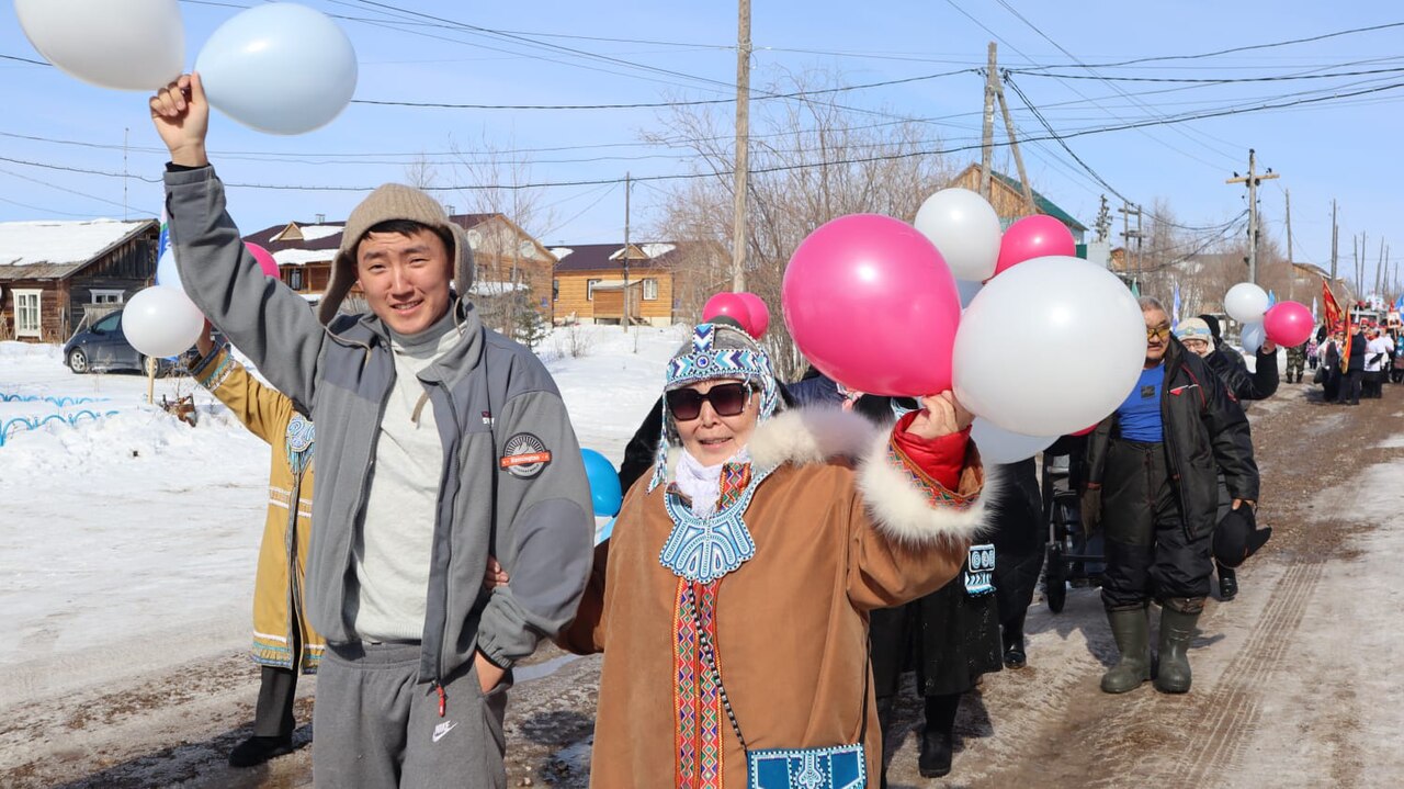
Frequently Asked Questions
Who is Sakha Republic?
Sakha Republic, commonly called Yakutia, is a federal subject in Russia's Far East that holds the record as the largest subnational territory on the planet. Its capital, Yakutsk, is recognized as the coldest major city anywhere on Earth.
How big is Sakha Republic compared to other regions?
At roughly 3.08 million square kilometers, it outstrips every other country subdivision and is larger than most sovereign states. The Lena River, stretching about 4,400 km, threads through its interior, and its highest point, Peak Pobeda, reaches 3,003 meters.
What are Sakha Republic's signature traits or 'powers'?
The republic is defined by two extremes: it recorded the second-lowest natural temperature in the Northern Hemisphere (−67.8 °C at Verkhoyansk and Oymyakon), and it extracts approximately 99% of Russia's diamonds, which in turn represent well over a quarter of global production.
Where is Sakha Republic located and what is its population?
It occupies the northeastern quadrant of Russia, with the Arctic Ocean forming its northern boundary. Despite its enormous footprint, the republic is home to only around one million residents spread across that vast expanse.
Why is Sakha Republic considered important in the broader picture?
Its diamond, gold, and mineral wealth make it a cornerstone of Russia's resource economy, while its sheer size—comparable to the entire European Union—makes it a unique case in how a single administrative unit can cover such territory. The combination of extreme climate, strategic location, and resource output gives it a role far beyond its population size.
More in States And Regions 1-15
Spotted an error? Know more?
This is a living reference — every entry is fact-audited, and reader corrections feed straight into our audit queue. Suggest an edit · See this site's audit record