Irtysh
Longest tributary river in the world, flowing through three countries.

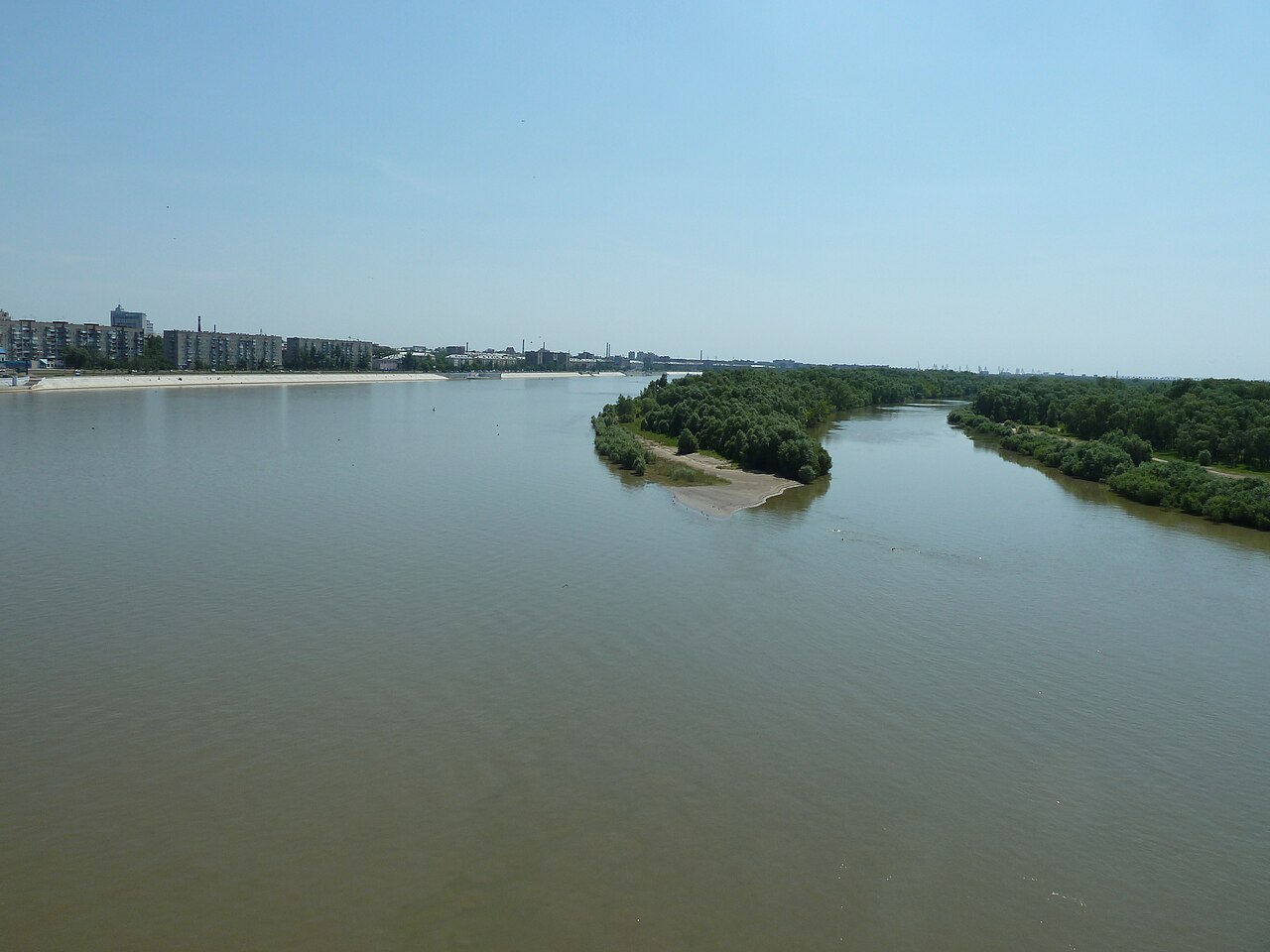
Sibom · Public domain
The Irtysh flows through Russia, China, and Kazakhstan. It is the main tributary of the Ob River and holds the record as the world’s longest tributary. Its headwaters begin in the Mongolian Altai mountains, in the Dzungaria region of northern Xinjiang, China, close to the Mongolian border. The river’s major tributaries are the Tobol, Demyanka, and Ishim. Together, the Ob and Irtysh create a vast drainage basin that covers most of Western Siberia and the Altai Mountains.
The name Irtysh first appears in inscriptions honoring the Turkic commanders Tonyukuk (646–724) and Kul Tigin (684–731). The Turkic scholar Mahmud al-Kashgari (1029–1101) was the first to analyze the name, linking it to the word *ertishmak*, meaning “quick jump.” A contemporary, the Persian geographer al-Gardizi (d. 1061), recorded a legend in which a slave of Prince Shad, founder of the Kimaks, saw Turks wandering near the river and told them “irtysh,” meaning “stop.” Later, Gerhard Friedrich Müller suggested the name came from the Tatar Khan Irtyshak. Another theory derives it from Turkic *ir* (“earth”) and *tysh* (“dig”), so “digging the earth.” A. P. Dulzon and V. N. Popova proposed that *tysh* comes from the Ket word for “river” (*chesh*, *shesh*, *sis*, *ses*), while *ir* stems from a pre-Ket (Iranian) root meaning “stormy” or “rapid.” Hungarian chronicles refer to a river called Togora (or Togat), which Hunfalvi identified as the Irtysh; the Ostyaks reportedly call it Tangat or Tlangatl.
From its source as the Kara-Irtysh (Black Irtysh) in China’s Mongolian Altai, the river flows northwest through Lake Zaysan in Kazakhstan, then meets the Ishim and Tobol before joining the Ob near Khanty-Mansiysk in western Siberia, Russia, after 4,248 kilometers. The upper course, from its source to Lake Zaysan, is often called the Black Irtysh (Kara-Irtysh or Cherny Irtysh). The term White Irtysh, once used for the stretch below Lake Zaysan, is now largely obsolete.
The largest tributaries, listed from source to mouth, include the Tobol, Demyanka, and Ishim.
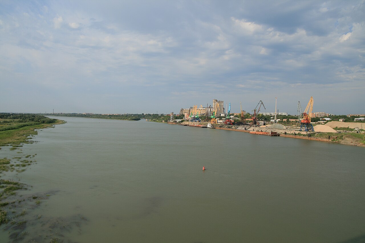
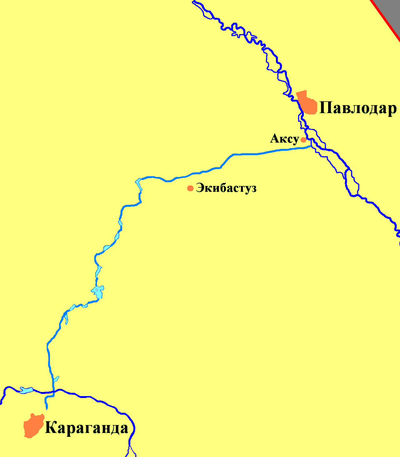
Economically, the river is navigable between April and October in Kazakhstan and Russia, carrying tankers, passenger ships, and cargo. Omsk, home to the state-owned Irtysh River Shipping Company, is the largest river port in Western Siberia. Three major hydroelectric plants operate on the Kazakh section: Bukhtarma, Ust-Kamenogorsk, and Shulbinsk. The world’s deepest lock, with a 42-meter drop, allows vessels to bypass the Ust-Kamenogorsk dam. Additional dams are planned. On the Chinese section, three dams have been built: Keketuohai, Kalasuke, and Project 635. Right tributaries the Burqin and Haba rivers also have dams: Burqin Chonghu’er, Burqin Shankou, Jilebulake, and Haba River Shankou. In the 1960s and 1970s, Soviet planners proposed diverting Irtysh (and Ob) water to central Kazakhstan and Uzbekistan; one version would have reversed the Irtysh’s flow between Tobolsk and Khanty-Mansiysk, creating an “Anti-Irtysh.” These large schemes were not built, but the Irtysh–Karaganda Canal was completed in 1974, supplying the Kazakh steppes and Karaganda. In 2002, pipelines extended water from the canal to the Ishim River and Astana. In China, a short canal built in 1987 diverts water to Lake Ulungur, whose level had dropped due to irrigation. Later, the Irtysh–Karamay–Urümqi Canal was completed. Increased Chinese water use—about 3 cubic kilometers per year, according to a 2013 Kazakh report—means only about 6 cubic kilometers of the river’s natural 9 cubic kilometers reach the Kazakh border, raising concerns among Kazakh and Russian environmentalists.
Major cities along the Irtysh, from source to mouth, include: in China—Fuyun, Beitun, Burqin; in Kazakhstan—Oskemen, Semey, Aksu, Pavlodar; in Russia—Omsk, Tara, Tobolsk, Khanty-Mansiysk.
Seven railway bridges cross the river: about 15 kilometers downstream from Serebryansk (on a dead-end branch from Oskemen to Zyryanovsk), at Oskemen, at Semey (on the Turkestan–Siberia Railway), at Pavlodar (on the South Siberian rail line from Nur-Sultan to Barnaul), and near Cherlak (on the Middle Siberian rail line).
- source
- Mongolian Altai, Dzungaria, Xinjiang, China
- mouth
- Confluence with the Ob near Khanty-Mansiysk, Russia
- major_tributaries
- Tobol, Demyanka, Ishim
- countries
- Russia, China, Kazakhstan
- economic_use
- Navigation, hydroelectricity, irrigation
Lore & Background
A legend cited by Persian geographer al-Gardizi (d. Other proposed etymologies include derivation from the Tatar Khan Irtyshak, from Turkic words for 'earth' and 'dig', or from Ket and Iranian roots meaning 'river' and 'stormy'.
Reader's Guide
The Irtysh has been a vital waterway for centuries, serving as a route for trade, conquest, and settlement. In the 16th century, the lower and middle courses lay within the Tatar Khanate of Sibir, whose capital Qashliq was on the Irtysh. The river's economic importance continues today: it is navigable from April to October, hosts three major hydroelectric plants in Kazakhstan, and supplies water via the Irtysh–Karaganda Canal. In China, the Irtysh–Karamay–Urümqi Canal diverts water, causing environmental concerns in Kazakhstan and Russia.
Did You Know?
- The Irtysh is the longest tributary river in the world.
- The world's deepest lock, with a drop of 42 m, bypasses the dam at Ust-Kamenogorsk.
- The name 'Black Irtysh' (Kara-Irtysh) refers to the upper course entering Lake Zaysan.
A Transcontinental Waterway
The Irtysh is a river that threads through three nations—China, Kazakhstan, and Russia—before joining the Ob, making it the longest tributary on Earth. Its journey begins in the Mongolian Altai mountains within Dzungaria, the northern reaches of Xinjiang province, close to the Mongolian border. From there it flows northwestward, passing through Lake Zaysan in Kazakhstan. Along its course it receives major tributaries including the Ishim, the Tobol, and the Demyanka. The upper stretch, from its source to Lake Zaysan, is traditionally called the Kara-Irtysh or Black Irtysh, while the lower section was once referred to as the White Irtysh, a designation that has largely fallen out of use. Together, the Ob and Irtysh create one of Asia's great drainage basins, sweeping across most of Western Siberia and the Altai Mountains.
A Name Woven Through Centuries
The name Irtysh carries a remarkably layered etymological history. The earliest known references appear in the stone epitaphs of two commanders of the Second Eastern Turkic Khaganate, Tonyukuk and Kul Tigin, dating to the seventh and eighth centuries. The first scholar to attempt a systematic decipherment was the Turkic philologist Mahmud al-Kashgari in the eleventh century, who linked the name to a word meaning "quick jump." His contemporary, the Persian geographer al-Gardizi, preserved a folk legend in which a slave of the Kimak founder, Prince Shad, uttered the word "irtysh"—meaning "stop"—to wandering Turks near the water. Other interpretations trace the name to a Tatar khan called Irtyshak, or to Turkic roots combining "earth" and "dig." Linguists Dulzon and Popova proposed a different reading: the suffix derives from Ket words for "river," while the prefix connects to a pre-Ket, possibly Iranian, root meaning "stormy" or "rapid." Hungarian chronicles even mention a river called Togora, and the Ostyaks reportedly knew it as Tangat or Tlangatl.
Water, Power, and Political Tension
The Irtysh has long served as a vital artery for commerce and energy. During the ice-free months from April through October, tankers, passenger vessels, and cargo ships ply its waters, with Omsk in Russia functioning as the largest river port in Western Siberia and home to the state-owned Irtysh River Shipping Company. Kazakhstan hosts three major hydroelectric plants along the river—Bukhtarma, Ust-Kamenogorsk, and Shulbinsk—the last featuring the world's deepest lock, a 42-metre drop that lets traffic bypass the dam. China has built three dams on its section of the river, plus additional structures on tributaries. Soviet-era planners once floated the radical idea of reversing the river's flow to irrigate central Kazakhstan and Uzbekistan, a so-called "Anti-Irtysh" that was never realized. More modest projects did proceed: the Irtysh-Karaganda Canal, completed in the 1970s, and the Irtysh-Karamay-Urümqi Canal finished in the early 2000s. A 2013 Kazakh fishery report estimated that Chinese water withdrawals of roughly three cubic kilometres per year reduce the flow reaching the Kazakh border to only two-thirds of its natural volume, sparking ongoing environmental concern.
Bridges, Railways, and the Cities That Line the Banks
The Irtysh has long been a corridor for overland transport, and its banks are dotted with cities across all three countries. In China, Fuyun, Beitun, and Burqin sit along the upper reaches; in Kazakhstan, Oskemen, Semey, Aksu, and Pavlodar mark the middle course; and in Russia, Omsk, Tara, Tobolsk, and Khanty-Mansiysk line the lower stretch toward the Ob. Additional crossings serve the Middle Siberian rail line near Cherlak and a dead-end branch near Serebryansk. As the Kuytun-Beitun Railway in Xinjiang extends toward Altay City, a new bridge at Beitun will be required. Beyond rail, numerous highway bridges in all three nations ensure that the Irtysh, for all its length, remains a bridgeable rather than a barrier.
Gallery
Frequently Asked Questions
What are Irtysh's key roles and 'powers'?
The river supports commercial navigation, hydroelectric generation, and large-scale irrigation across the regions it crosses. It also gathers several significant tributaries of its own, including the Tobol, Demyanka, and Ishim.
Which countries does Irtysh flow through?
The Irtysh threads through three nations—China, Kazakhstan, and Russia—making it a rare multi-border waterway. Its source sits in the Mongolian Altai region of Dzungaria, in northern Xinjiang, China.
How does Irtysh's story end?
The river's independent journey concludes when it merges with the Ob near Khanty-Mansiysk in Russia. At that confluence point the Irtysh ceases to exist as a separate channel and becomes part of the larger Ob system.
Why is Irtysh important in the river world?
No other tributary on Earth rivals its length, which is why it tops every 'longest tributary' list. Its three-country route and its economic roles in shipping, power, and farming make it a standout entry in any river reference.
More in Rivers And Lakes 1-17
Spotted an error? Know more?
This is a living reference — every entry is fact-audited, and reader corrections feed straight into our audit queue. Suggest an edit · See this site's audit record