Mount Garibaldi
Sacred Squamish volcano with a history of subglacial eruptions.
Last updated
Where it is
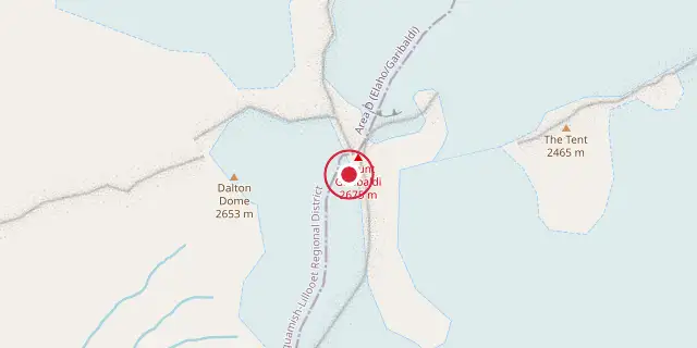
Coordinates: 49°51′00″N 123°00′18″W (49.8500, -123.0050) · Open in OpenStreetMap
Coordinates and connected clubs: the infobox of Wikipedia: Mount Garibaldi (CC BY-SA 4.0). Map: drawn by Codexery from OpenStreetMap tiles.
Mount Garibaldi (Nch'ḵay̓) is a dormant stratovolcano in southwestern British Columbia, Canada, rising to 2678 m. It is the largest volcano in Squamish Nation territory and holds deep cultural significance for the Squamish people, who consider it sacred. The mountain features two named sub-peaks, Atwell Peak and Dalton Dome, and has been volcanically active over the last 260,000 years.
Geography
Mount Garibaldi lies on the east side of the Cheakamus River between Squamish and Whistler, within the Pacific Ranges Ecoregion. This ecoregion is a mountainous area of the southern Coast Mountains with high, steep, rugged granitic rocks. The Eastern Pacific Ranges Ecosection, which contains Mount Garibaldi, has a transitional climate between coastal maritime and interior continental, with little precipitation and mild temperatures from Pacific air, though cold Arctic air can bring extreme cloud cover and snow in winter.
Rivers in this ecosection include the Fraser, Coquihalla, Cheakamus, Squamish, Elaho, and Lillooet. Valleys and lower slopes are dominated by coastal western hemlock forests, while upper slopes have subalpine mountain hemlock, Engelmann spruce, and subalpine fir forests. Alpine vegetation lies above the subalpine forests, often overlain by barren rock. Wildlife includes grey jays, chipmunks, squirrels, flickers, Columbian black tailed deer, mountain goats, wolverines, cougars, and grizzly and black bears.
Communities such as Whistler, Pemberton, Mount Currie, Hope, and Yale are within this ecosection, connected to the Lower Mainland by highways.
Geology
Mount Garibaldi is one of three principal volcanoes in the southern Garibaldi Volcanic Belt, along with Mount Price and The Black Tusk. It is the largest volcano in the combined Mount Garibaldi–Garibaldi Lake volcanic field, which contains 26 km³ of volcanic material and at least twelve eruptive centres. The volcano formed due to subduction zone volcanism as the Juan de Fuca Plate thrusts under the North American Plate at the Cascadia subduction zone.
Mount Garibaldi is a moderately eroded stratovolcano made exclusively of dacite, one of three such Cascade Arc volcanoes; rhyodacite and high-silica rhyolite are also present. Andesite erupted early in its history. The total volume of volcanic rocks is 16 to 20 km³, spanning activity from about 670,000 years ago to the Holocene. Andesite-dacite lavas initially filled glacially incised paleovalleys, and dacitic domes built the main edifice starting about 260,000 years ago.
Much of the volcano was rebuilt in the last 50,000 years by violent eruptions similar to the 1902 Mount Pelée eruption. The modern 6.5 km³ edifice is a supraglacial volcano partially constructed over glacial ice during the Pleistocene.
Human history
To the Squamish people, Mount Garibaldi is called Nch'ḵay̓, meaning 'Dirty Place' in their language, referring to the muddy waters of the Cheekye River. It is considered sacred and is an important part of their history. In oral tradition, during the great flood after the last ice age, Mount Garibaldi was one of only two mountains that remained above water. The Squamish people latched their canoes to the mountain with a rope of woven cedar bark to avoid being swept away.
As flood waters receded, a large lake formed, and the people returned to their home site in Squamish. An obsidian outcrop on the southeastern flank is said by the Squamish to have been created by the thunderbird, a legendary creature that helped them fight evil by shooting lightning from its eyes. The obsidian was used for tools, though its quality is poor compared to other British Columbia sources. Pieces of Garibaldi obsidian appear in archaeological sites in the Strait of Georgia as early as 4,500 years old.
Climbing and skiing
Mountain climbing on Mount Garibaldi is typically done in winter when loose volcanic rocks are frozen in place by snow and ice. Most routes are on glaciers and snow slopes, requiring some climbing skill, with grades from II to V and class 2 to 5 on the Yosemite Decimal System. Ski camping on the Garibaldi Névé is common in winter, though high winds are not unusual, so campsites are often protected by digging into snow or building snow walls or igloos.
The Garibaldi Névé is a popular ski destination, especially in spring, and provides access to many climbing routes. By June or July, skis are rarely used as glaciers and snow slopes become boggy and melt away. Bergschrunds and crevasses can be dangerous in late spring or summer, and rockfalls and loose rock are ever-present hazards; early-season cold-weather snow ascents are recommended. Avalanche danger can be high in winter and spring.
In April 1950, Vancouver photographer Otto E. Landauer fractured a leg when a ski broke while skiing on Mount Garibaldi. He was brought down by a party of 25 holidayers at Diamond Head Lodge, transferred to a light truck to Squamish, and then taken by speedboat to St. Paul's Hospital in Vancouver in a 46-hour rescue operation.
Did You Know?
- The Brohm Ridge Chalet, a three-story European-style lodge built in the 1960s, is now operated by the Black Tusk Snowmobile Club and sleeps 40 people.
- The Elfin Lakes shelter, equipped with a propane heater and wash sink, can sleep up to 33 people.
- Mamquam Road, 4 km north of downtown Squamish, provides access to Mount Garibaldi from Highway 99.
More in Religious Places of the Indigenous Peoples of North America
Sources
Compiled from Wikipedia and the sources listed below. Text from Wikipedia is available under CC BY-SA 4.0; this entry is adapted from it.
- Wikipedia: Mount Garibaldi (CC BY-SA 4.0).
- Word definitions: the Codexery glossary, each quoted from its Wikipedia article.
Spotted an error? Know more?
Reader corrections go straight into our review queue. Suggest an edit · How this site is sourced