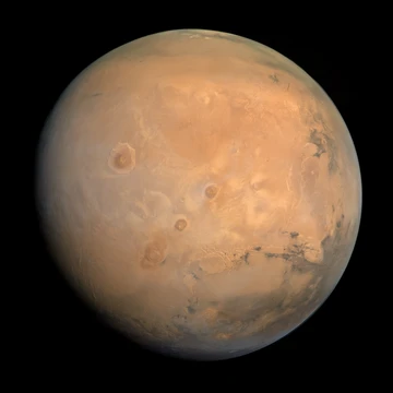
Mare Tyrrhenum quadrangle
Quadrangle containing ancient volcano Tyrrhenus Mons and crater Herschel.
Last updated
The Mare Tyrrhenum quadrangle, designated MC-22, is one of 30 USGS Astrogeology Research Program quadrangle maps of Mars. It covers the area from 225° to 270° west longitude and 0° to 30° south latitude, containing parts of Tyrrhena Terra, Hesperia Planum, and Terra Cimmeria. The region is notable for the large, ancient volcano Tyrrhenus Mons and the crater Herschel, its largest impact feature.
Quick Facts
- Quadrangle designation
- MC-22 (Mars Chart-22)
- Longitude range
- 225° to 270° west
- Latitude range
- 0° to 30° south
- Largest crater
- Herschel
- Major volcano
- Tyrrhenus Mons
- Named after
- Earth's Tyrrhenian Sea (by Schiaparelli)
Facts from the source article.
Fossa on Mars
Large troughs on Mars, called fossae, form when crustal stretching creates breaks. Such stretching can result from the weight of a nearby volcano. A trough with two parallel breaks and a dropped middle section, forming steep cliffs, is termed a graben.
Studies indicate a fault on Mars may extend as deep as 5 km. When a fault widens, a void forms; material sliding into it creates a pit crater or pit crater chain, which lack rims or ejecta. Individual pit craters can merge into chains or scalloped troughs. Some evidence links fossae and pit craters to magma dikes: magma moving underground may break rock and melt ice, producing surface cracks.
Pit craters are uncommon on Earth, where similar sinkholes typically result from limestone dissolution. Tyrrhenus Mons displays notable fossae and pit craters, visible in HiRISE imagery. Understanding these features is important for future colonization, as they may serve as water reservoirs.
Hydrothermal features in Auki
The crater Auki contains ridge networks interpreted as evidence of post-impact hydrothermal activity. Impacts fracture rock and generate heat that can melt ice, allowing water to move through cracks and deposit minerals. These deposits, more resistant to erosion, become visible as surrounding ground erodes. Instruments on the Mars Reconnaissance Orbiter identified minerals in Auki—including smectite, silica, zeolite, serpentine, carbonate, and chlorite—that are common in impact-induced hydrothermal systems on Earth.
Channels
Evidence indicates water once flowed in river valleys and channels on Mars. Curved channels have been imaged since the Mariner 9 orbiter. The Viking Orbiters revealed extensive river valleys, showing that floods broke through dams, carved deep valleys, eroded grooves into bedrock, and traveled thousands of kilometers.
Some valles, such as Mangala Vallis and Athabasca Vallis, begin at graben. Others originate in rubble-filled low areas called chaos or chaotic terrain. One hypothesis suggests that water trapped under pressure beneath a thick cryosphere was suddenly released when a fault broke the frozen ground.
Dunes
Sand dunes, found in many Martian locations, indicate the presence of an atmosphere with wind. The old Martian surface has allowed rocks to erode into abundant sand. Dunes have been observed to move many meters; sand moves up the windward side and falls down the leeward slip face, causing the dune to advance. Enlarged images sometimes reveal ripples on dune surfaces, formed by sand grains rolling and bouncing up the windward side, landing on each ripple's windward face.
Did You Know?
- Linear ridge networks, found in and around craters, are thought to form when impacts create fractures that later channel fluids, cementing the structures; surrounding material then erodes away, leaving hard ridges.
- Ridges occurring in locations with clay could serve as a marker for clay, which requires water for formation and may have supported past life.
- Clay may preserve fossils or other traces of past life.
More in Mars
Sources
Compiled from Wikipedia and the sources listed below. Text from Wikipedia is available under CC BY-SA 4.0; this entry is adapted from it.
- Wikipedia: Mare Tyrrhenum quadrangle (CC BY-SA 4.0).
Spotted an error? Know more?
Reader corrections go straight into our review queue. Suggest an edit · How this site is sourced