Chiba Prefecture
Eastern Pacific prefecture of Japan, part of Greater Tokyo Area.

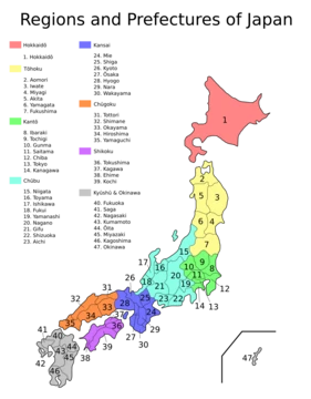
Chiba Prefecture sits in Japan’s Kantō region on Honshu, stretching along the Pacific coast east of Tokyo. It’s part of the Greater Tokyo Area—the world’s most populous metro region—and covers 5,157 square kilometers. As of June 1, 2019, its population was 6,278,060. The capital, Chiba City, is the largest urban center, followed by Funabashi, Matsudo, Ichikawa, and Kashiwa. Most of the prefecture is taken up by the Bōsō Peninsula, which forms the eastern shore of Tokyo Bay and separates it from Kanagawa Prefecture. Key landmarks include Narita International Airport, the Tokyo Disney Resort, and the Keiyō Industrial Zone.
The name “Chiba” comes from two kanji: 千 (thousand) and 葉 (leaf). It first appeared as the Chiba Kuni no Miyatsuko, an ancient regional command office. During the late Heian period, a branch of the Taira clan moved into what’s now Chiba City, adopted the name, and became the Chiba clan, which held sway over the area until the Azuchi–Momoyama period. When the prefecture was created in 1873, the Assembly of Prefectural Governors—an early Meiji-era body—chose “Chiba” as its name. The compound “Keiyō” (京葉) combines the second character of Tokyo (京, read “kei”) with the second of Chiba (葉, read “yō”), and appears in terms like the Keiyō Line, Keiyō Road, Keiyō Rinkai Railway Rinkai Main Line, and the Keiyō Industrial Zone.
Prehistoric settlement is evident from Jōmon period remains across the region. Chiba holds Japan’s largest kaizuka (shell mounds), pointing to a population that relied heavily on the Pacific and Tokyo Bay’s marine life. Kofun burial mounds are widespread, with the biggest cluster in Futtsu along Tokyo Bay. During the Asuka period (538–710), the Taika Reform of 645 reshaped local administration: the old Fusa Province—which may have covered much of Chiba and Ibaraki—split into Shimōsa (or Shimofusa) in the north and Kazusa in the south. Awa Province, at the southern tip, broke off from Kazusa in 718. These provinces lasted until the Meiji Restoration, when they merged into Chiba Prefecture. The central government built a kokubunji (provincial temple) in each.
In the Nara (710–794) and Heian (794–1185) periods, the imperial court gradually tightened its grip over the three provinces. Shōen (feudal estates) spread across the land, making the region a key source of tax revenue—agricultural goods and other products flowed to the capital in Kyoto. As the Heian period wore on, however, kokushi (provincial governors) began wielding military power independent of Kyoto. The Chiba clan broke from the imperial court entirely and helped found the Kamakura shogunate.
Chiba Prefecture was officially created on June 15, 1873, by merging Kisarazu Prefecture and Inba Prefecture. Militarization kicked off during the Russo-Japanese War (1904–1905), with coastal fortifications built along Tokyo Bay as far south as Tateyama to protect Tokyo. The Great Kantō earthquake of September 1923 caused widespread destruction, especially in the southern Bōsō Peninsula, where 1,300 residents died out of 142,000 total deaths. Areas near Tokyo also suffered heavy damage, and mob violence against Koreans and other ethnic minorities erupted in the chaos, notably in Funabashi, Ichikawa, and Yachiyo. A tower was erected near Yachiyodai Station in 1972 to memorialize those killed. In the 1930s, northern and central Chiba became hubs for large-scale military production, and bases and fortifications went up along most of the coast. After the U.S. took Saipan, the northern part of the prefecture—especially Chiba City and Chōshi—was firebombed, destroying much of the industrialized north. Operation Coronet, part of the planned U.S. invasion of Japan, designated Kujūkuri Beach as one of two initial landing sites (the other being Hiratsuka via Sagami Bay). The U.S. First Army would have landed at Kujūkuri, swept across the Bōsō Peninsula, and met the Eighth Army in Tokyo. The plan was abandoned after Japan surrendered following the atomic bombings of Hiroshima and Nagasaki. During the Occupation (1945–1952), American forces controlled Chiba Prefecture from the second floor of the prefectural capitol building in Chiba City. Other cities, including Chōshi to the north and Tateyama to the south, also hosted occupation forces.
- population
- 6,278,060 (1 June 2019)
Verified Timeline
Lore & Background
Chiba Prefecture was settled in prehistoric times, with Jōmon period remains and the largest kaizuka sea shell mounds in Japan. In the Asuka period, the historical Fusa Province was divided into Shimōsa and Kazusa provinces, with Awa Province separated in 718. The Chiba clan, a branch of the Taira clan, adopted the name in the late Heian period and held strong influence until the Azuchi–Momoyama period. The name 'Chiba' was chosen for the prefecture in 1873 by the Assembly of Prefectural Governors. In the modern period, coastal fortifications were built during the Russo-Japanese War. The Great Kanto earthquake in September 1923 caused widespread destruction, with 1,300 residents killed in the southernmost part of Boso Peninsula out of 142,000 deaths. During World War II, the northern part of the prefecture was firebombed after the U.S. took control of Saipan. Operation Coronet planned Kujūkuri Beach as a landing base, but was not carried out. During the Occupation, American forces administered the prefecture from the second floor of the prefectural capitol building in Chiba City. After the war, the Keiyō Industrial Zone became an important center of heavy industrial production and large-scale port facilities. Narita International Airport began operation in 1978. On March 11, 2011, the 9.0 magnitude earthquake and tsunami caused 20 deaths in Chiba Prefecture, including 13 in Asahi, and led to soil liquefaction in reclaimed areas. The population fell for the first time since the Spanish flu pandemic in 1918 and Great Kanto earthquake in 1923.
Reader's Guide
Chiba Prefecture holds significance as a key component of the Greater Tokyo Area, housing critical infrastructure such as Narita International Airport, which handles the majority of international air traffic into Japan. Its Keiyō Industrial Zone is a major center for heavy industrial production and large-scale port facilities. The prefecture's history reflects broader Japanese developments, from prehistoric Jōmon settlements through the feudal dominance of the Chiba clan to modern industrialization and urbanization. The 2011 triple disaster highlighted vulnerabilities in reclaimed land areas, causing population decline for the first time since the Spanish flu pandemic in 1918 and Great Kanto earthquake in 1923. Chiba's agricultural output, particularly rice and vegetables, supports the Tokyo metropolitan region, while its bedroom communities northeast of Tokyo exemplify post-war suburban expansion. The prefecture's name, derived from the Chiba clan, and its compound 'Keiyō' used in regional infrastructure, underscore its enduring identity within Japan's political and economic landscape.
Did You Know?
- Chiba Prefecture has the largest kaizuka (ancient shell mounds) in Japan, evidence of a large prehistoric population relying on marine resources.
- The name 'Chiba' was chosen for the prefecture in 1873 by the Assembly of Prefectural Governors, an early Meiji-period body.
- Operation Coronet planned Kujūkuri Beach as a landing base for the U.S. First Army to sweep across the Boso Peninsula, but was never carried out due to Japan's surrender.
- On March 11, 2011, 20 people were killed in Chiba Prefecture from the 9.0 magnitude earthquake and tsunami, including 13 in Asahi.
- The compound word Keiyō, used in terms like Keiyō Line and Keiyō Industrial Zone, is formed from the second character in Tokyo (京) and the second character in Chiba (葉).
Geography & Metropolitan Identity
Chiba Prefecture stretches along Japan's eastern Pacific coastline, positioned just east of Tokyo within the Kantō region of Honshu. Spanning 5,157 square kilometers and home to 6,278,060 residents as of 1 June 2019, it shares borders with Ibaraki Prefecture to the north at the Tone River, Tokyo and Saitama Prefecture to the west at the Edo River, the Pacific Ocean to the east, and Tokyo Bay around its southern boundary. The prefecture's defining geographic feature is the Bōsō Peninsula, which wraps around the eastern shore of Tokyo Bay and effectively separates it from Kanagawa Prefecture. Chiba City serves as both capital and largest urban center, while Funabashi, Matsudo, Ichikawa, and Kashiwa form the other principal cities. As a constituent part of the Greater Tokyo Area—the most populous metropolitan region on Earth—Chiba hosts several globally significant landmarks: Narita International Airport, the Tokyo Disney Resort, and the sprawling Keiyō Industrial Zone. The Kuroshio Current flows near Chiba, keeping it relatively warm in winter and cooler in summer than neighbouring Tokyo.
Etymology & Naming Heritage
The Japanese name for Chiba is built from two kanji: 千, meaning 'thousand,' and 葉, meaning 'leaf.' The designation first surfaced in historical records as the Chiba Kuni no Miyatsuko, a regional command office in the ancient administrative system. During the late Heian period, a branch of the Taira clan relocated to the area now known as Chiba City and took the name for itself, becoming the Chiba clan. This family wielded considerable regional power until the Azuchi–Momoyama era. When the modern prefecture was formally created on June 15, 1873, the Assembly of Prefectural Governors—an early Meiji-era body tasked with reorganizing local administration—selected 'Chiba' as the official name. The compound term Keiyō, blending the second character of Tokyo (京) with the second character of Chiba (葉), has since permeated everyday language and infrastructure naming, appearing in designations such as the Keiyō Line, the Keiyō Road, the Keiyō Rinkai Railway's main line, and the Keiyō Industrial Zone.
Ancient Settlement & Medieval Power
Archaeological evidence confirms that human communities inhabited the Chiba region as far back as the Jōmon period, with remains discovered across the entire area. The prefecture is home to the largest kaizuka—ancient shell mounds—in all of Japan, testifying to a substantial prehistoric population that depended heavily on the abundant marine resources of the Pacific and Tokyo Bay. Kofun burial mounds are scattered throughout the region, with the most concentrated cluster found at Futtsu along the bay. In 645, the Taika Reform restructured the area's administration, splitting the historical Fusa Province into Shimōsa in the north and Kazusa in the south; Awa Province was later carved out of Kazusa in 718. Each province received a kokubunji provincial temple. During the Heian era, the region became a critical source of agricultural and other tax revenue shipped to the capital at Kyoto, with shōen feudal estates spread across all three provinces. However, provincial governors gradually asserted military independence, and the Chiba clan ultimately severed ties with the imperial court, playing a key role in establishing the Kamakura shogunate.
Twentieth-Century Turmoil & Postwar Rebuilding
The twentieth century brought repeated waves of destruction to Chiba. During the Russo-Japanese War, coastal fortifications were erected along Tokyo Bay stretching as far south as Tateyama to shield the imperial capital. The 1923 Great Kanto earthquake devastated the prefecture, killing 1,300 residents in the southernmost part of Boso Peninsula out of 142,000 deaths nationwide; in the aftermath, mob violence targeted Koreans and other ethnic minorities in Funabashi, Ichikawa, and Yachiyo, where a memorial tower was erected in 1972 near Yachiyodai Station. The 1930s saw the northern and central areas transformed into hubs of large-scale military production, with bases and fortifications built along most coastal stretches. After the fall of Saipan, American firebombing obliterated much of the industrialized north, particularly Chiba City and Chōshi. The planned Operation Coronet invasion—designating Kujūkuri Beach as a landing point for the U.S. First Army to sweep across the Boso Peninsula—was never executed due to Japan's surrender. During the 1945–1952 Occupation, American forces administered the prefecture from the second floor of the prefectural capitol building in Chiba City, while Chōshi and Tateyama served as military bases. Rich farmland helped prevent widespread starvation, and the post-war era brought planned industrial expansion in the north alongside agricultural growth following land reforms.
Frequently Asked Questions
Who is Chiba Prefecture?
Chiba is one of Japan's 47 prefectures, perched on the eastern Pacific coast of Honshu in the Kantō region. It sits directly to the east of Tokyo and is a core member of the Greater Tokyo Area.
What are Chiba Prefecture's powers or special abilities?
Chiba packs a serious punch: it hosts Narita International Airport, the Tokyo Disney Resort, and the sprawling Keiyō Industrial Zone. With roughly 6.26 million residents (June 2019), it's one of the most densely populated prefectures in the country.
Where does Chiba Prefecture sit on the map?
It occupies the Bōsō Peninsula and the surrounding coastal plain on the eastern edge of the Kantō region, bordered by Tokyo to the west and open Pacific waters to the east. This makes it the easternmost anchor of the world's most populous metropolitan area.
How does Chiba Prefecture's story end?
As a living, ongoing place rather than a narrative, Chiba has no final chapter — it simply keeps functioning as a critical transportation, entertainment, and manufacturing hub. Its continued role as home to Narita Airport and the Keiyō Industrial Zone keeps it woven into Japan's economic fabric indefinitely.
Why is Chiba Prefecture important to the Greater Tokyo Area?
Chiba provides the eastern backbone of the Greater Tokyo Area, the most populous metropolitan region on Earth, by supplying international air access through Narita and heavy-industrial capacity through the Keiyō zone. Remove it and Tokyo loses a major pillar of both global connectivity and production.
More in Japanese Prefectures 1-24
Spotted an error? Know more?
This is a living reference — every entry is fact-audited, and reader corrections feed straight into our audit queue. Suggest an edit · See this site's audit record