Plateau
High, flat landform raised sharply above surrounding terrain.

Alasdair MacDonald · CC BY-SA 2.0
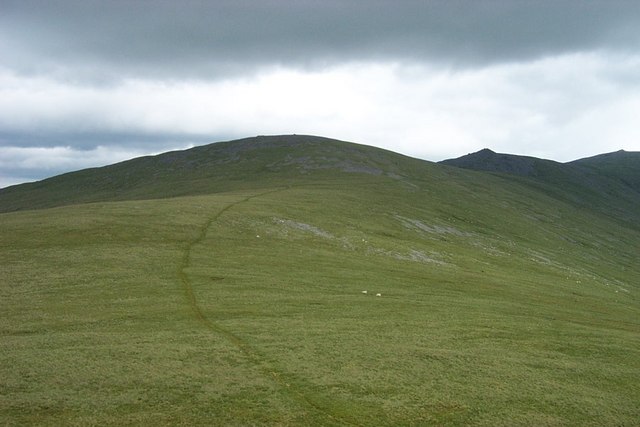
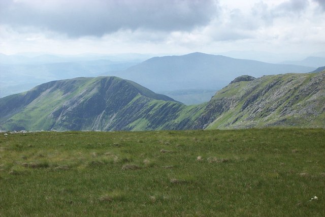
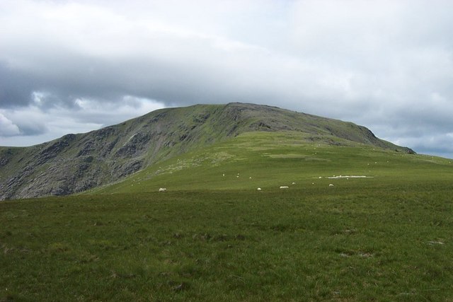
A plateau, also known as a high plain or tableland, is a landform characterized by flat, elevated terrain that rises abruptly from the surrounding area on at least one side, often featuring deep escarpments or hills. These formations arise through several geological processes. Volcanic activity can create plateaus when magma upwells from the mantle, swelling the ground upward into a broad, flat expanse, or when lava extrudes from cracks and weak points in the crust, building up rock layers over time. Tectonic plate movements also uplift large, uniform-altitude plateaus, while erosion by water and glaciers can carve mountains down into elevated flatlands or leave plateaus sitting between ranges. Highly eroded examples, known as dissected plateaus, are cut by rivers and broken by deep, narrow valleys.
Plateaus are classified by their surrounding environment. Intermontane plateaus, among the highest and most extensive, are enclosed by fold mountains—the Tibetan Plateau, for instance, lies between the Himalayas and the Kunlun Mountains. Piedmont plateaus are bordered on one side by mountains and on the other by a plain or sea, such as the Piedmont Plateau of the eastern United States. Continental plateaus are surrounded by plains or oceans, like the Antarctic Plateau in East Antarctica. Notable examples include the Ethiopian Highlands, Africa’s highest plateau, where most of the surface lies above 1,500 meters, and the Highveld of South Africa, which supports major urban areas. The Tibetan Plateau, the world’s largest and highest, covers roughly 2.5 million square kilometers at an average elevation of over 4,500 meters, influencing monsoon patterns. The Colorado Plateau in North America, bisected by the Grand Canyon, was formed over millions of years as subterranean forces gradually uplifted the land while the Colorado River eroded its course.
- definition
- Area of highland with flat terrain raised above surroundings
- formation_processes
- Volcanic upwelling, lava extrusion, tectonic movements, water and glacial erosion
- classification_types
- Intermontane, piedmont, continental
- highest_plateau
- Tibetan Plateau (Roof of the World)
- example_volcanic_plateau
- Columbia Plateau (United States)
- example_continental_plateau
- Antarctic Plateau
Lore & Background
Plateaus, also known as high plains or tablelands, are elevated landforms characterized by a flat top that rises sharply above the surrounding terrain on at least one side, often featuring deep escarpments or hills. Their appearance can vary from a small flat summit to a much broader one. They are formed through several distinct geological processes. Volcanic activity can create plateaus either when magma upwelling from the mantle causes the ground to swell upward, or when lava spreads outward from cracks in the crust and builds up over time. Notable examples of such lava plateaus include the Antrim Plateau in Northern Ireland, the Deccan Plateau in India, the Big Raven Plateau in Canada, and the Columbia Plateau in the United States. Tectonic plateaus arise from the movement of tectonic plates, which cause large areas of land to uplift to a fairly uniform altitude, as seen in the Deccan Plateau and the Meseta Central on the Iberian Peninsula. Erosional processes also shape plateaus: glaciers can erode mountain ranges, leaving plateaus sitting between them, while water erosion can carve mountains into plateaus. Highly eroded plateaus cut by rivers and broken by deep, narrow valleys are known as dissected plateaus, such as the Scottish Highlands. Plateaus are classified by their surroundings: intermontane plateaus are enclosed by fold mountains and are among the highest and most extensive, like the Tibetan Plateau between the Himalayas and the Kunlun Mountains; piedmont plateaus are bordered by mountains on one side and a plain or sea on the other, such as the Piedmont Plateau of the Eastern United States; and continental plateaus are bordered by plains or oceans on all sides, like the Antarctic Plateau in East Antarctica.
Reader's Guide
Plateaus are significant landforms that cover large areas of Earth's surface and influence climate, ecosystems, and human settlement. The Tibetan Plateau, the largest and highest, drives the Indian monsoons by reversing Hadley cell convection. The Altiplano in South America hosts major cities like La Paz and El Alto, while the Mexican Plateau is home to over 70 million people. Plateaus also contain unique geological features, such as the Grand Canyon carved into the Colorado Plateau. Their classification helps geographers understand regional geology: intermontane plateaus lie between fold mountains, piedmont plateaus border mountains on one side and plains on the other, and continental plateaus are surrounded by plains or oceans. The Antarctic Plateau, covered by massive ice, demonstrates how isostatic rebound may raise land as ice melts. Overall, plateaus provide flat, elevated terrain for agriculture, urban development, and scientific study.
Did You Know?
- The Tibetan Plateau is sometimes metaphorically described as the 'Roof of the World'.
- The Antarctic Plateau covers most of East Antarctica and has 3,000 m of superficial ice.
- The Colorado Plateau is bisected by the Grand Canyon, where the river eroded at nearly the same rate as the plateau uplifted.
- The Altiplano plateau hosts Lake Titicaca, the largest lake in South America.
A Continent-Reshaping Flood
During the late Miocene and into the early Pliocene, an extraordinary volcanic episode transformed the Pacific Northwest. The accumulated flows reached a combined thickness exceeding 6,000 feet, a staggering vertical record of repeated eruptions. As each new batch of molten rock surged to the surface, the underlying crust gradually subsided into the void left behind, producing a broad, gently depressed plateau. The Columbia River Basalt Group, the formal name for this assemblage, is divided into seven distinct formations—Steens, Imnaha, Grande Ronde, Picture Gorge, Prineville, Wanapum, and Saddle Mountains—many of which are further broken into named members and individual flows. Together, these layers constitute one of the most extensive flood-basalt sequences on Earth, and they define the very landscape that stretches between the Cascade Range and the Rocky Mountains today.
The Yellowstone Connection
The sheer volume of lava that built the Columbia Plateau has long puzzled geologists, particularly because the region sits far from any active plate boundary. In search of an explanation, researchers painstakingly determined hardening dates for numerous individual lava flows across the province. The pattern they uncovered was striking: the youngest volcanic rocks clustered near the Yellowstone Plateau, while the lavas grew progressively older the farther west one traveled. This age gradient pointed toward a single, stationary heat source deep within the Earth. The leading hypothesis invokes a mantle hot spot—an extraordinarily hot plume of deep mantle material hundreds of kilometers in diameter that ascends from near the core-mantle boundary, much as it does beneath Hawaii and Iceland. The North American plate, meanwhile, has been drifting steadily over this fixed plume, leaving behind a geological tapestry that records both the rate and direction of continental motion. Today, the steaming fumaroles and explosive geysers of Yellowstone National Park stand as vivid, surface-level proof that this concentrated heat still smolders beneath the crust.
A River Carved by Fire
The Columbia River, which today slices through the heart of the plateau, owes its present course in large part to the very lava that buried the surrounding landscape. As successive basalt flows advanced from the southeast toward the northwest, they overtopped and dammed the ancient river channels. Where the molten rock filled stream valleys, it created natural barriers that impounded water into vast lakes. Over time, the river was forced to carve a new path through the solidifying basalt, establishing the corridor it still follows. The lake beds left behind became extraordinary time capsules. Within their sediments, paleontologists and geologists have recovered fossil leaf impressions, petrified wood, fossil insects, and the bones of vertebrate animals—evidence of the ecosystems that thrived in those temporary water bodies millions of years ago. The interplay between advancing lava and a persistent river produced one of the most dramatic examples of volcanic and fluvial interaction in North America, shaping the topography of a region that spans three states.
A Tri-State Ecoregion
The Columbia Plateau is not merely a geologic curiosity; it is a living landscape that stretches across portions of Washington, Oregon, and Idaho, nestled between the Cascade Range to the west and the Rocky Mountains to the east. Ecologically, a portion of this plateau falls within the Columbia Plateau ecoregion, which is classified under the broader Nearctic temperate and subtropical grasslands, savannas, and shrublands ecoregion. This places the area within the temperate grasslands, savannas, and shrublands biome—a designation that reflects the open, semi-arid character of much of the terrain. The plateau's identity is further enriched by its connections to neighboring features: the channeled scablands to the north, the Columbia Plateau Aquifer System that sustains agriculture and communities, the dramatic walls of Grand Coulee, and the High Desert of Oregon. Together, these elements form a cohesive geographic and ecological unit whose boundaries are drawn not by political lines but by the shared geology, hydrology, and vegetation that the ancient basalt flows established.
Gallery
Frequently Asked Questions
What exactly is a plateau?
A plateau is a broad stretch of elevated, level ground that sits noticeably higher than the land around it, with at least one side dropping off sharply. Think of it as a giant natural table perched above the surrounding countryside.
How do plateaus actually form?
They come to life through a mix of geological forces—magma pushing up from below, successive lava flows building up layers, tectonic plates shifting and lifting crust, and the slow carving work of rivers and glaciers. It is usually a combination of these processes rather than one single cause.
What are the different types of plateaus?
Geologists sort them into three categories based on their setting: intermontane (tucked between mountain ranges), piedmont (sitting at the base of mountains), and continental (vast, isolated high plains). The Tibetan Plateau is a classic intermontane example, while Antarctica's ice sheet rests atop a continental plateau.
What is the highest plateau on Earth?
That title belongs to the Tibetan Plateau, often nicknamed the 'Roof of the World,' which averages well over 4,000 metres above sea level. It is both the highest and one of the largest elevated flat regions on the planet.
Can you give a good example of a volcanic plateau?
The Columbia Plateau in the United States is a textbook case, built up over millions of years by repeated basalt lava flows. It stretches across parts of Washington, Oregon, and Idaho as a broad, flat highland.
More in Geology & Earth Surface 1-23
Spotted an error? Know more?
This is a living reference — every entry is fact-audited, and reader corrections feed straight into our audit queue. Suggest an edit · See this site's audit record