
Malawi

Sputink · CC BY-SA 4.0
Malawi, whose official name is the Republic of Malawi, sits landlocked in Southeast Africa. It shares borders with Zambia to the west, Tanzania to the north and northeast, and Mozambique to the east, south, and southwest. Covering 118,484 square kilometers (45,747 square miles), the country had an estimated population of 22,224,282 as of July 2025. Lilongwe serves as both the capital and the largest city.
The area that is now Malawi was first settled around the 10th century by the Akafula, also called the Abathwa. Later, Bantu groups arrived, pushing out the Akafula and establishing kingdoms like the Maravi and Nkhamanga, which thrived from the 16th century onward. British control over the region tightened after the 1890 British Ultimatum, which countered Portuguese claims—based on the 1885 Pink Map—to the land between Angola and Mozambique. In 1891, the British designated the area the British Central African Protectorate, renaming it Nyasaland in 1907. Nyasaland gained independence in 1964 under Prime Minister Hastings Banda, taking the name Malawi. Two years later, Banda turned the country into a one-party presidential republic and became president; in 1971, he was declared president for life. The early decades of independence were marked by Banda’s harsh, repressive rule. After a multi-party system was introduced in 1993, Banda lost the 1994 general election, and since then, the country has seen peaceful transfers of power. Today, Malawi is a democratic, multi-party republic led by an elected president. The 2024 V-Dem Democracy indices rank Malawi 74th globally and 11th in Africa for electoral democracy. It maintains diplomatic ties with most nations and is active in organizations such as the United Nations, the Commonwealth of Nations, the Southern African Development Community, the Common Market for Eastern and Southern Africa, and the African Union.
Malawi is among the world’s least developed countries. Its economy relies heavily on agriculture, and the population is largely rural and growing. Life expectancy is low, and infant mortality is high. HIV/AIDS is widespread. The population is diverse, including native peoples, Asians, and Europeans. Most people are Christian, with Protestants forming the majority.
**Etymology** The name Malawi means “flames” in Chichewa and Chitumbuka. It was chosen by Hastings Banda, the country’s first president, after independence from Great Britain in 1964.
**History**
**Pre-colonial history** Before Bantu peoples arrived from the north around the 10th century CE, the region now called Malawi had a small population of hunter-gatherers. In local oral tradition, these people are known as the Akafula, BaTwa, Akaombe, or Mwandionerakuti. The BaTwa were gradually displaced by the agrarian Bantu groups. Most Bantu peoples continued southward, but some stayed and formed ethnic groups based on shared ancestry. By the 16th century, several kingdoms had emerged, including the Maravi Empire—which stretched from north of what became Nkhotakota to the Zambezi River and from Lake Malawi to the Luangwa River in what is now Zambia—and the Nkhamanga kingdom. In the 17th century, when much of the area was under a single native ruler, local tribes began encountering, trading with, and forming alliances with Portuguese traders and soldiers. By the 18th century, however, the empire had fragmented into territories controlled by various individual ethnic groups. The Indian Ocean slave trade peaked in the mid-19th century, with an estimated 20,000 people enslaved and transported each year from Nkhotakota to Kilwa for sale.
**Colonialisation (1859–1960)** Missionary and explorer David Livingstone reached Lake Malawi (then Lake Nyasa) in 1859 and identified the Shire Highlands south of the lake as suitable for European settlement. Following his visit, several Anglican and Presbyterian missions were established in the 1860s and 1870s. The African Lakes Company Limited was founded in 1878 to handle trade and transport, and a small mission and trading post were set up at Blantyre in 1876. A British consul took up residence there in 1883. The Portuguese also had interests in the area, so to prevent Portuguese occupation, the British government sent Harry Johnston as consul with instructions to negotiate treaties with local rulers beyond Portuguese jurisdiction. In 1889, a British protectorate was declared over the Shire Highlands, and in 1891 it was expanded to cover all of present-day Malawi, becoming the British Central Africa Protectorate. In 1907, the protectorate was renamed Nyasaland, a name it kept for the rest of British rule. The colonial government of Nyasaland was formed in 1891, an example of what is sometimes called the “Thin White Line” of colonial authority in Africa. The administrators had an annual budget of £10,000 (in 1891 value), enough to employ ten European civilians, two military officers, 70 Punjabi Sikhs, and 85 Zanzibar porters. This small staff was expected to administer and police a territory of about 94,000 square kilometers, home to between one and two million people. In 1944, the Nyasaland African Congress (NAC) was created to promote local interests to the British government. In 1953, Britain linked Nyasaland with Northern and Southern Rhodesia to form the Federation of Rhodesia and Nyasaland, often called the Central African Federation (CAF), mainly for political reasons. Although the federation was semi-independent, the union sparked opposition from African nationalists, and the NAC gained widespread support. A key opponent of the CAF was Hastings Banda, a European-trained doctor.
- capital
- Lilongwe
- former_name
- Nyasaland
- government
- democratic, multi-party republic
- ranking
- 74th electoral democracy worldwide (2024 V-Dem)
Lore & Background
Malawi is a landlocked nation in Southeast Africa, bordered by Zambia to the west, Tanzania to the north and northeast, and Mozambique to the east, south, and southwest. Its capital and largest city is Lilongwe. The country’s population was recorded at over 22 million as of mid-2025. The region was first settled around the 10th century by a small population of hunter-gatherers known in oral tradition as the Akafula or Abathwa. Bantu groups later arrived, displacing these earlier inhabitants and establishing kingdoms such as the Maravi Empire and the Nkhamanga kingdom, which flourished from the 16th century. Following British colonial rule—first as the British Central African Protectorate, then as Nyasaland—the territory gained independence in 1964 under Prime Minister Hastings Banda and was renamed Malawi. Banda soon converted the country into a one-party presidential republic and was declared president for life in 1971, presiding over a highly repressive dictatorship. A multi-party system was introduced in 1993, and Banda lost the subsequent general election. Since then, Malawi has maintained peaceful transitions of power and is now a democratic, multi-party republic with an elected president. Its economy is heavily agricultural, and the population is predominantly Christian, with a majority being Protestant. The country faces challenges including low life expectancy, high infant mortality, and a high prevalence of HIV/AIDS.
Reader's Guide
The country has maintained diplomatic relations with most nations and participates in key international organizations, including the United Nations, the Commonwealth, and the African Union. Despite political stability, Malawi remains one of the world's least developed countries, with a largely rural population, low life expectancy, high infant mortality, and a high prevalence of HIV/AIDS. Its economy is heavily agricultural. The name 'Malawi' means 'flames' in Chichewa and Chitumbuka, chosen by Banda upon independence. The country's history includes pre-colonial kingdoms, colonial rule as Nyasaland, and a brief federation with Northern and Southern Rhodesia. Malawi's democratic trajectory, despite challenges, marks it as a notable example of political change in Africa.
Did You Know?
- Malawi is landlocked and bordered by Zambia, Tanzania, and Mozambique.
- The name 'Malawi' means 'flames' in Chichewa and Chitumbuka.
A Framework Without Power
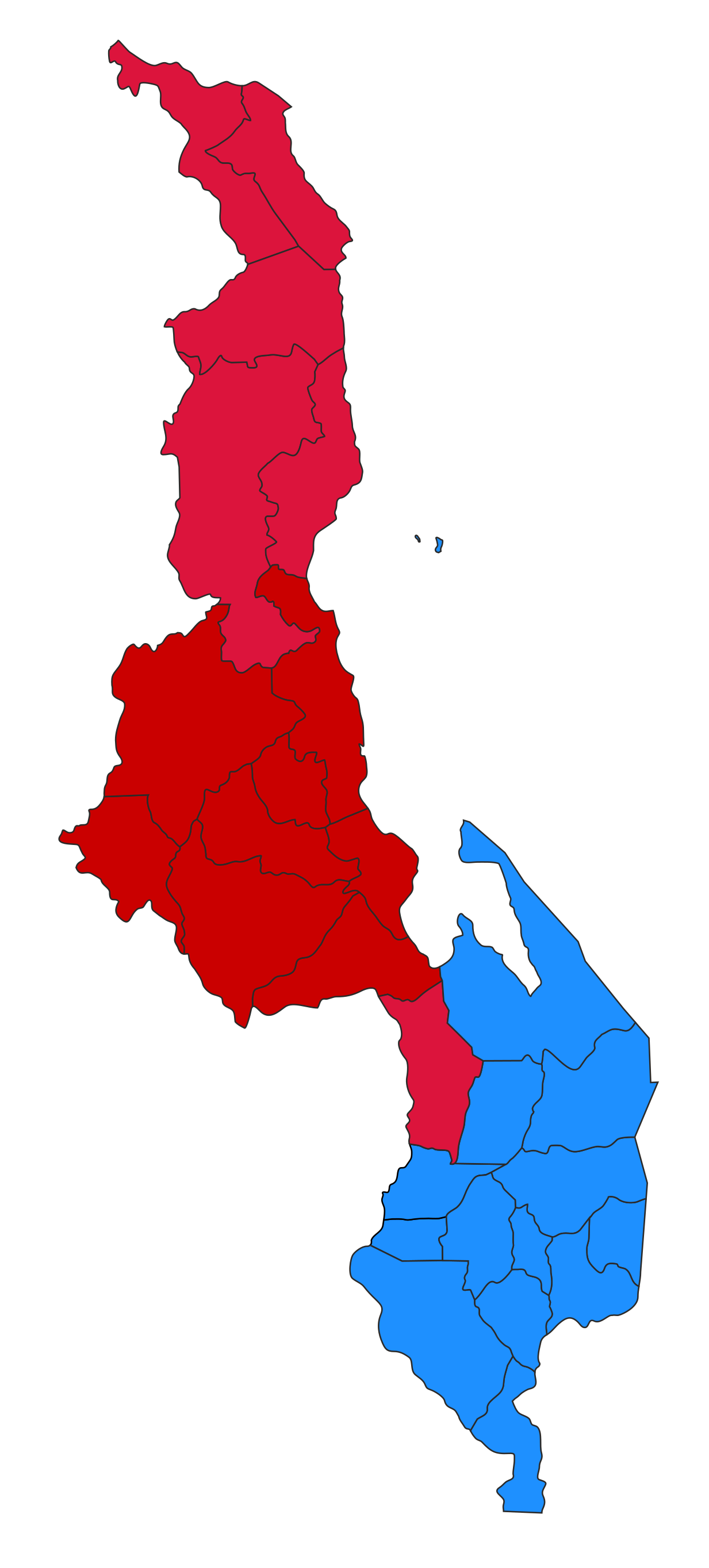
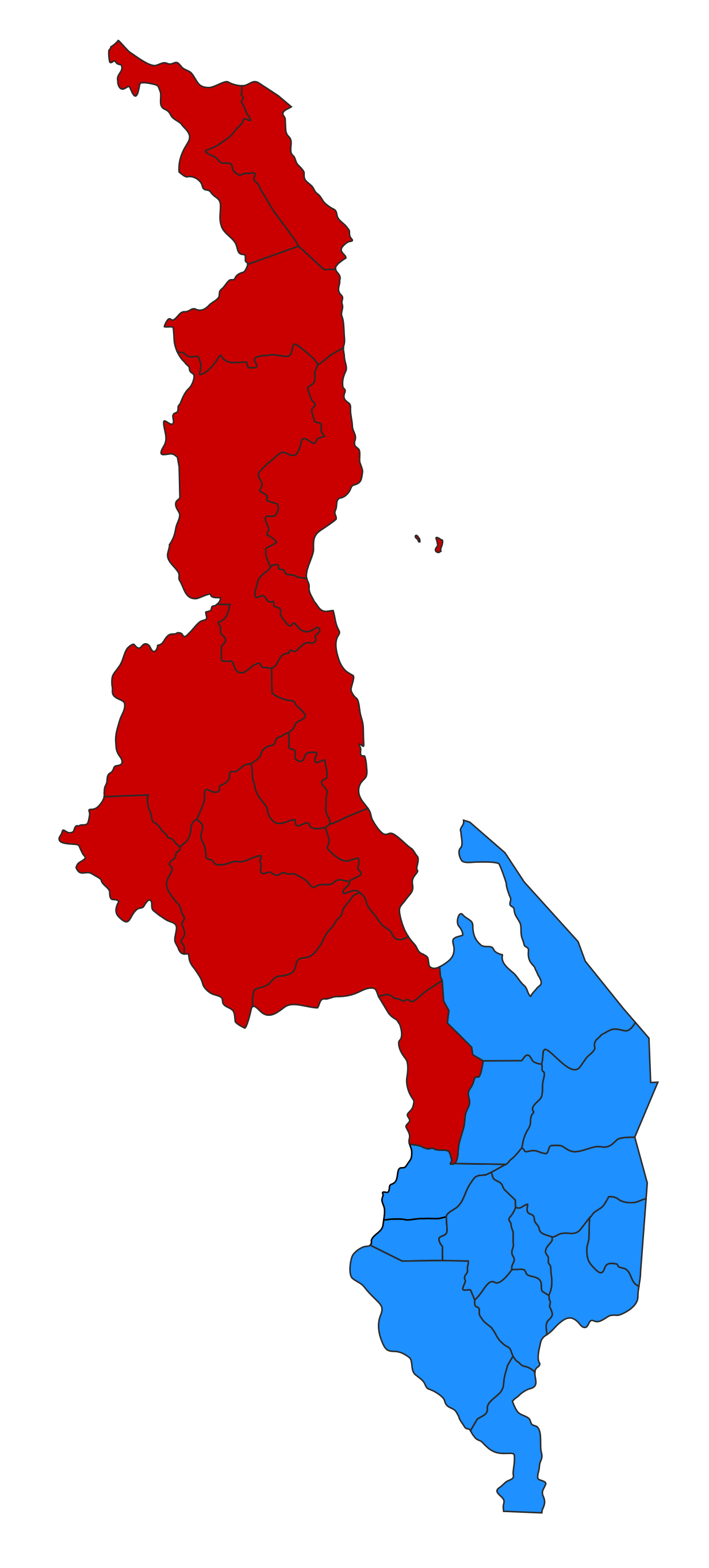
Malawi's internal administrative map rests on a principle that might surprise visitors accustomed to layered governance: the country's three regions—Northern, Central, and Southern—carry no administrative authority whatsoever. They exist purely as organizational containers, a way of bundling the nation's 28 districts into three broader geographic groupings. There is no regional government, no regional executive, no regional legislature. The regions do not levy policy, allocate budgets, or enforce regulations. Their sole purpose is to let the 28 districts be discussed and referenced in a structured, hierarchical manner rather than as a flat list. This design choice means that all genuine administrative power flows directly to the district level, while the regional layer functions as a cartographic convenience. For anyone studying Malawian governance, the key takeaway is that the three regions are a bookkeeping tool, not a governing one. The districts, not the regions, are where administrative life actually happens.
The Weight of Population
According to the 2018 national census, Malawi's three regions hold vastly different numbers of residents, and the gap between the least and most populated is striking. The Northern Region, with Mzuzu as its designated capital, was home to roughly 2.29 million people. The Central Region, anchored by Lilongwe, counted approximately 7.52 million residents. The Southern Region, with Blantyre at its head, recorded the highest figure at about 7.75 million. Taken together, the Central and Southern regions account for the overwhelming majority of the country's population, while the Northern Region holds a fraction of that total. This uneven distribution means that the bulk of Malawian daily life—commerce, schooling, healthcare demand—concentrates in the two southern portions of the country. The 2018 census figures thus paint a picture of a nation where the northern third, though geographically distinct, is comparatively sparsely inhabited relative to the densely settled central and southern zones.
Stretching Across the Landscape
The three regions of Malawi cover a combined area that spans a range of sizes, with the Central Region occupying the largest expanse of territory at 35,592 square kilometres, roughly 13,742 square miles. The Southern Region follows at 31,753 square kilometres, about 12,260 square miles, while the Northern Region is the most compact at 26,931 square kilometres, approximately 10,398 square miles. What makes these figures particularly interesting when read alongside the 2018 census population data is the inverse relationship between area and population density. The Northern Region, the smallest in land area, also holds the fewest residents, yet the Central Region—largest in area—houses a population nearly three times the Northern figure. The Southern Region, sitting between the other two in both area and population, completes a pattern where territory size and human settlement do not scale in lockstep. These three geographic blocks, together encompassing all 28 districts, form the physical canvas on which Malawian life unfolds.
Three Anchors, Three Names
Each of Malawi's three regions is identified by a capital city that serves as its nominal reference point, even though the regions themselves wield no administrative power. In the north, Mzuzu stands as the designated capital, anchoring a region of approximately 2.29 million people spread over 26,931 square kilometres. In the centre, Lilongwe carries the same title for a region that is both the largest in area at 35,592 square kilometres and home to roughly 7.52 million residents. In the south, Blantyre fulfils the capital role for a region of about 7.75 million people across 31,753 square kilometres. These three cities—Mzuzu, Lilongwe, and Blantyre—thus function as the geographic and symbolic anchors of their respective groupings. They give each region a name on the map and a point of reference in conversation, even though the actual administrative machinery of Malawi operates at the district level below. The capitals are, in essence, the labels that make the three-region grouping legible to the outside world.
Gallery
Frequently Asked Questions
How did Malawi become a democracy?
Malawi spent decades under a one-party authoritarian system led by Hastings Banda. In the 1990s, the country transitioned to a multi-party democratic republic, a structure it retains today.
What drives Malawi's economy?
Agriculture is the dominant sector, underpinning most of the nation's economic activity. Malawi remains classified among the world's least developed countries, with farming and crop production shaping daily life and trade.
More in Countries And Regions 1-24
Spotted an error? Know more?
This is a living reference — every entry is fact-audited, and reader corrections feed straight into our audit queue. Suggest an edit · See this site's audit record