Arroyo (watercourse)
Dry watercourse that flows after sufficient rain.

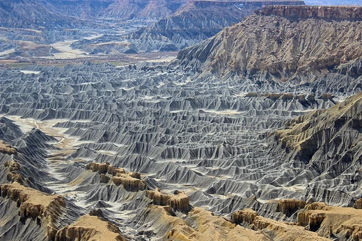
An arroyo—from the Spanish word for “brook”—is a dry channel that only carries water after enough rain falls, often filling and flowing seasonally or temporarily. Thunderstorms can trigger flash floods in these washes. The term typically describes a watercourse in sloped or mountainous areas of dry, desert climates. Similar landforms go by other names around the world: wadi in North Africa and Western Asia, chapp in the Gobi, laagate in the Kalahari, donga in South Africa, nullah in India, fiumare in Italy, and dry valley in England.
Arroyos can be natural features or man-made flood-control channels. In many rural areas, they serve as main transportation routes; in cities, they often become parks with trails for biking, walking, and horseback riding. Flash floods can carve deep arroyos or deposit sediment on flooded land, lowering the local groundwater level and making farming difficult. However, a lowered water table in desert arroyo valleys can also reduce salty seepage and alkali buildup in topsoil, which may improve conditions for irrigated agriculture.
Natural arroyos form through a process called arroyo-cutting, which happens in arid regions like New Mexico. Heavy rains can enlarge rivers, cutting into surrounding rock and creating ravines that stay dry in normal weather. But whether stormy periods alone cause this cutting is debated; long-term climate changes also play a role. Overgrazing by livestock has removed surface vegetation, reducing how much rain soaks into the ground and increasing runoff, which speeds up and strengthens high-flow events. Groundwater pumping adds to the downcutting. Arroyo-cutting in the southwestern United States during the 1900s caused serious farming problems, including a lowered water table and loss of agricultural land.
In agricultural areas needing irrigation, farmers have long used small constructed arroyos, acequias, zanjas, or ditches to distribute water. A larger example is in Albuquerque, New Mexico, where miles of open-air concrete drainage channels feed into the North Diversion Channel, a tributary of the Rio Grande. Signs warn people to stay out because flash floods can turn a dry channel into a roaring river in under two minutes, even without local rain. Between 2017 and 2021, twelve people died in Albuquerque drainage channels from sudden flooding, despite most residents knowing the risk. The Arroyo Seco and Los Angeles River in Southern California are famous examples of natural seasonal arroyos that were turned into constructed open drainage systems.
- type
- Landform
- also_known_as
- Wash, wadi, nullah, donga, fiumare, dry valley
- climate
- Xeric and desert climates
- key_feature
- Intermittent or ephemeral flow after rain
- associated_hazard
- Flash flooding
- biome
- Desert dry wash biome (southwestern United States)
Lore & Background
An arroyo is a dry watercourse that temporarily or seasonally fills and flows after sufficient rain, with flash floods being common following thunderstorms. These landforms are typically found in sloped or mountainous terrain within xeric and desert climates. Natural arroyos are created through arroyo-cutting, a process observed in arid regions like New Mexico, where heavy rains enlarge rivers cutting into surrounding rock, forming ravines that remain dry under normal weather. The causes of arroyo-cutting are debated; while stormy periods contribute, long-term climate changes and human activities such as overgrazing by livestock, which removes surface vegetation and reduces ground infiltration, along with groundwater pumping, increase runoff and downcutting. This erosion can lower the water table and destroy agricultural lands. Arroyos also serve as water sources for desert animals and, in many rural communities, as principal transportation routes. In urban areas, they often function as parks and recreational locations with trails. Constructed arroyos exist as concrete-lined drainage channels, such as those in Albuquerque, New Mexico, where signs warn of flash flooding dangers that can turn a dry channel into a roaring river in under two minutes. Examples of former natural arroyos turned into constructed drainage systems include the Arroyo Seco and Los Angeles River in Southern California.
Reader's Guide
Arroyos are significant as both natural fluvial landforms and constructed flood control channels. In rural communities, they often serve as principal transportation routes, while in urban areas they function as parks and recreational locations with linear multi-use trails. Flash flooding can cause deep arroyos or sediment deposition, lowering the groundwater level and making land unsuitable for agriculture, though a lowered water table can reduce saline seeping and alkali deposits, enabling irrigated farming. The desert dry wash biome is restricted to arroyos of the southwestern United States, providing a water source for desert animals.
Did You Know?
- Flash floods can turn a dry arroyo into a roaring river in under two minutes, even with no local rain.
- The term 'arroyo' is akin to the Catalan 'rambla', which stems from the Arabic 'ramla' meaning 'sand'.
- Overgrazing by livestock throughout the 20th century has increased runoff and downcutting in arroyos.
Frequently Asked Questions
What is an arroyo (watercourse)?
An arroyo is a dry, channel-like landform that only carries water temporarily after heavy rainfall, then returns to a dry state. The word comes from Spanish, where it simply means 'brook.'
What are arroyos also known as around the world?
Depending on the region, the same feature goes by names like wadi (North Africa and Western Asia), sai or sair (the Gobi), nullah (India), and donga or fiumare in other areas. In English, 'wash' is the most common synonym.
Where do arroyos typically form and what climate do they need?
They are most common on sloped or mountainous terrain in xeric and desert climates, such as the southwestern United States. The defining requirement is a climate dry enough that the channel stays empty for most of the year.
What is the main hazard linked to arroyos?
Flash flooding is the key danger, since a brief thunderstorm can send a sudden, powerful surge of water through a channel that has been bone-dry for months. This makes arroyos especially treacherous in desert environments where people might underestimate the risk.
Why do geomorphologists care about arroyos?
They are a classic example of how intermittent flow shapes landscapes in arid regions, carving channels, transporting sediment, and building alluvial fans over time. The desert dry wash biome they create is a distinct ecological and geomorphic setting studied in its own right.
More in Coastal And Fluvial Geomorphology 1-24
Spotted an error? Know more?
This is a living reference — every entry is fact-audited, and reader corrections feed straight into our audit queue. Suggest an edit · See this site's audit record